felt like having some fun with this TR. It’s a lot longer and includes than more stuff than I usually write

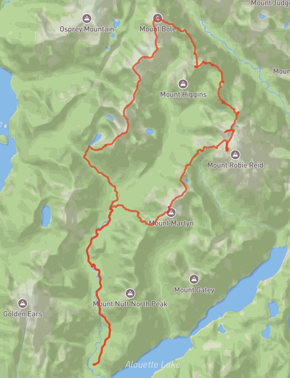
The Big Bole Traverse
Day 1
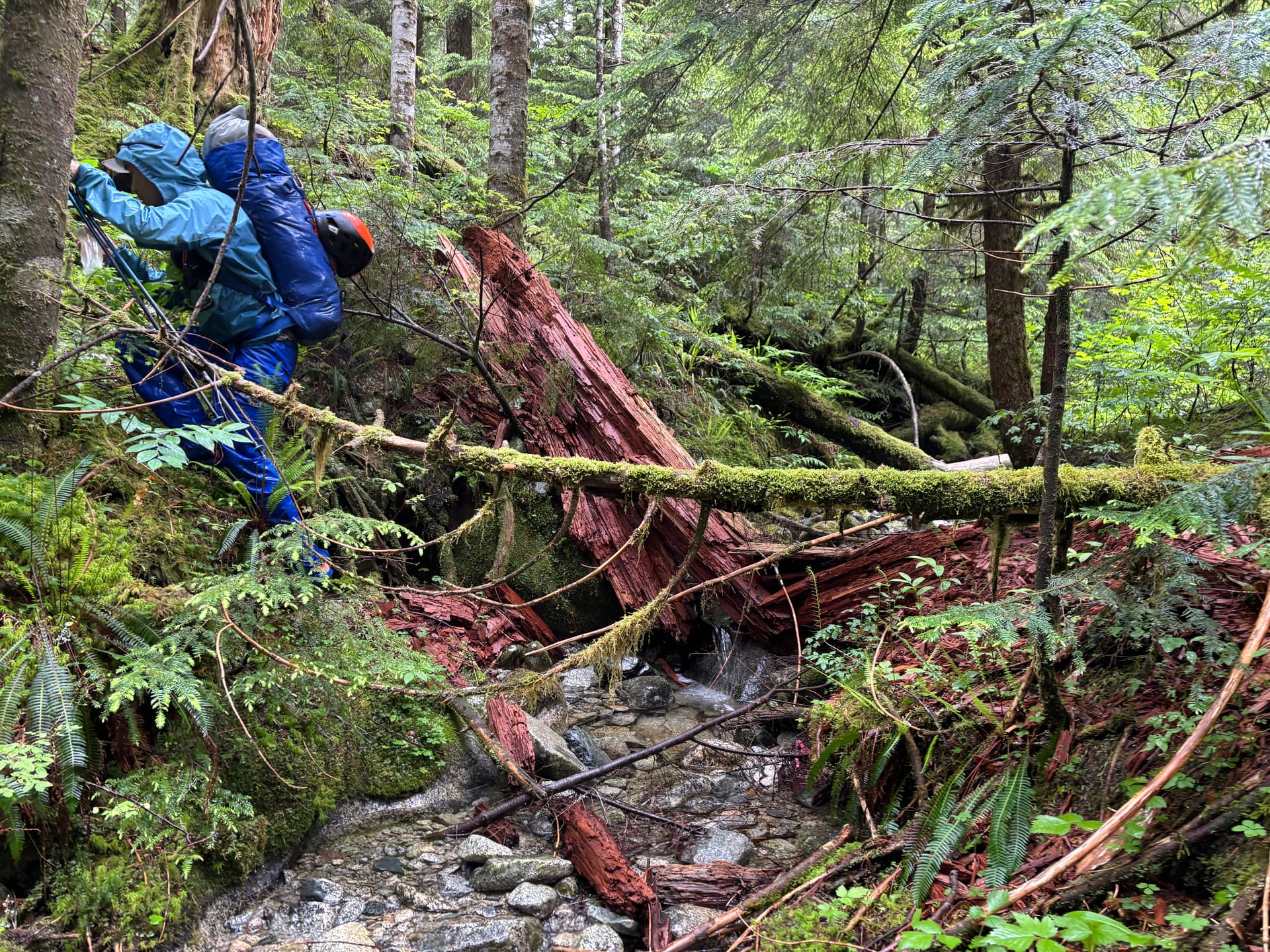
The first roughly 10km to Half-moon Beach is maintained, although the last few kilometres have some fallen logs over the trail. Shortly after Half-moon we put on rain jackets as it was going to be wet ‘shwhackin, with it having rained yesterday. I did not (but should have) put rain pants over my shorts, as I anticipated wading across Gold Creek in not long and would put them on after that.
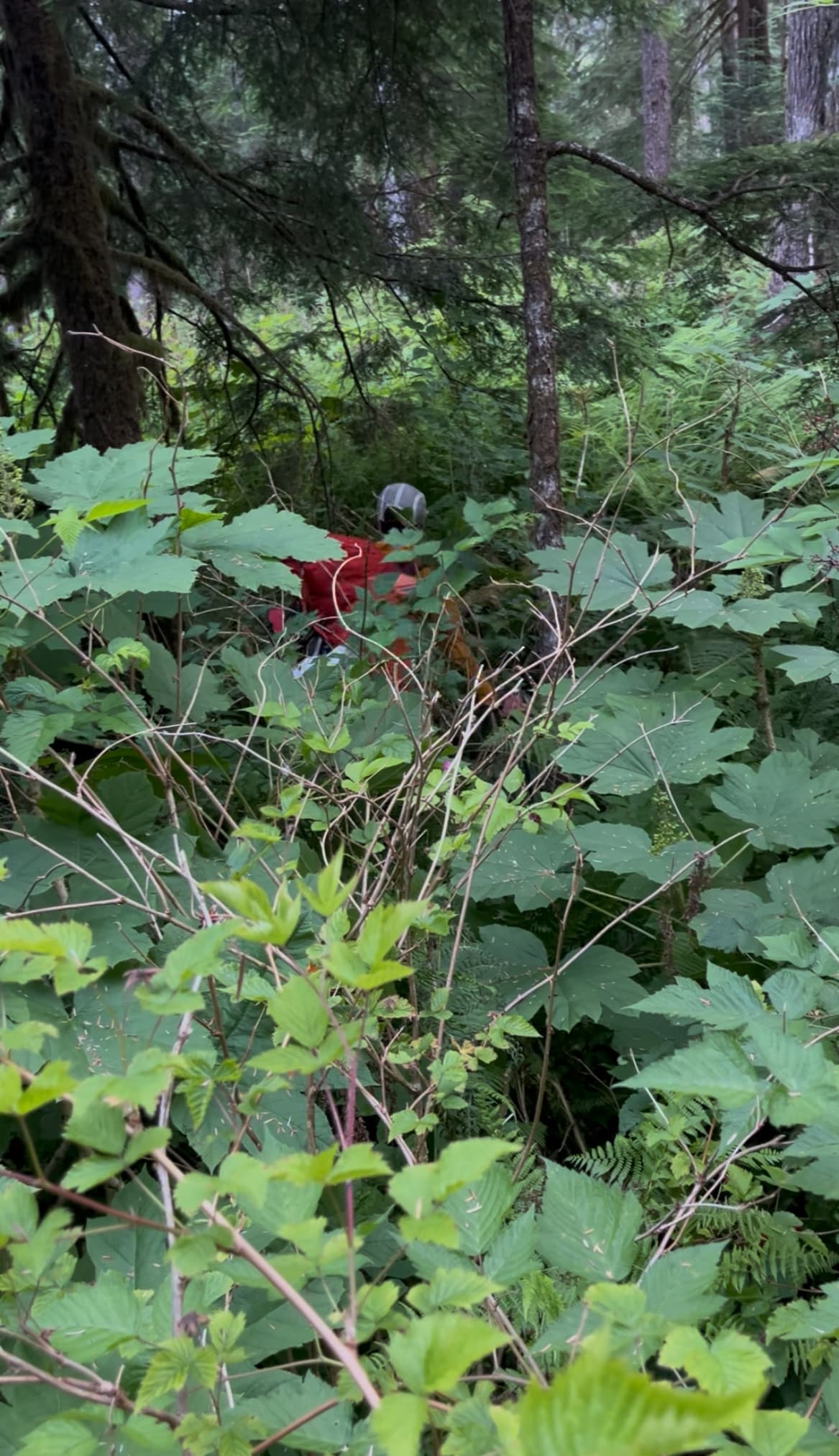
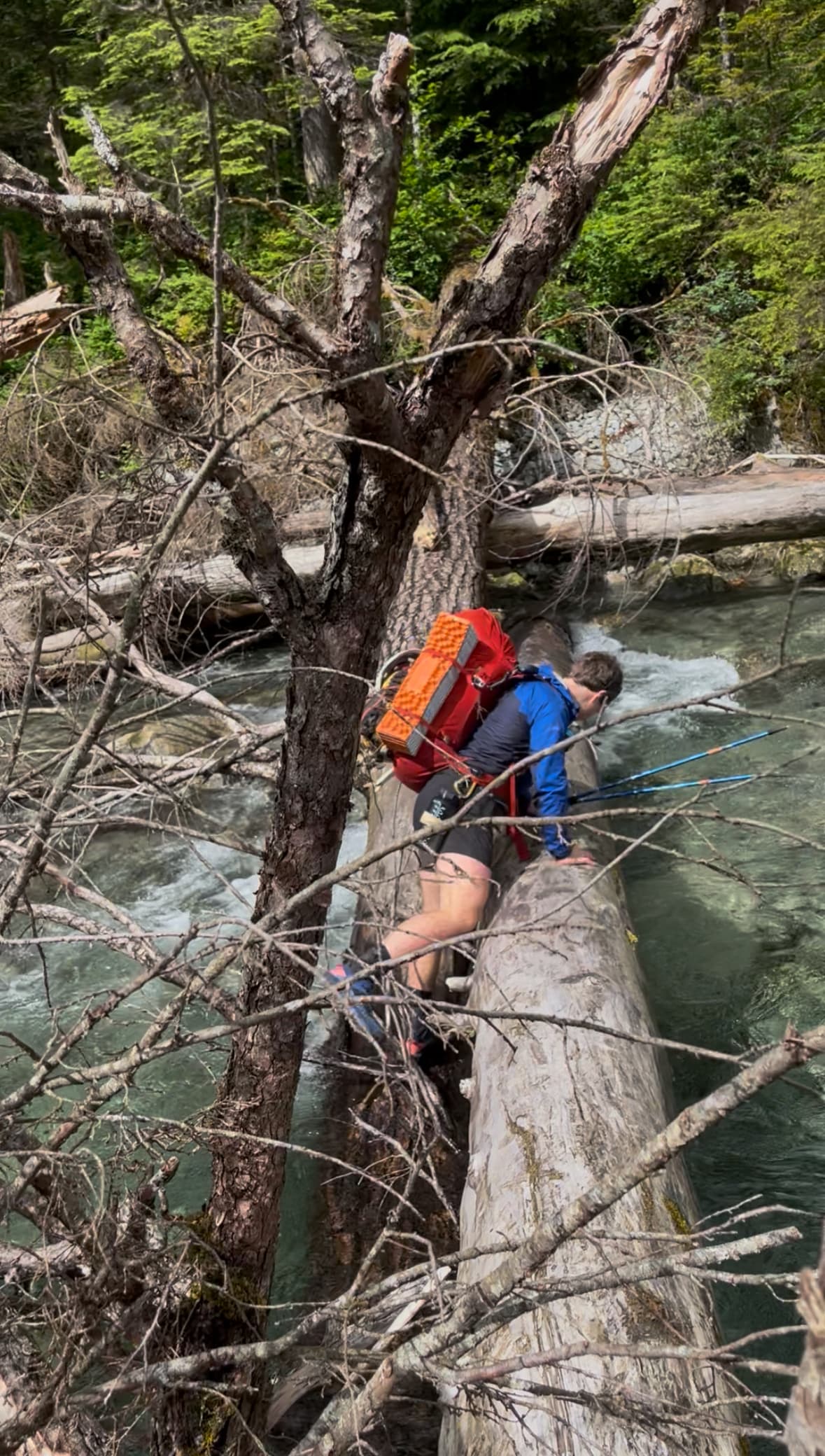
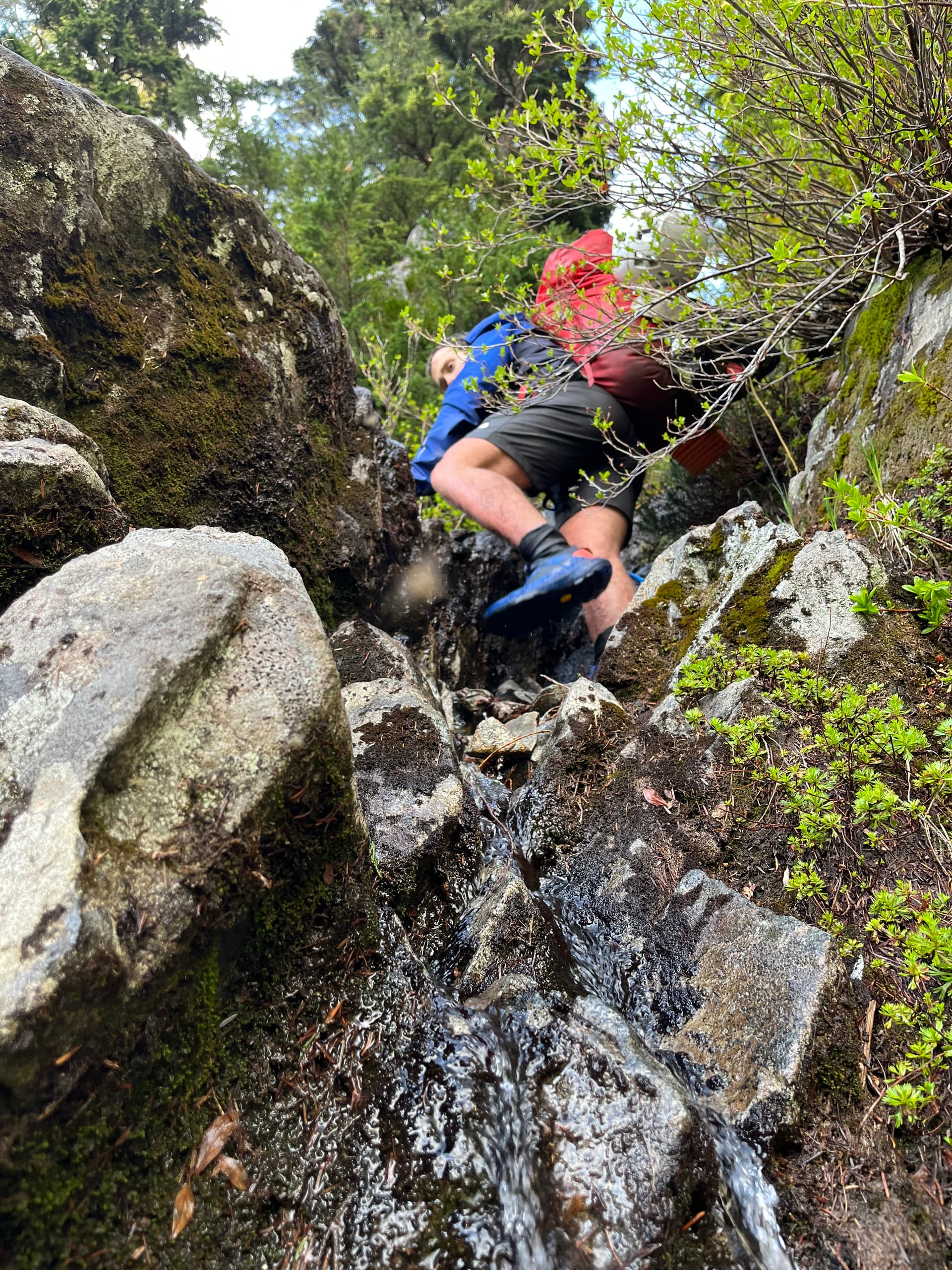
~1km after Half-moon, the path is obliterated by deadfall/washout and flagging directs to the rocky creek shore. We followed the creek for a bit, then came to a log crossing. Thinking this as an opportunity to avoid having wading farther up, I suggested we cross. I saw a pink ribbon on our side of the shore, which made me think this may be the place to cross. This turned out to be a bad decision. The trail was still ~1km north of where we now were on the W side of the creek. At one point we came across some ancient flagging, interestingly. And some bear paths to follow. Eventually (about 1h) we reached the trail. There is a lot of blowdown near the creek, but it gets better after. To HF Lake, is mostly a defined single-track trail. There is a moderate amount of fallen trees, and occasionally the trail disappears under them, but the flagging is good and following the trail is never challenging. We reached HF Lake 6 hours after starting.
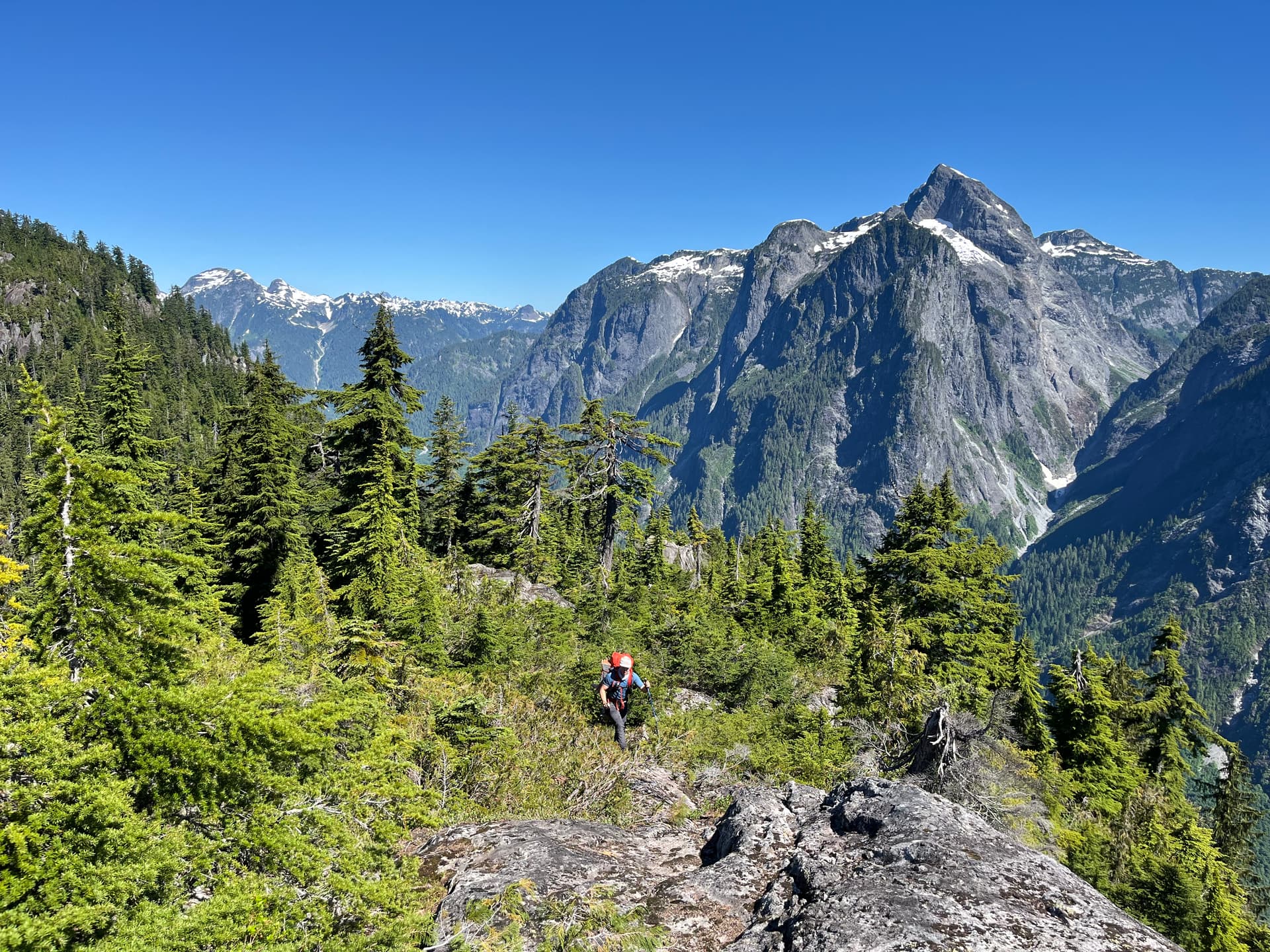
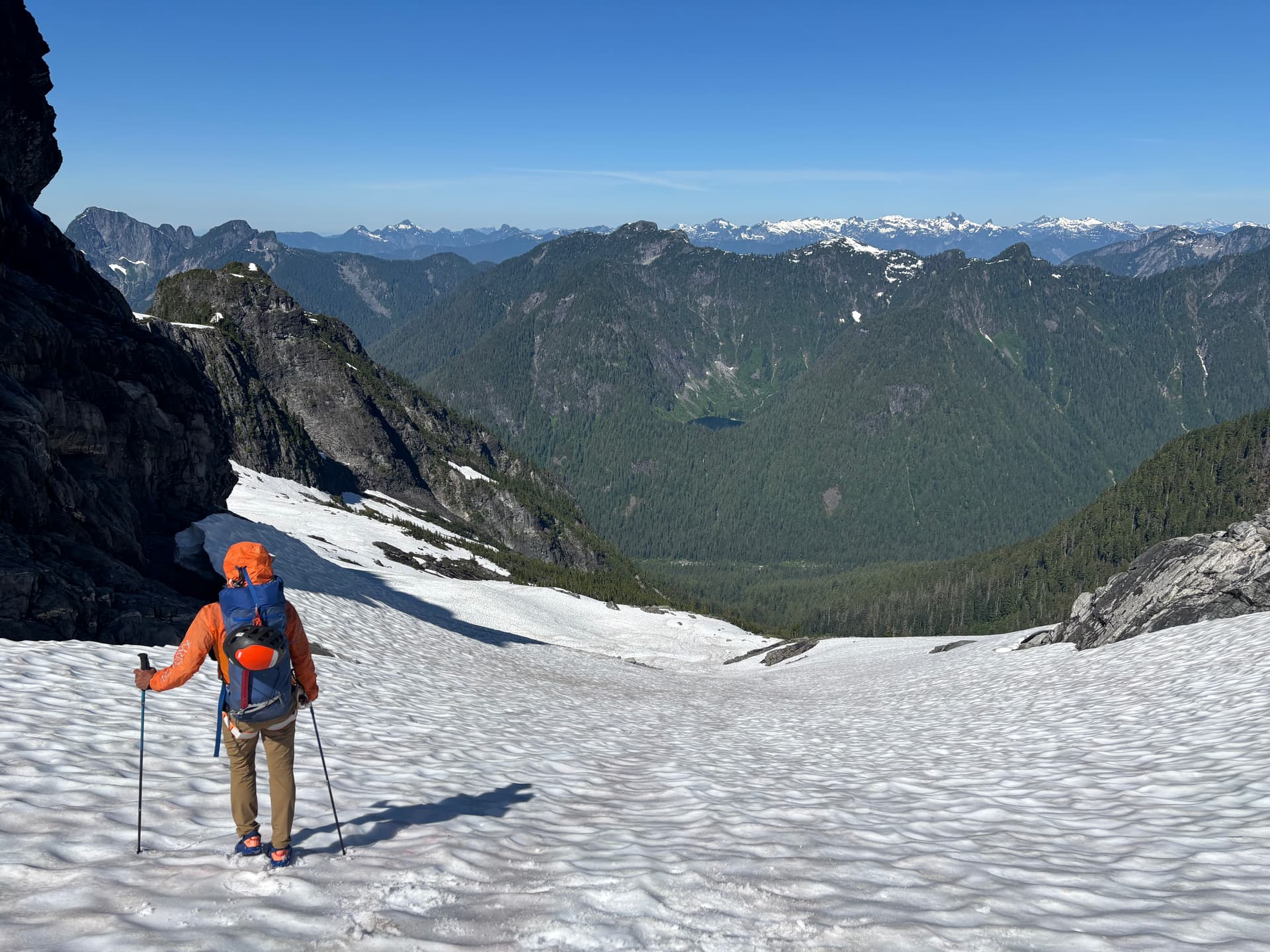
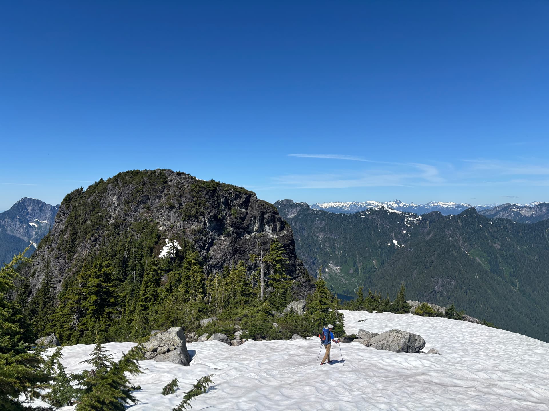
From HF lake we started both our off-trail adventure and first steep ascent. Interestingly, for ~1/3 of the ascent to HF peak we followed relatively new blue and pink flagging along the path of least resistance. I don’t recall the ascent up to HF peak being anything too crazy in terms of bushwhacking but it was a bit steep in places. When we finally broke into the snow, it was awesome! No bushwhacking! (Well this was short-lived). The summit was cool rocky sub-alpine and would have nice views but was totally socked in for us. At this point, although I was 100% soaked I was not cold, as it wasn’t cold out and we were moving well.
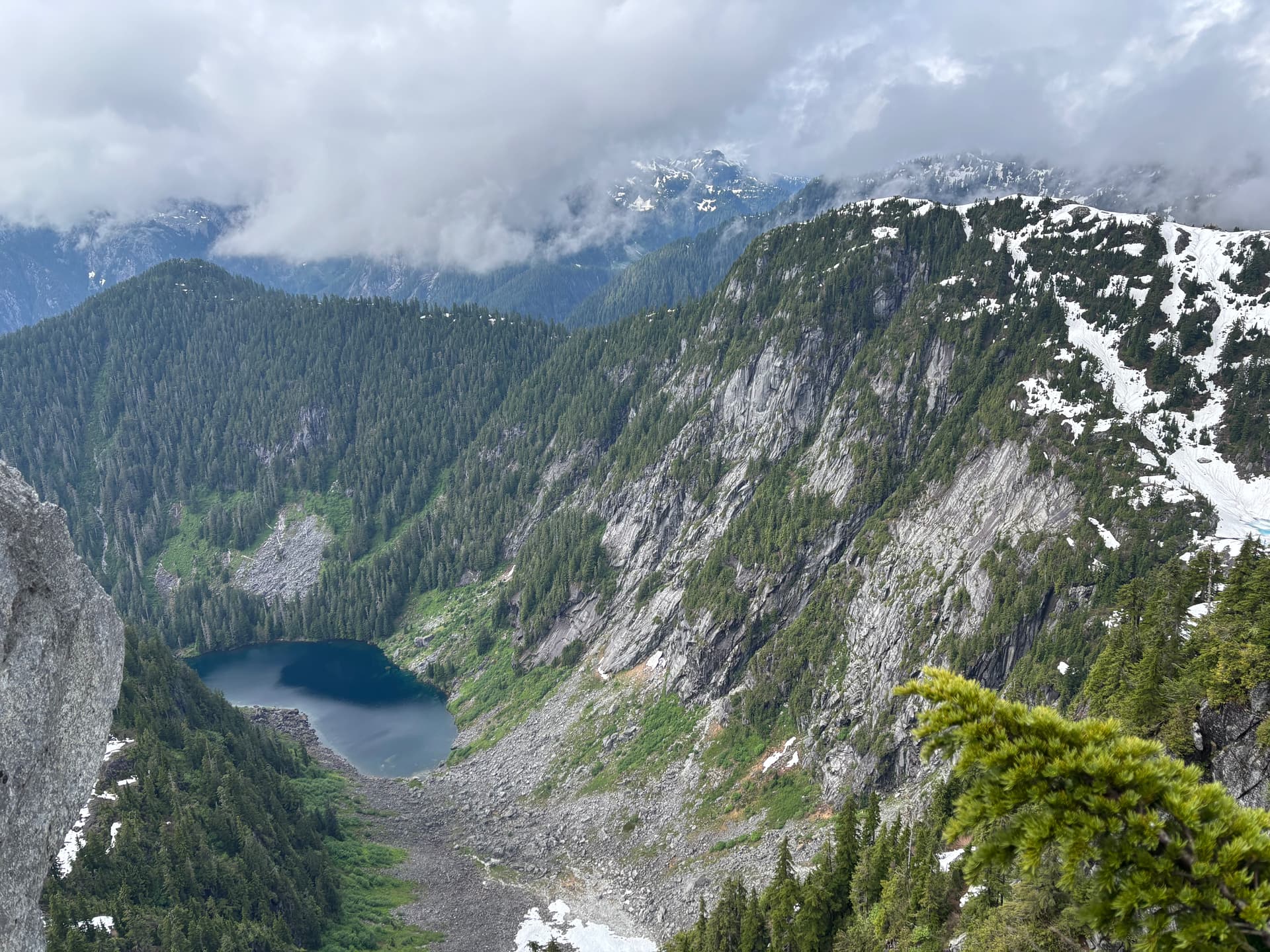
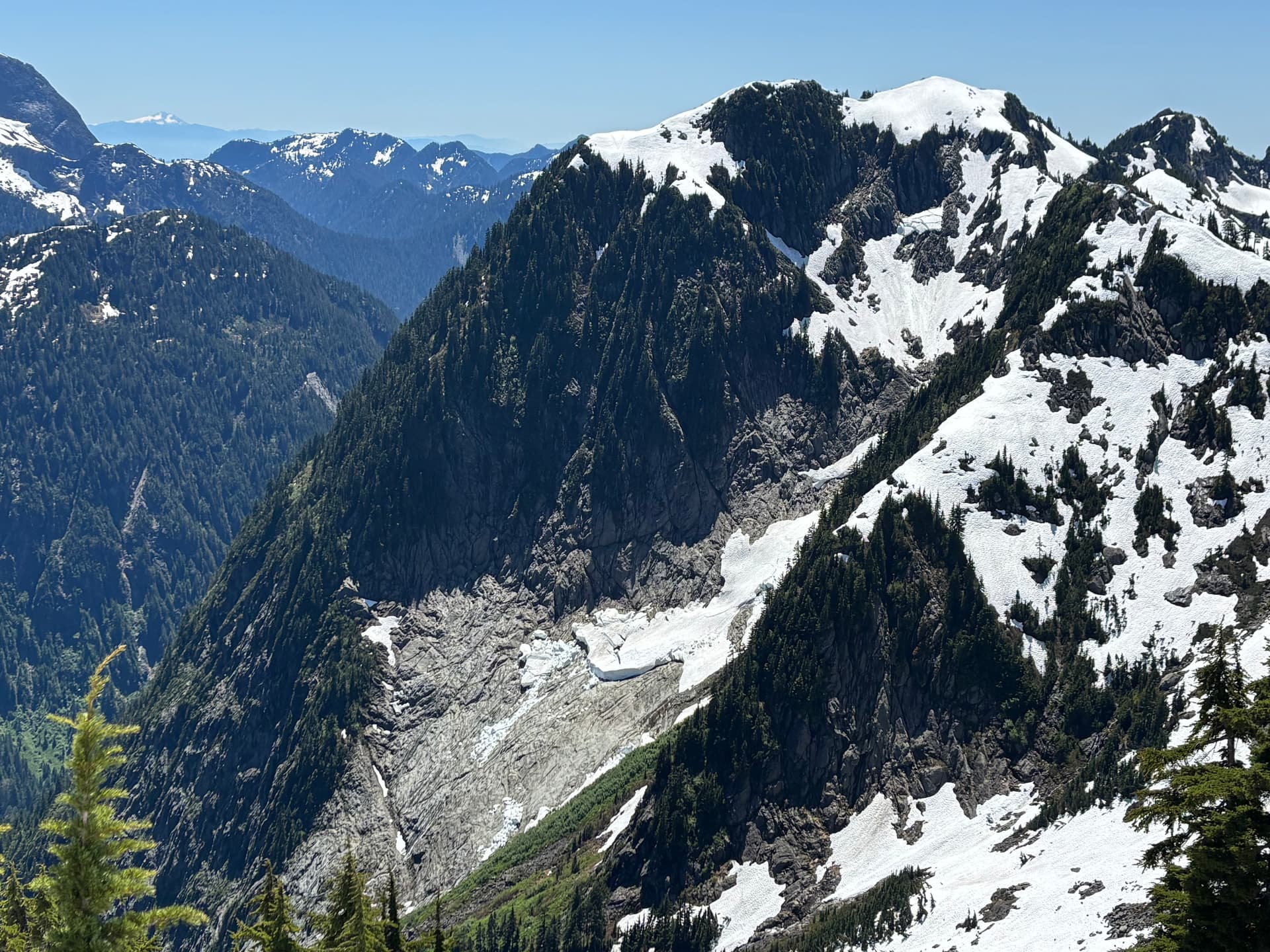
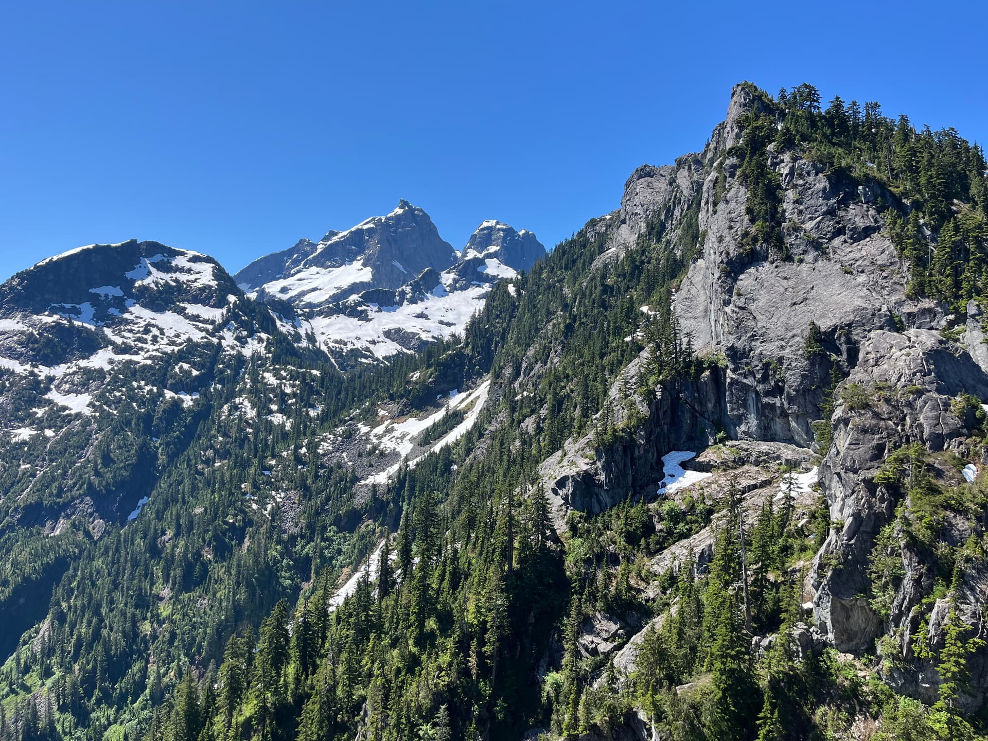
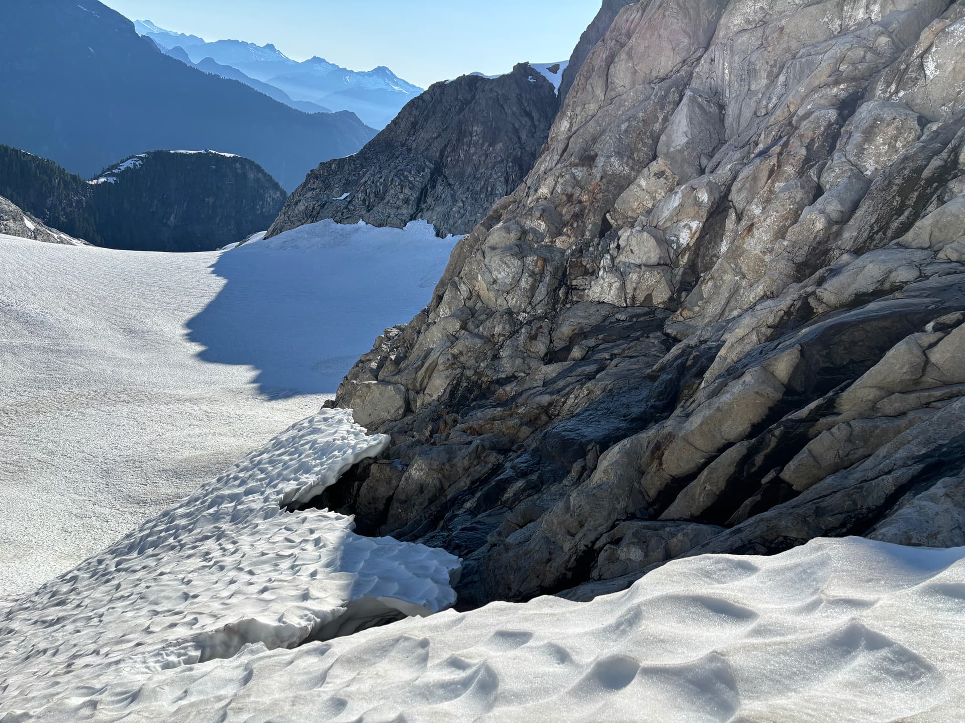
As we went to the north edge of the peak to continue along the ridge, it became a cliff. We found a steep bushy way down on the E side. Right after descending, we got a glimpse of blue skies, and some pretty sweet views looking down HF lake. From where the trail leads, the lake is swampy treed in, and lame, but the other end of the lake has open shores with a true alpine lake appearance, lying at the base the steep incline of the ridge where we stood now. There is a lot of cool solid-looking rock on HF peak on this side. We took in the views, snapped some pics, then continued on.
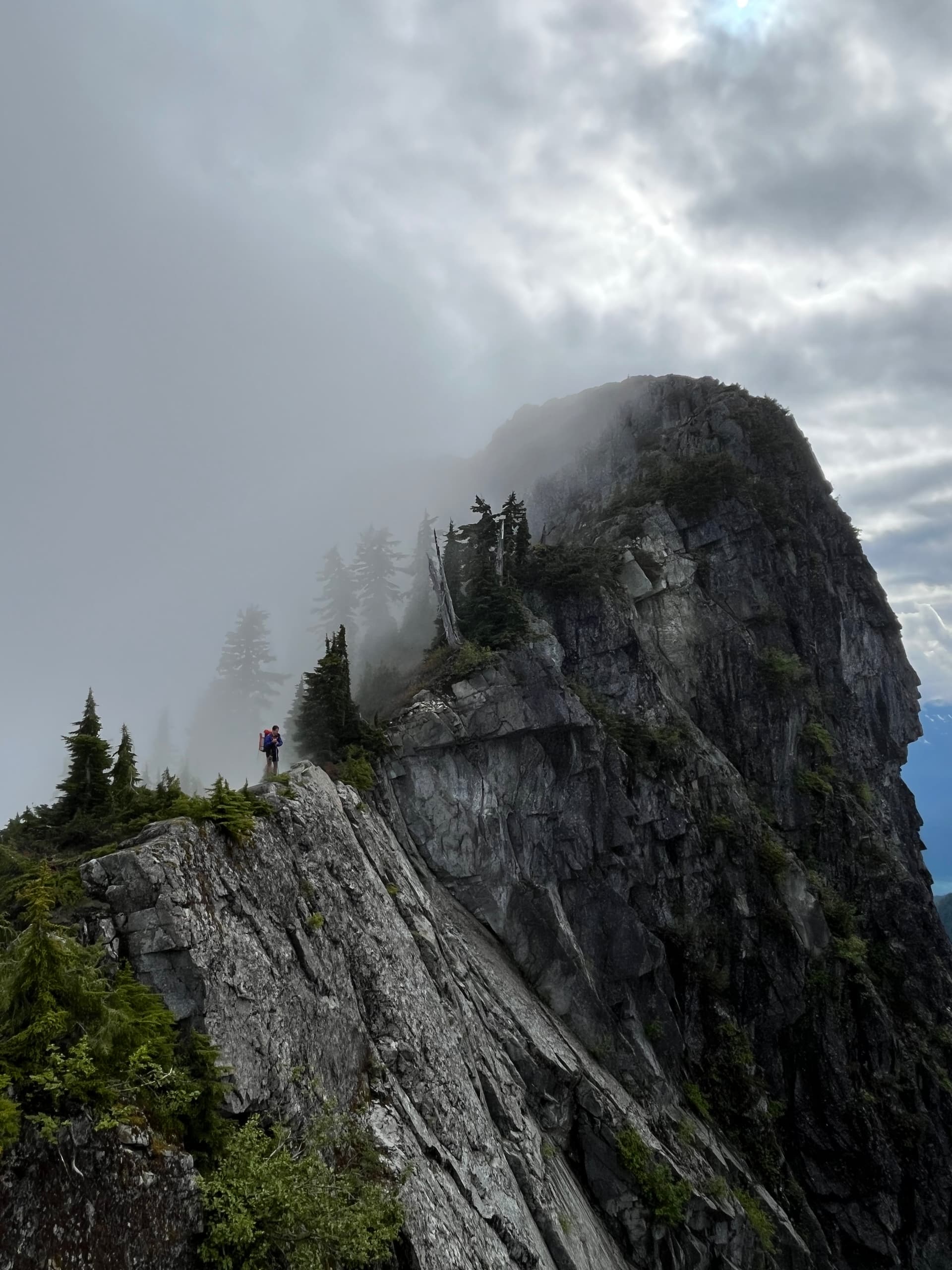
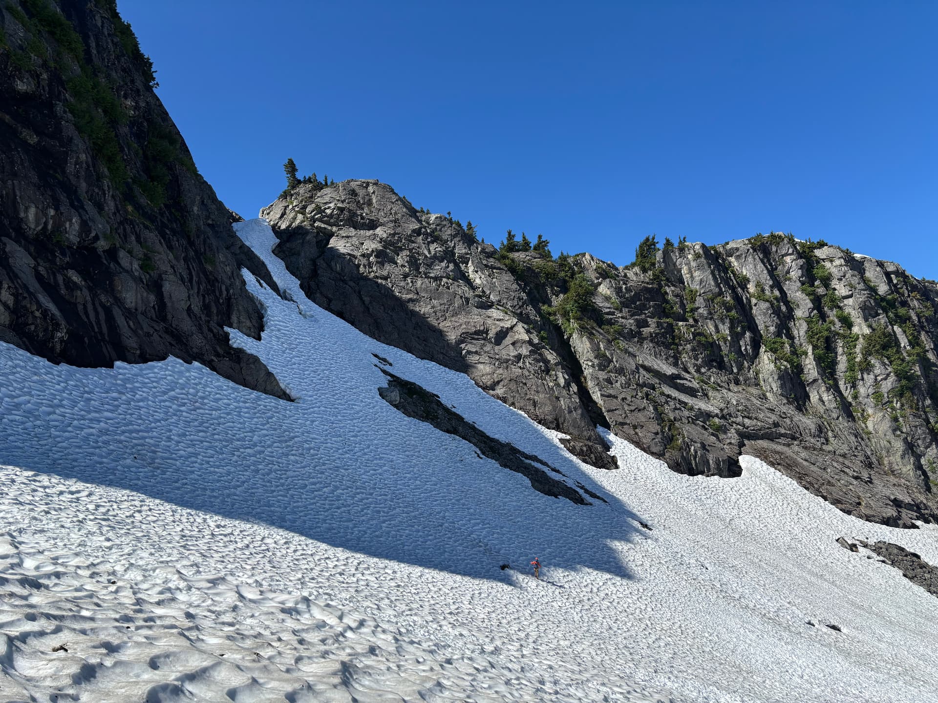
At one point I looked down at my legs and saw a pretty substantial lump on my L shin. It had been mildly painful after I smashed it into a rock when some snow gave way ~30 minutes prior, but I hadn’t thought much of it. Seeing it now I was a little concerned. I held some snow on it to minimize swelling and hoped it wouldn’t become something major later on. Travel was good for a bit as we approached a small snowy bowl where we saw our first major obstacle: a steep rocky bushy pinnacle followed by a steep bushy rise. We just had to get to the saddle between them.
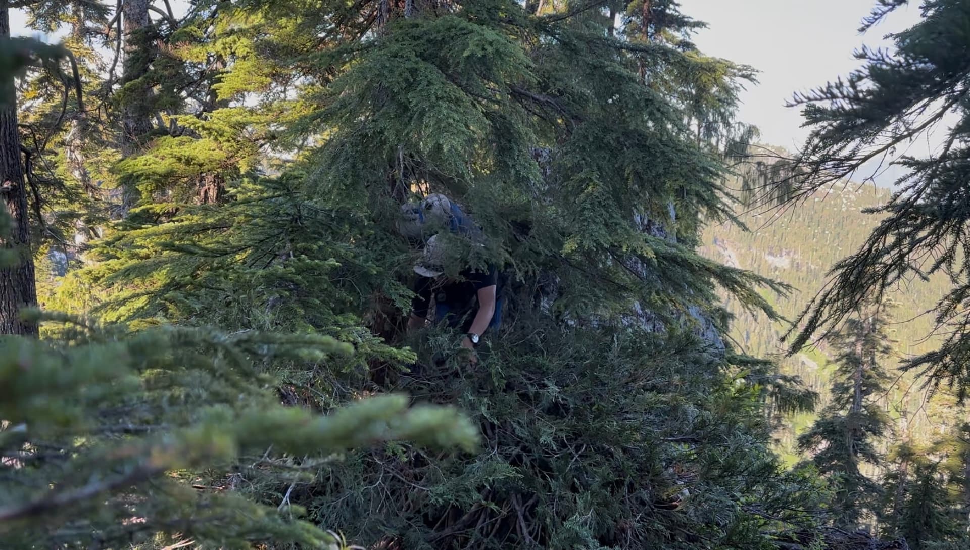
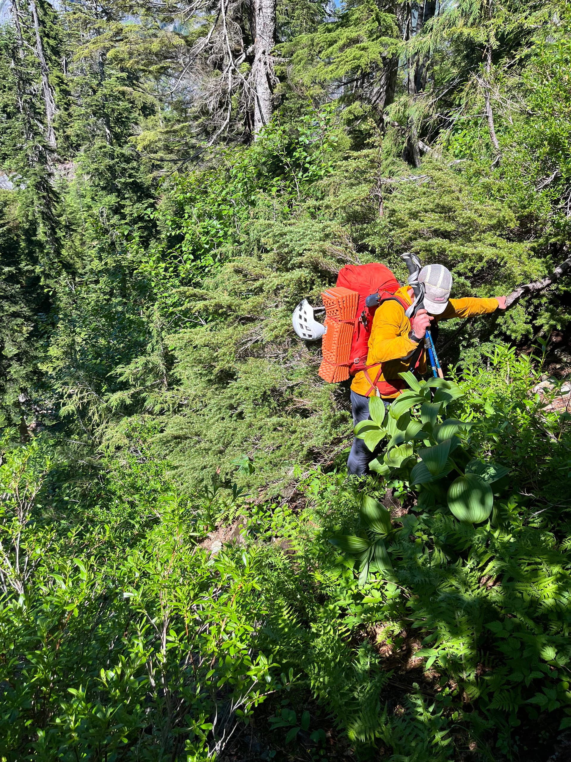
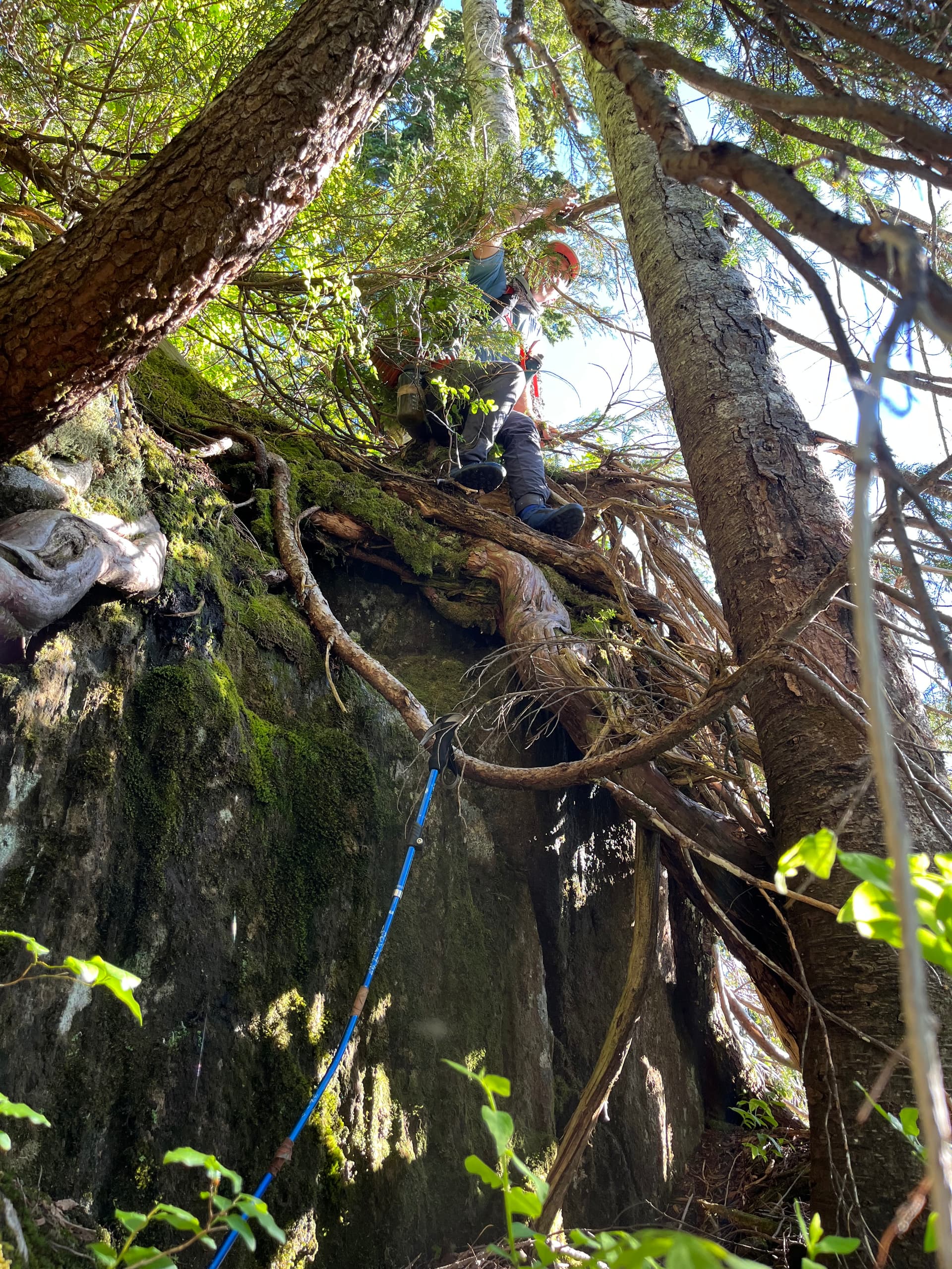
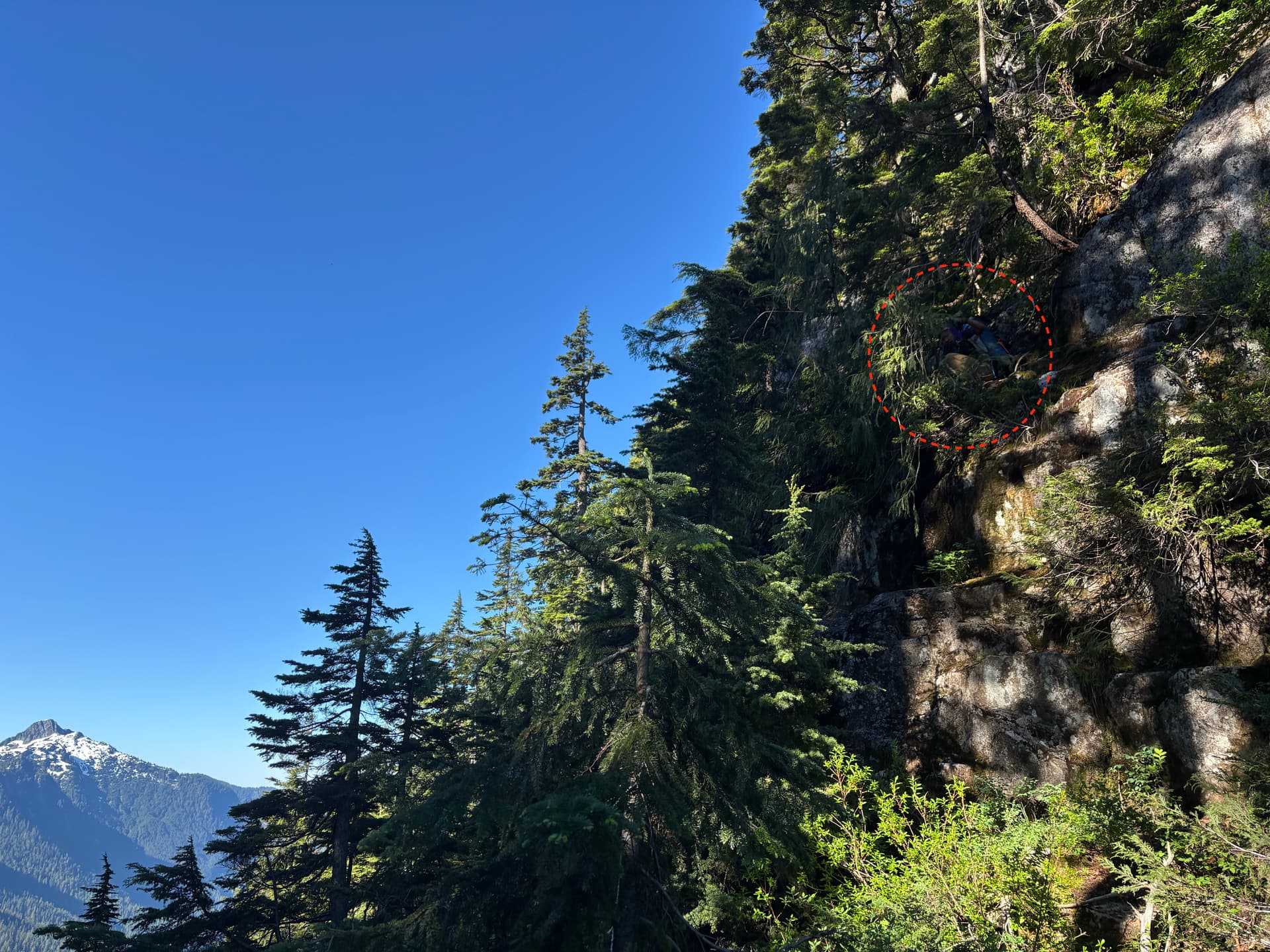
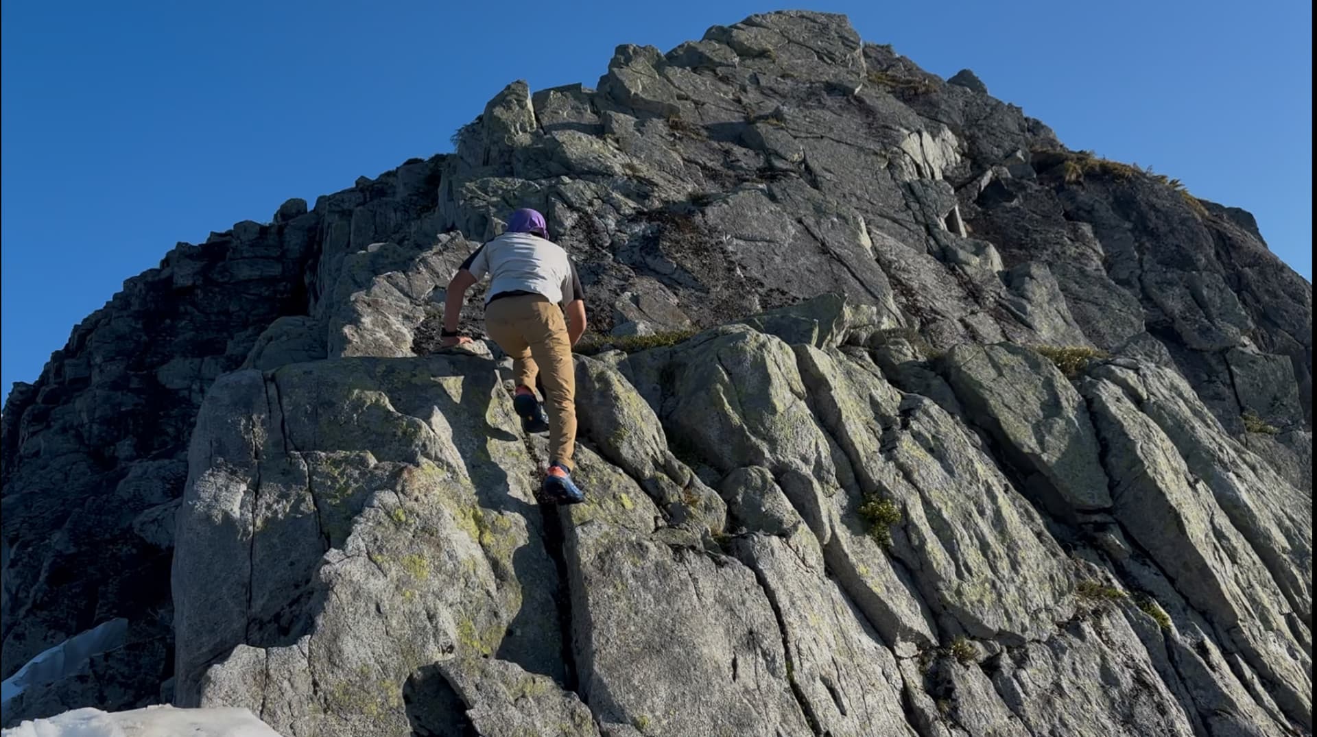
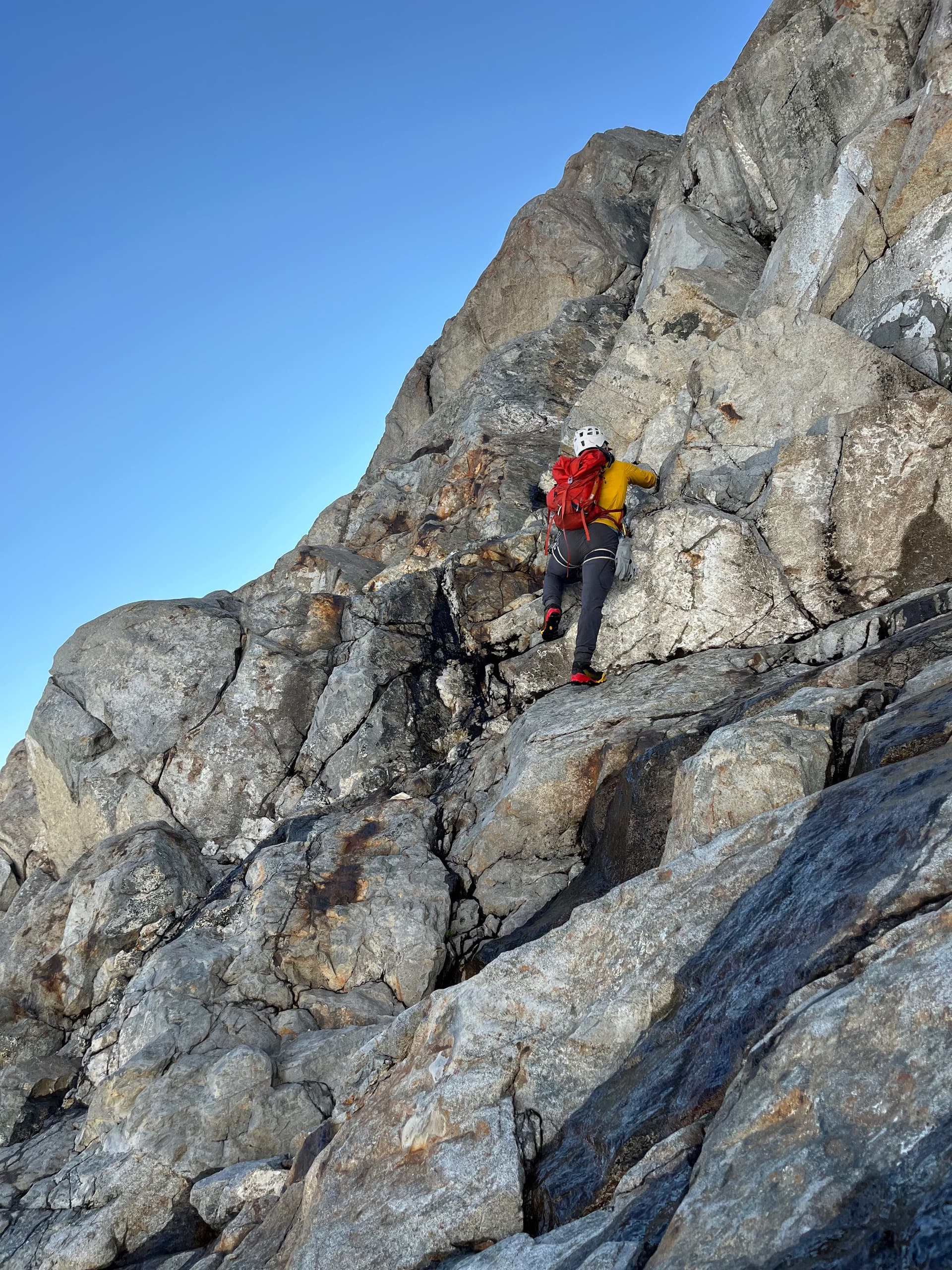
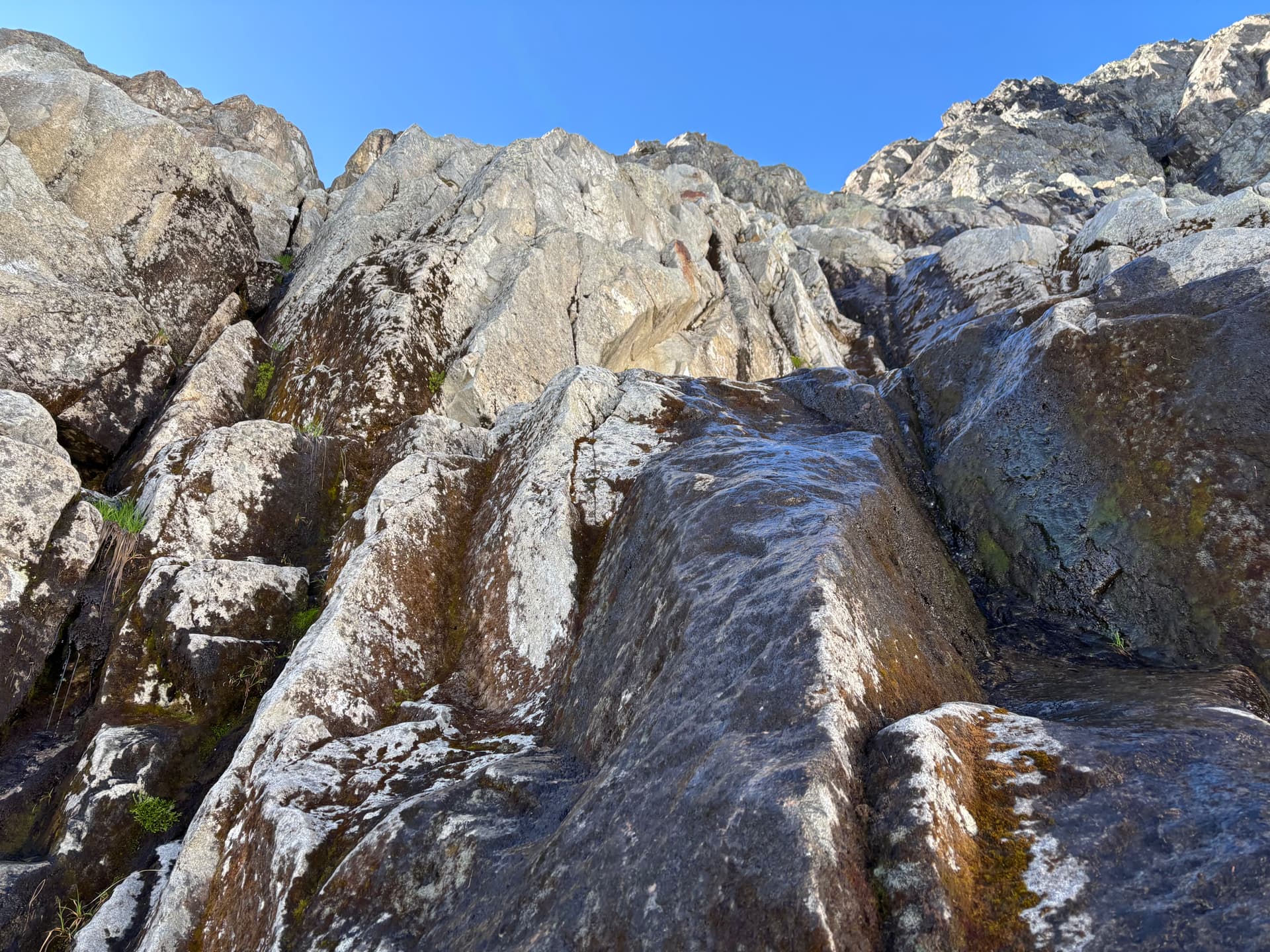
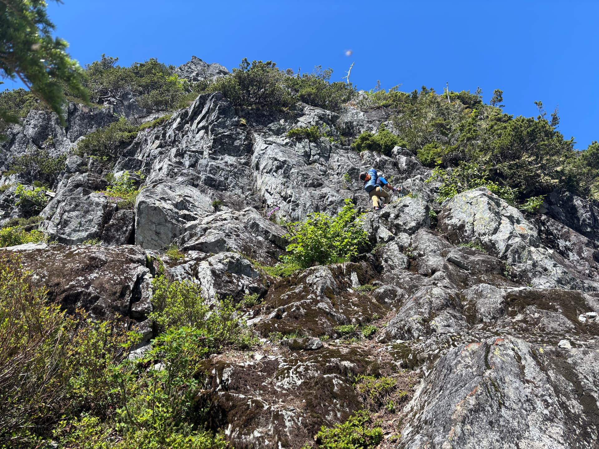
There was no need to ascend the pinnacle, and descending the other side from the top might be difficult and require a rappel, so we opted to side hill around the E side to the saddle. This was pretty tedious, especially with the recent rain making the heather slopes slick. It took some time to reach the narrow saddle. The following rise was quite steep. At one point, Dean went right and I went left to get up a steep section and I did what was for me the most tiring sequence of bush-climbing of the trip, using various cedar branches to pull myself up while my feet had virtually no purchase on the both steep and mossy/muddy wet slope. It was one of those moments where I basically had to hold on because if I let go I would have slid a decent way down. Above this we came to a small rocky waterfall where we refilled bottles, then began climbing up it, with no other ascent route visible. After the waterfall steepened to nearly vertical, we bailed left onto still steep, but treed slopes. This led to some pretty exposed and tough bush-scrambling. I ended up on a tiny ledge with the ledge above me at upper-chest height. To get up I had to lift my right leg up to hip-height and reach around a tree with left arm while pulling on a root crimp edge with my right hand. The first time I tried this, my pack slid around to my left side and blocked me from pulling up. [My pack was a bit big for me, as even with all the straps tightened down, it shifted side to side. This combined with the foam sleeping pad on the outside made thick bushwhacking difficult]. After a quick-reset I got up. Dean gave me his poles then did some wild traverse around climbers left of where I went up and met me above the steep section. From here it was a relatively straightforward ascent. We reached the top of this bump around 7:30pm and decided to make camp wherever it looked good next. Dean found a flat heather spot on the other side and we pitched camp.
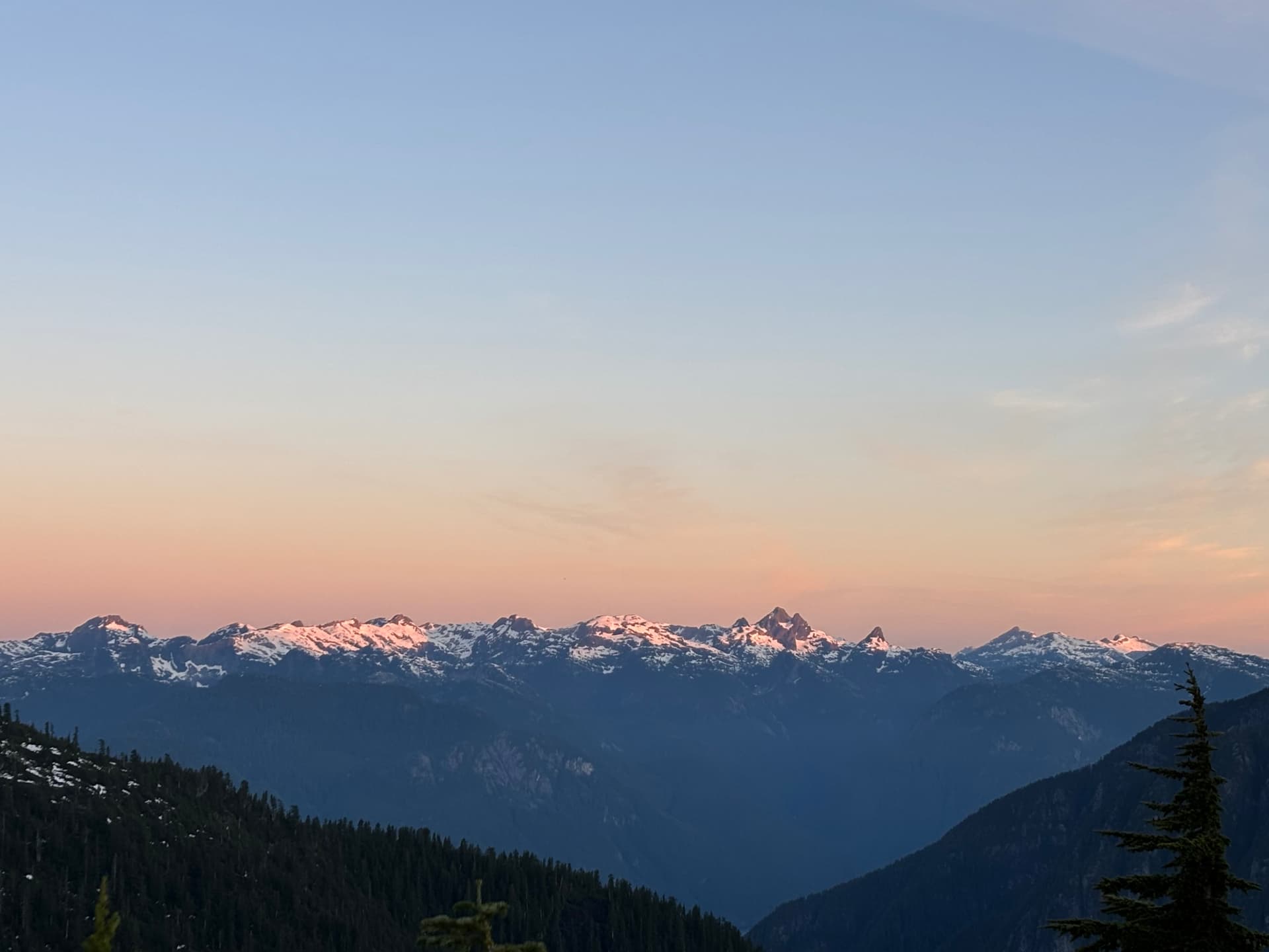
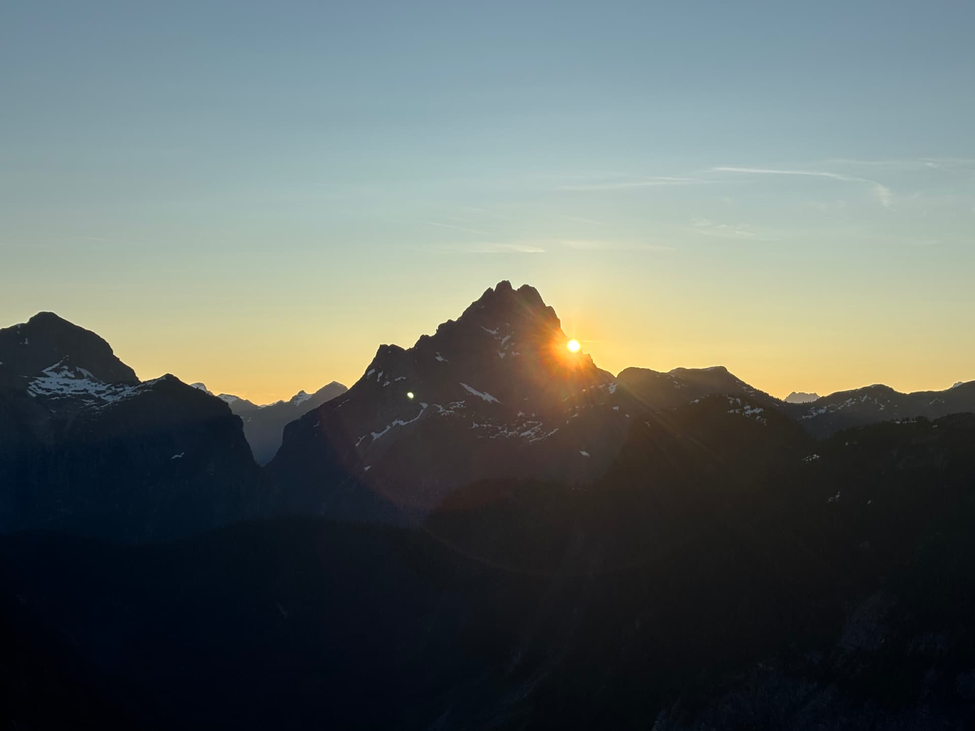
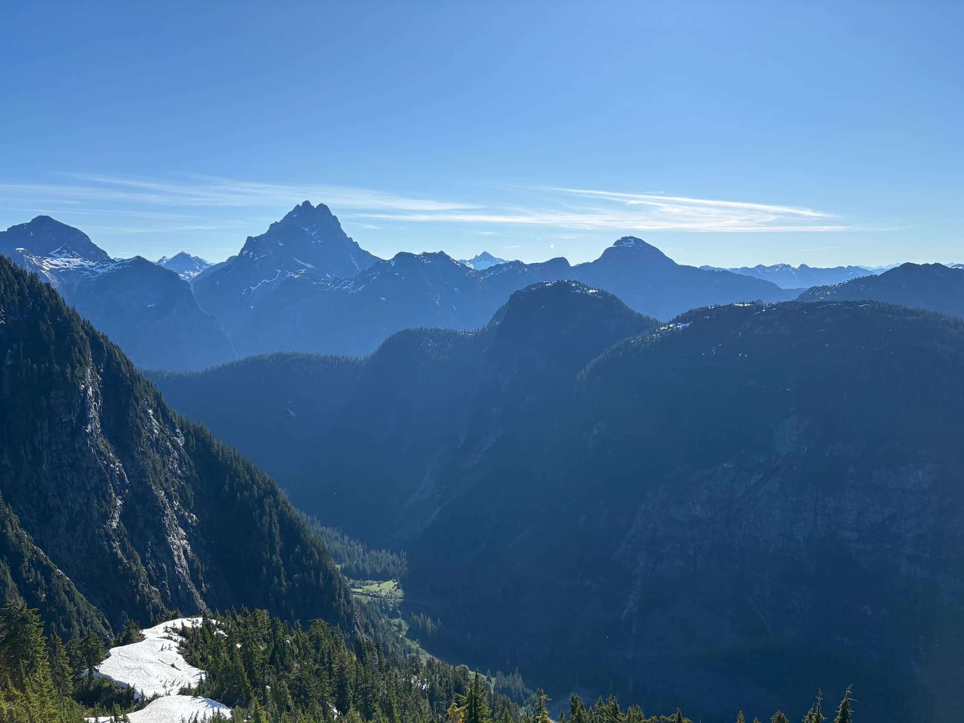
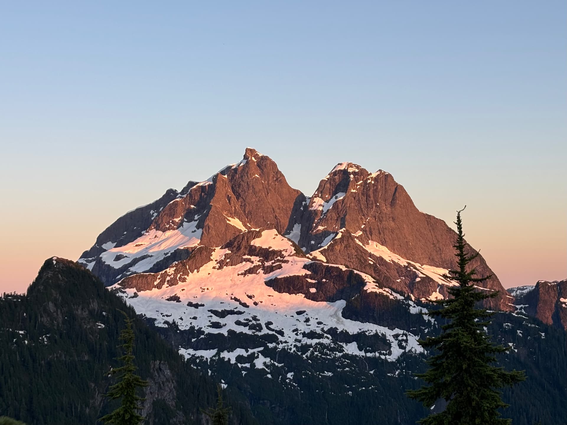
We had gone farther than I initially planned on day 1, so were off to a good start even if the bushwhacking was harder than I hoped. I wrapped my swollen shin in a tensor bandage. Right before going to bed the clouds lifted and we got sweet views of Robie Reid, the Judge, and Defendant. But these views were nothing compared to what we’d get later on!
Day 2
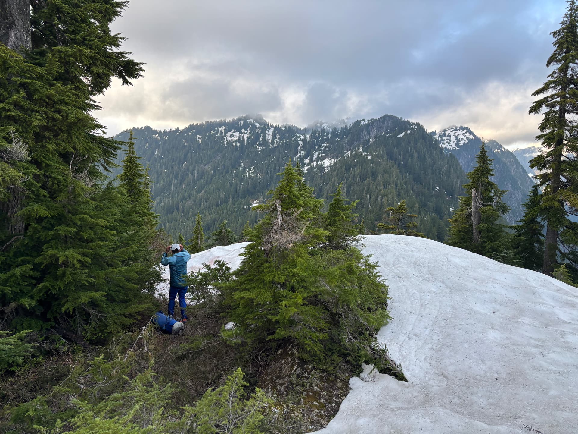
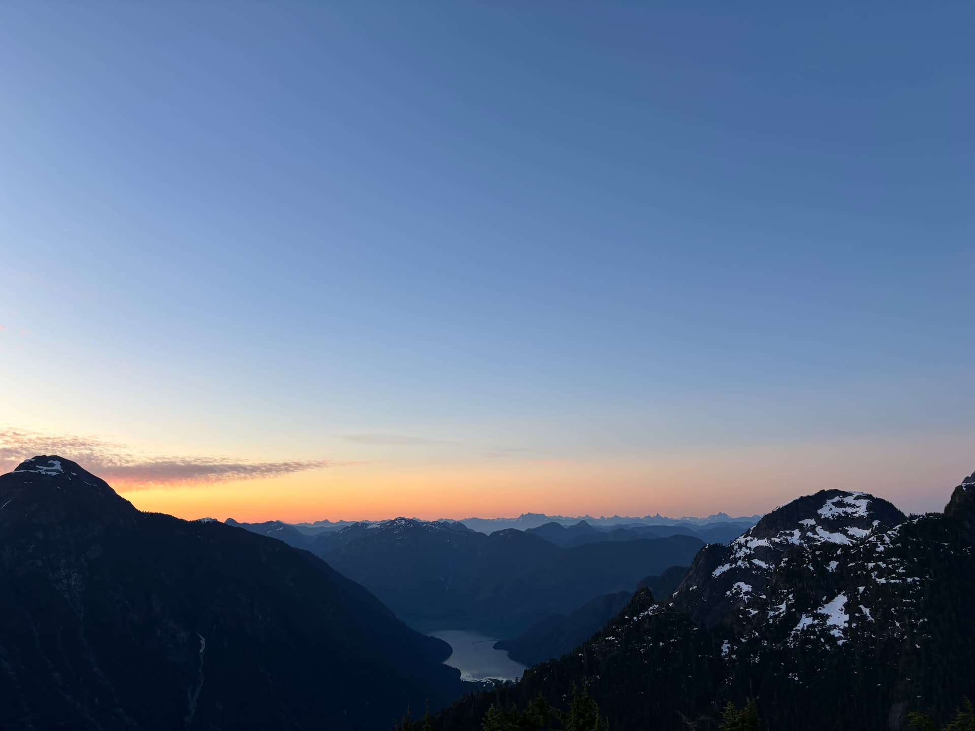
Overnight the clouds drifted in and out before finally departing for good leaving the skies completely clear, which lasted the rest of our trip. My sleep wasn’t great, as closed-cell foam pads work best on flat ground, and the uneven heather made things a bit lumpy. But I wasn’t too tired, despite waking around 4:30am. After taking in the spectacular morning alpenglow, with especially nice views of Pinecone Burke + the Fingers, we made breakfast, repacked and headed out.
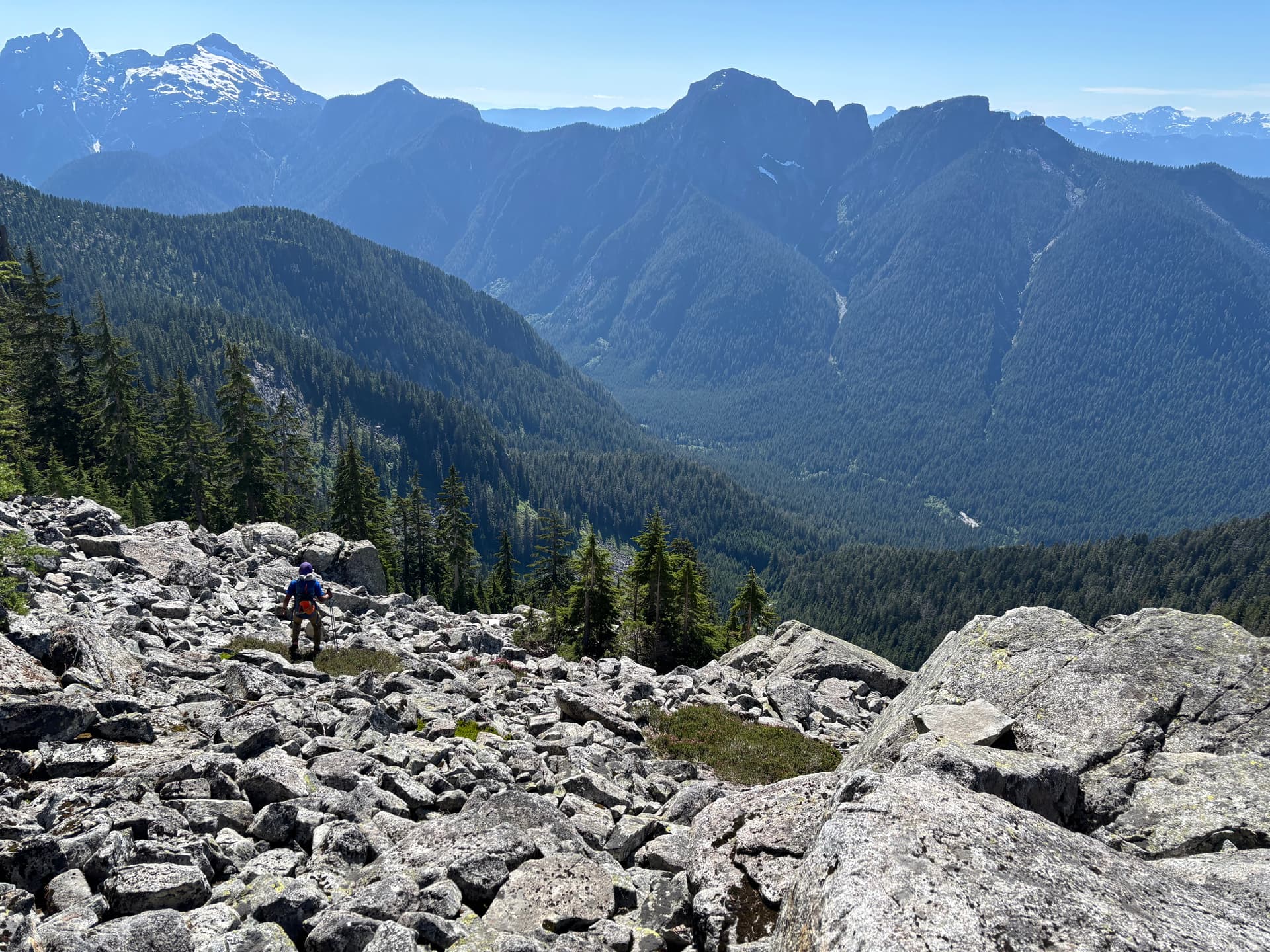
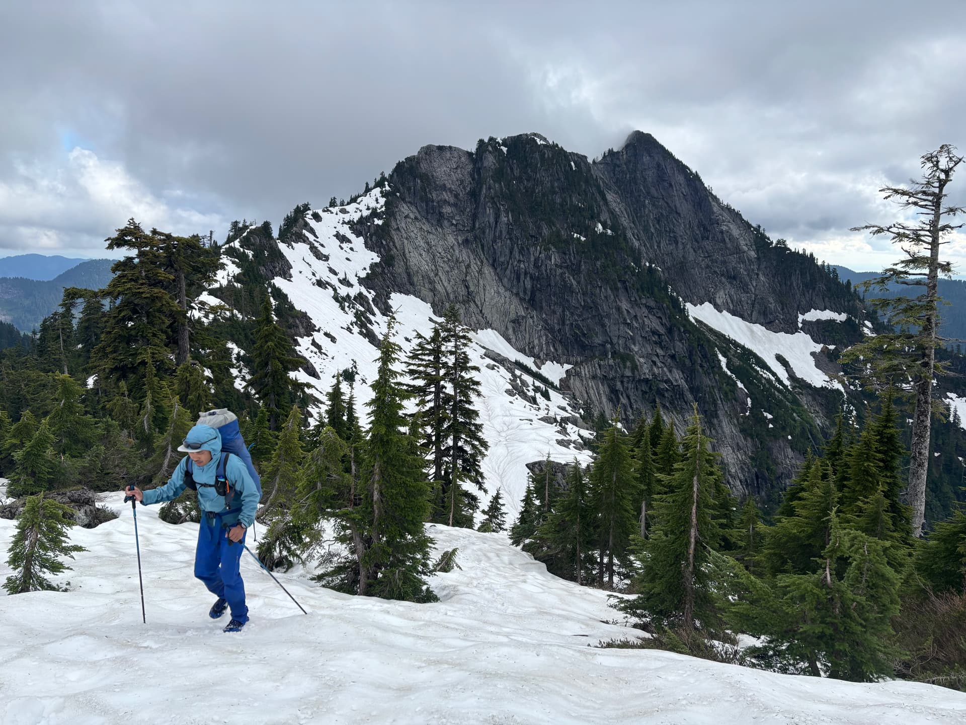
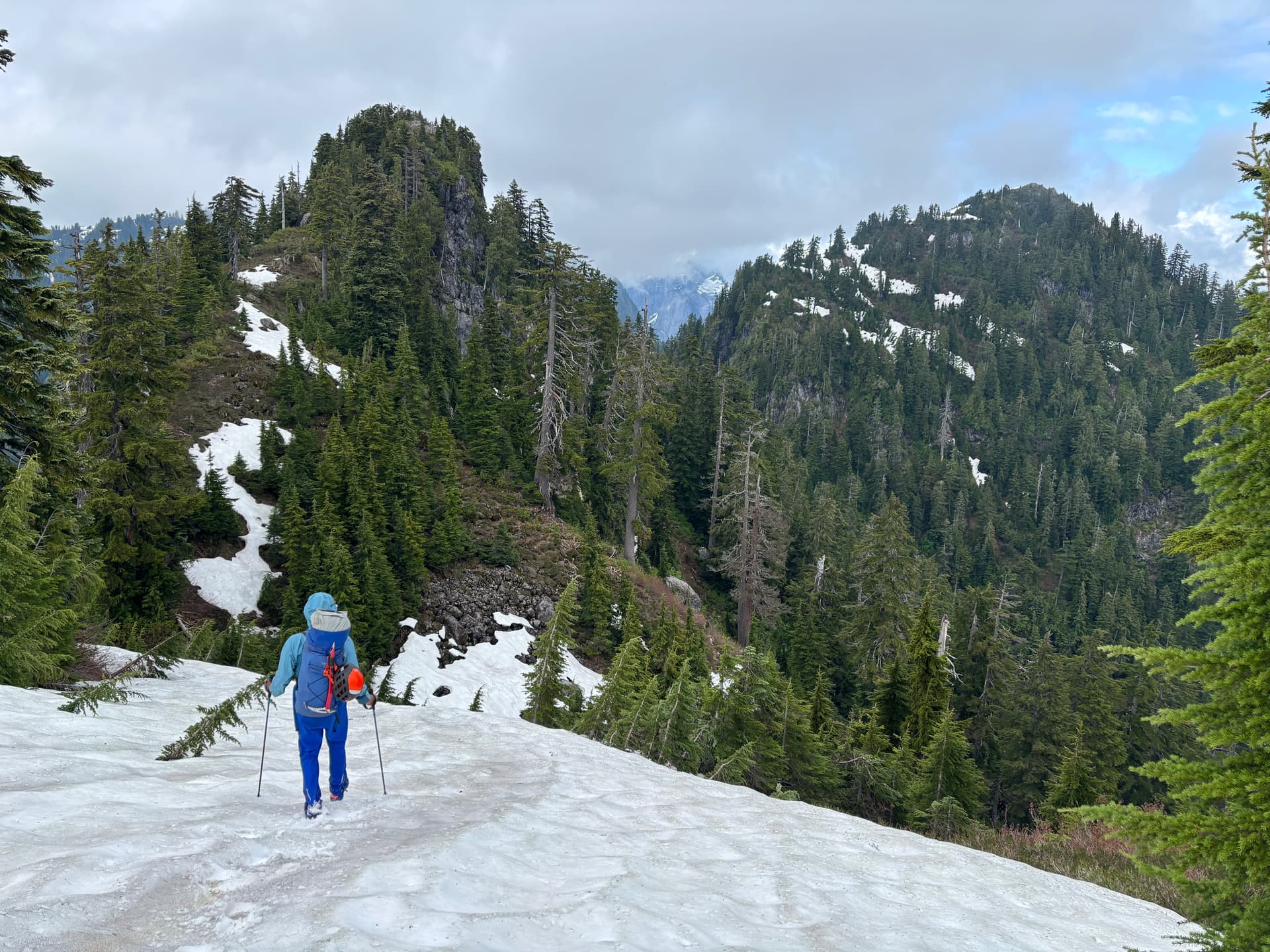
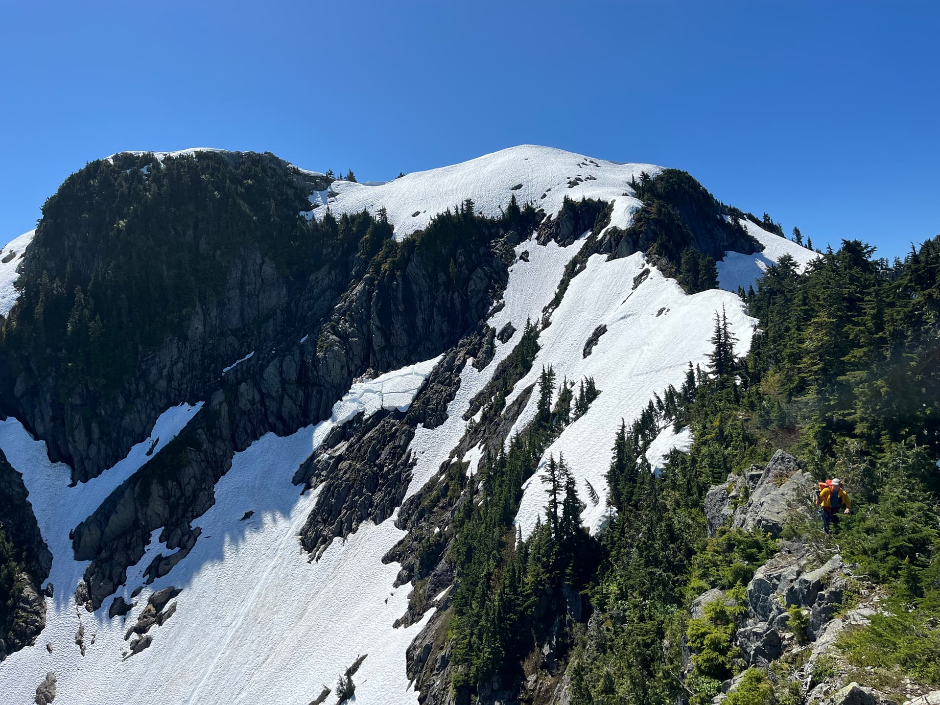
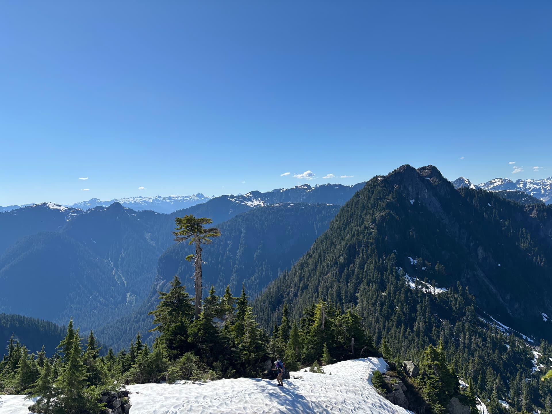
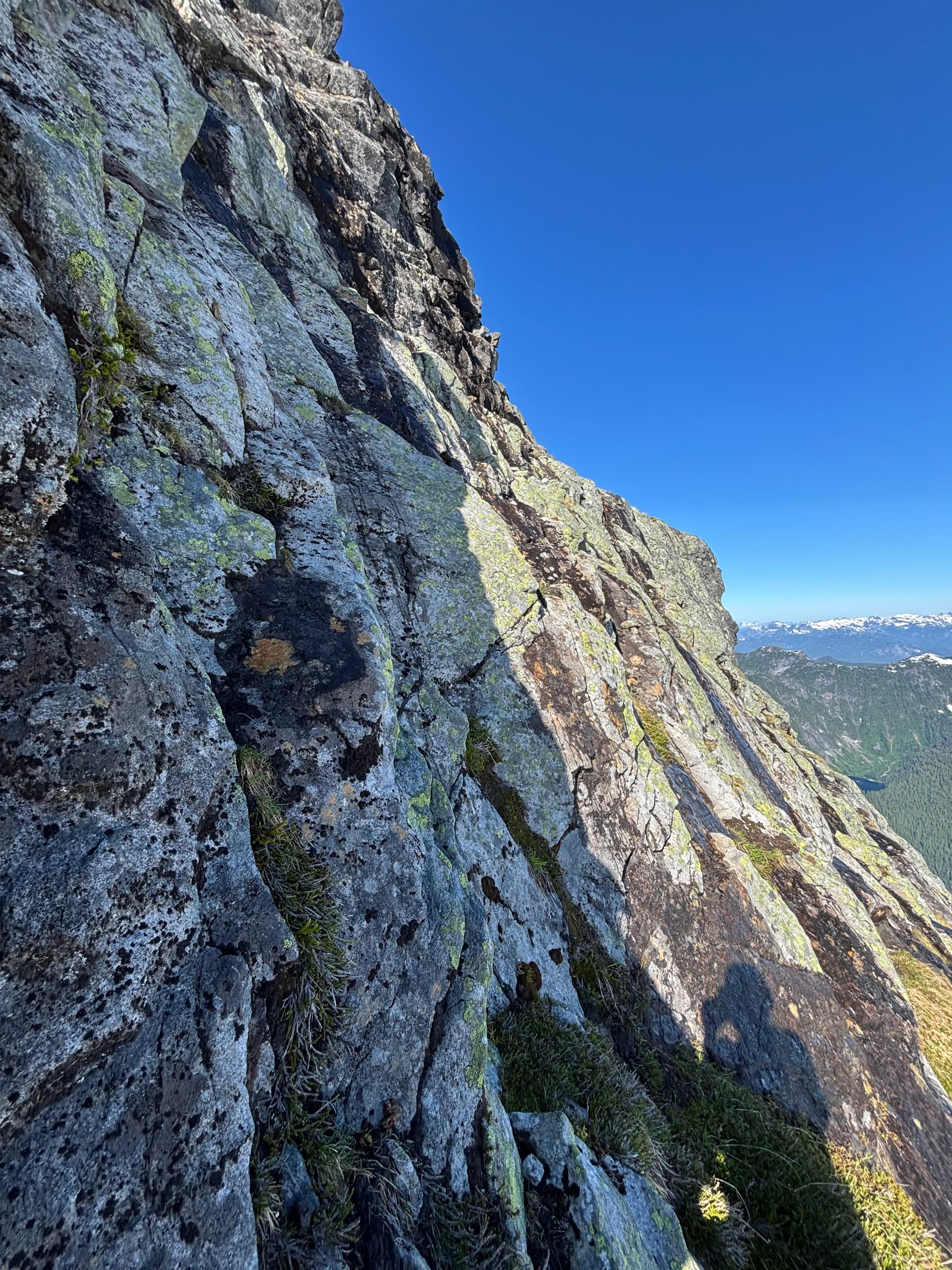
The ridge from camp to Bole was undulating, but also had modest amounts of nice open snow travel. Several knife-edge rocky sections of ridge were incredibly bushy making for pretty slow going. Each time we approached the part of the ridge where it dropped down to the saddle before the next rise there was a moment of trepidation before whoever was leading announced if the route ‘would go’ or not. I totally expected us to get cliffed out, but there was a always a viable way down- and it was always bushy, mixed with some easy scrambling. About 1.5h after leaving camp we came to what would have made a much nicer site. An expansive open area of ridge with nice flat rocks and stunning views to the valley immediately to the E below Mt Higgins.
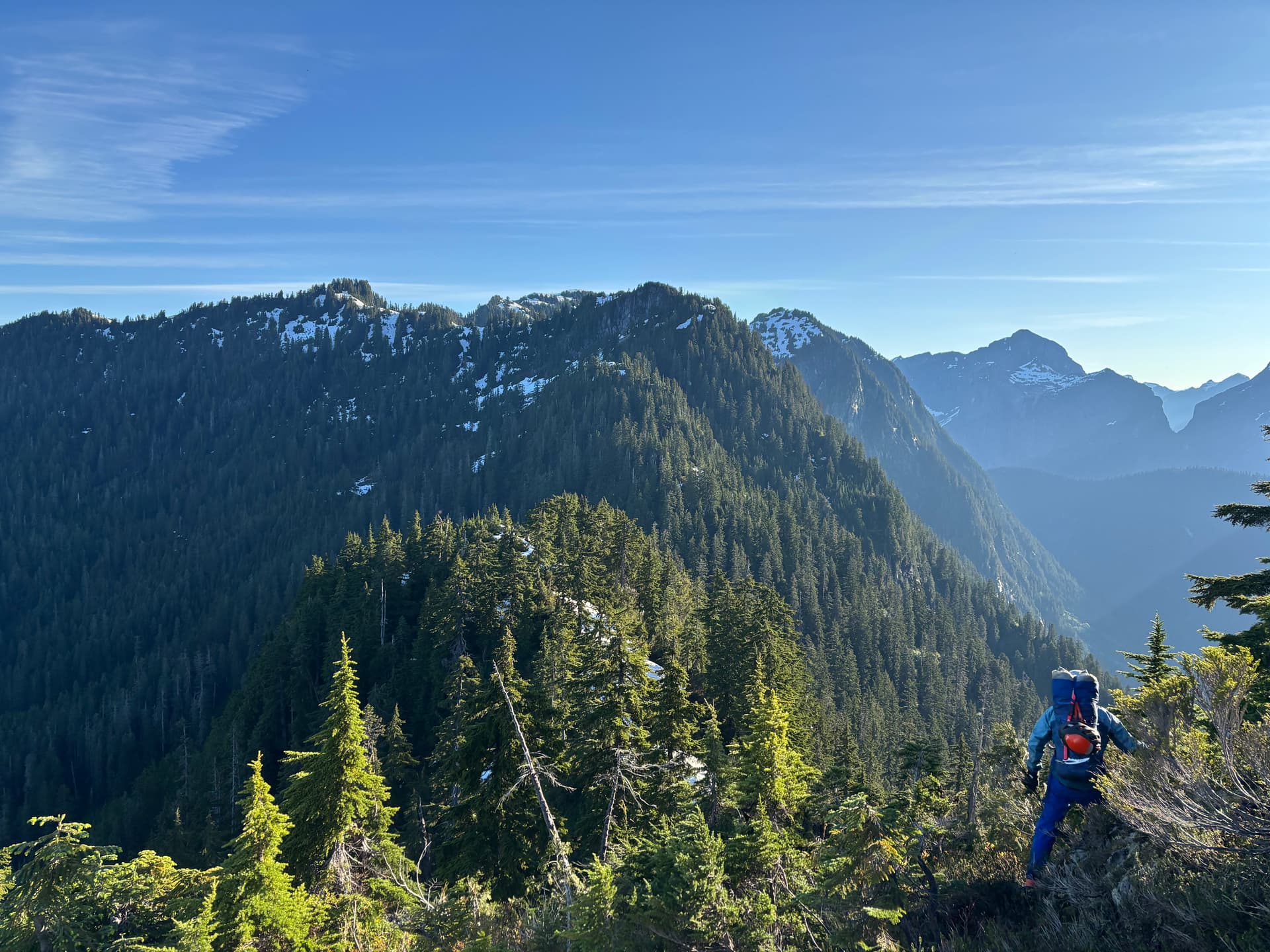

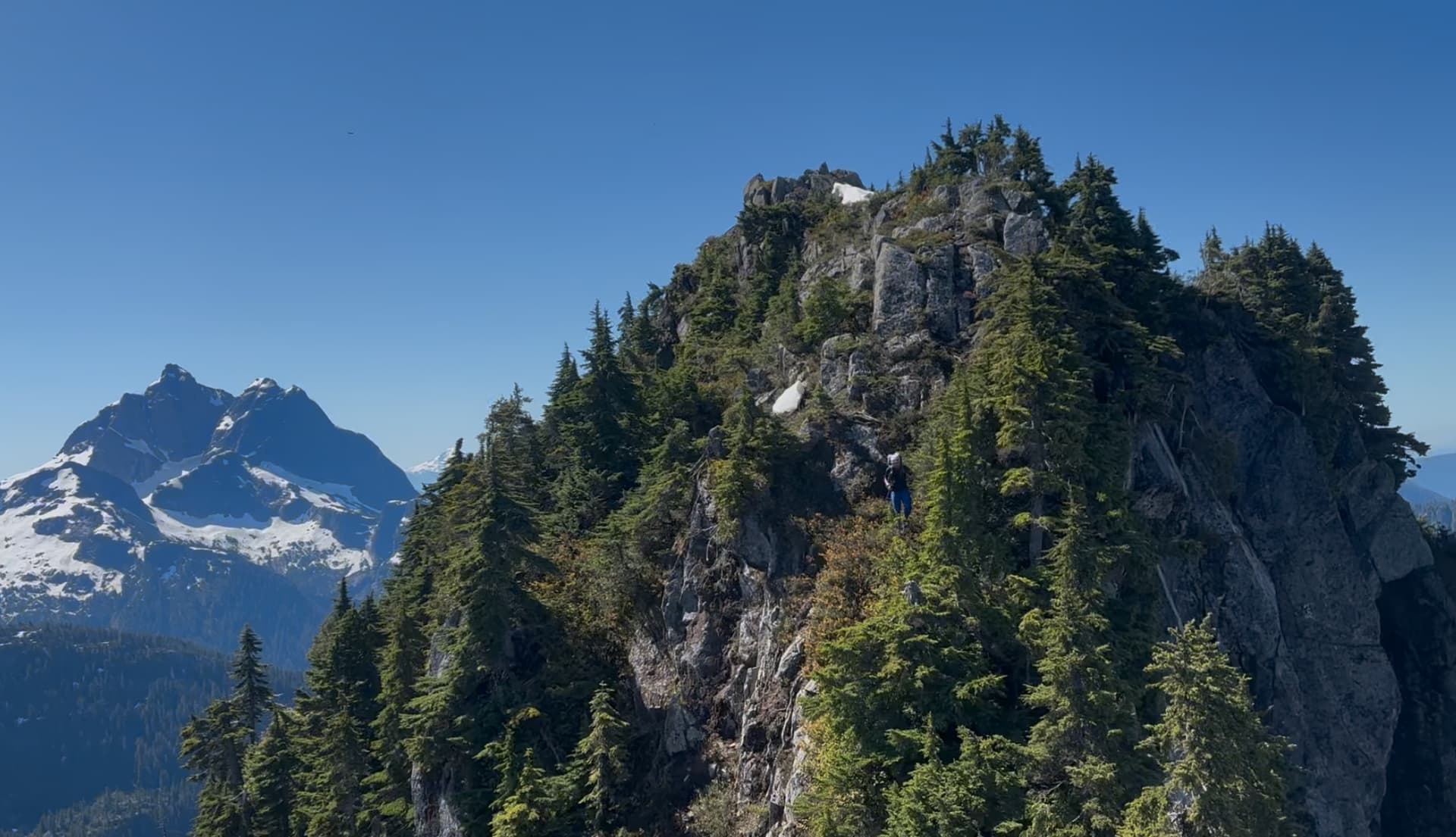
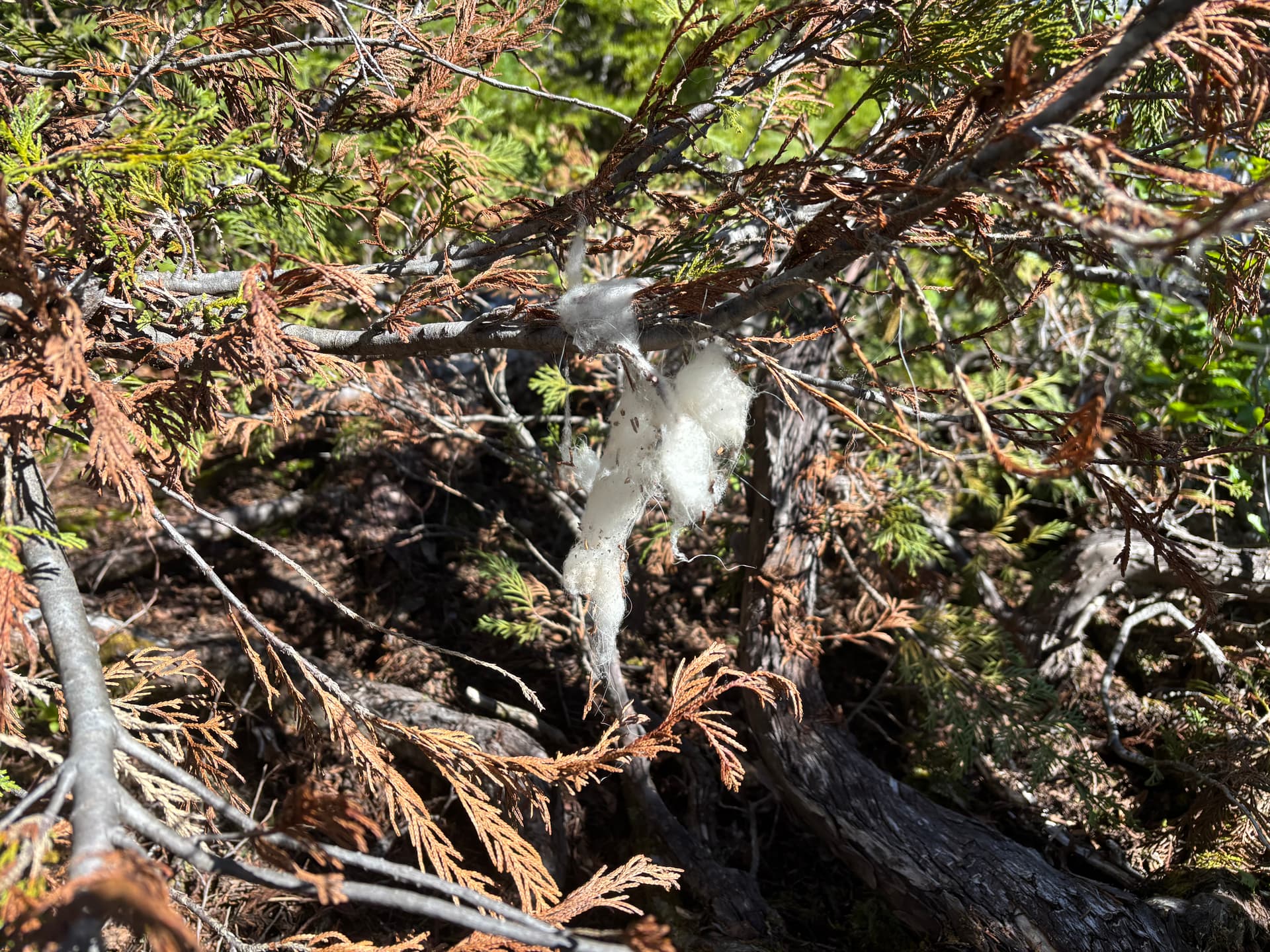
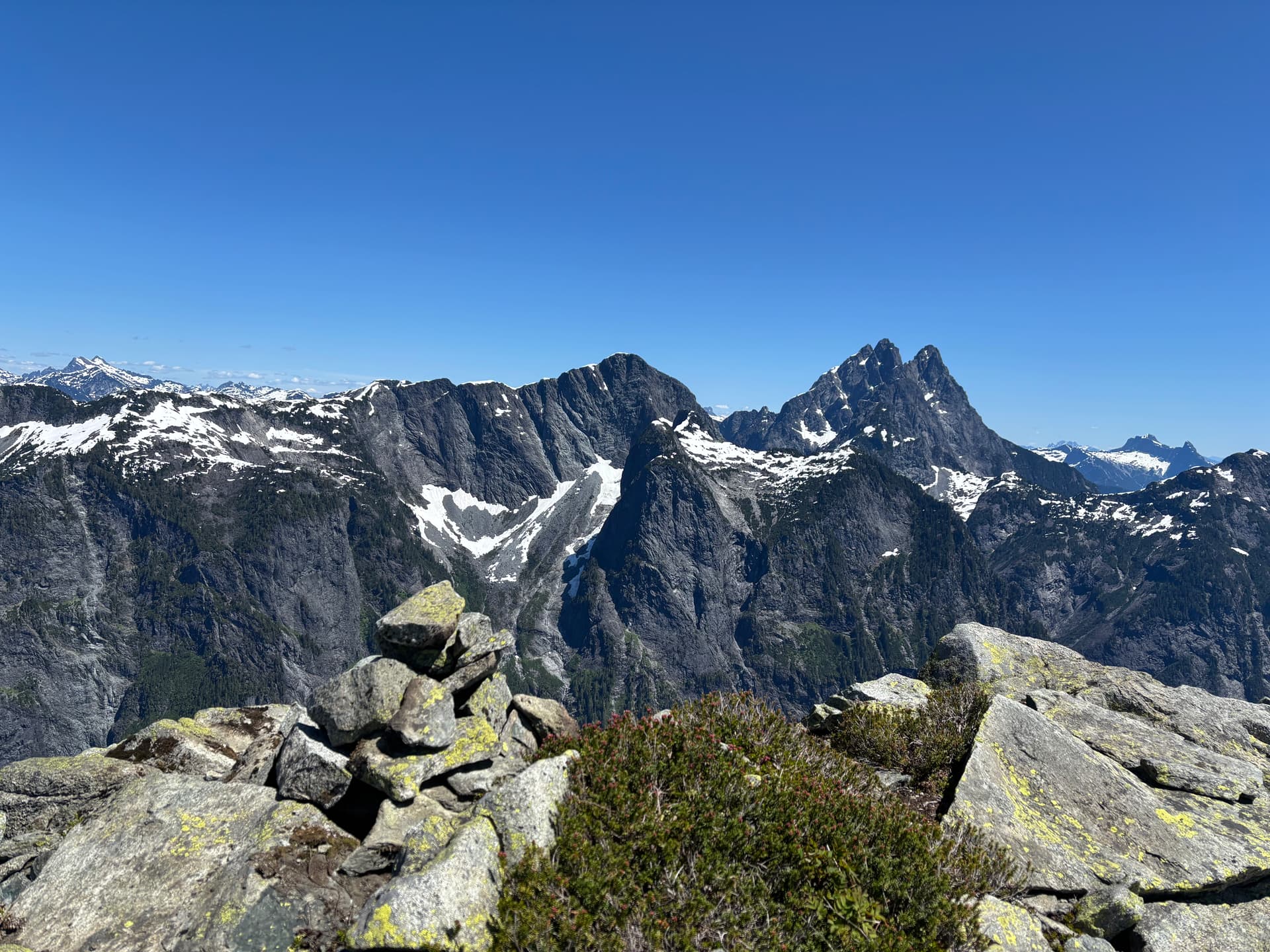
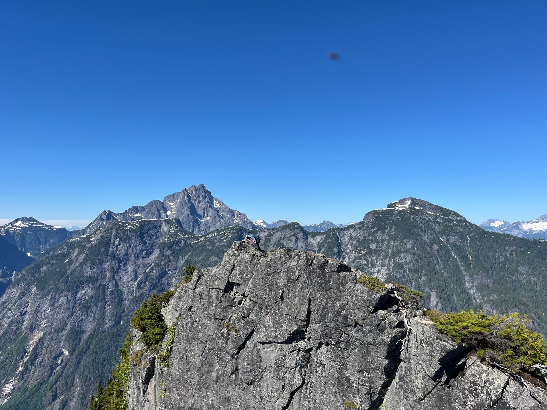
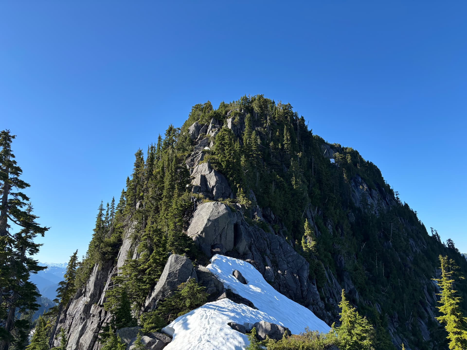
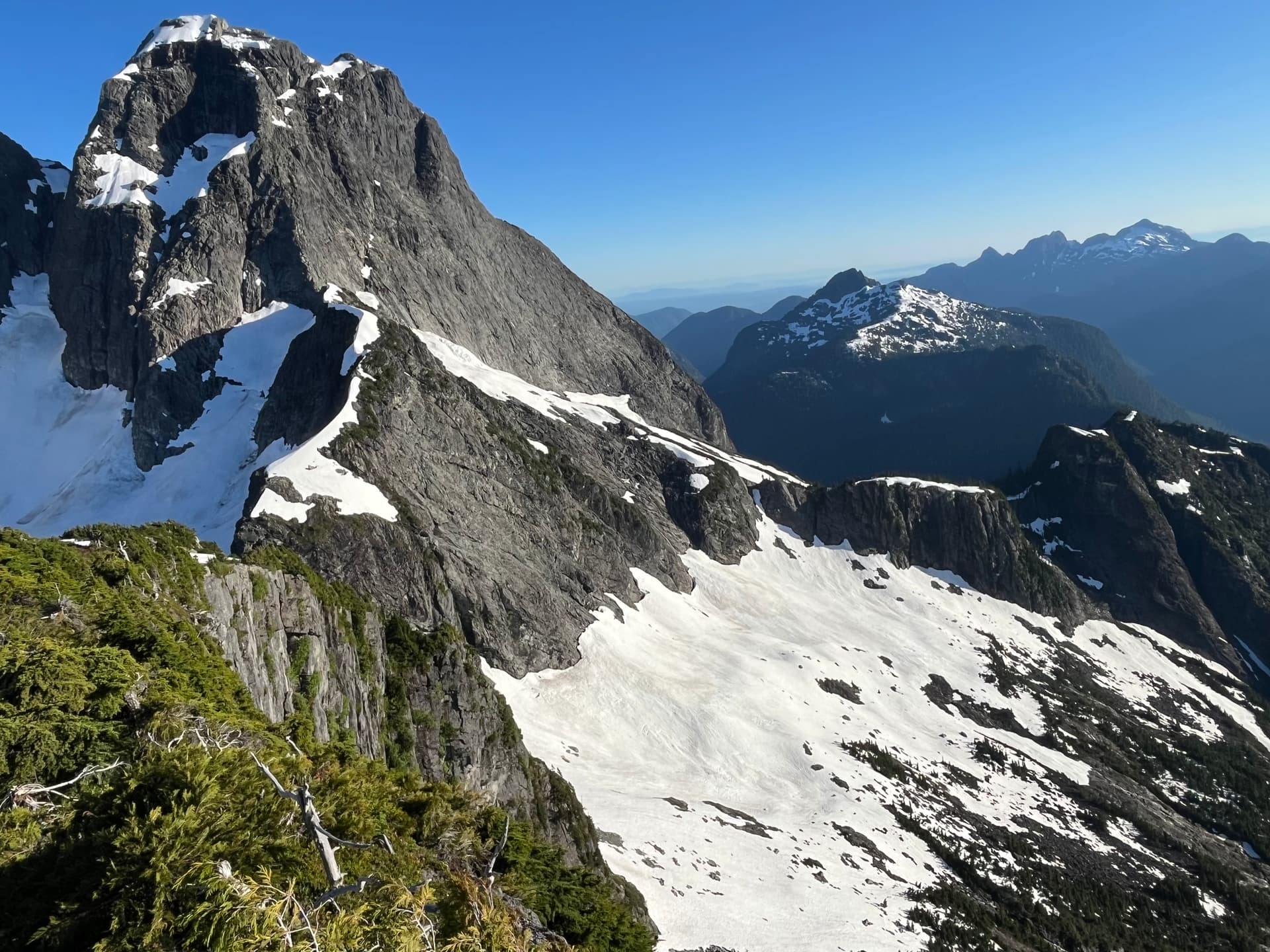
As we approached Bole, the summit looked cooler than I expected. It was aesthetically smoothly tapered with a rocky cap, unlike most of the other bumps on the ridge which were broad, bushy and non-distinct. We came across some mountain goat fur caught in the bush. It was interesting that they were in this narrow sub-alpine area. We passed above remnants of an ancient glacier, noted by its rocky light grey ice-scoured and lined surface. The area really gave a sense of remoteness, and this trip was already becoming a favourite.
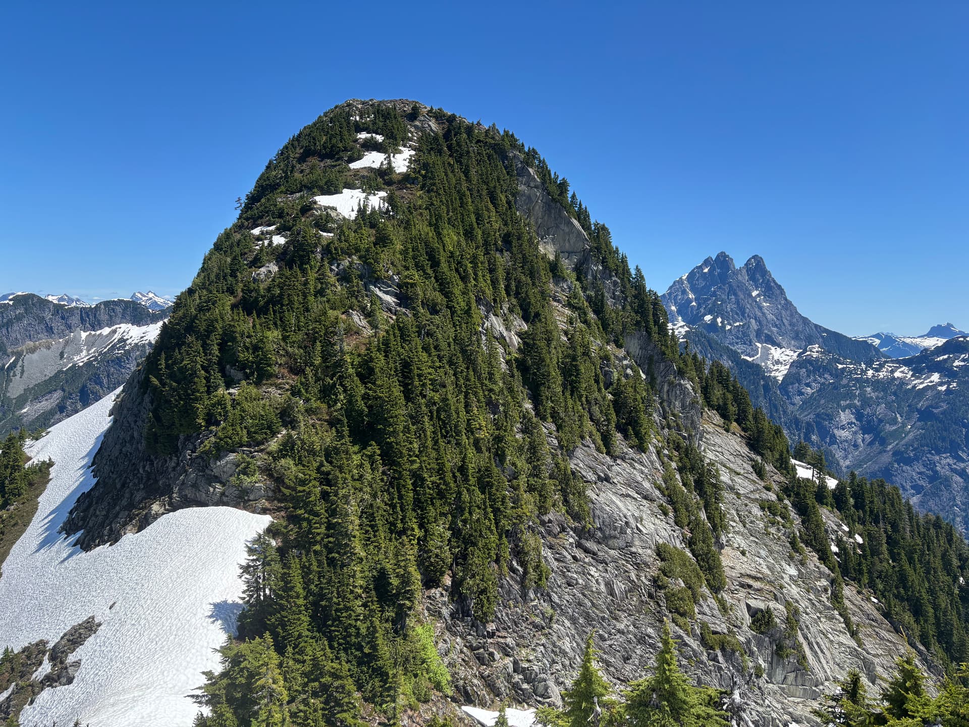
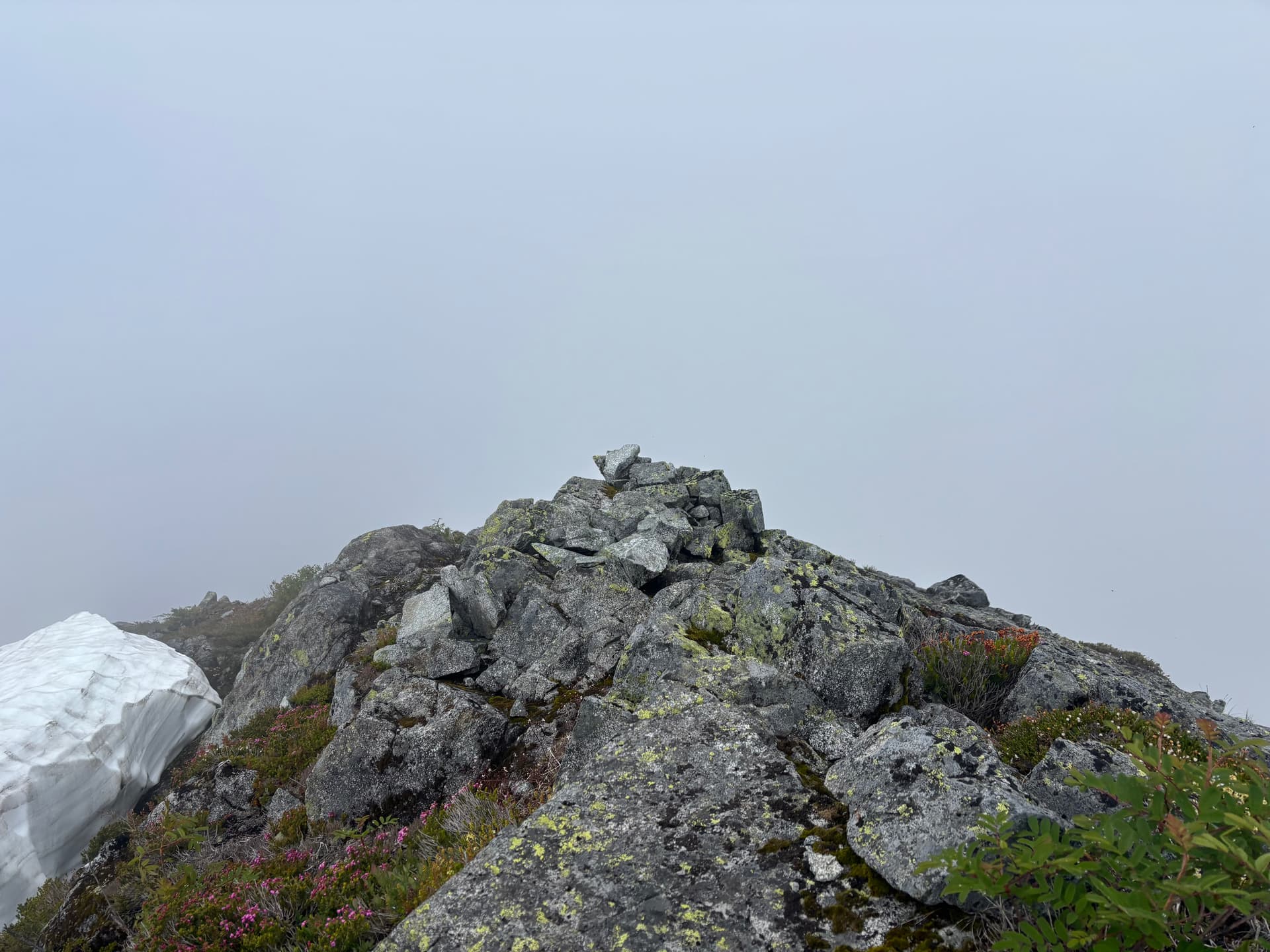
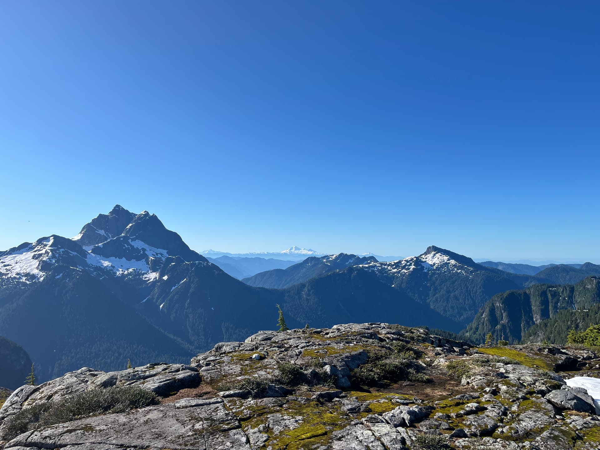
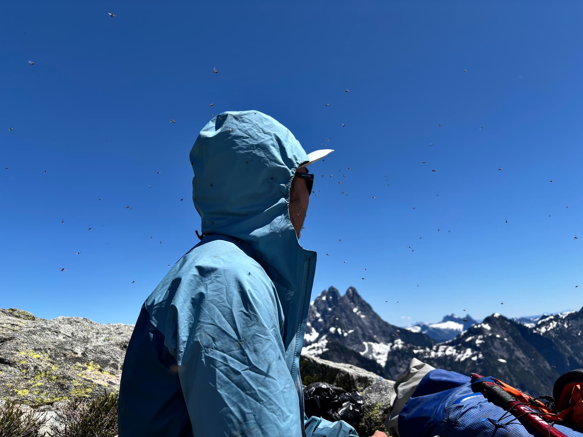
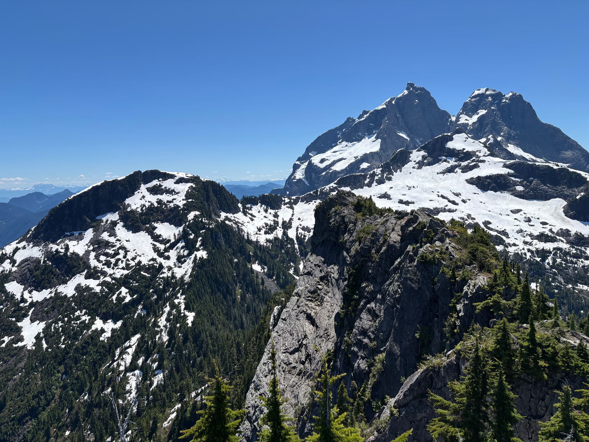
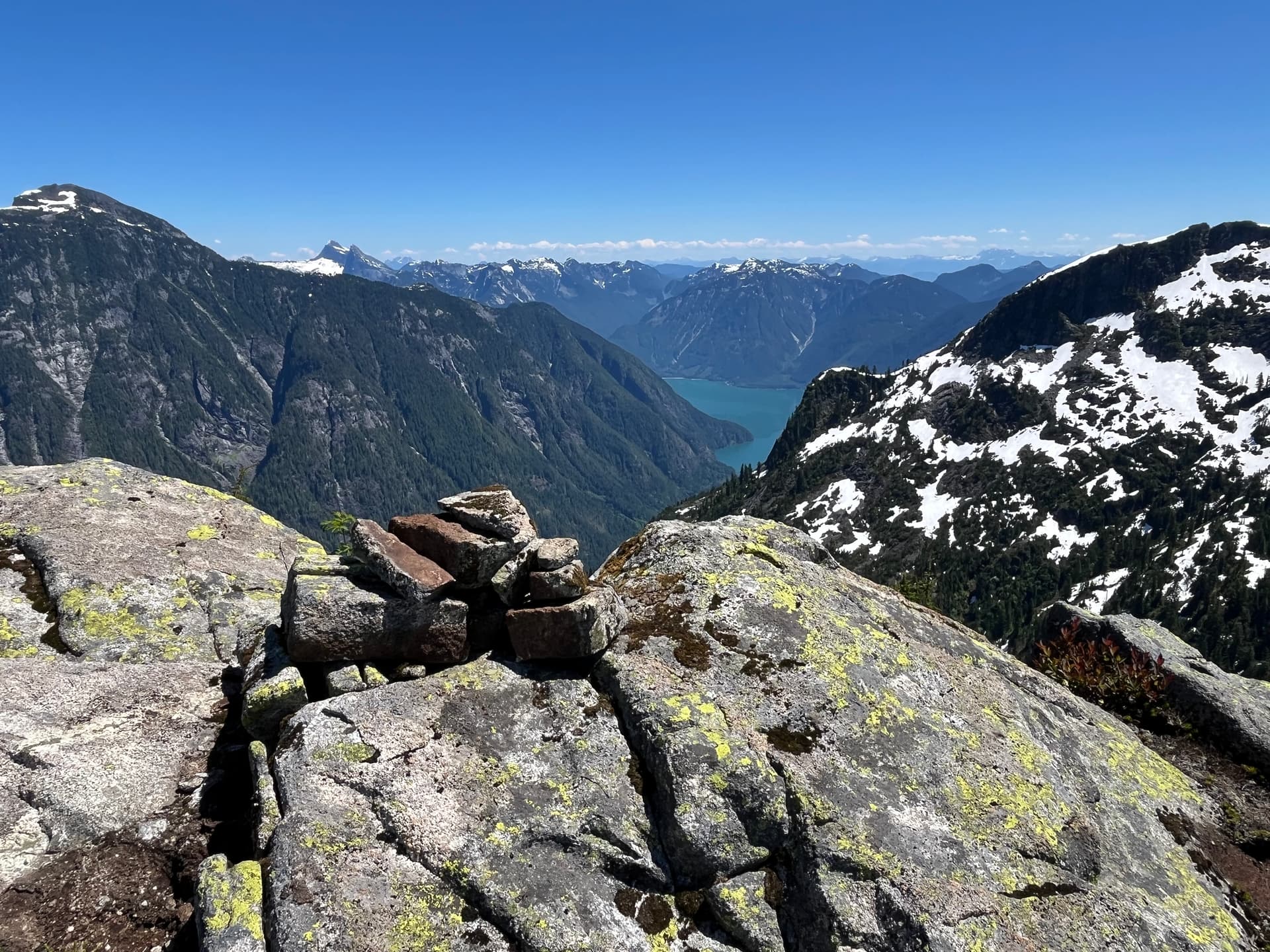
The summit of Mt Bole was one of the highlights for me. It held a fair amount of mystery, for despite being relatively close to civilization it was unclear when the last ascent was. Logistically, it isn’t hard to get to but requires a willingness to endure some unpleasant bushwhacking. Here we were treated to the best views of the Defendant I’ve seen, and second-to-none views of Osprey peak. The only downside was the insane amount of bugs. Most of them were just those annoying gnats, not the biting kind. I built a cairn on the summit after failing to find one. It seemed like there might have been one around where I built mine, as some flat-ish rocks were scattered about. We spend about 30min on the summit. From here we could see the Tingle Valley South ridgeline. It looked relatively straightforward except for the ascent up Mt Higgins. I couldn’t see a clear way up, and the lower part looked incredibly steep with some tall cliffs.
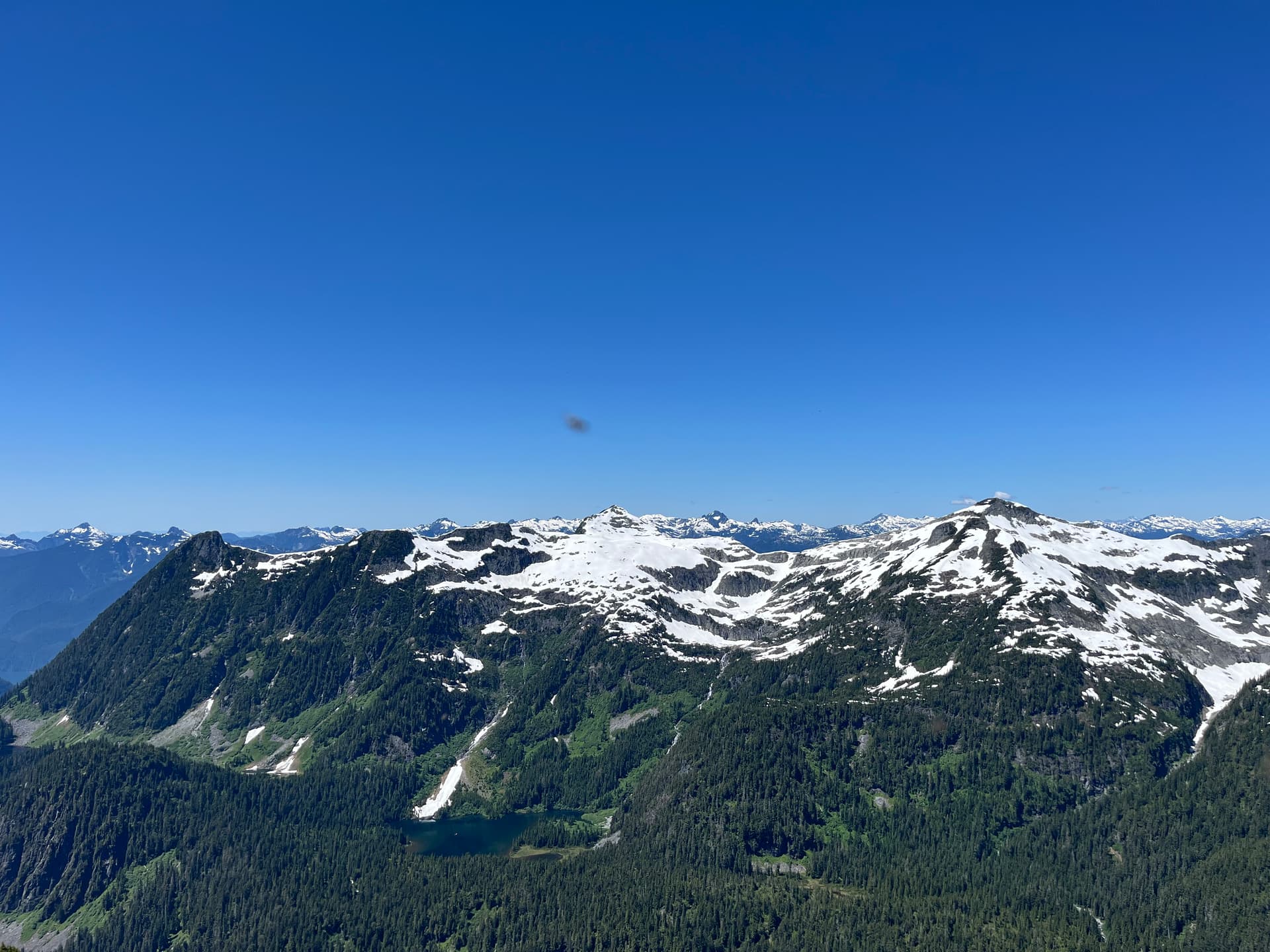
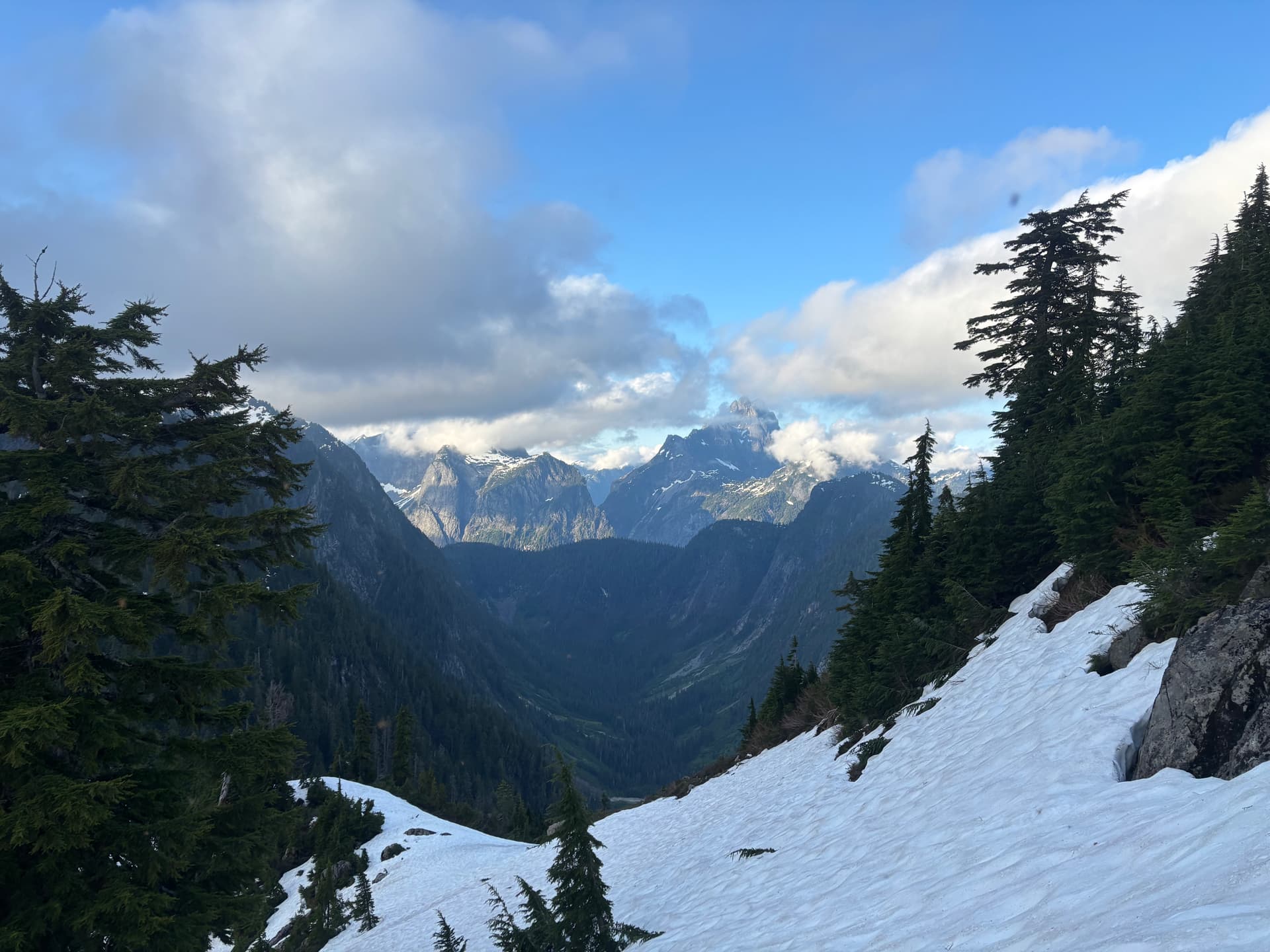
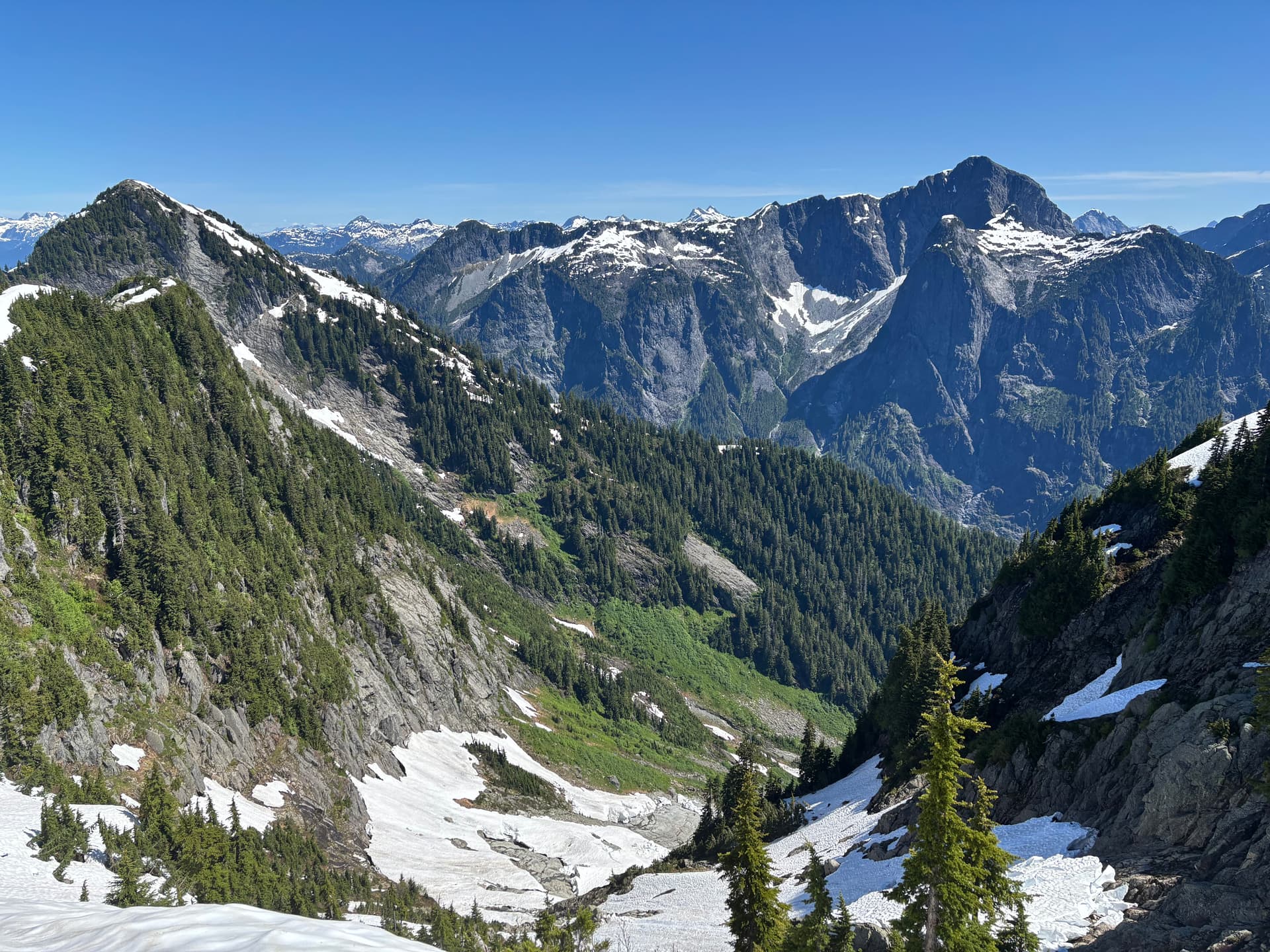
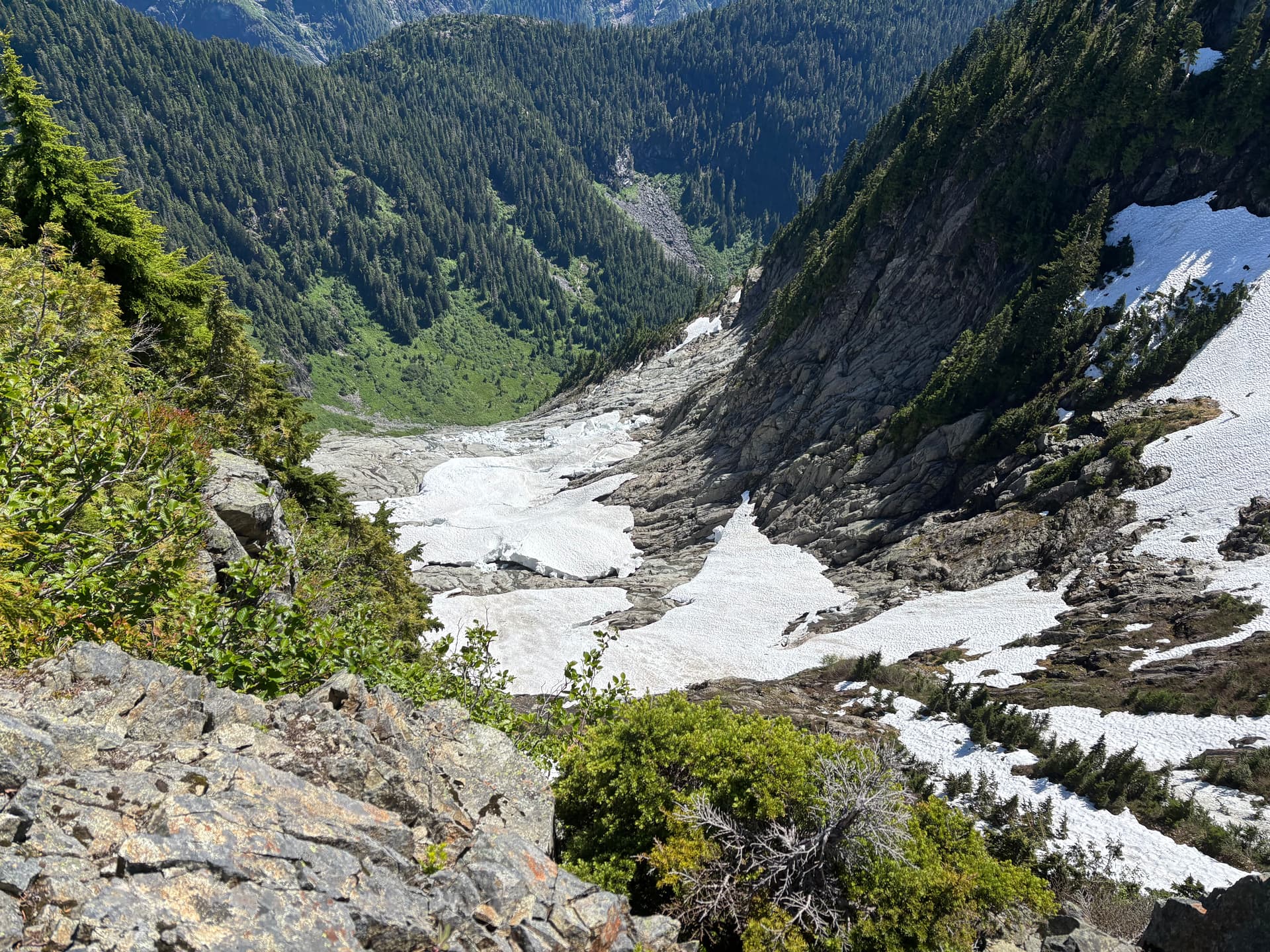
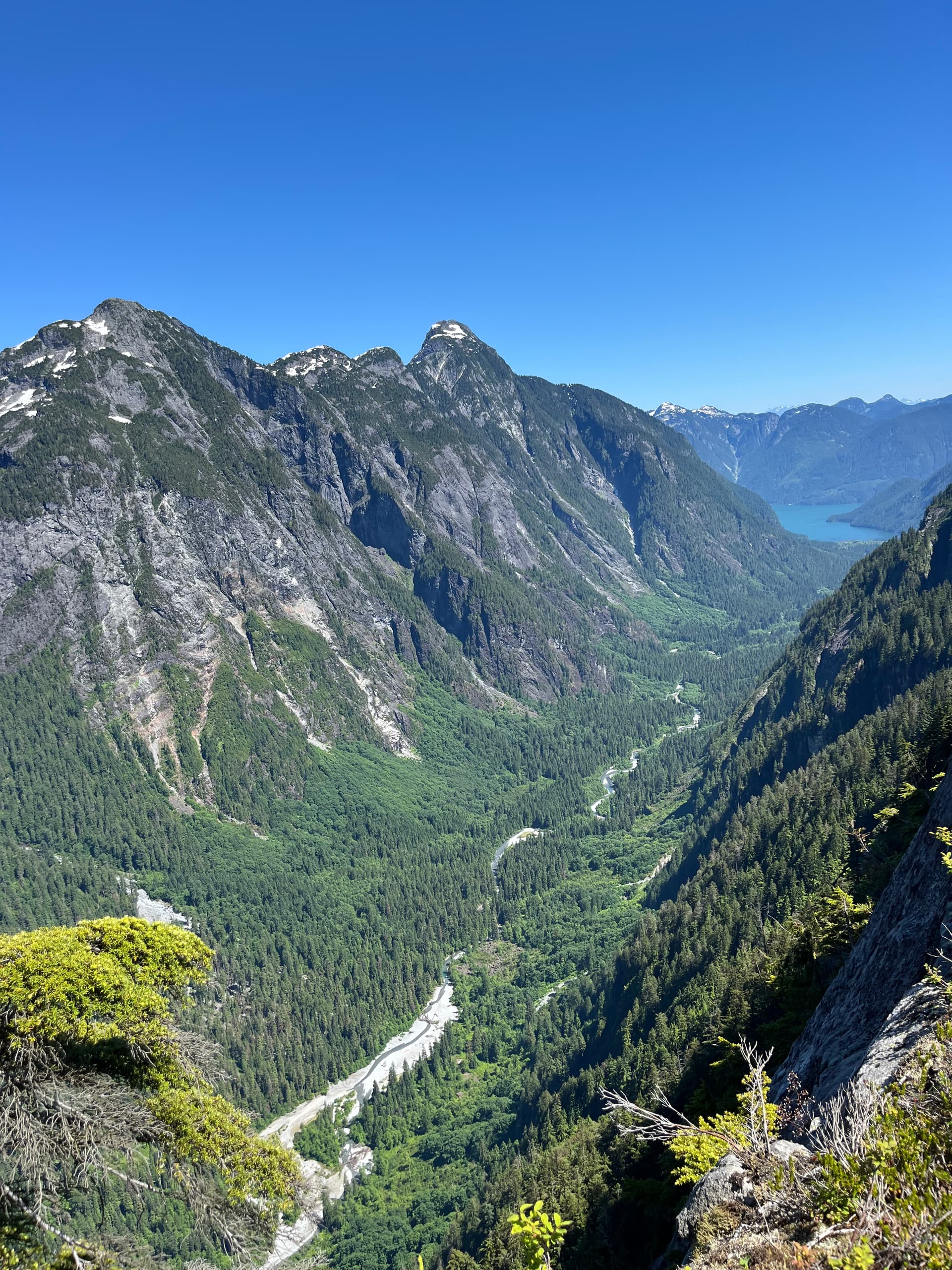
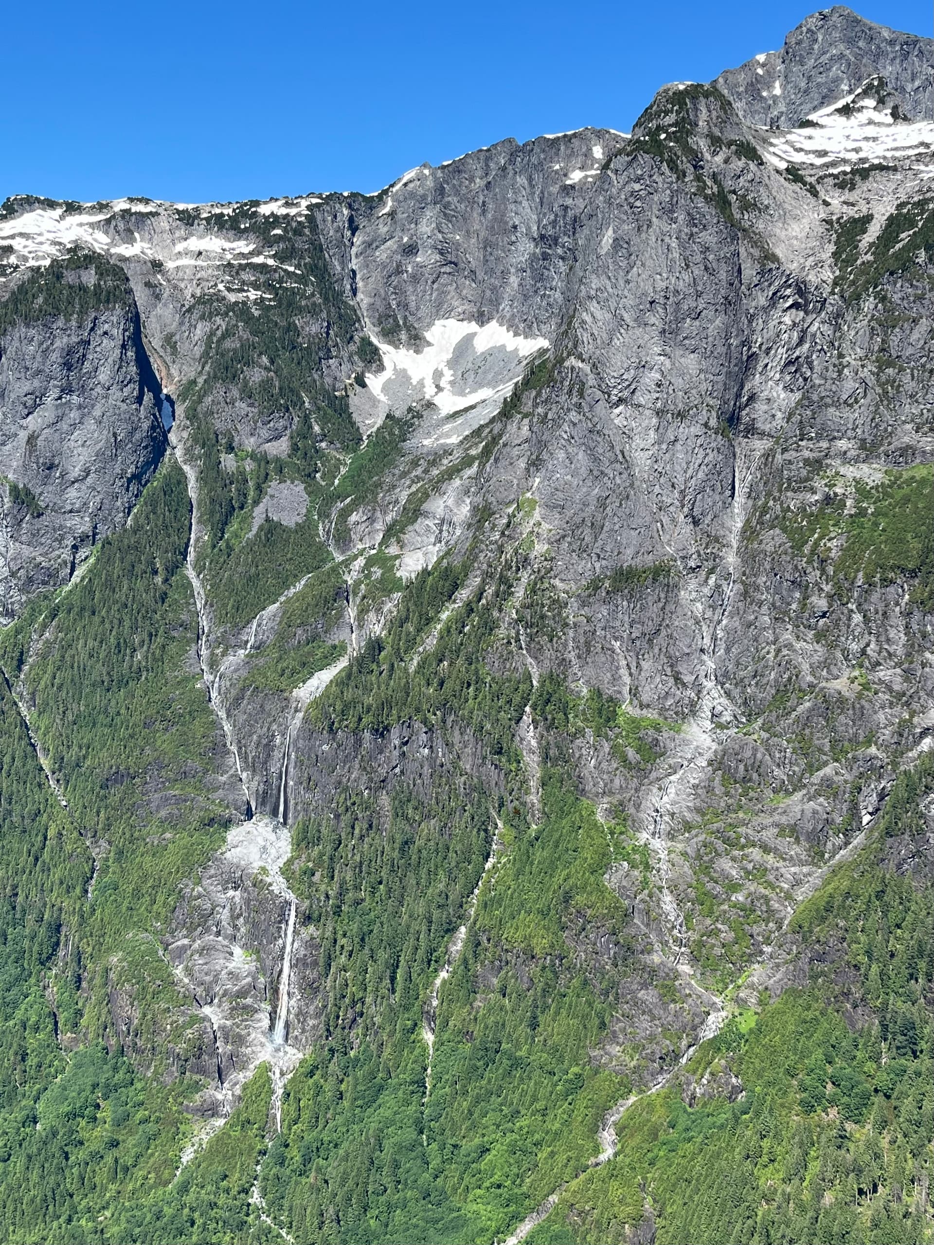
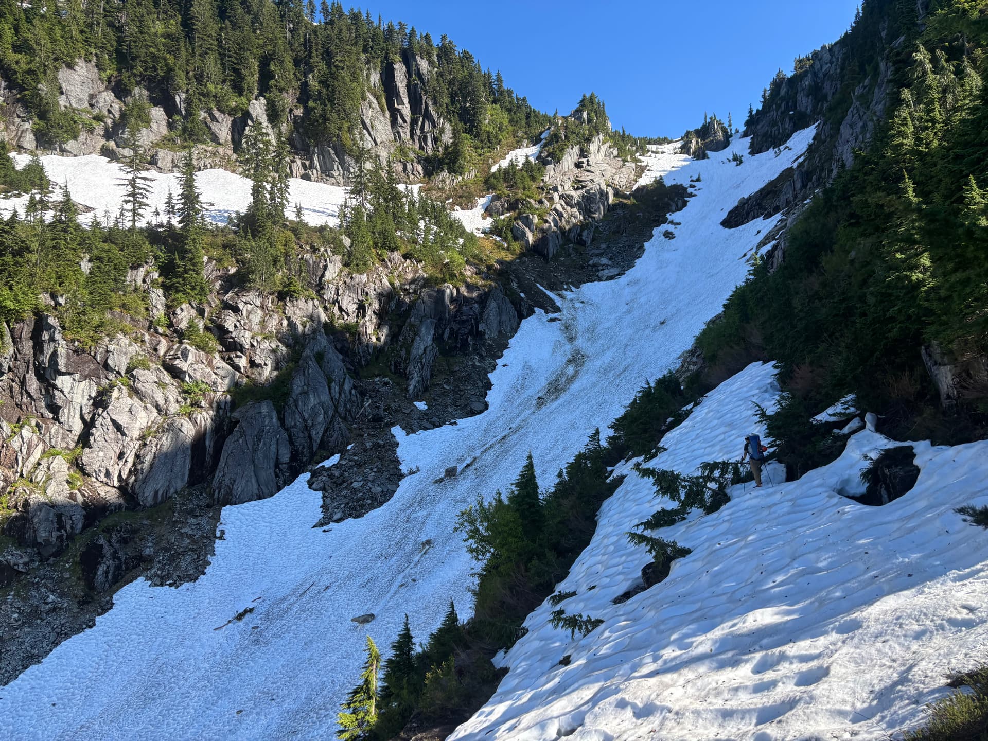
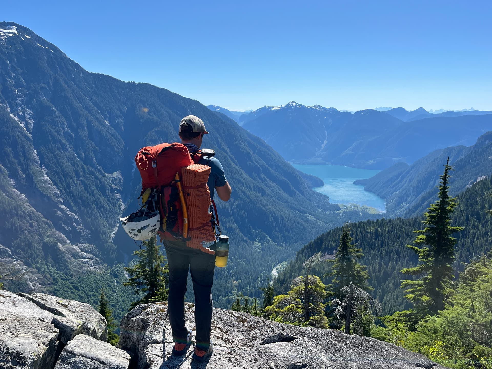
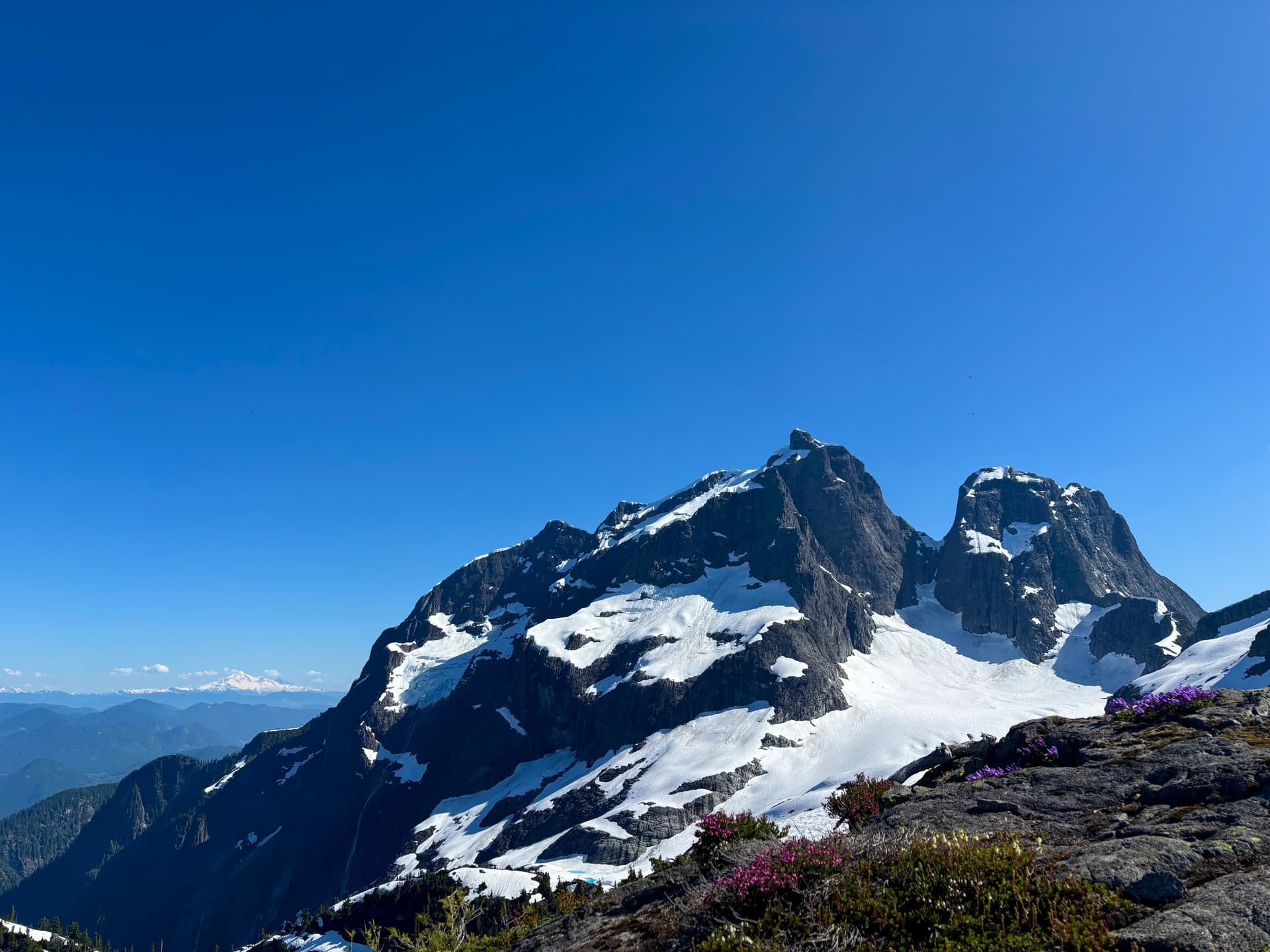
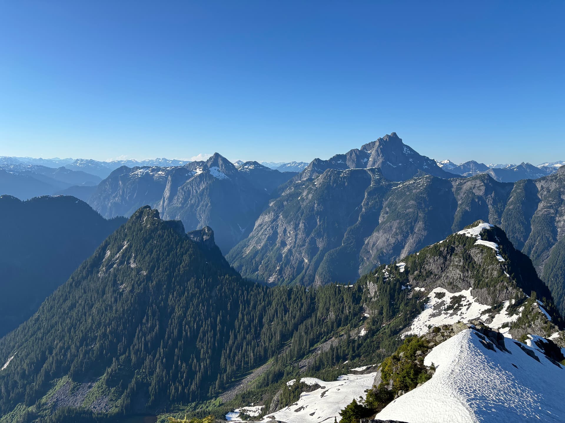
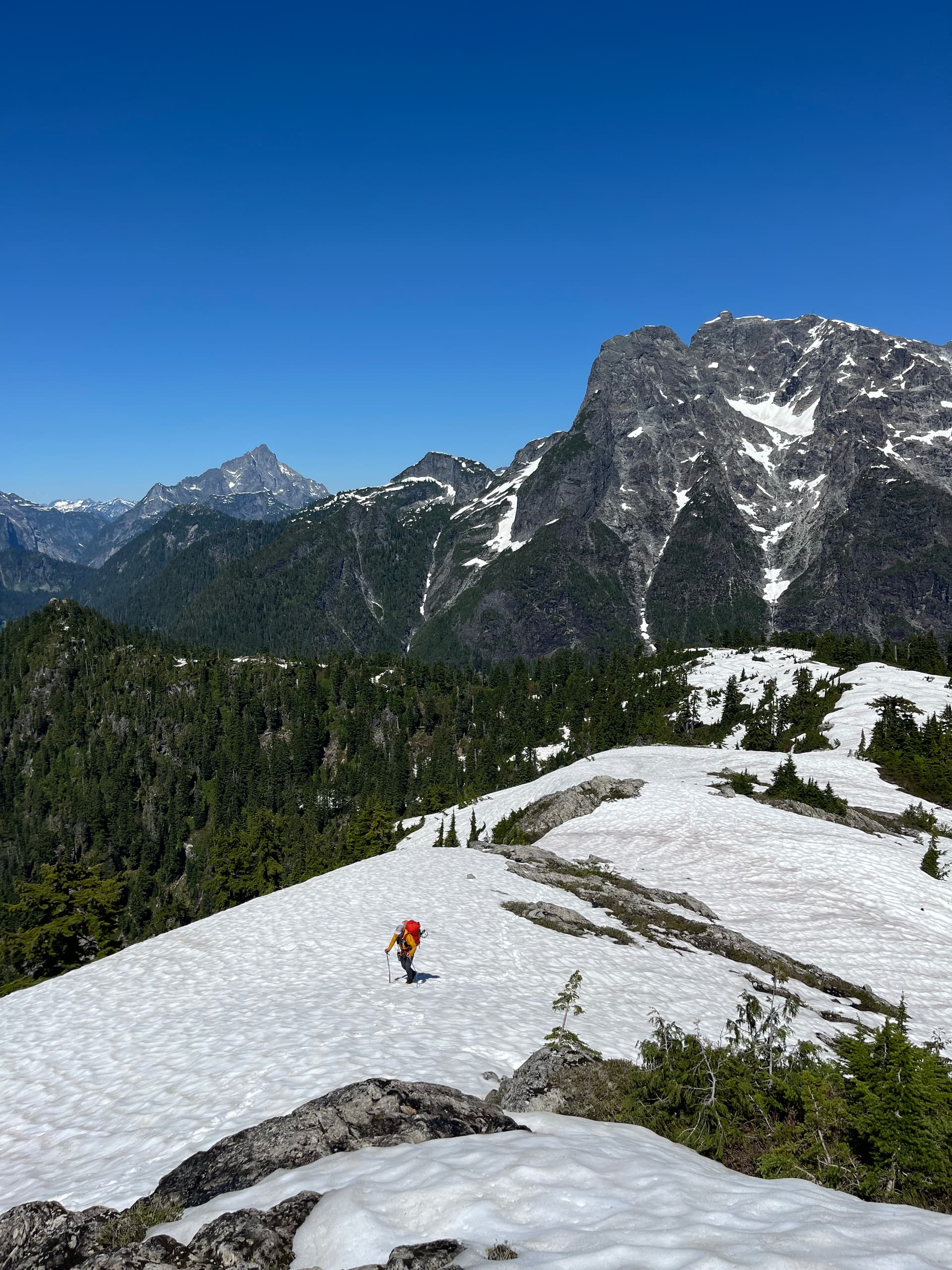
The first 1/3 of the descent from Bole to Tingle S ridge was a blast boot-skiing down the sun-softened snow. The bush gradually became thicker. By this time of day it was heating up. The nice thing about yesterday was that since it was wet and overcast we were never hot and water was no concern. Finding water was still not a concern, as there were numerous tarns on this part of the ridge (which I filtered) but I was guzzling down a lot of water and still dehydrated. After a short grunt up from the saddle we got yet more amazing views including another highlight of the trip for me: Tingle Creek Valley. When Chris and I did Mt Kranrod via clearwater bay I was struck by the sheer verticality of the walls that flank the valley- from head on it looks like a giant “U”. This part of the ridge was rocky and open, and we could get right up to the edge. Looking down the 900m near-vertical drop to Tingle Creek snaking its way through the valley far below was wild. We saw some sweet massive tiered waterfalls cascading off of the south face of Defendant. In my optimistic personal itinerary I’d hoped to get to the N glacier of Robie Reid today, and we still had a ways to go including the foreboding obstacle we’d seen from Bole: Mount Higgins.
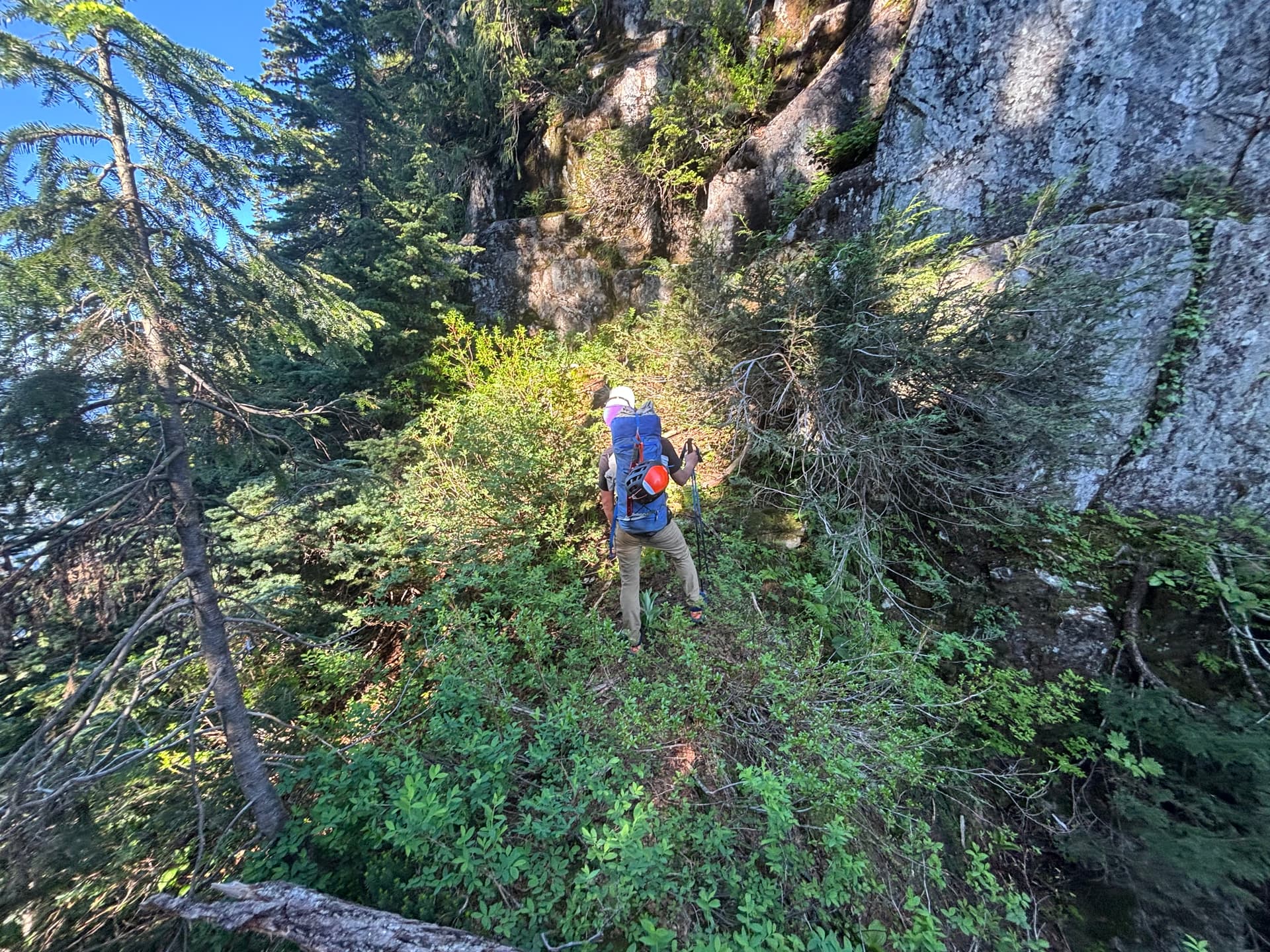
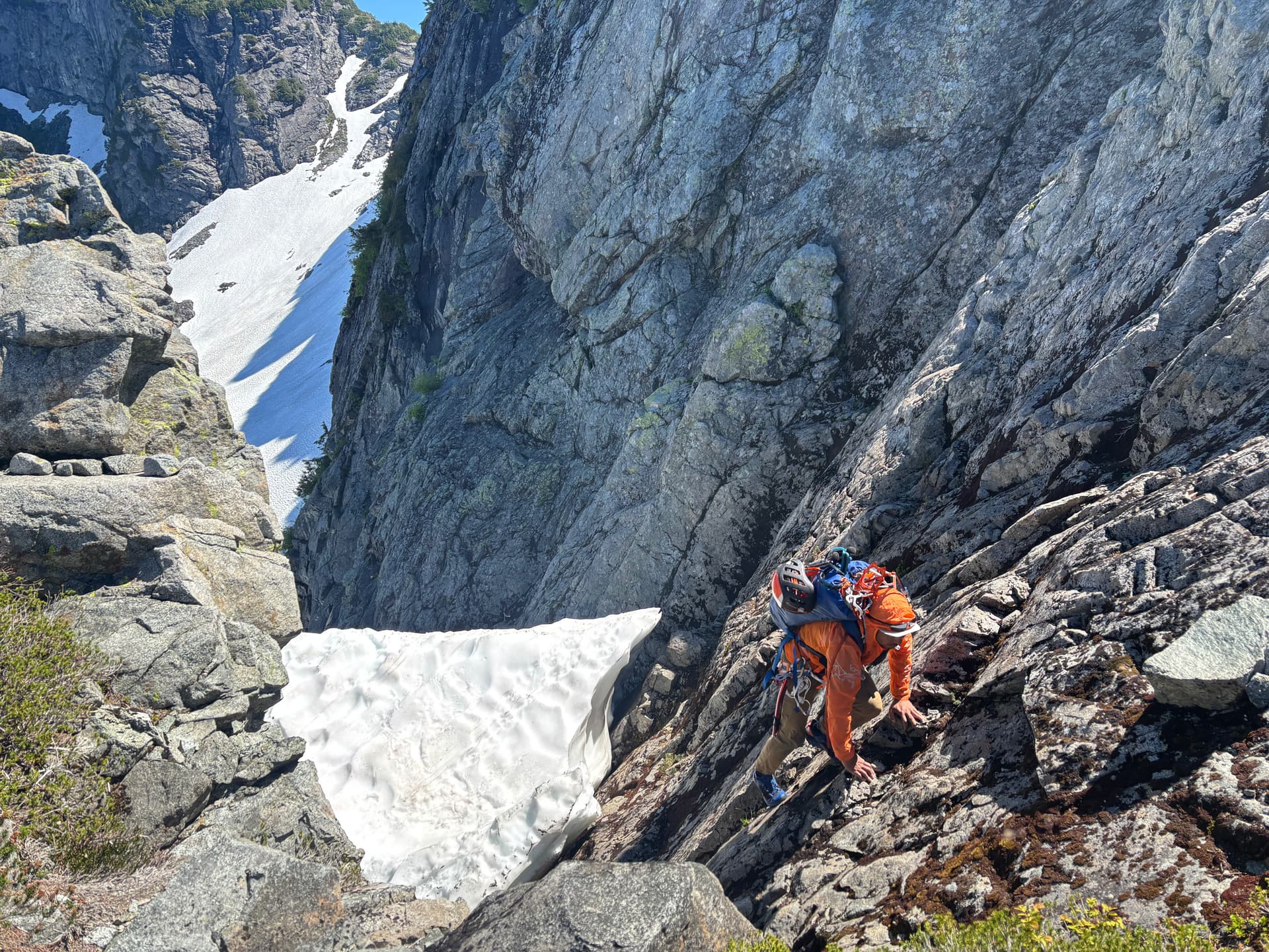
Getting to the saddle at the base Higgins was the usual thick annoying bushwhack. Once there, we began contouring climbers right (south) as the bluffs were on the left. There was some pretty thick slide alder. The good thing about alder is it meant endless handholds, so sliding down generally wasn’t a big issue. The bad thing is slide alder is super annoying and slow. After side-hilling for maybe only 30min, or maybe it was 1h, I reached a point where mentally I was just like 'f* it, I’m done with this I’m, going up’, and led the way up a pretty steep section relying predominantly on pulling myself up using mixed foliage handholds. Then across an exposed step below a cedar tree. Followed by some mostly dry granite slabs, more ‘shwhacking and pretty steep veg-belay shenanigans until at last we were above what had been the worst sustained section of the traverse by far. Thankfully from this new vantage point we saw a wide snow ramp leading up to col between Higgins true high point and a high point to the west (which was the way we’d be going). A very welcome change after what we just went through.

I was feeling tired boot-packing up the ramp. We’d only been moving for 11h but it felt like almost double that to me. There was a nice cool breeze in the ramp which I appreciated. Being out of the sun was also nice. Dean led the way, impressively kicking steps in just his trail runner/approach shoes. At the top of the ramp we dropped our bags and scrambled up to Higgins’ high point. This is what’s labeled as ‘Mt Higgins’ on Peakbagger.com, likely because it’s higher (and thus more prominent, >100m) than the lower point on the ‘peninsula’ that extends to the south. My initial plan included going there, but I was beat and did not feel like doing the ~2km round-trip. I mean, someone decided to call the lower spot the official peak, maybe because it was a cool location or they didn’t realize the higher point was back here. So it’s totally arbitrary. If the officially named summit was higher we would’ve gone there. The overall objective of the trip was to do the [first] circumnavigating ridge traverse. But now I also have an excuse to go back to Higgins haha!
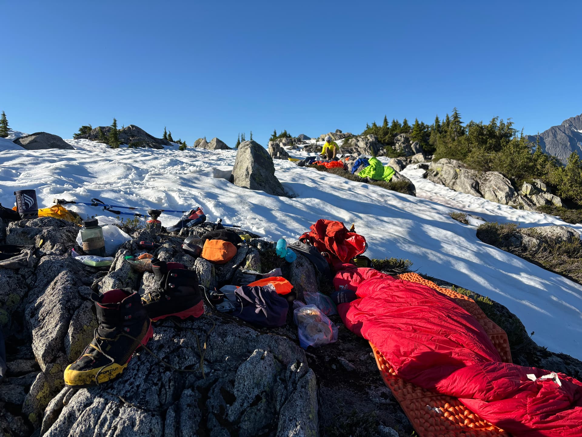
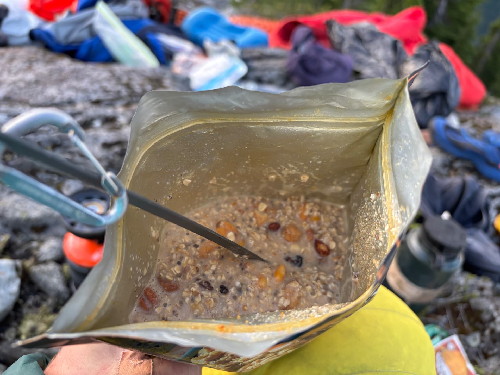
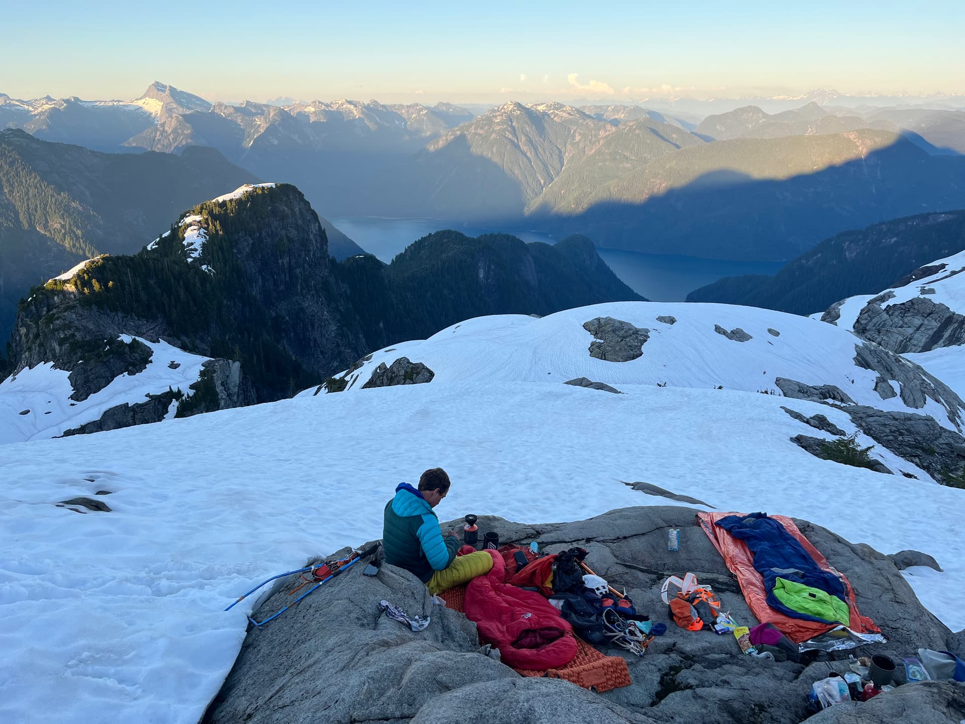
We descended back to the col, grabbed our bags, and went to the other high point on the ridge just north of Mt Higgins (which, interestingly, is almost as high). Here we heard an amazing sound: running water. Better yet, when we located the stream we saw nearby areas of flat rock/heather. I asked Dean if he wanted to keep going or camp, hoping he’d say to camp here. If he wanted to continue, I would. To my relief he said this was a good spot to camp. I claimed the spot closest to the stream, feeling a little bad at Dean having the slightly farther one, but being completely exhausted I didn’t feel too bad lol, as he looked fresher than me. Filled up my bottles, made some Coconut chicken curry, and off to sleep.
Day 3
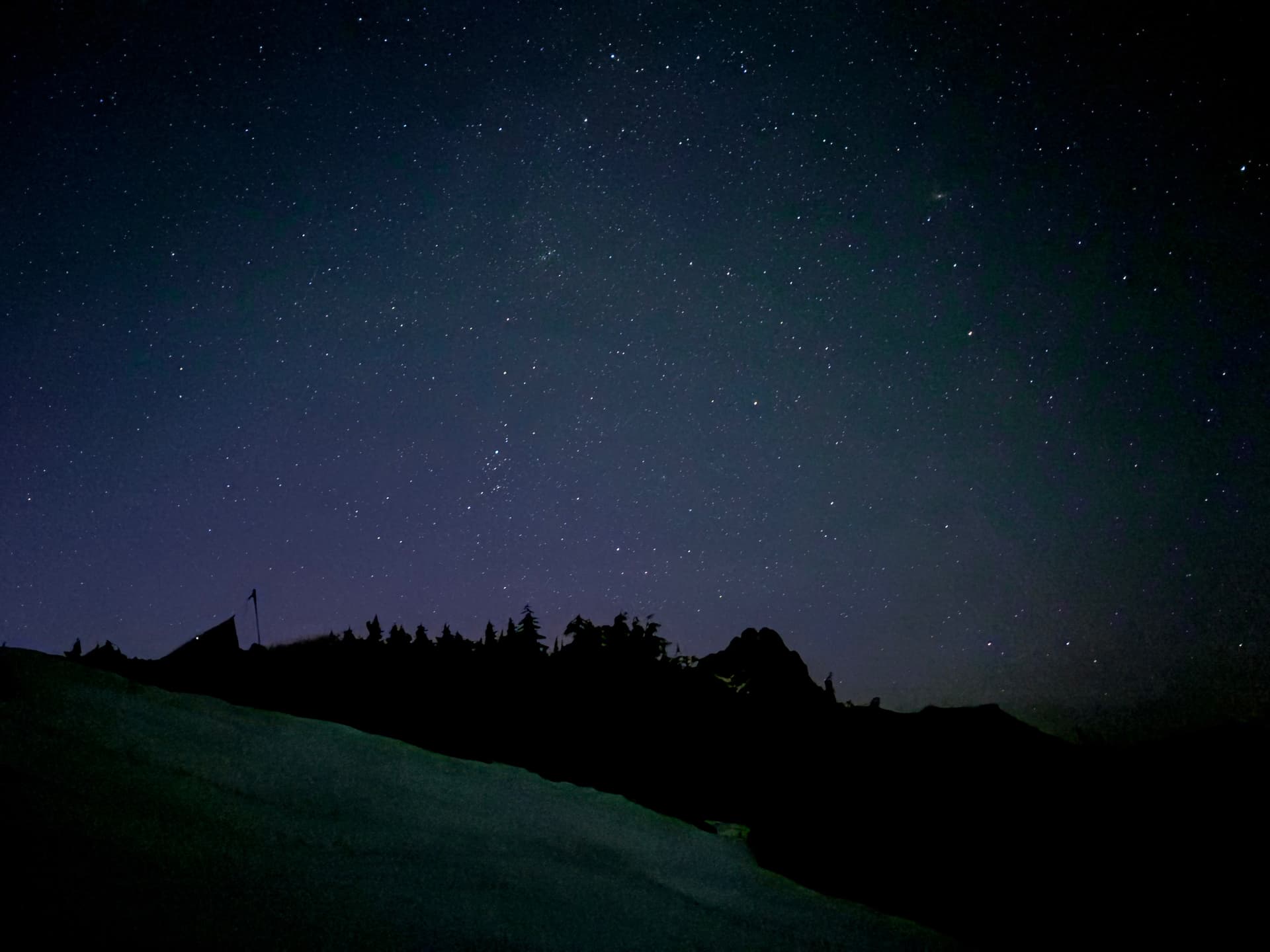
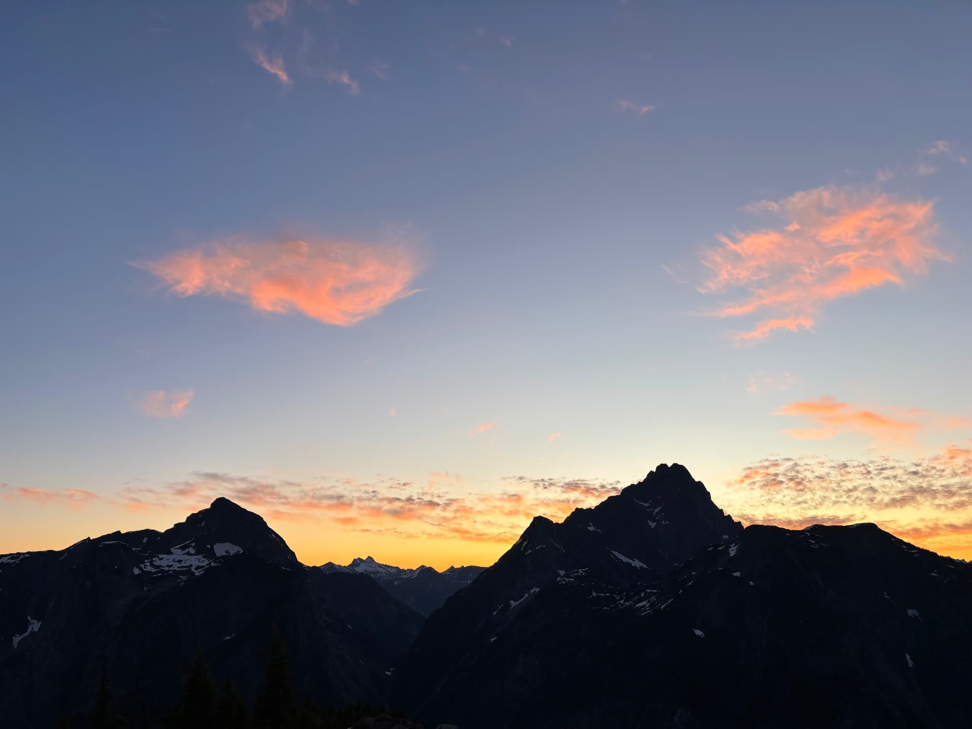
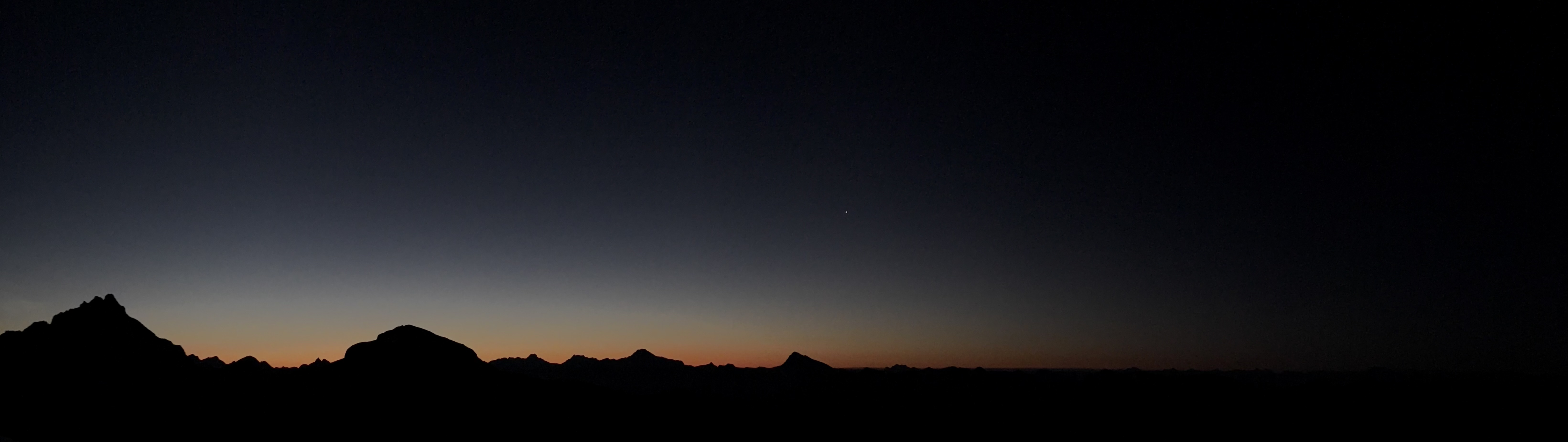
I randomly woke up and checked my watch- it was 1:30am. While sleep would have been nice, waking to a pristine starry night sky was worth it. Whenever I wake up at home in the middle of the night it sucks. Doing so here, I could gaze at the stars forever before finally drifting back off to sleep. We had a relatively leisurely morning. I awoke around 5am, lied in my sleeping bag watching the morning alpenglow over Robie Reid and the myriad of peaks to the E before breakfast, repacking, and heading out around 7:15am.
We started by descending to the next col. It was steep, but with relative ease we somehow managed to pick the line that was literally only way down to the very narrow, ~15 foot wide col in 90min. I say relative ease but it did involve some mildly exposed branch/root scrambling near the bottom. Looking back at what we descended, either sides of our descent route was flanked by cliffs with no bottom in sight.
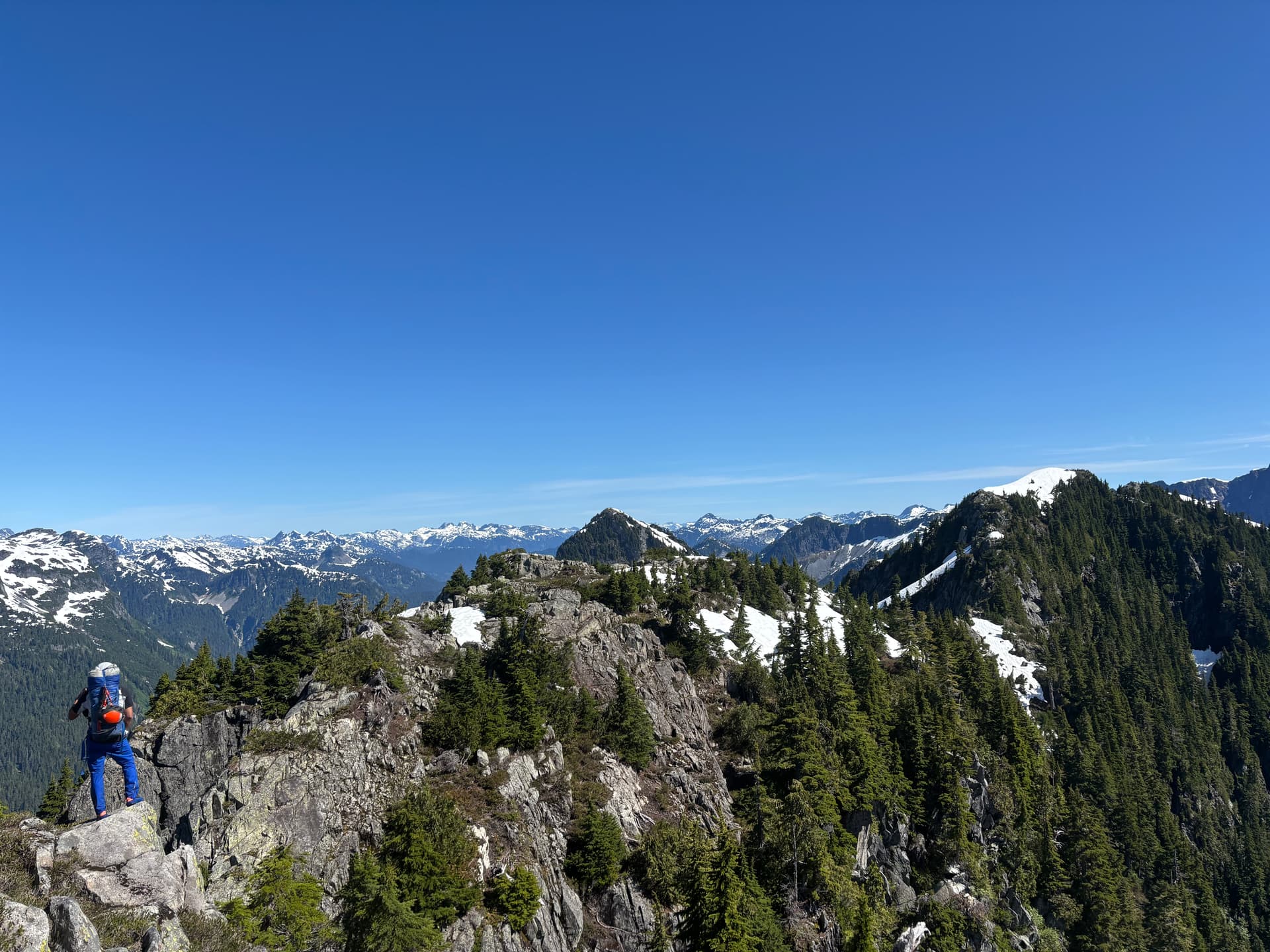
After that we had an uphill ridge-walk to the first unnamed prominent peak N of Robie Reid. Views opened up to Tingle Creek and Stave Lake once more. 2h later we reached the base of a small rocky pinnacle (the ‘Shark Fin’) we’d spied from camp. Of course, we had to scramble up! It took less than 5min of easy scrambling without packs to the top. We were treated to pretty cool views of the rocky peak ahead, as well as an impressively steep drop to the ravine below. I really like how this area looks with its solid perfectly grey granite interposed with the pines. There is something unique about the Upper Stave area. The rest of the way up to the peak was mostly straightforward with mixed bushwhacking, scrambling, and a bit of snow. We refilled water from a small stream formed by melting snow just below the summit. The summit area was nice- rocky and not just a boring bushy bump. It was a double peak, with the peak closer to Robie Reid being slightly shorter. We talked about calling it Mt Chris. I thought it was a pretty cool looking peak in a nice area, one that both Chris and I had spent a decent amount of time so it was a fitting name. I built a cairn, and after a short break we began our descent (this involves crossing over the shorter peak). From here our next goal was getting to the last prominent peak on the ridgeline before R Reid.
We knew the descent to the col would be steep, but we’d always managed to connive some way down the numerous steep descents without [too] much difficulty. Until now. This was also the last longer descent before R Reid, so I was eager to get it over with. Dean led the way, and about halfway down, we hit a bluff that couldn’t be down climbed. We had a 30m rope, but the drop may have been longer. We grudgingly retraced our steps up the slope to find another way, traversing around to the S side to try and get below the bluff and contour back to the col. This failed, and we wasted a bunch of time navigating steep terrain only to end up right back where we got stuck in the first place. Just before committing to a rappel, Dean spotted a steep bushy (at this point do I really need to keep saying that things are steep and bushy) gully we could follow down on the N side of the slope. Not long after, we were onto mellow terrain of the col, and just like the last one, we it dropped off steeply to either side.
Now we just had one last ascent up to the 2nd unnamed peak. The E bowl of this peak was very mesmerizing with countless small waterfalls cascading down its snowy slopes. To regain the ridge I led up a steep gully abutting the snowfield on climbers L and rocky wall to the R. From the ridge it was straightforward to the top, where we had the best views of the N side of Robie Reid possible. After a quick jaunt to the true summit of this peak, we were off. Soon we were halted by a short bluff. Without my pack, I was able to lower myself down using cedar branches, but this deposited me on some moderate angle wet slabs that would have been tricky to navigate even without packs. We opted to rappel. While time consuming, it validated bringing the climbing gear, and rappelling is fun!
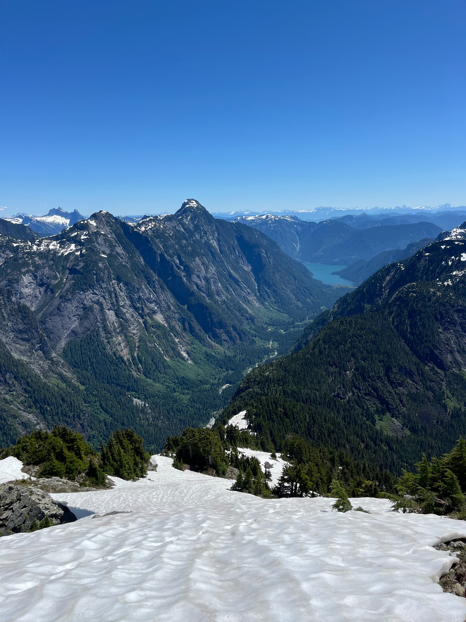
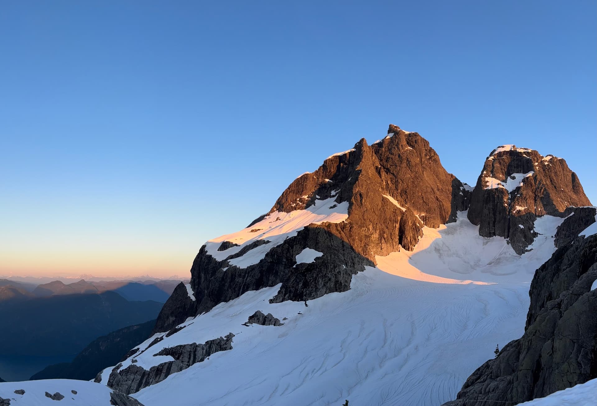
By the time we had descended onto snow above the little alpine lake on the N side of R Reid it was a little after 6pm. We considered dropping down to the lake and around to the tongue of the glacier, where we’d seen some partially frozen tarns, to camp, but decided against it as this would add unneeded elevation gain, and we also wanted a site with a full view of Robie Reid’s N face. Dean scoped out a small mostly flat rocky slab just above the glacier. It was a totally surreal camp site.

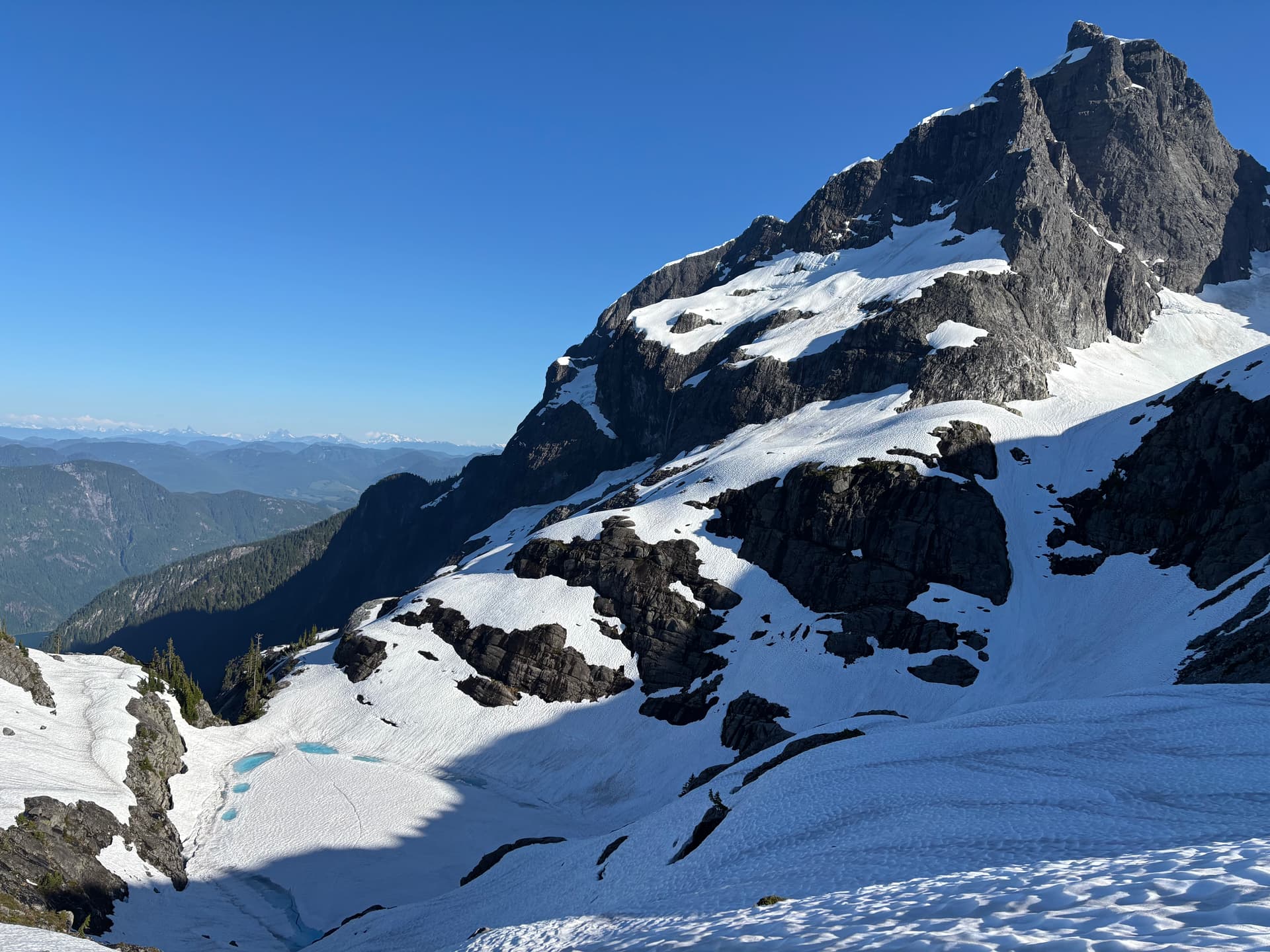
As it wasn’t that late yet, I wanted to ascend the last prominent peak of the day, conveniently located right above our camp. We both put crampons on, took out an ice axe and made our way up. It was only about 15min to the top. The summit block involved some fun class 3 scrambling on very solid rock and provided views to assess our route to regain the ridge leading to Mt Martyn.
Day 4
Our alarms were set for 5am, with plans to leave camp at 6am. An earlier start than previous days as I wanted to attempt Robie Reid West Summit’s N face. Getting down to the glacier was quick, and the glacier itself was tame, with no open crevasses. We still stuck to the side, away from all depressions, in line with satellite images I had for the glacier. A little below the base of RR W summit, we took all non-climbing gear out of our packs to make the ascent easier and safer. We could see a large bergshrund leading up to the col between RRW0 and the unnamed summit from last night.
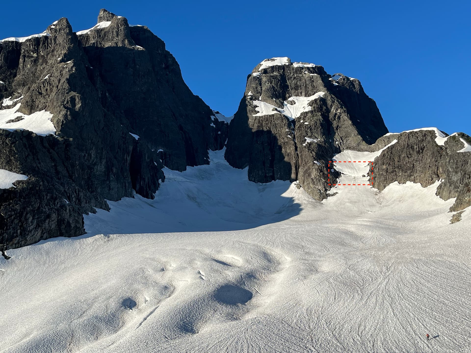
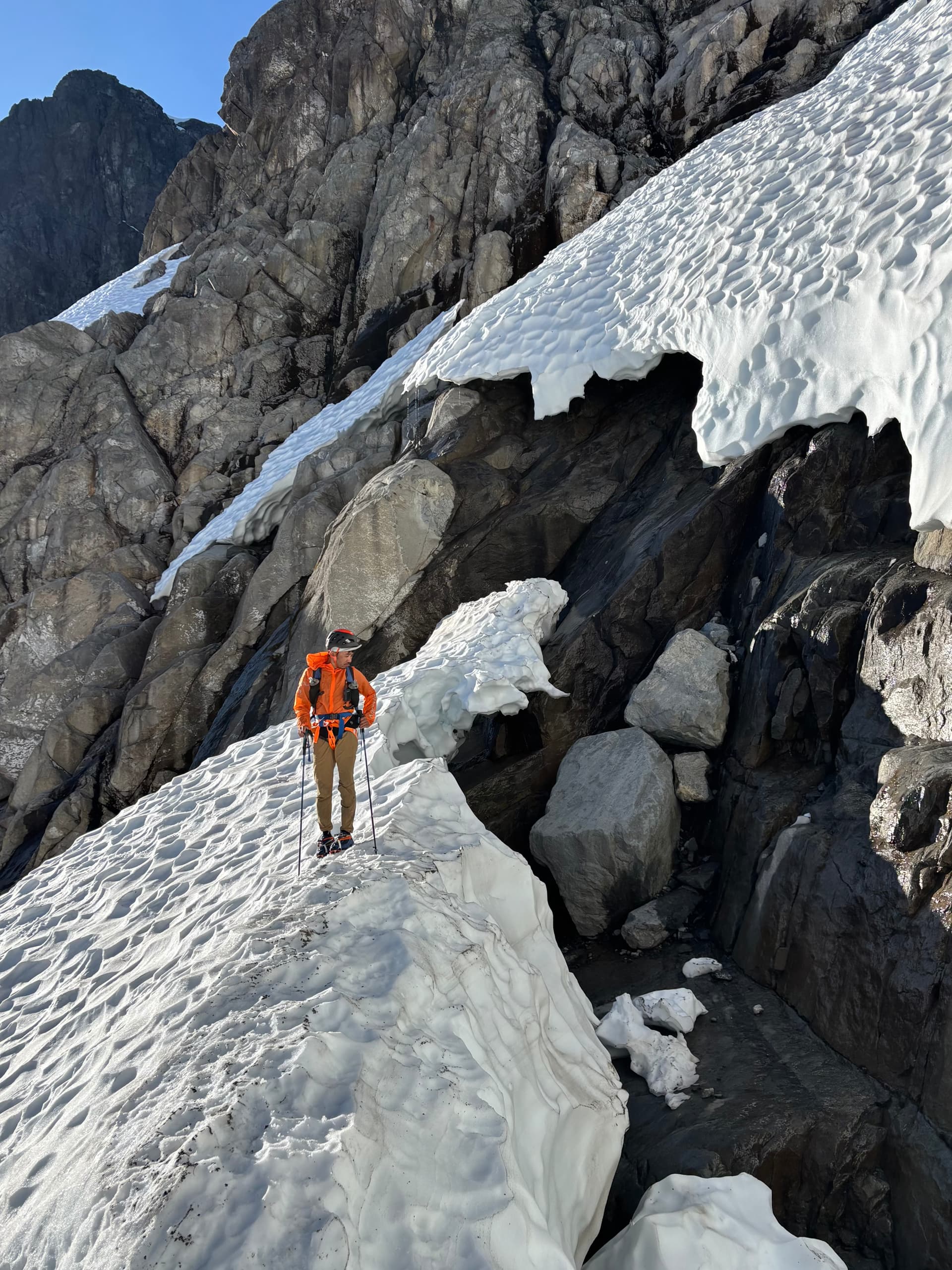
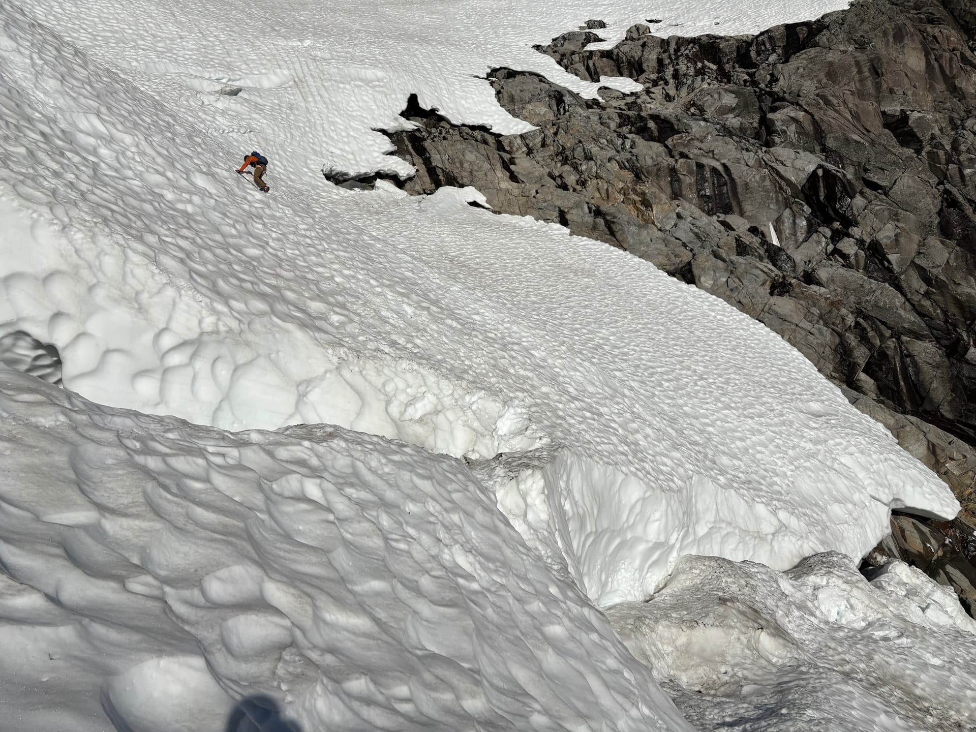
To access the rocky face of RRW0, we went up to the ‘shrund. From there we saw a deep moat surrounding the base of the peak, with one possible snow bridge to the rock near where we were, and another higher up. We opted to check out the higher bridge, as it would be faster than scrambling all the way from down here, and the scrambling looked slightly easier. After assessing the bergshrund was solid, we donned crampons, got out ice axes and started climbing the steep snow above the ‘shrund. Snow was relatively firm, as it was still early, and crampons were definitely necessary. I don’t believe the angle exceeded 45 degrees. Unfortunately, getting off the upper snow bridge to the rock would require a sketchy dismount so we retraced our route down. The lower snow bridge was ‘thick enough’ and led to a small flat platform to take off crampons.
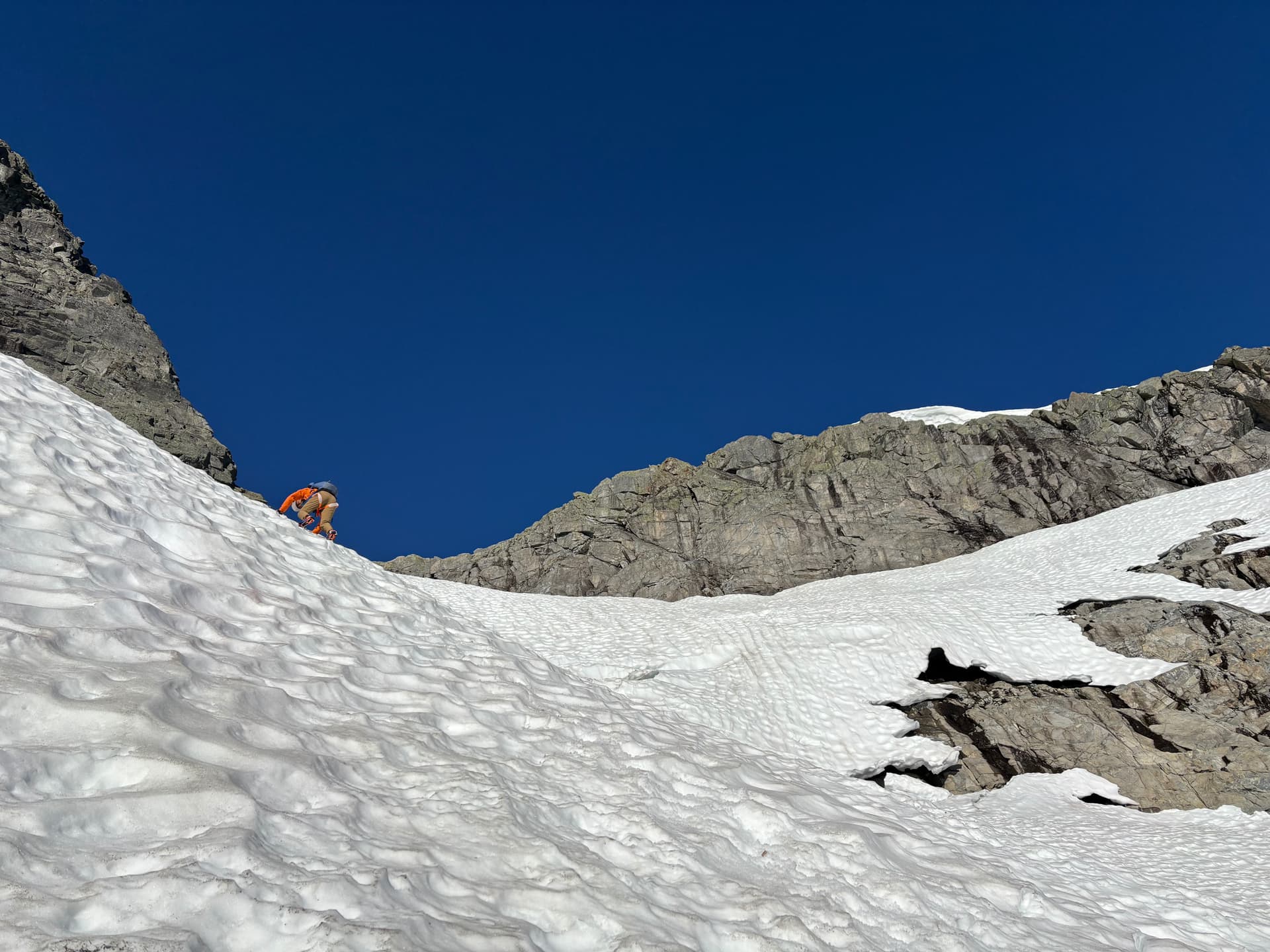
I started scrambling. From afar RRW0 looks impossibly steep- too steep for safe scrambling. As you approach, the angle looks much more mellow. But starting out, it again seemed quite steep. The rock at the bottom is very solid and blocky. Not many holds, but solid. However, with it being the start of July (happy Canada Day!) the lingering snow on the peak was melting, making some areas of rock dangerously slick- essentially putting those areas off-limits. Early on, I had to go around a moderately exposed corner with a class 4 move, and Dean opted to stay behind. After that, it was more straightforward up to a low angle grassy/snowy bench. Route-finding was difficult, especially with the wet sections. I went climbers L and scrambled up some slabs next to a deep water-filled ravine that splits the lower part of the peak. As I went above this section, the terrain became increasingly exposed. At one point I saw a crack that would go, but 5th class, and while not directly exposed, it was still steep terrain. I honestly can’t remember exactly how I got above this step, but I’m pretty sure I went as far climbers R as I could to a very exposed corner and made some class 4/5 moves to the ledge above. I spent a while picking my way slowly up, involving some relatively precarious ledge traverses on wet slabs before hitting a section of steep wet rock. Already, I probably should not have soloed up to where I was, and with safety in mind, I called it. I really wanted to summit, but safety was paramount. But I still had to get down.
Of course, I thought it would be easy to follow my exact ascent route. That was not the case, as rocks all look pretty similar, and while I had a general idea of the way I’d gone up, I needed to know exactly what I’d done. Plus, some moves are easier going up than down (and vice-versa) so going down the way I went up might not be the best idea. After some already precarious reachy moves, I found myself above the crack I’d seen before. With no other obvious way down, I committed to it. In all honesty it was a simple layback but in the context of the climb it felt more extreme. In total there were roughly 3 or 4 ‘sketchy’ sections before I got back to the low-angle grassy section, and from there it was straightforward to descend, including an optional passage between the snow moat and rock.
Dean had scouted that a col to the lower snowfield to the W was viable to get to the ridge leading Martyn. When I came was here last March with Chris, we simply climbed steep snow directly over the col between the unnamed peak from last night and RRW0, however we’d seen that this was discontinuous, steep, and rocky now. Thankfully, a finger from the lower snowfield looked to go almost to the ridge. We put crampons on for this. At the top of the finger, some steep scrambling had us on the ridge. The end now seemed in sight. Or at least Mt Martyn. The first part of this ridge I’d also done last March with Chris, and with a heavier pack so I knew it was good. The crux was a steep bushy bluff. It seemed more exposed than last time. Dean led up. After a lengthy struggle with a scraggly tree at the top, I was up.
After that battle I hoped for a straightforward shot to Martyn. The first bit of ridge travel was pleasant and open, but all too soon we were descending once more, to a low col above Alouette river. Dean blazed an excellent line on the way the way down with minimal (relatively) bushwacking, and we were much faster than on previous days. Then came the last uphill of the trip. Following the spine of the ridge up offered us a relatively open line, which was nice. There were a few steeper sections requiring veg-belays. In not too long we were on open ridgeline once more. At one point Dean, who was ahead of me, called out to stay away from the right side of the ridge. A few steps forward and I could see why- it dropped abruptly several hundred meters down, and the edge was obscured by low-lying vegetation. If you were careless or tired and too close to the edge, you could easily fall down. These abrupt very steep drops are common from Hector Ferguson onwards, and are an aspect of this area which makes it neat, dangerous and at times, difficult to navigate.
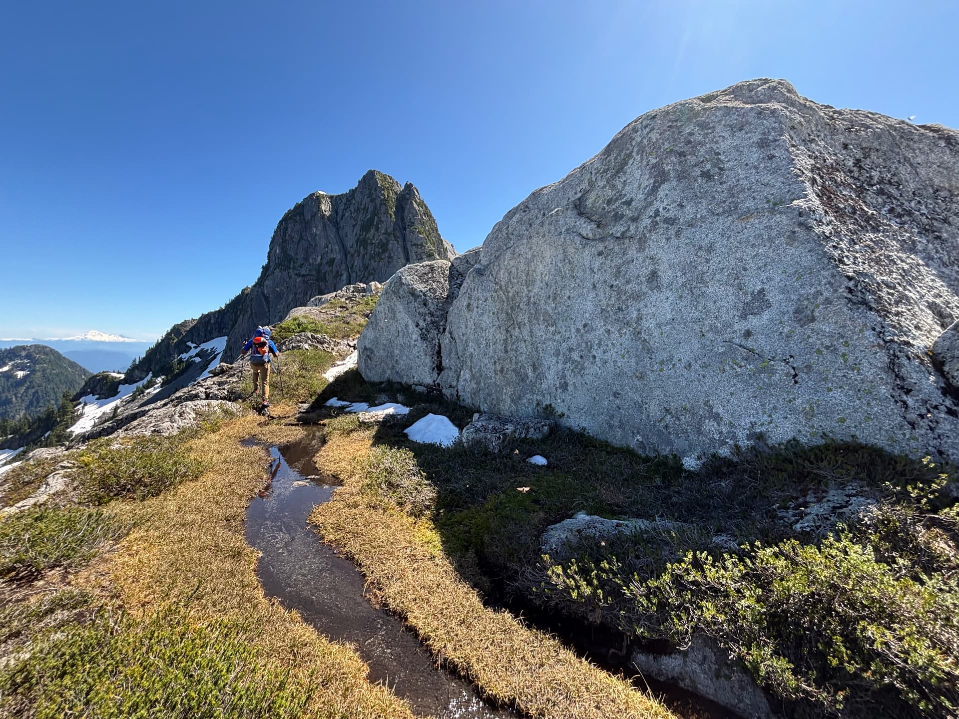
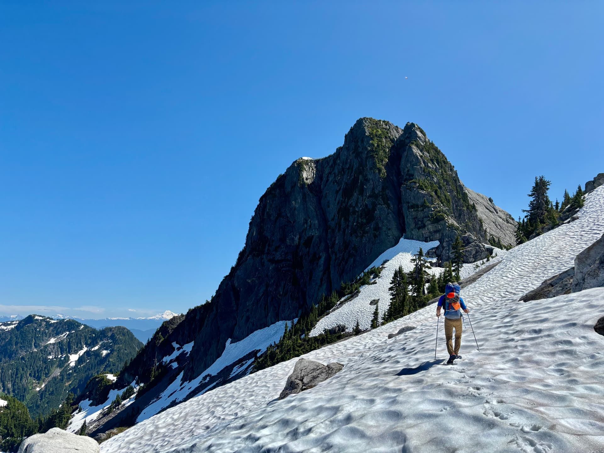
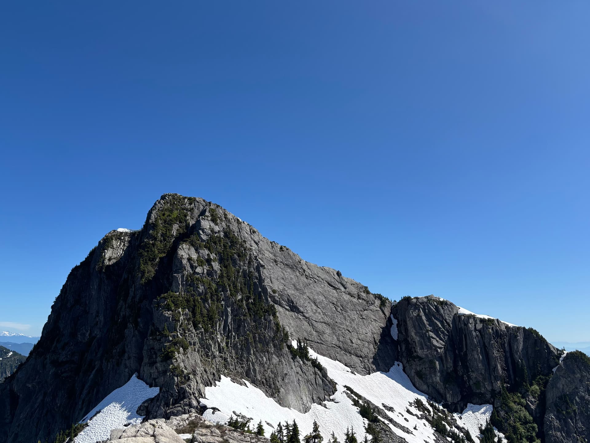
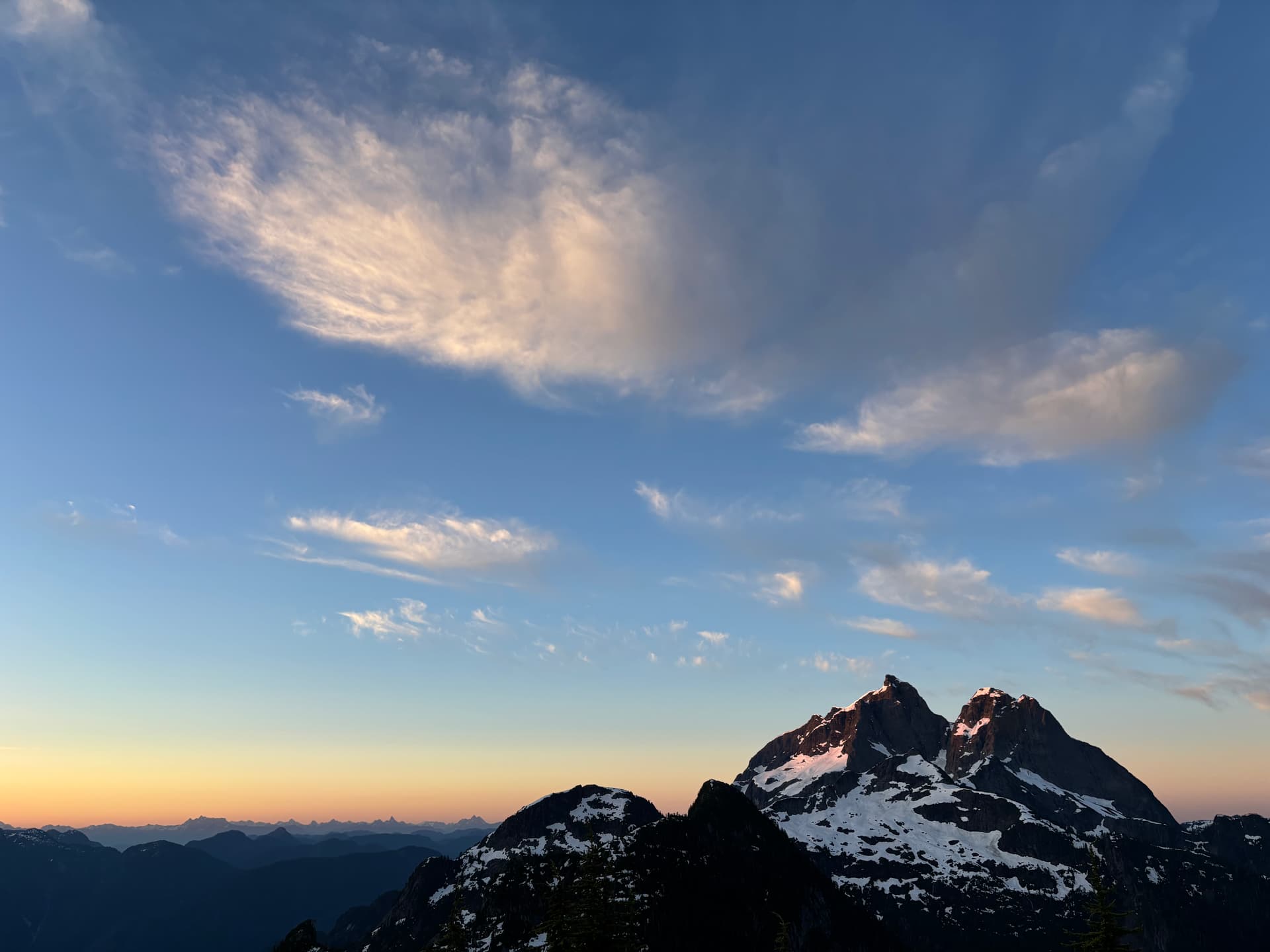
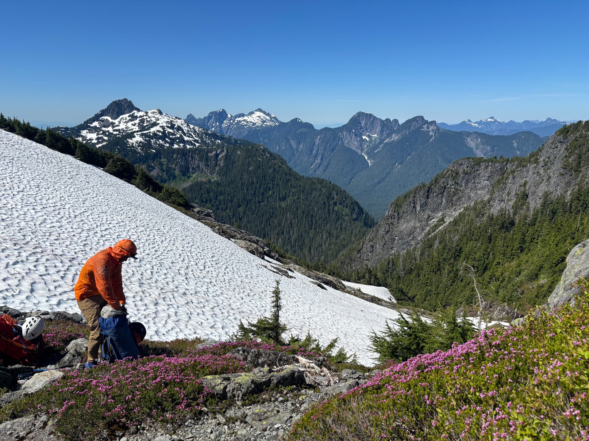
Once we made it to the snow-line we got excellent views of Mt Martyn, from this side looking formidable. Shortly before reaching Martyn, we stumbled upon the perfect camping spot. A small grassy plateau with a quaint bubbling stream and a massive boulder you could bivvy next to. Second-to-none views of Robie Reid. And plenty of small boulders scattered around for some fun bouldering. We ascended our last ‘peak’ of the trip, a barely prominent rocky outcrop immediately north of Martyn. Took in the views of where we’d been. I changed from wet boots into trail runners, and we began our final descent. (cont. in pictures since I overdid the character limit haha)