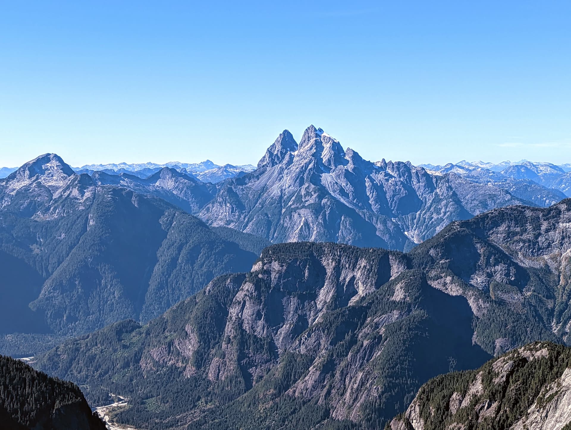
One of my first ever summits after moving to BC was Golden Ears. We camped on the ridge and had what is still to this date one of the best alpine sunsets I’ve had the fortune to take in. I recall seeing two behemoths on the horizon and being amazed. I eventually learned they were Robie Reid and Judge Howay. Researching them both, Robie was “just” a very long and steep hike with some class 4 scrambling, while The Judge was a remote multi-modal odyssey requiring a lake crossing, river crossing, bushwhack, climb, snow climb, and then scramble or alpine climb. Both sounded impossible at the time.
A couple years later, Trev and I had the fitness and experience to do Robie Reid as a day hike, and it was a highlight for the year - and still one of my top ten peaks ever. Over the years, doing many other peaks around SW BC, especially in the Lower Stave and Chehalis, the Judge was always on the horizon beckoning.
This year, it was a priority to make an attempt, but most of the summer went by without time off work, weather, river levels, smoke forecasts, or other crucial ingredients aligning. It was now October, and there was most of the above, with a period of high pressure forming early in the month, and we decided if we wanted to try this year, it was now or never. Francis and Trevor were both in, and I had made a connection to get us up the Stave and the FSR with a canoe for the river crossing; the only concern was that it had rained a lot in the previous week, and perhaps snowed in the alpine.
We all reached out to all our friends / colleagues / contacts who perhaps could see The Judge from their home / commute, but came back with nothing. After some final humming and hawing, we decided to lock in our approach up the Stave, and booked the Monday off work to give ourselves a 3-day window. The die was cast.
Day 1: Into the Upper Stave
We met a friend who was able to ferry us up then Stave, and then made our way up the Stave River FSR with a canoe. It was a cloudy overcast day to start the weekend, but the weather promised to improve tomorrow with a nice high pressure system. We carried the canoe off the road onto the beach just north of the 14km mark.
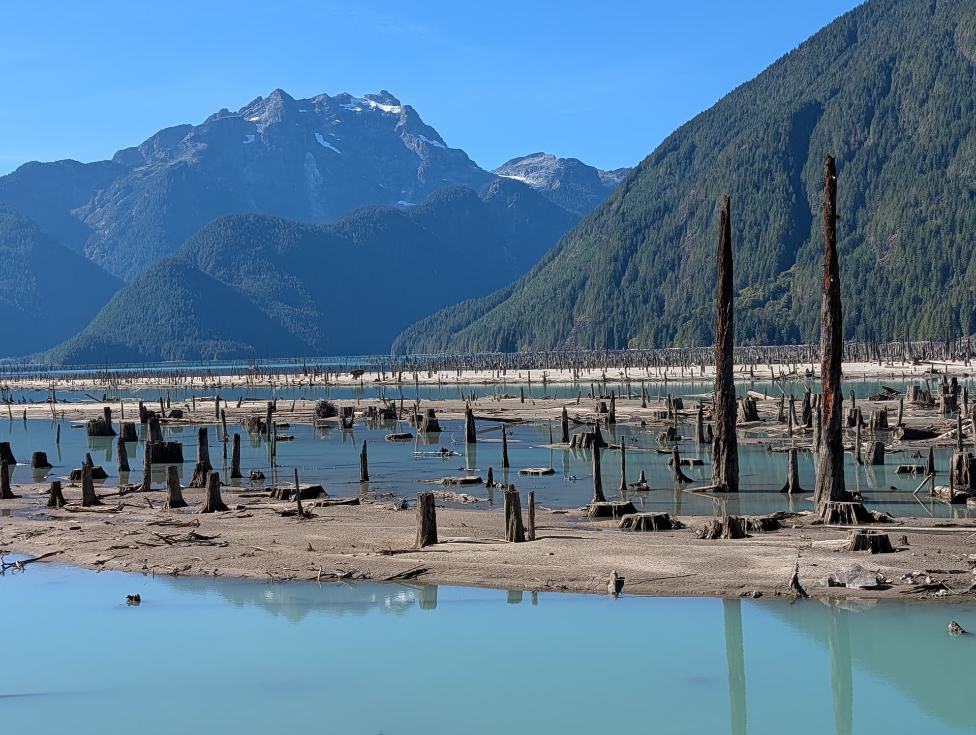
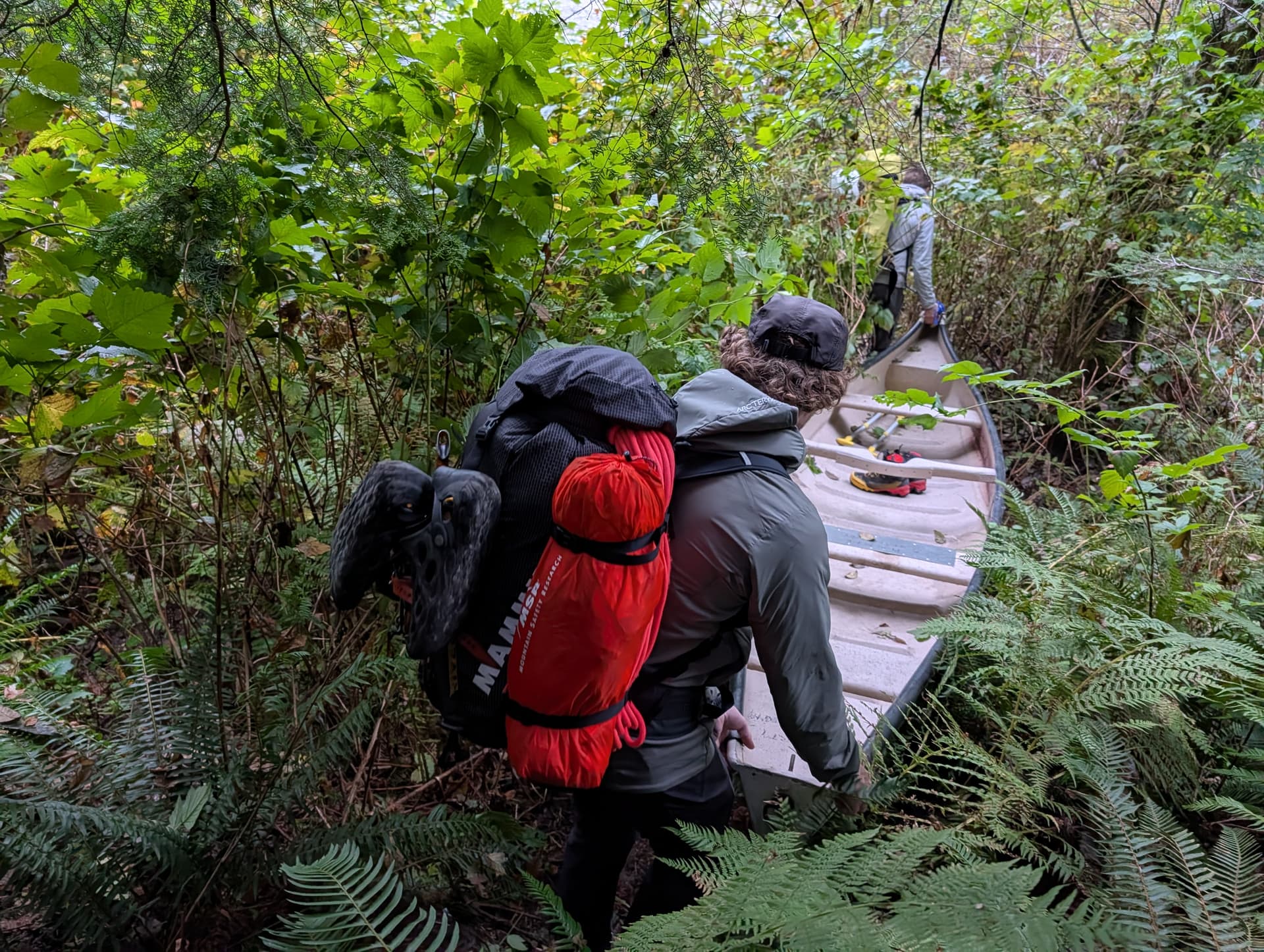
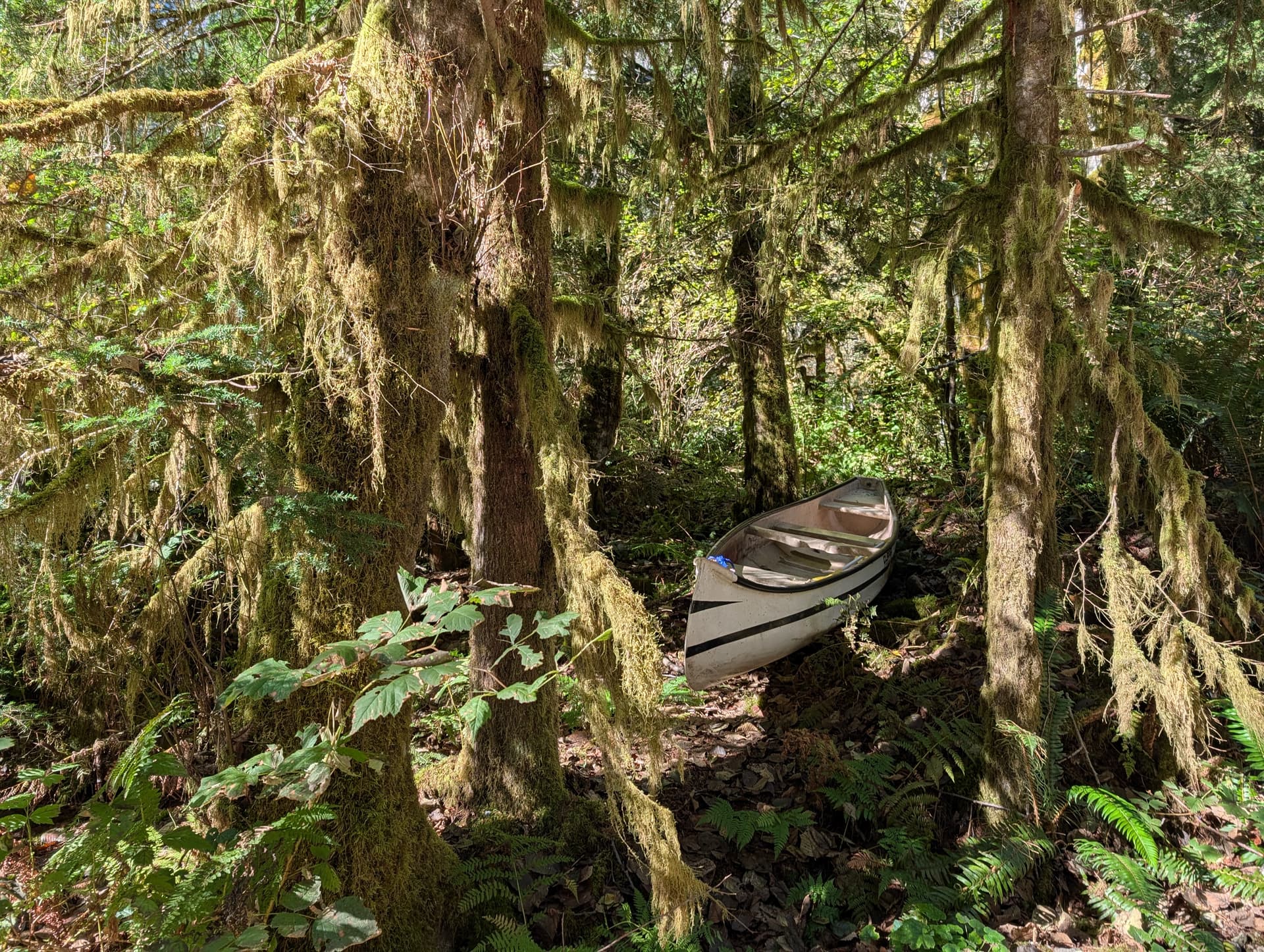
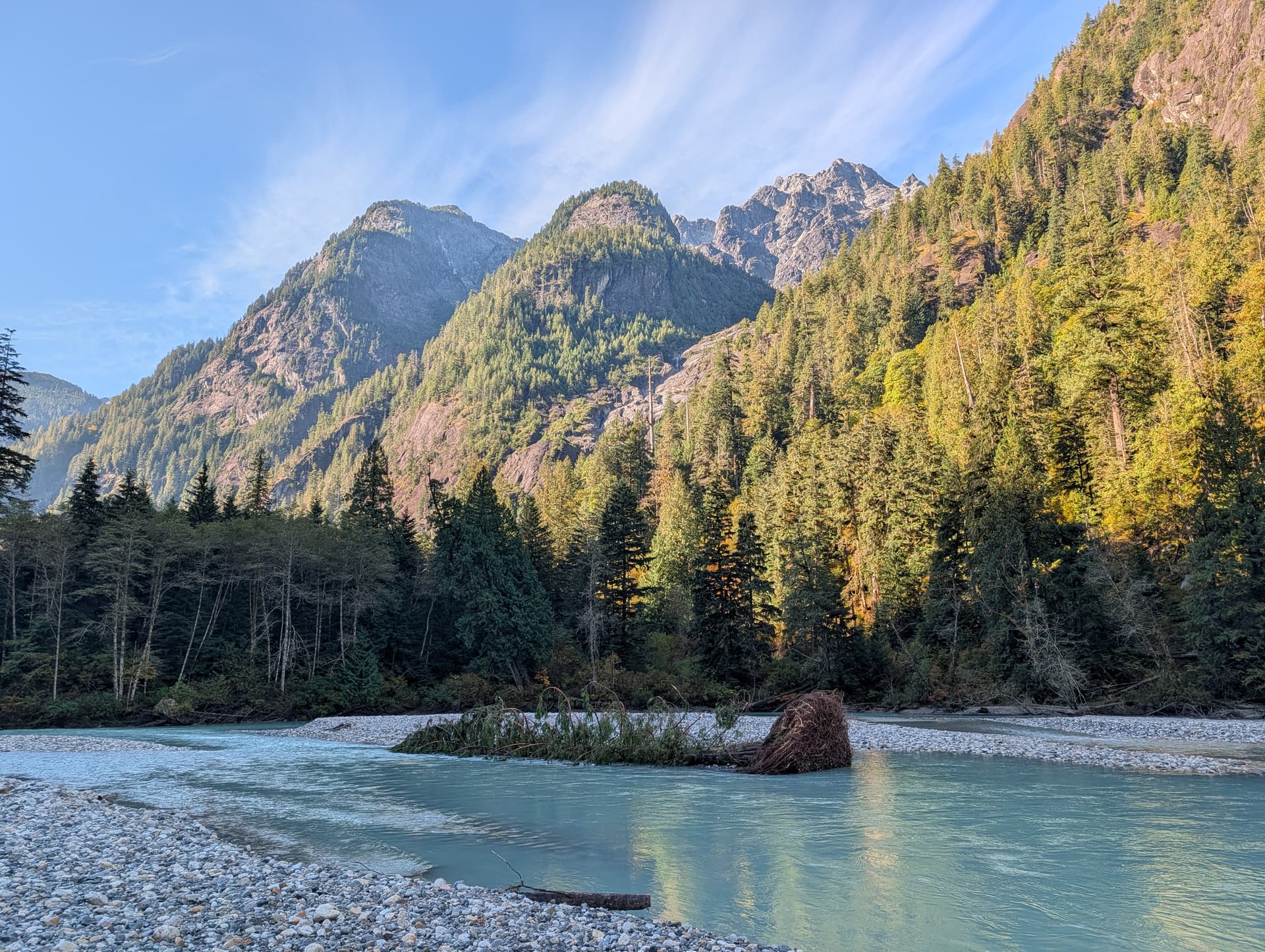
We put in and our initial plan of staying pointing up river survived contact with reality for about 15 seconds before the current swept as around. All was well as our crossing was short and the river overall was fairly gentle. We hauled the canoe up the far shore, and tied it to a tree in case the water level rose unexpectedly before we returned.
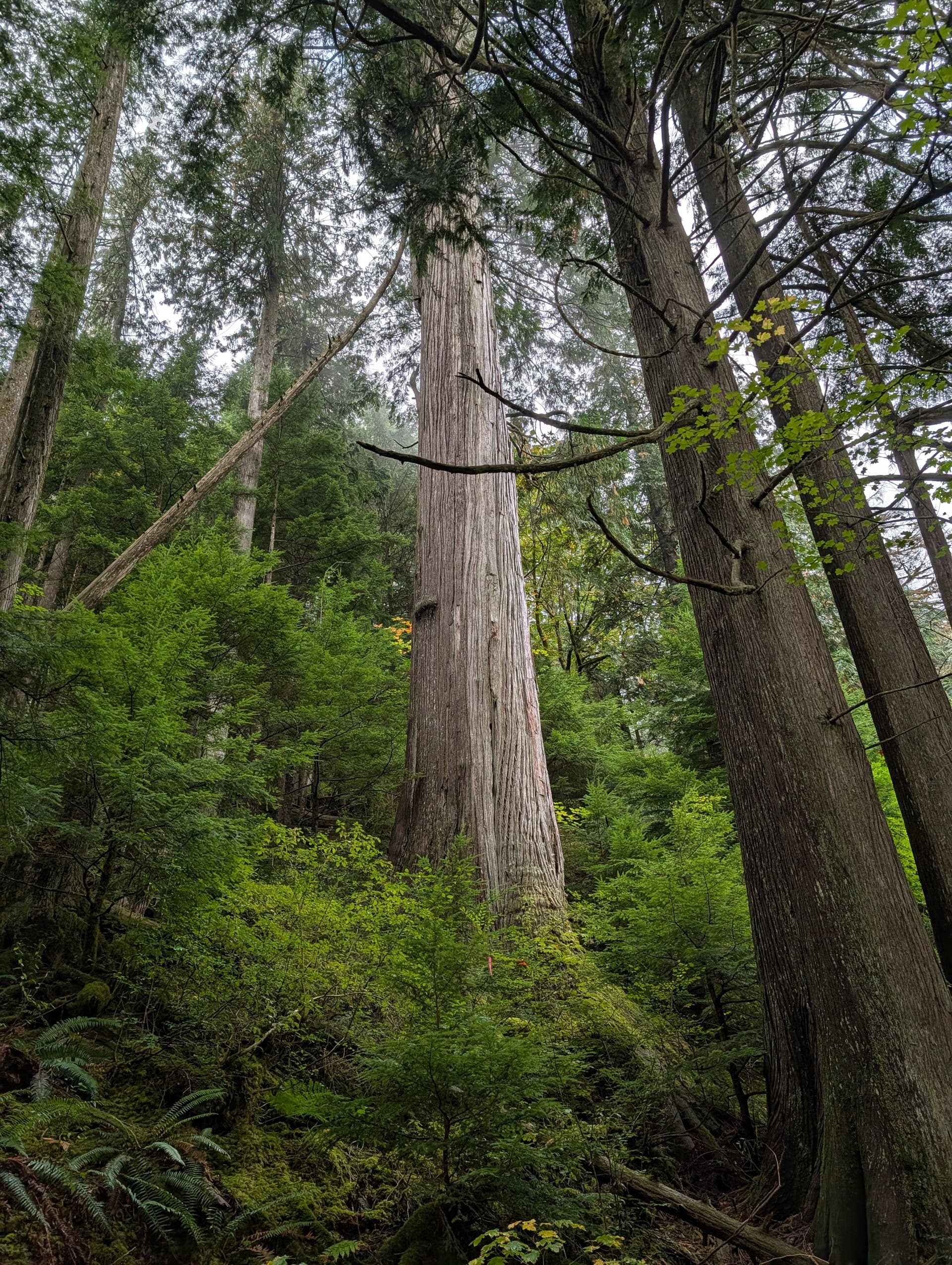
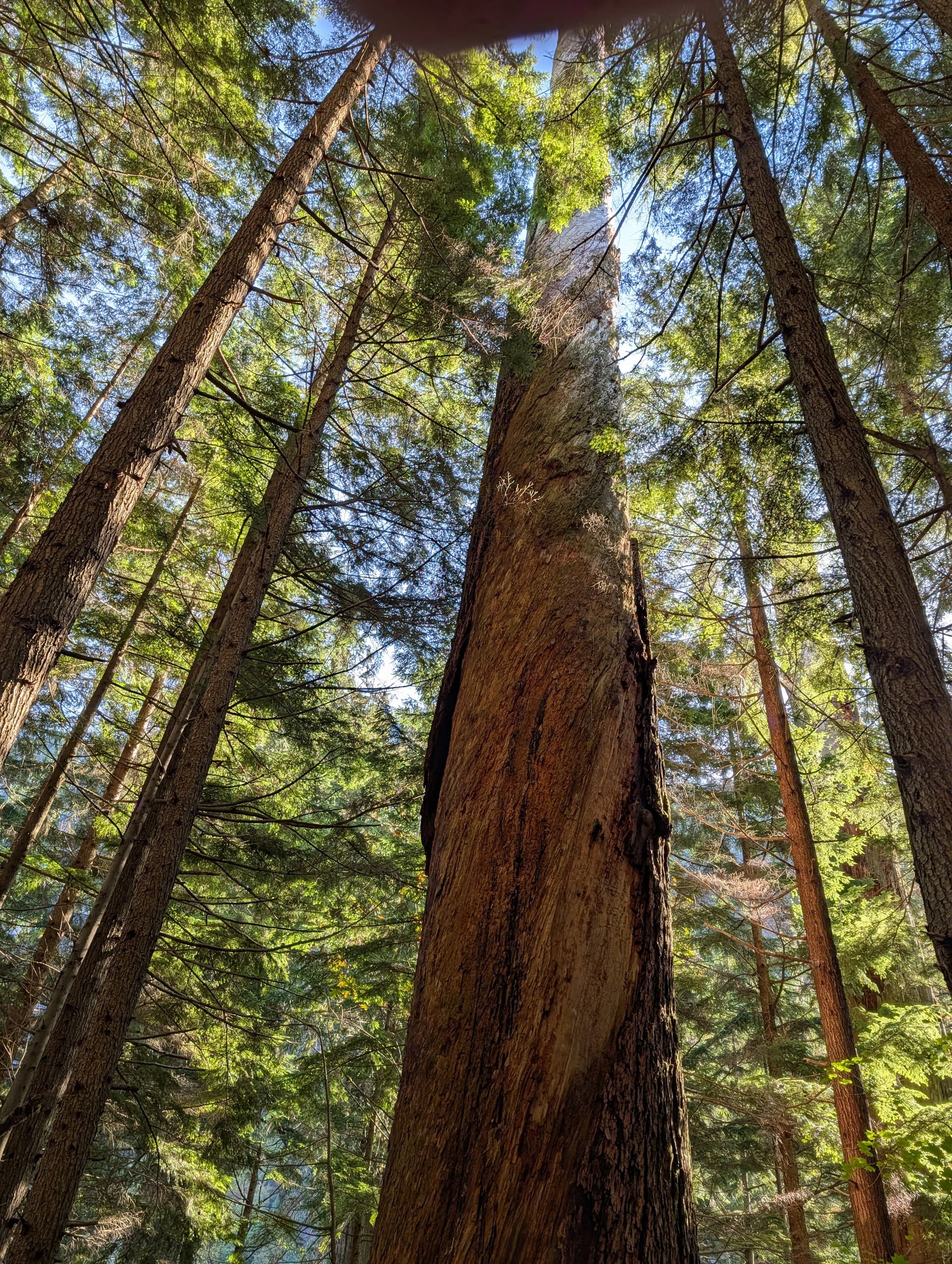
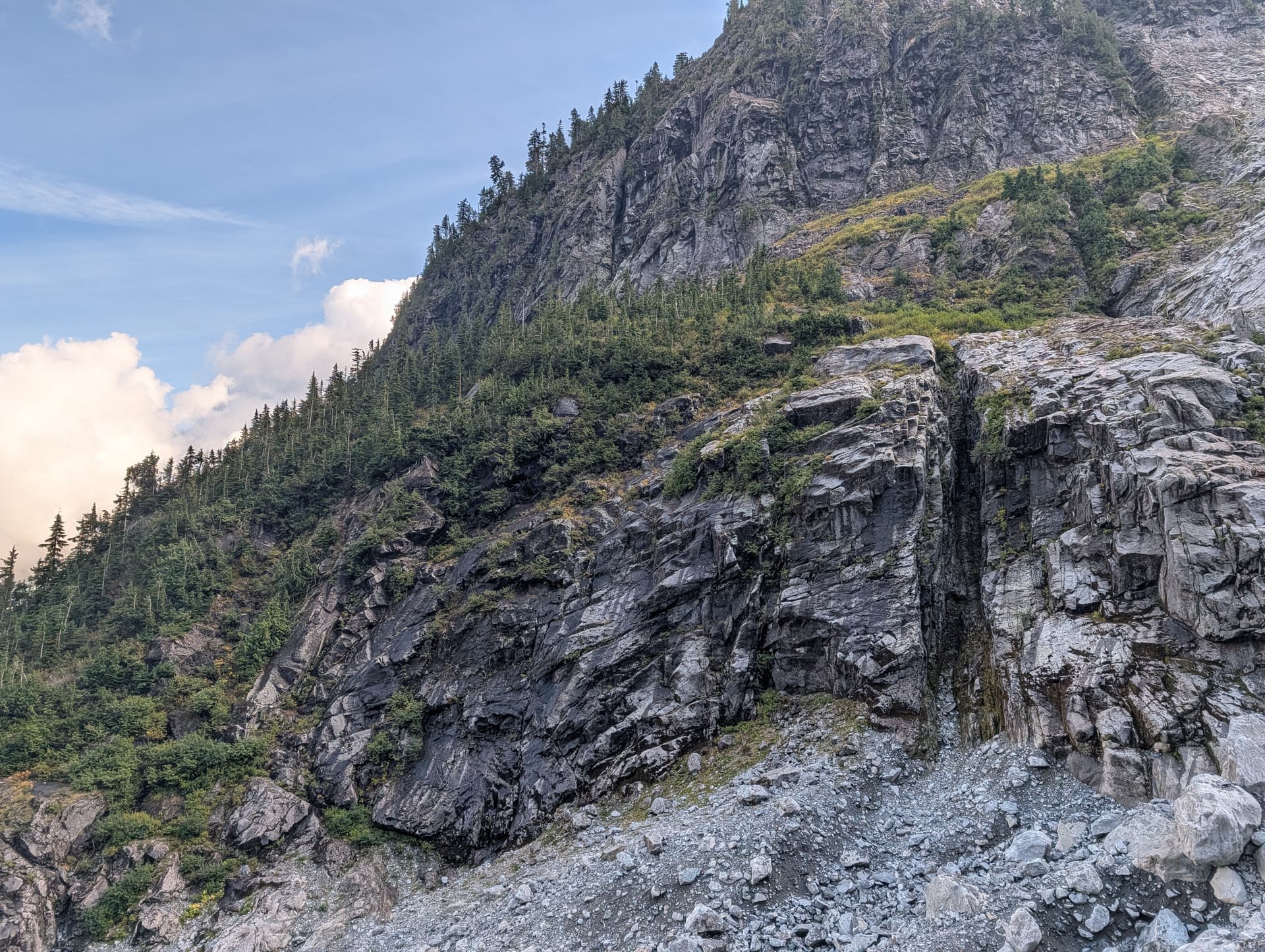
Next up was finding the flagged “trail” (route) up through the bush. This proved not too bad, and although we lost it a little at the start, we quickly found it and stuck to it. The route took us past some magnificent old growth, with the coastal jungle not being quite as bushwacky as the reputation of the Judge would imply. The recent era has likely seen an increase of attempts on this peak, which have tamed the bush on the route.
At 600m we hit the famous Water Platform, the flat bench bridging the main gully draining the East Face of the peak, and allowing passage to climbers left. The slabs were wet from recent rain and seepage, but there were enough dry patches and vegetation that we weren’t required to resort to Scottish tricks like walking in our socks for grip. After some brief schwacking beyond the Water Platform, the route climbed another 100m before traversing left to cross a large slide path, full of alder, fern, and the typical prickly guys. Again, the flagged route tamed the worst of this and kept the difficulties to short spikes of BW3+.
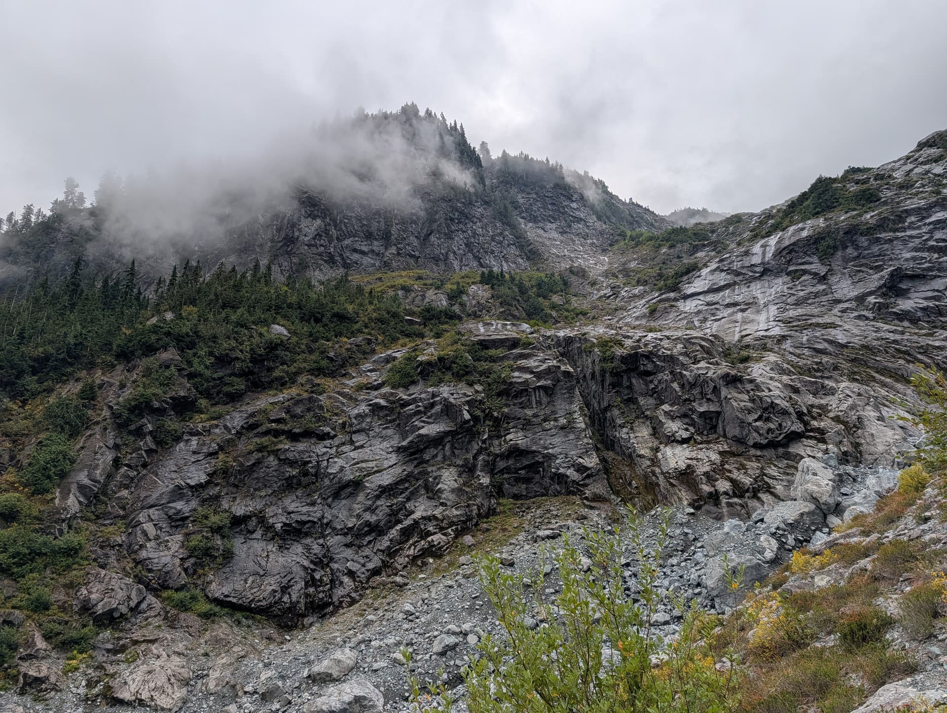
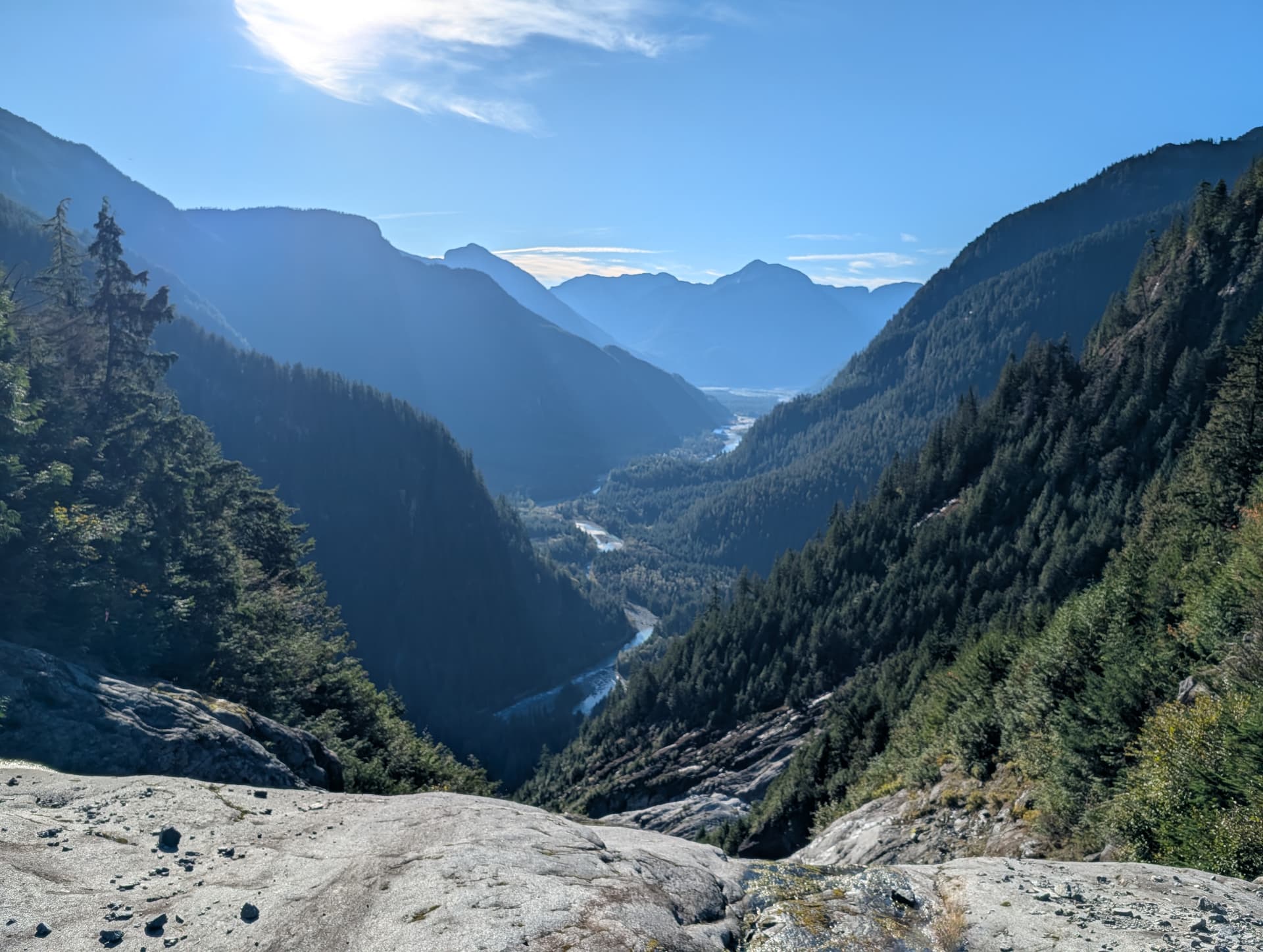
Just before the end of this section, we were faced with wet slabs with enough exposure that a slip would be trip-ending. In dry conditions these would be no problem, but they were currently seriously slick with their lichen + moss after all the recent rain. We ended up slinging a block for an anchor and hand-lining down. From there, a little more schwacking brought us into the “alpine” at 750m. The only reason no trees exist here is because this cirque is the confluence of about 4 giant slide paths that run massive in the winter.
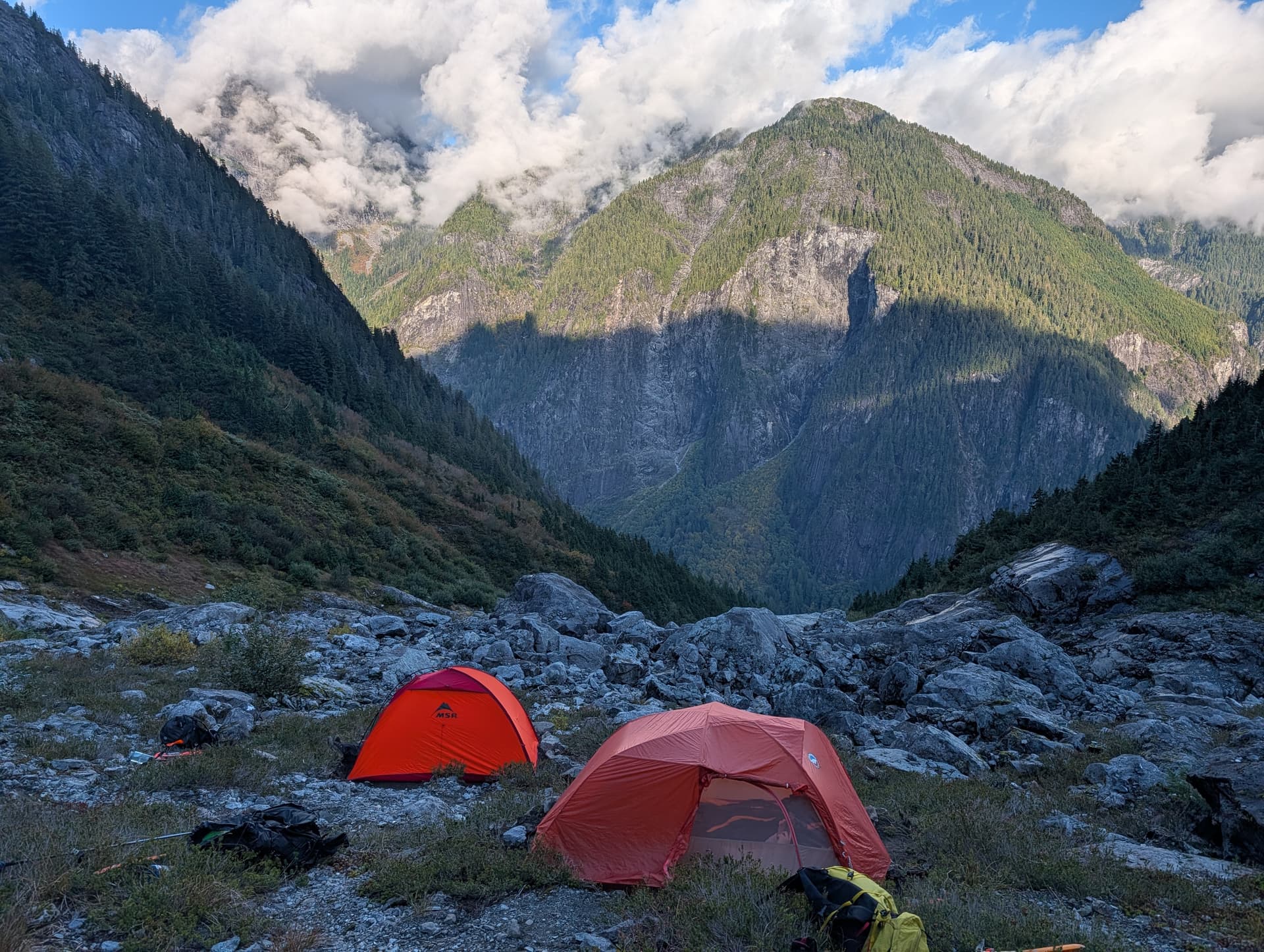
With nowhere flat to pitch tents, we spent an hour digging out platforms in the dirt, then ate, and had a leisurely afternoon plotting our summit push tomorrow. We knew exiting this cirque into the hanging valley would be the next logistical crux of the route with the current wet conditions. One must gain the hanging valley above and climbers left of this cirque, which provides access to the summit massif. The issue is it is guarded by many slabs, of which all were soaking. In past years, “permanent” snowfields used to extend all the way down here. We decided we’d take a bushwhacking line to the far left of the slabs, and then a boulder field + bush ramp above to a lower angle slab system that fortunately looked more dry, which would then yield to the easy slab, scree, and talus highway up the mountain. The plan was set and we went off to bed early.
I woke up at 9pm to raindrops on the tent. Mr Howay had not read the same weather forecast we had. It took me a long time to fall back asleep, every pitter patter on the fly appearing as a wetter slab and snowier summit for our bid tomorrow in my mind.
Day 2: The Push
We awoke with the sun the next morning, and were moving about an hour after that. The rain had indeed re-lubricated the slabs, but we found passage hauling on trees and doing the occasional wet scramble move to bypass this first and wettest slab system. We then hopped across the boulder field above, careful not to eat it on the slippery rock, before gaining a bushy bench taking us to the final slab before the easy terrain above. This was much lower angle than it appeared, and had enough dry spots that we cleared it with minimal difficulty. We had reached the Hanging Valley, the next major milestone one passes after the Water Platform.
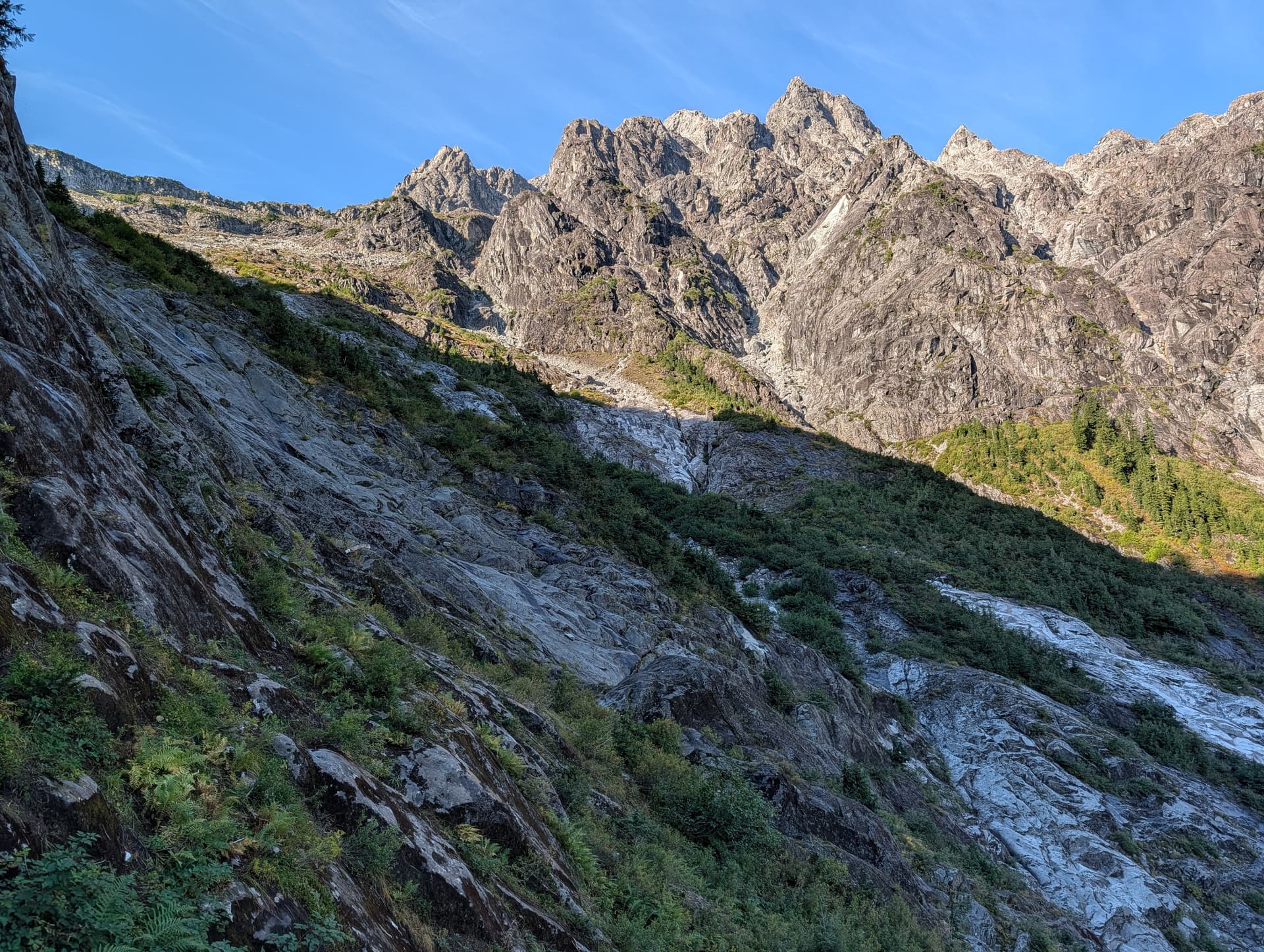
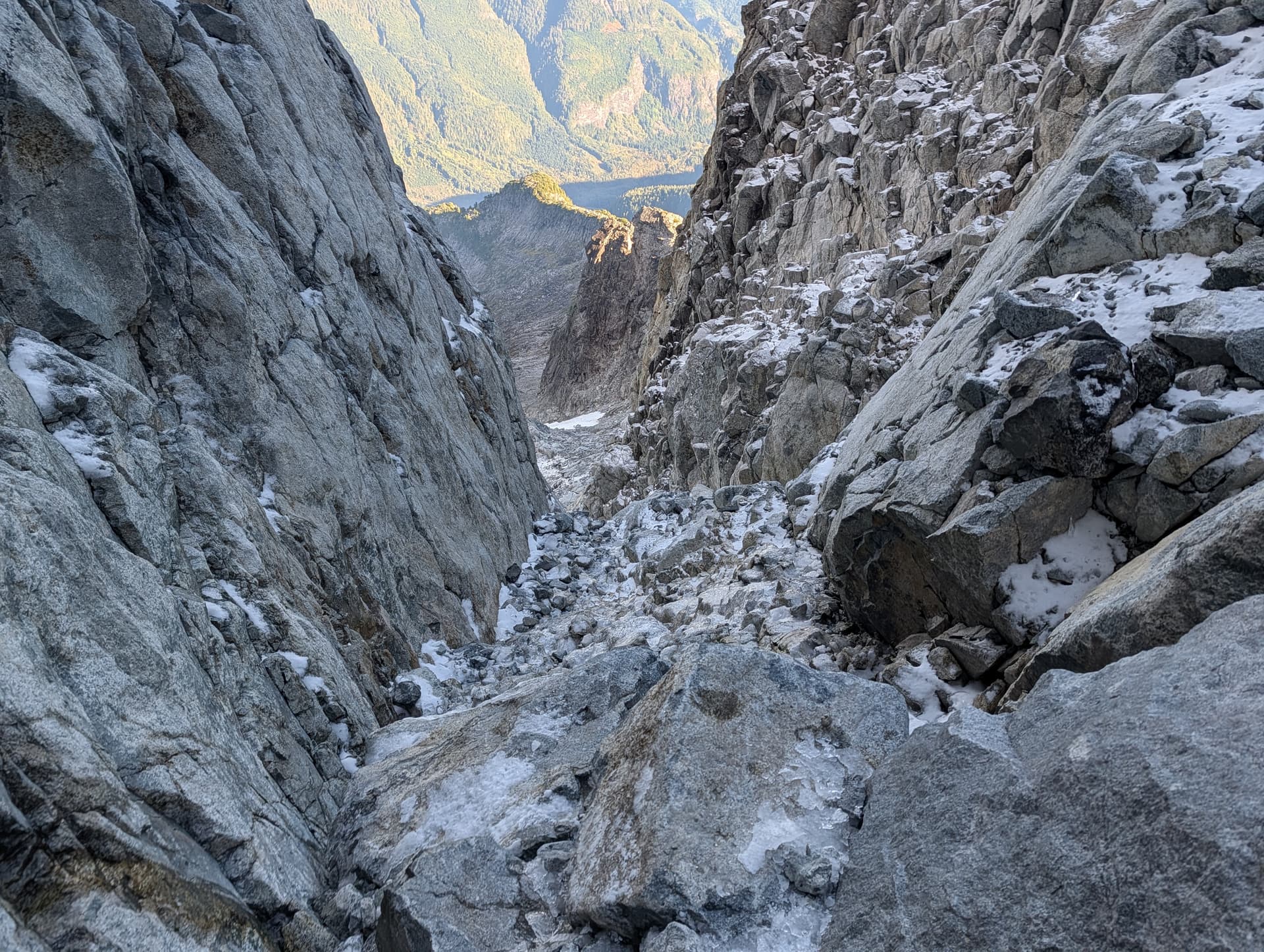
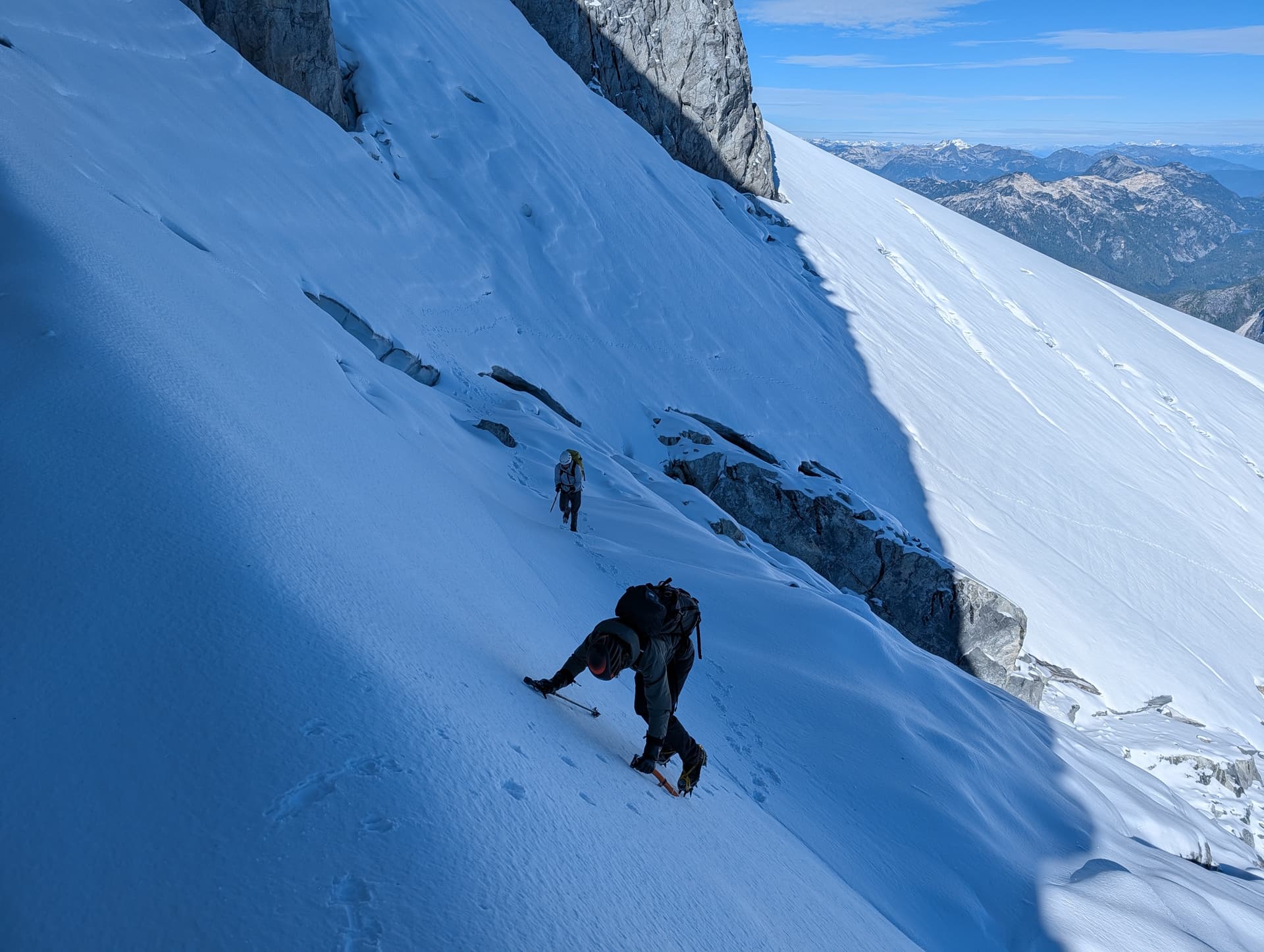
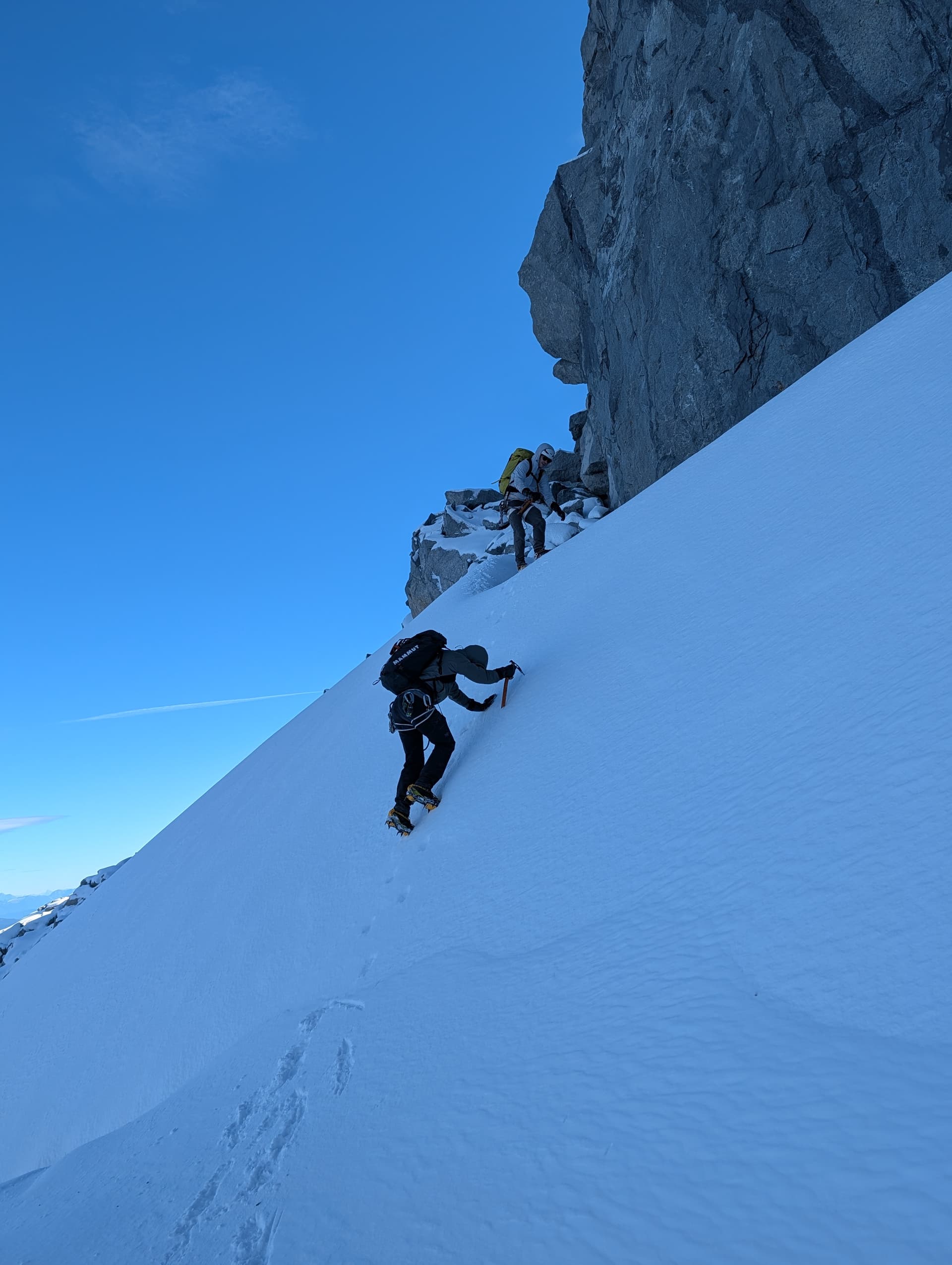
From here, it was easy travel on low angle slabs, scree, and talus until 1600m, where we encountered the first permanent snow. We donned crampons and walked up the quite icy slope. Crampons plus an axe were good here, microspikes / just boots would not have been sufficient. At 1800m, the snow ended, and then the next 200m was tedious moraine and glacial-retreat terrain, up until the narrowing of the valley - the “Hourglass Couloir”.
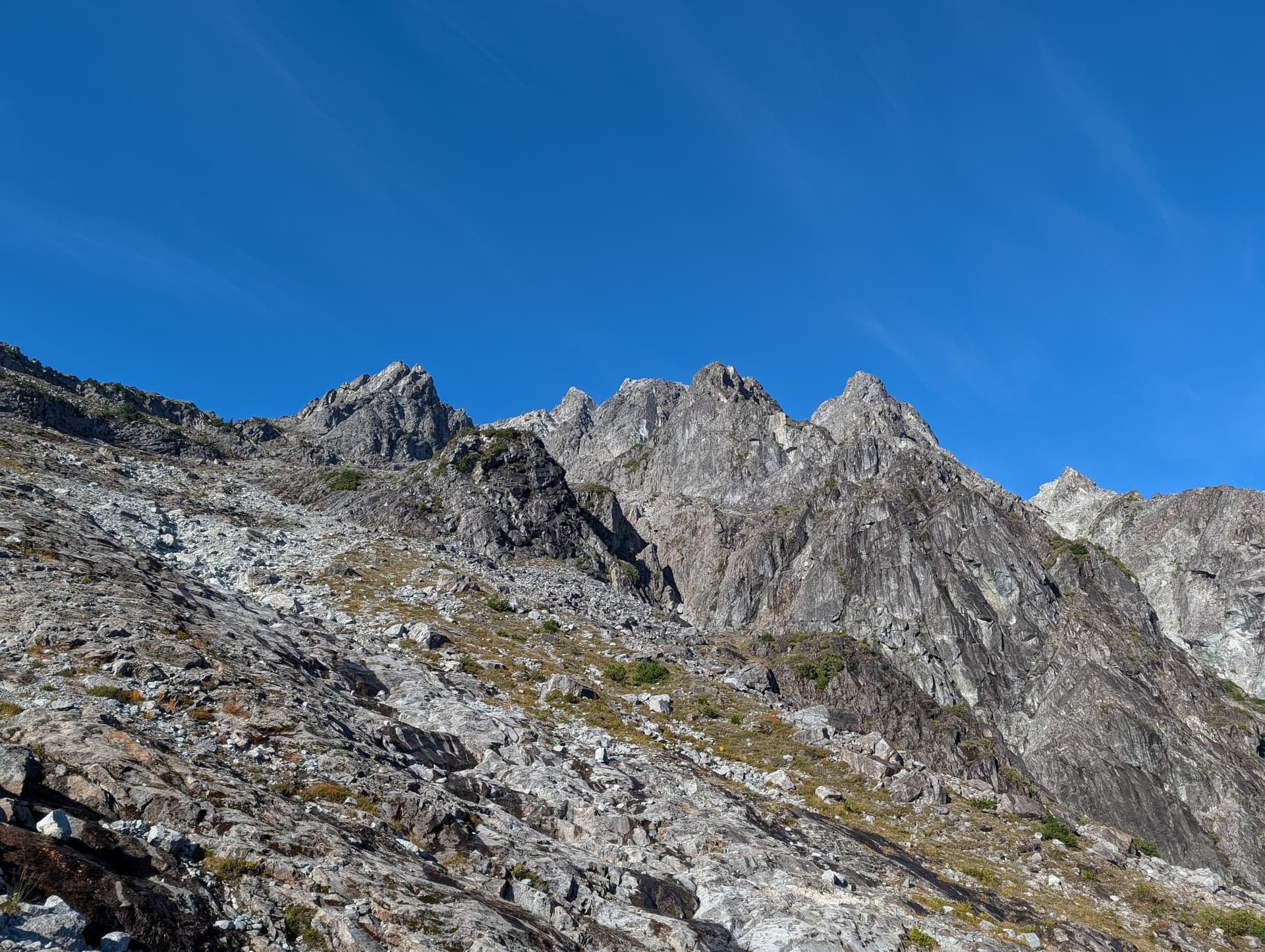
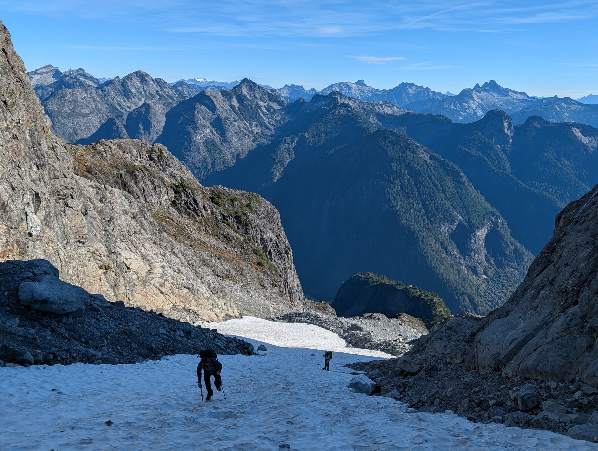
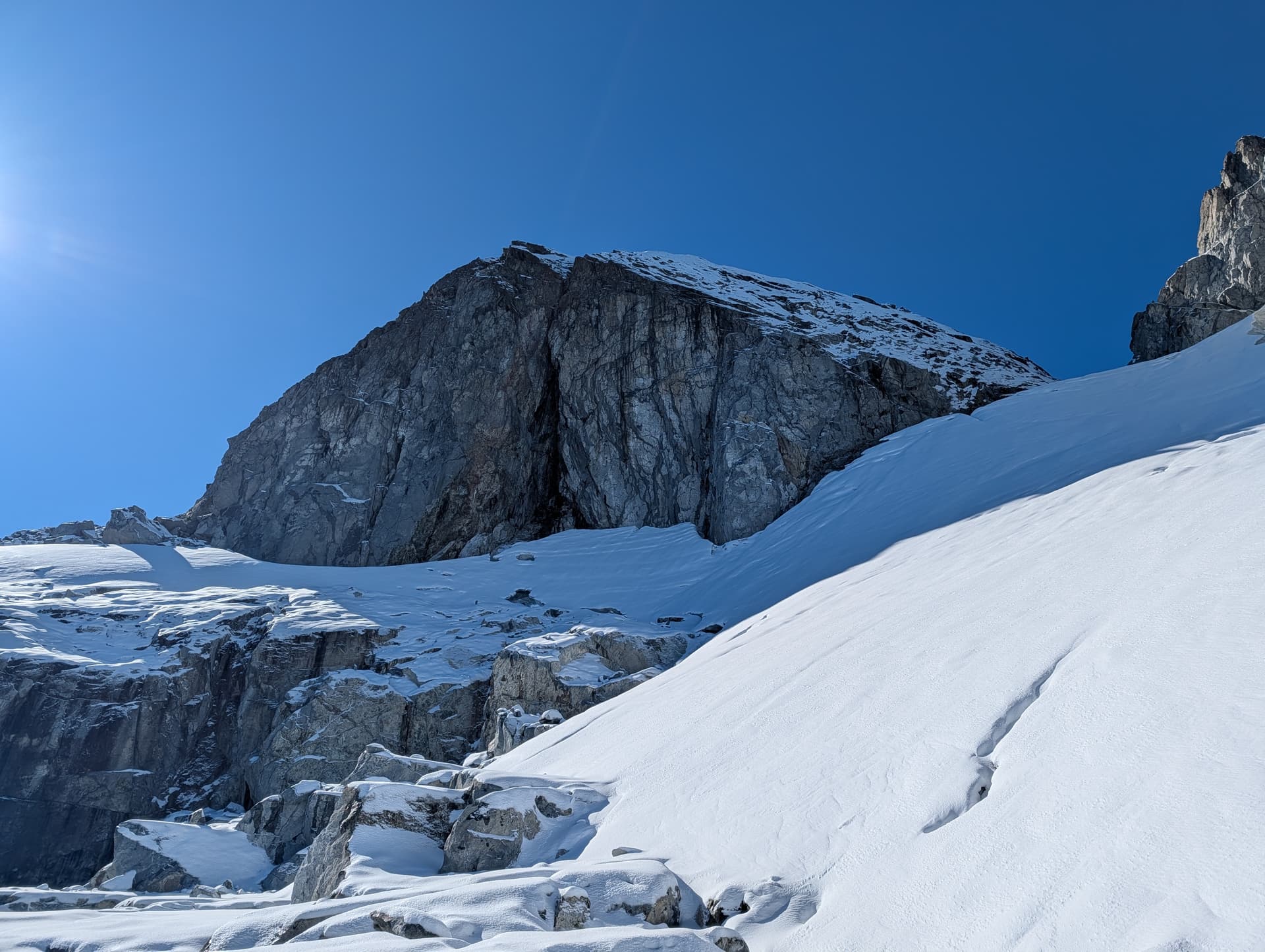
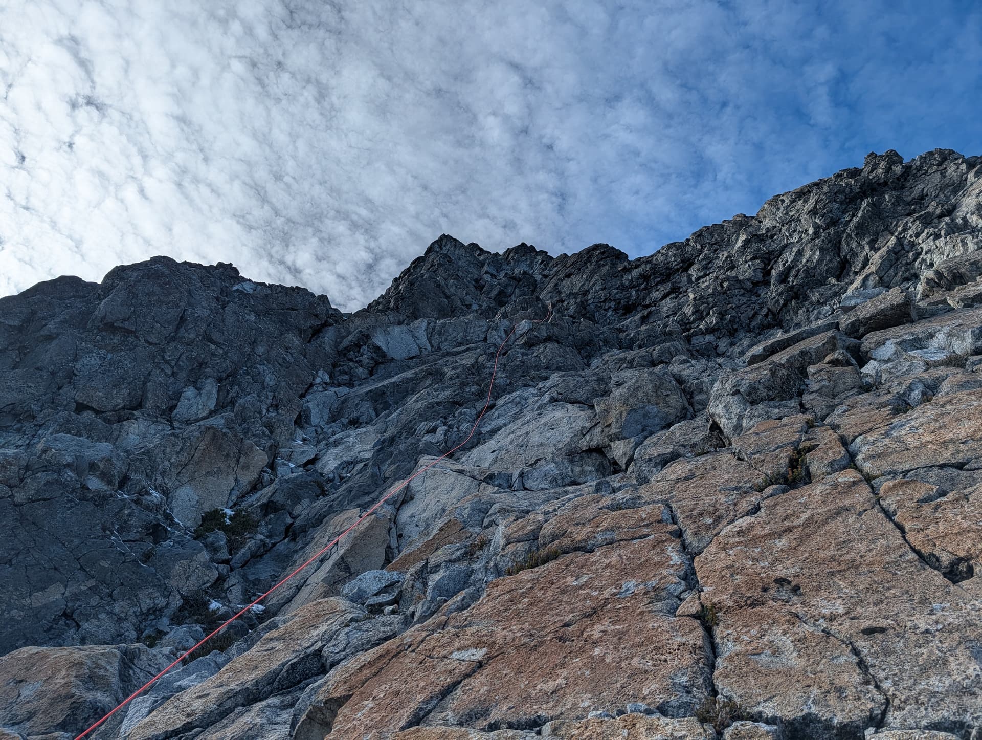
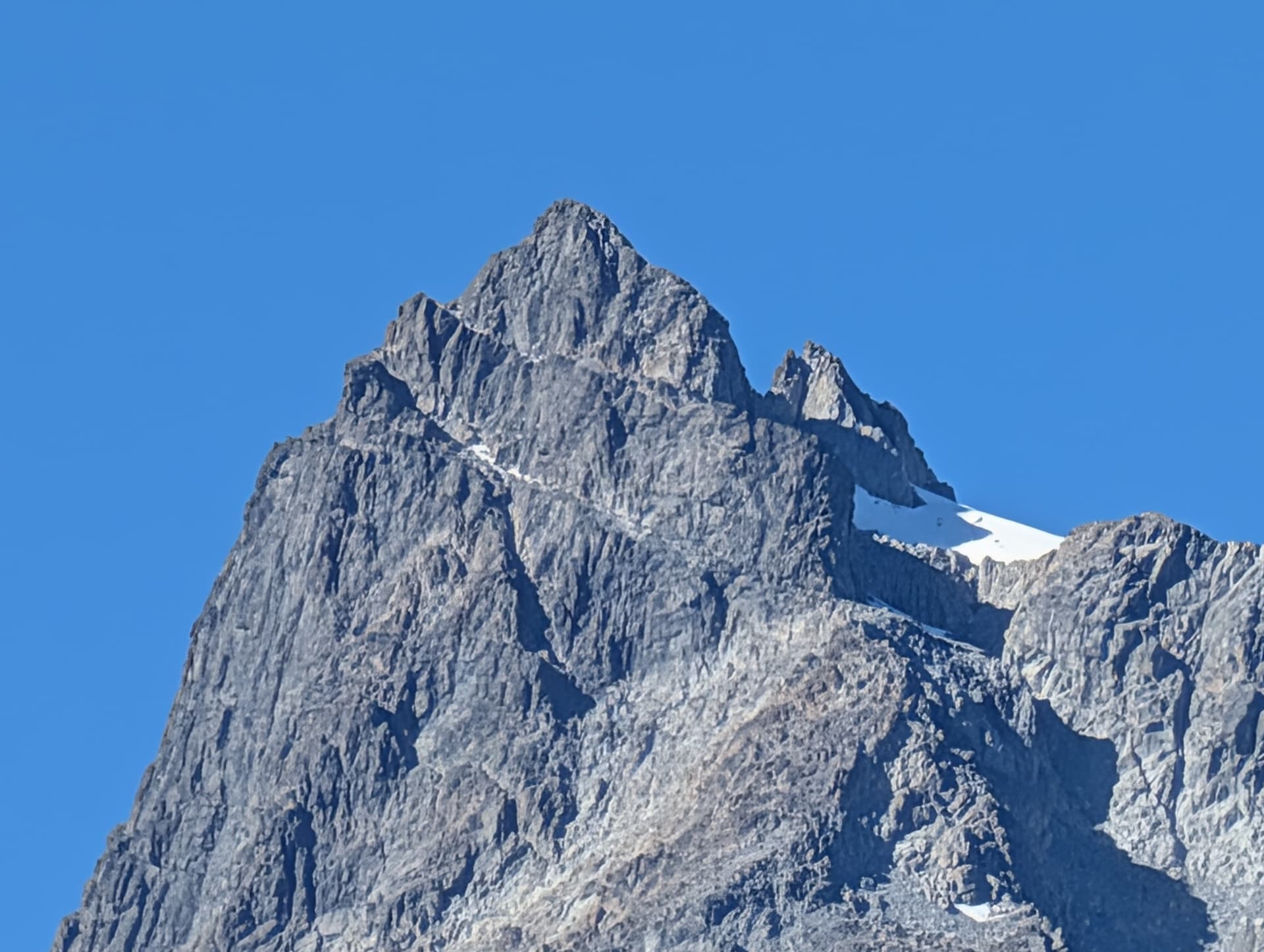
At this point, we could see the summit block had indeed caught a bit of snow, which made us apprehensive for our summit chances. We then entered the hourglass, which we forebodingly found covered in verglas. Although it was low angle, the long ascent of us smashing the ice off every boulder gave us a good amount of time to ponder if we would be going home empty handed. Above the hourglass, the snow got thicker, and we donned crampons and did some mixed scrambling towards the upper snowfield below the summit block. What appears to be the main gully would have involved some mixed climbing in current conditions, so we backtracked and found an easier thread slightly further climbers right that brought us to the incredible pocket glacier cradling the summit block.
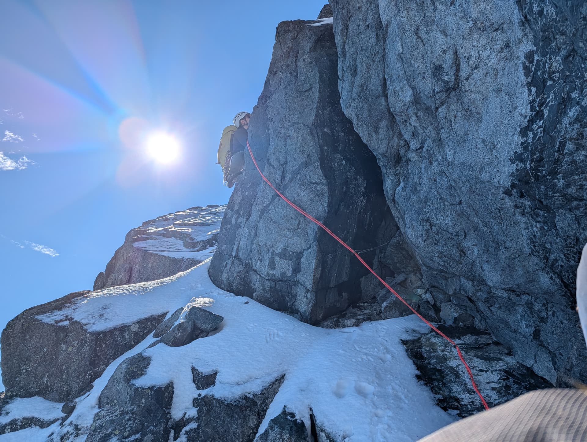
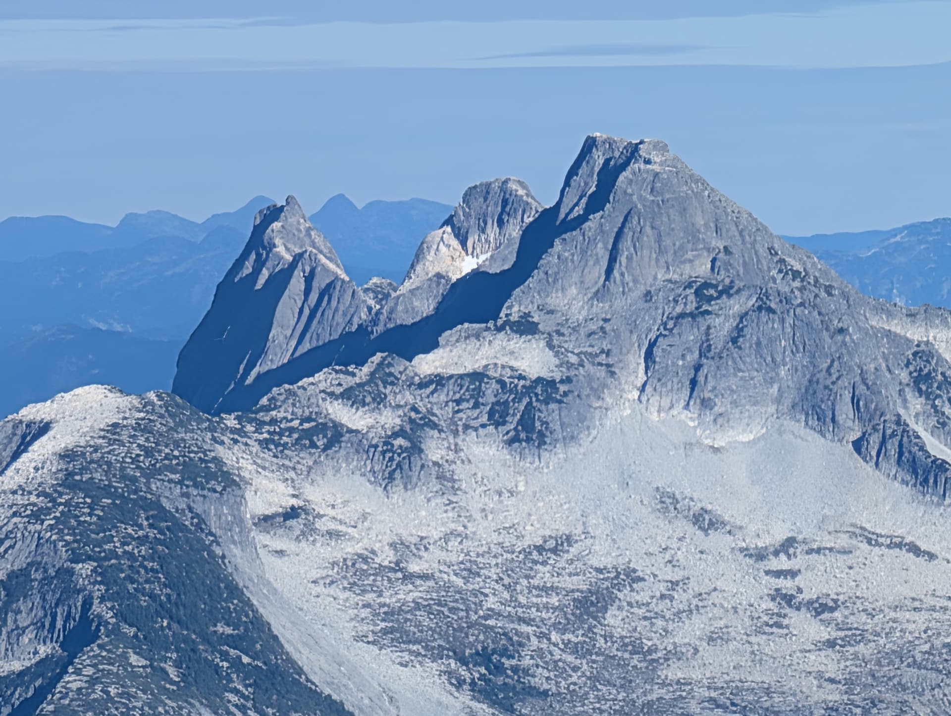
Clearly, the normal scramble route was covered in snow and ice. We had not come expecting to climb that route anyways though, knowing the moat had opened up weeks prior. Our original plan was to climb the 5.5 rock route to climbers right of the scramble, past the col with the false summit, on the North side of the peak. This aspect was plastered with snow and ice. Trevor suggested we check out the East Face / Ridge, climbers left from the snowfield.
Determined to make an effort (we were only 60m below the summit), we traversed some moderate snow, and then scrambled up onto the bench wrapping left to that aspect. Pulling around the corner, I looked up and saw some pretty dry and snow free looking rock that looked certainly climbable - mostly a scramble in fact.
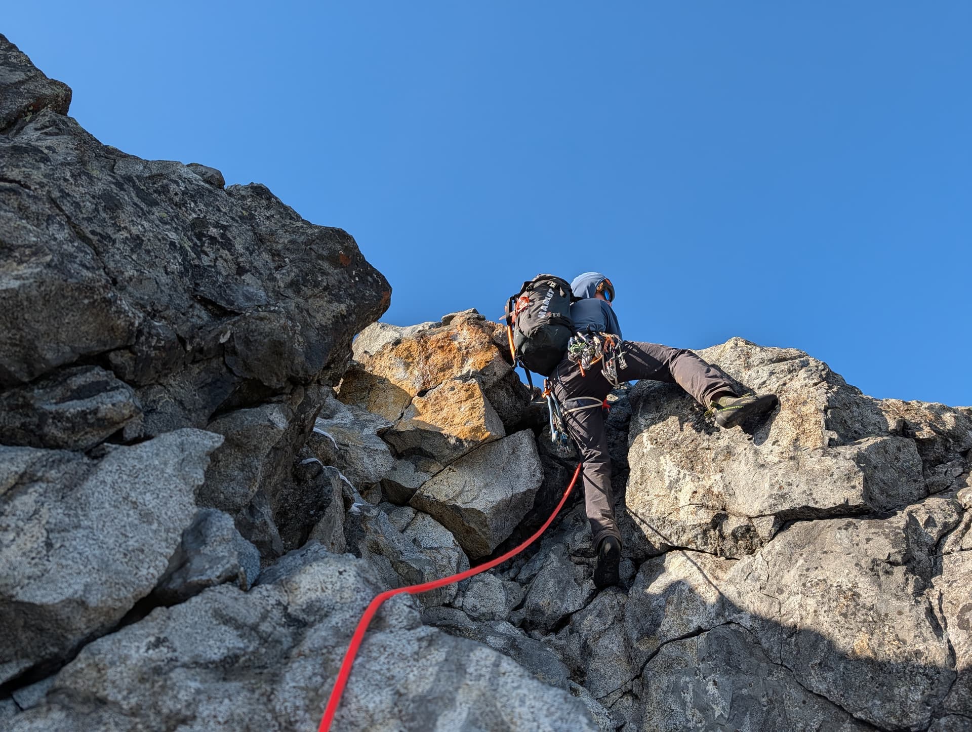
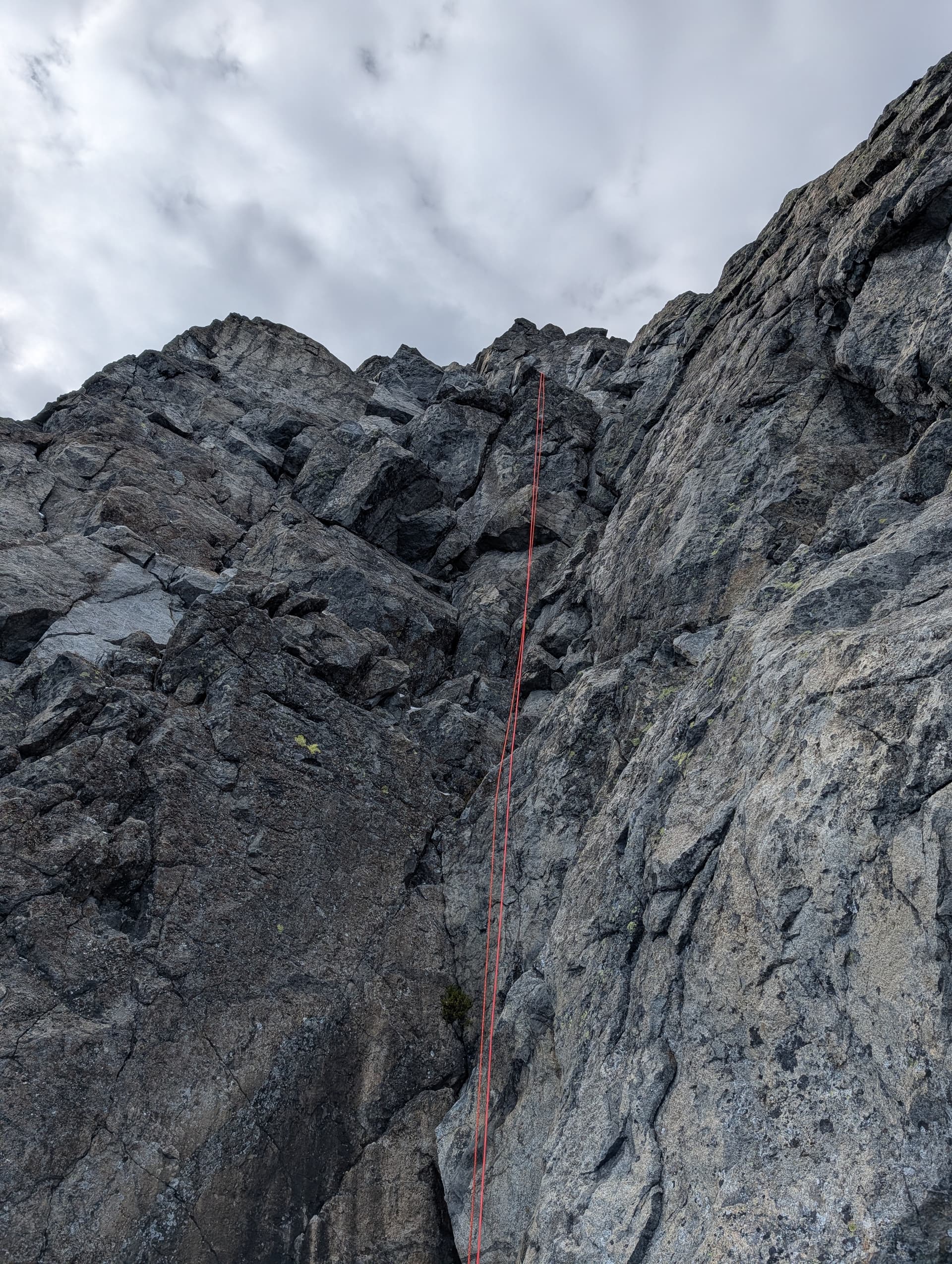
We all donned rock shoes, and then started the scramble. The face was defined by two small basins with steep headwalls, but easier ridges on either side that joined each other atop each headwall. I led us up the left ridge both times. The rock was grippy, featured, and generally solid. Overall this was mostly high 4th class, except for a few very exposed moves of low 5th on the left ridge on the upper basin. After pulling this, we were facing an arete leading to the summit. Unfortunately, it was plastered in snow again and would be a tricky rock lead. To the left, there was a ramp and chimney that looked more protectable.
We built an anchor in an awkward stance on a snowy ledge, and then Trevor took the lead, pulling onto a higher ramp, and the monkeying up climbers left of the chimney into another bay. In dry conditions this would be no problem, but with the snow it was a bit tricky. Francis and I followed, and then Francis took the next pitch, although after pulling a few 5.5 moves above us, he exclaimed that it was over and we should just come up.
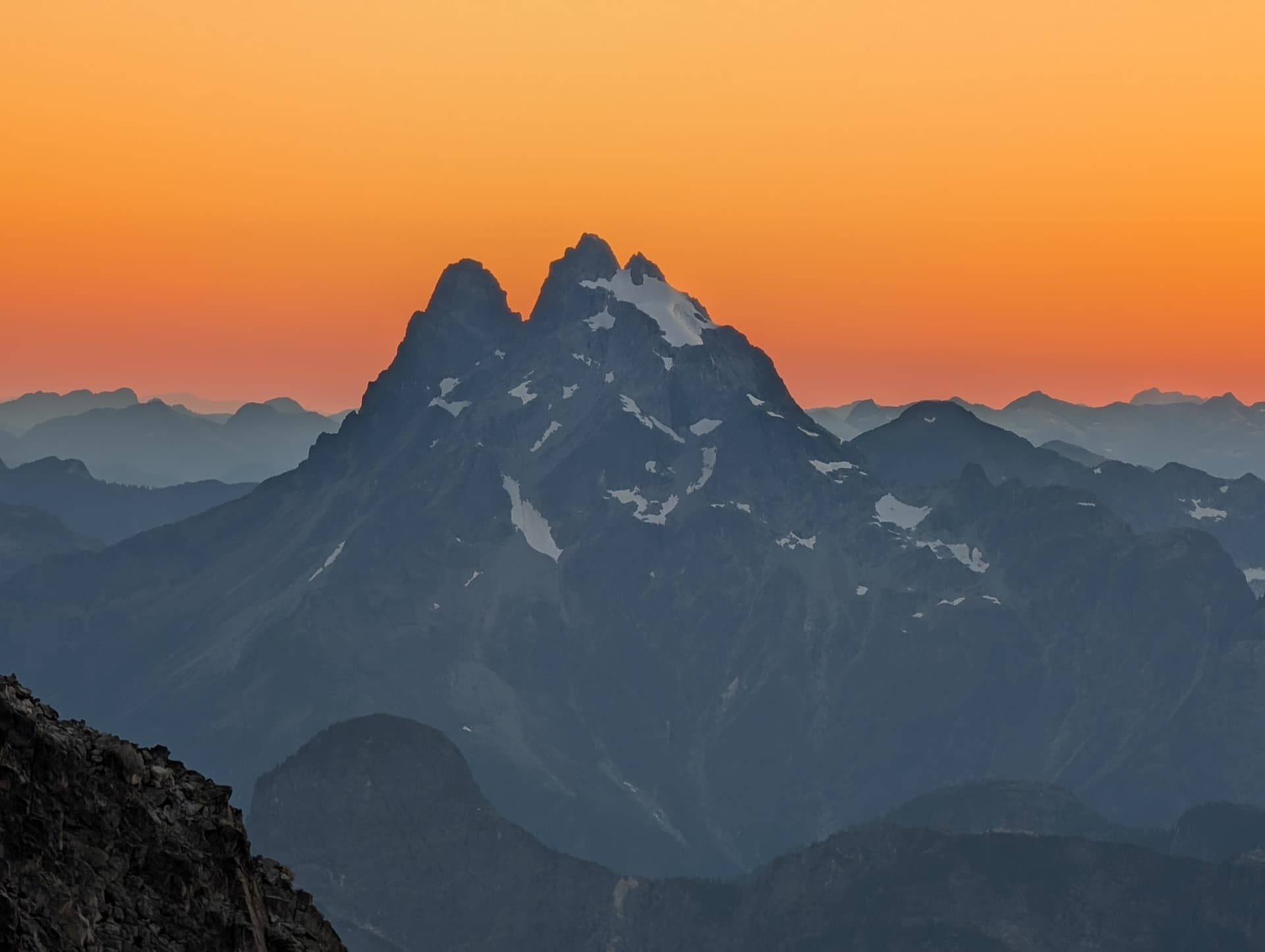
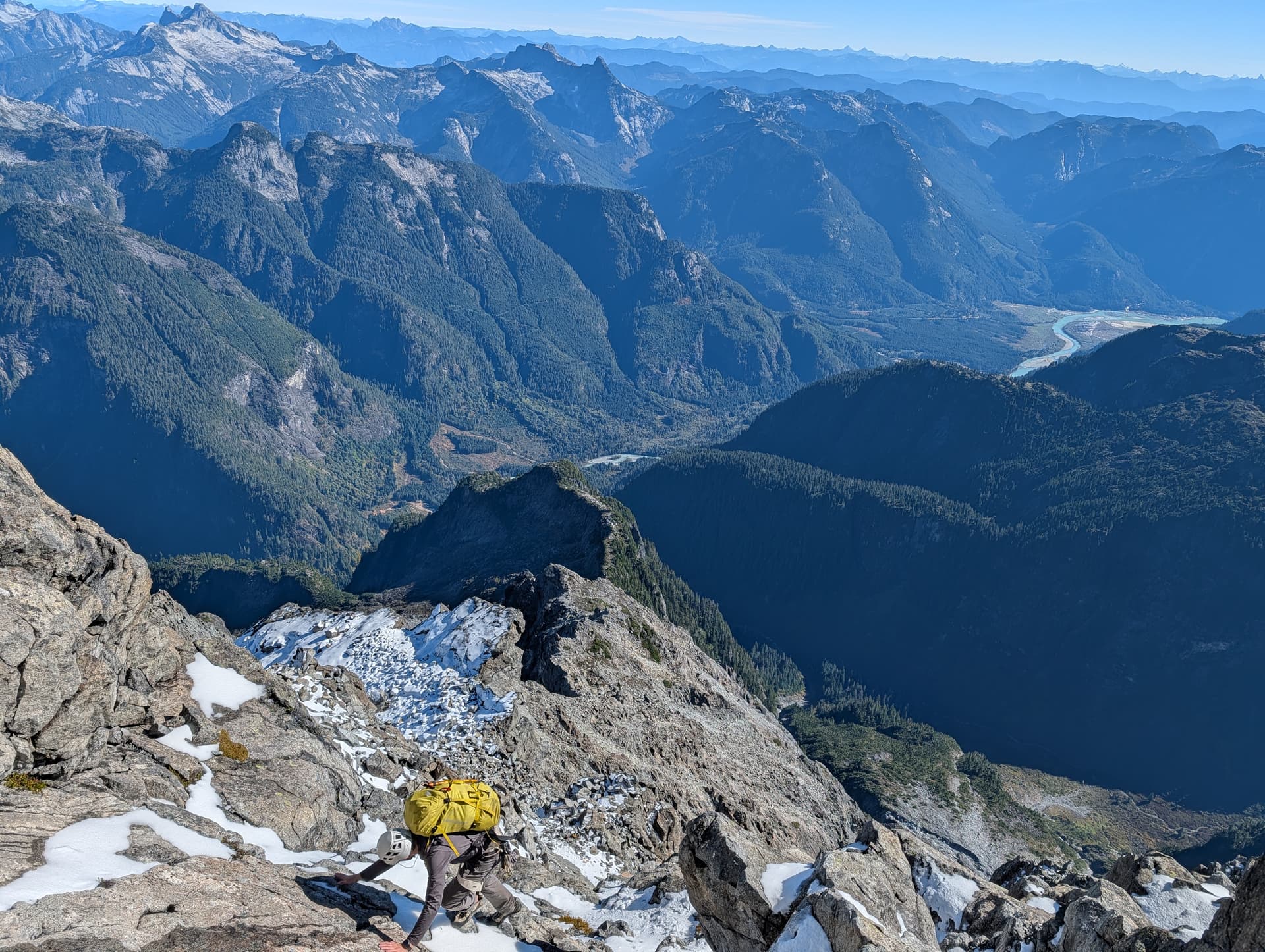
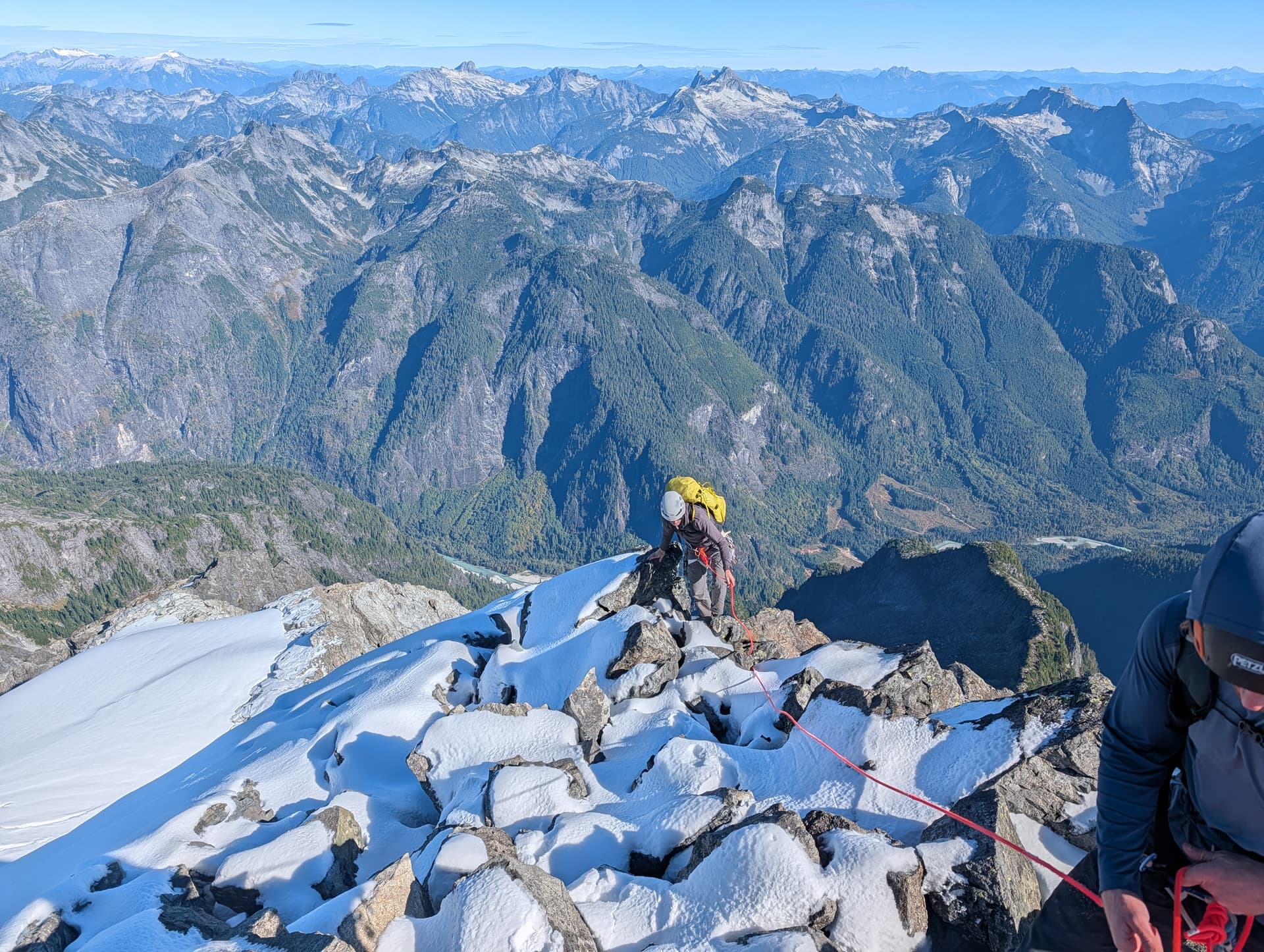
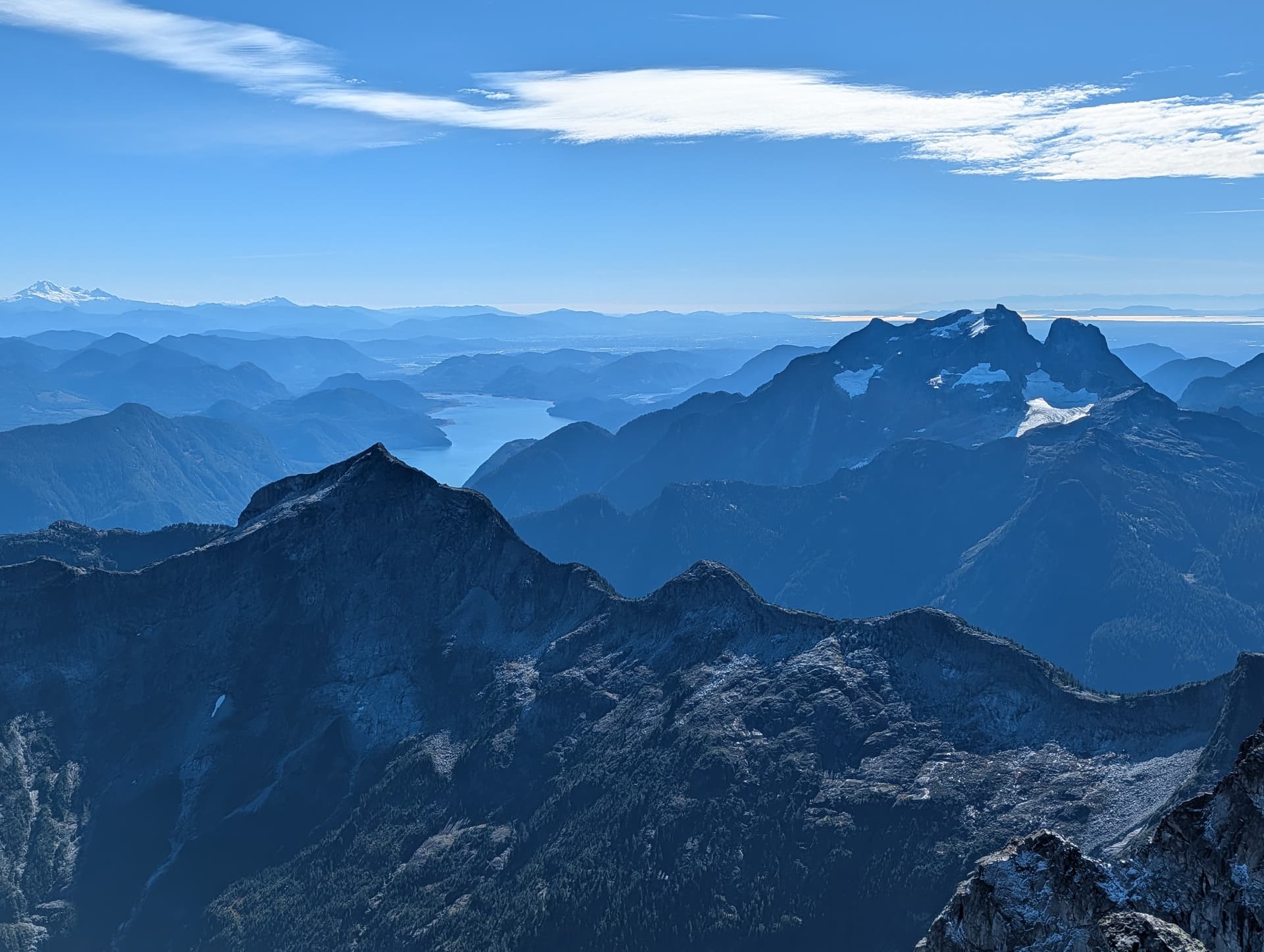
Trev was already on belay so he followed while I soloed up, and soon all 3 of us were standing on. top of a snowy Mount Judge Howay on a crisp October day! The views were of course enormous and incredible, and it was a real life highlight to summit a mountain that I have eyed for so long; one that demands both skill and good fortune, and has shut down many an attempt.
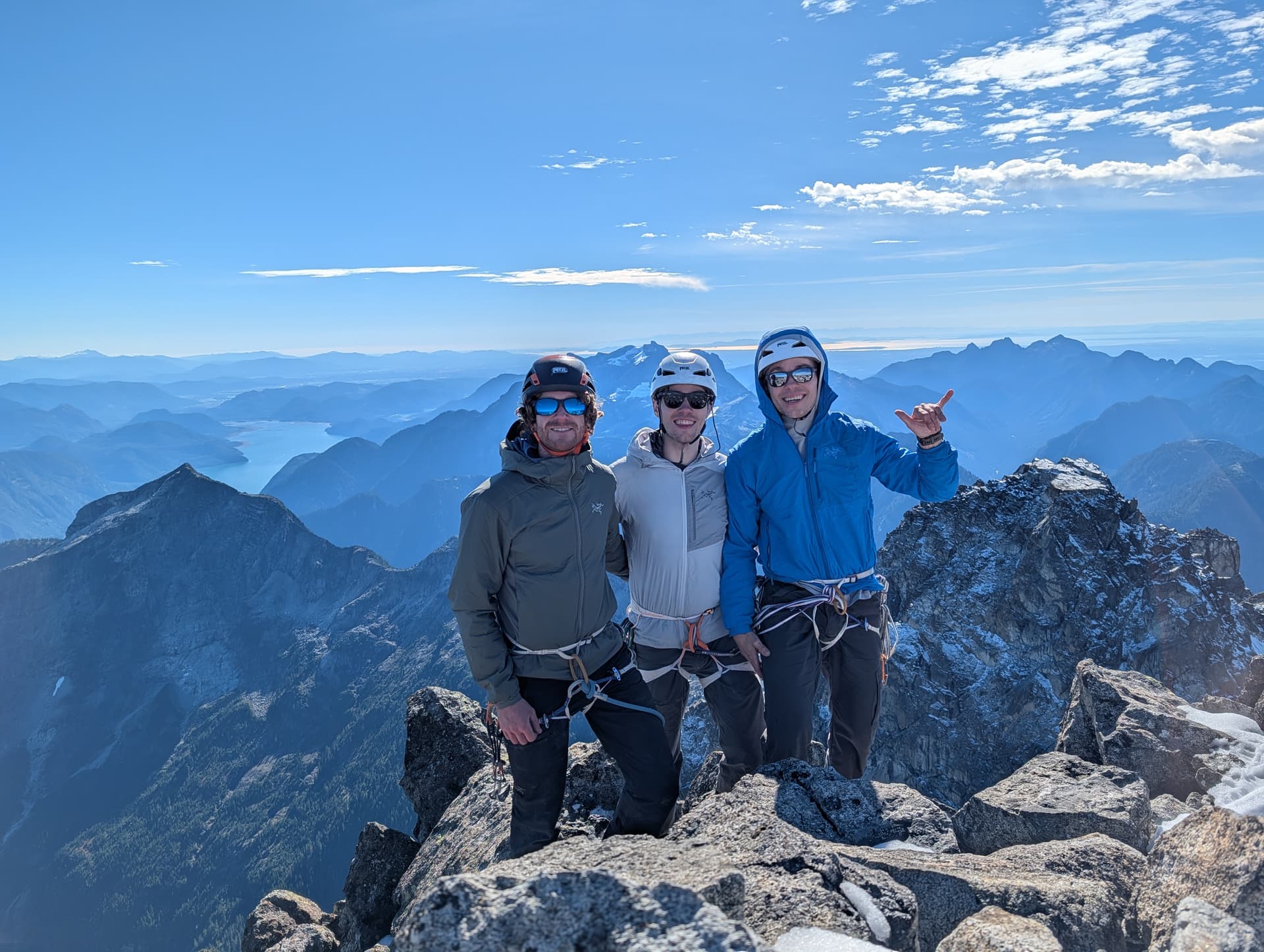
We descended our rock route with two very clean rappels - 50m and then 55m. We then reversed all of the above and staggered back to camp 20 minutes before the sun went down.
Day 3 - The Deproach
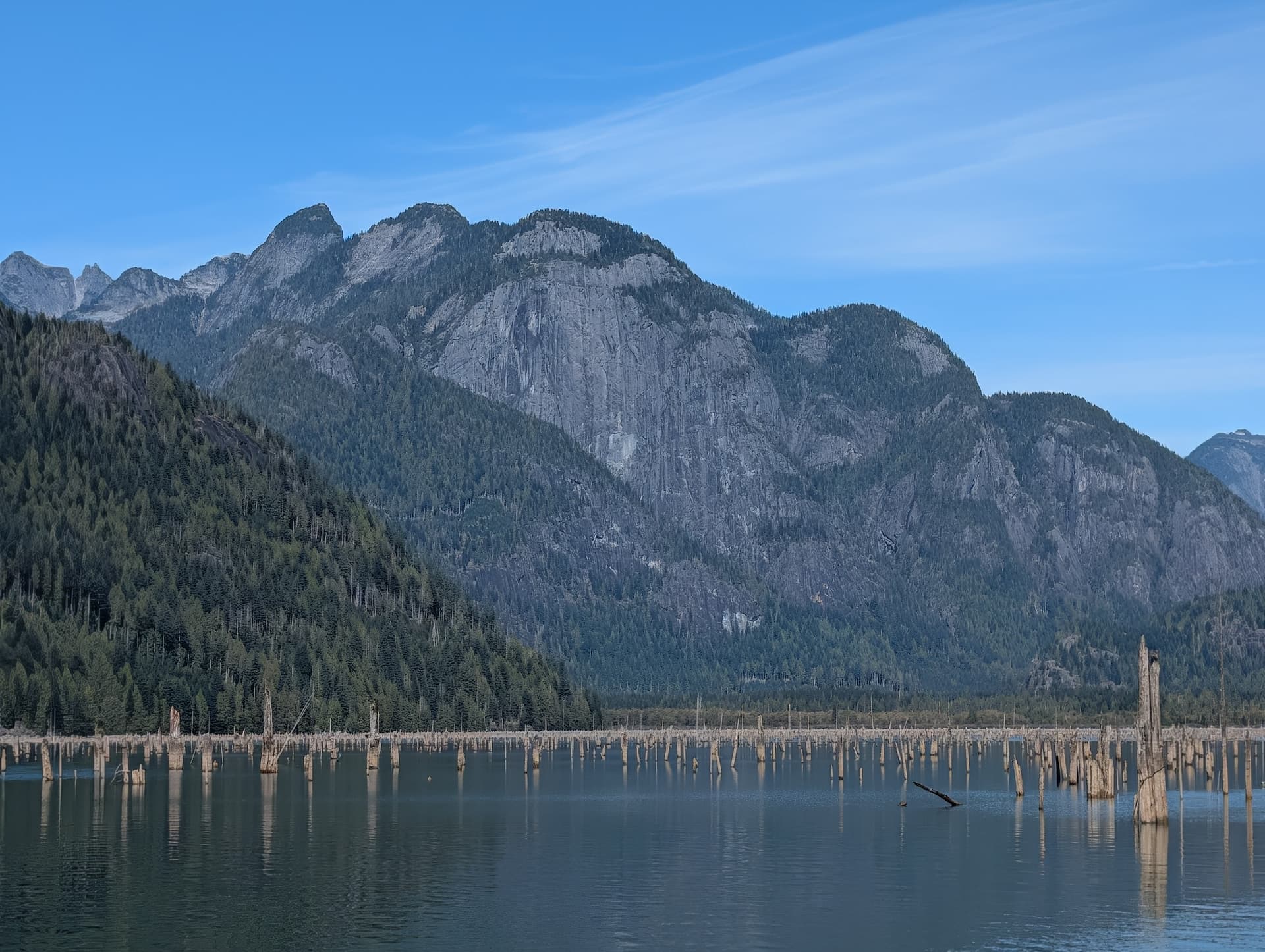
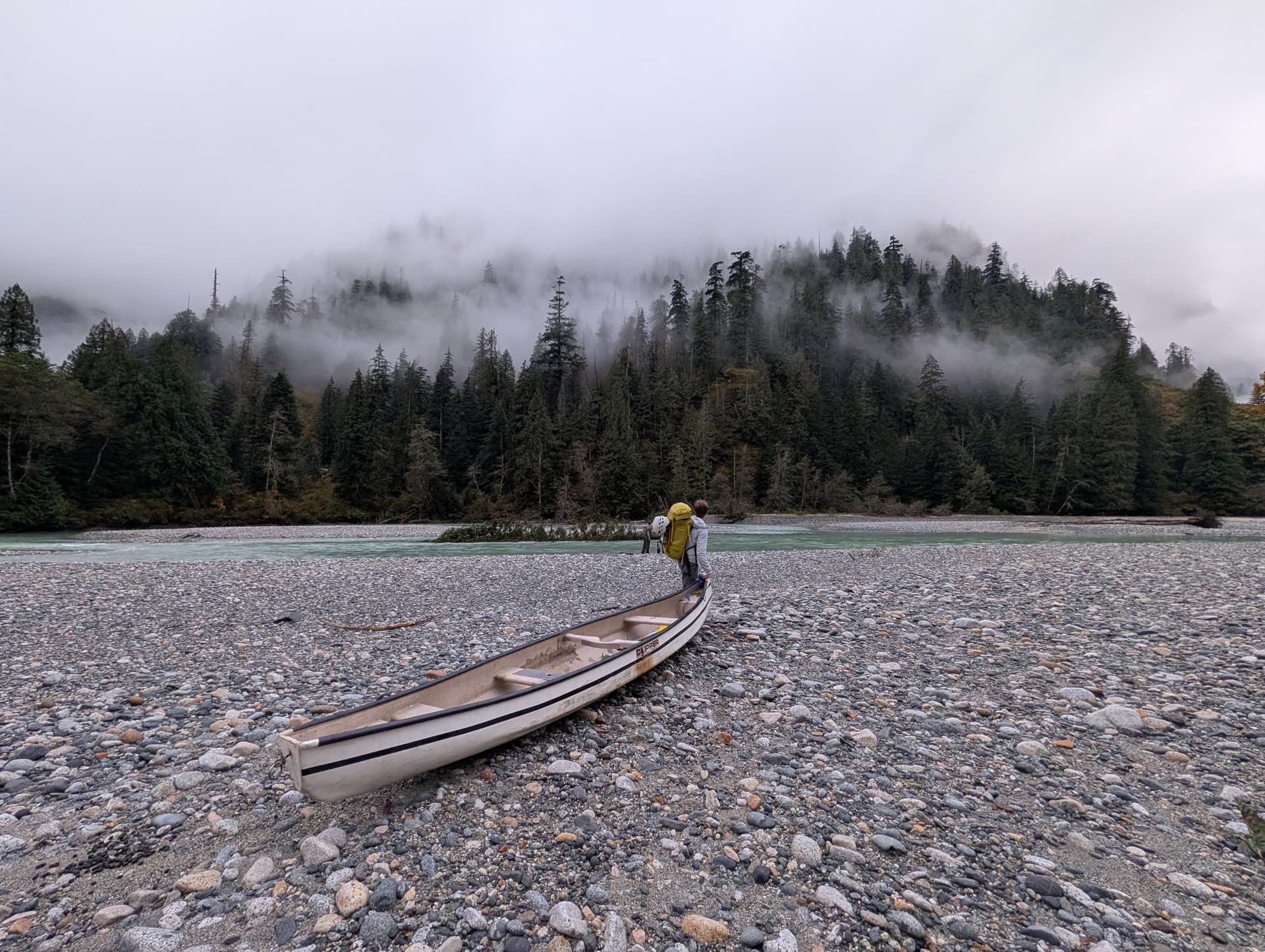
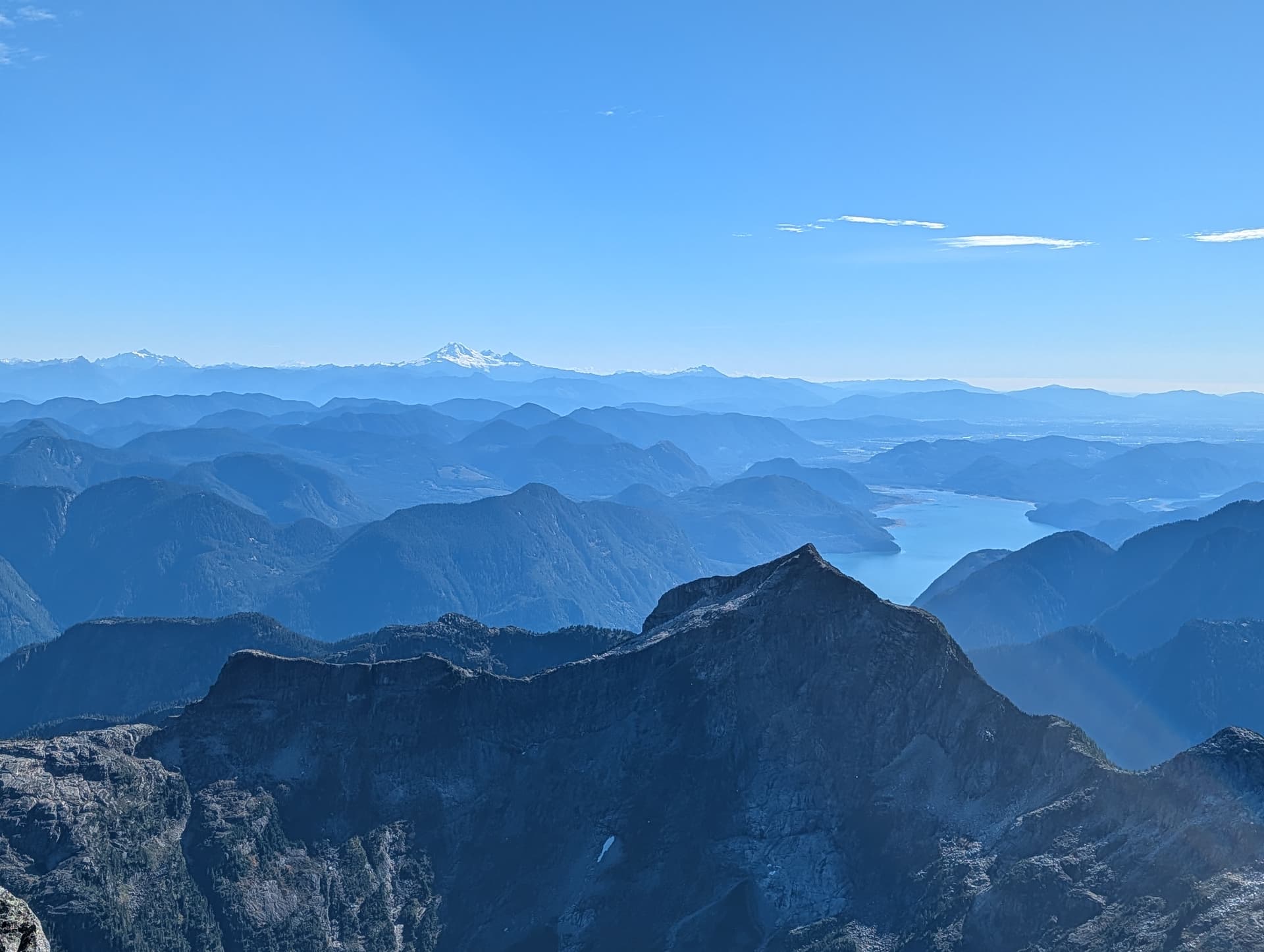
On the third day, we woke up with the sun again and had breakfast. The hike out was easier than expected, and we made it down to the river in about 2h15. We then had a more controlled crossing of the Stave, and spent some time on the beach eating lunch. The Judge loomed over 2000m above us, it’s snowy summit feeling so far away now. Basking in the sun in the beach felt like a different world. Eventually it was time to go and we headed out.
Overall, while our friend taking us up the Stave made the approach logistically very easy, the mountain conditions still made our ascent feel demanding; there are no easy summits of The Judge. In terms of of the summit beta, the East Face / Ridge is a good option for those that can climb up to about ~5.5 with exposure, and provides a path to the summit not dependant on a moat that opens earlier and earlier each year as the permanent snowfields and glaciers on the peak wither away.
Climbing The Judge turned out to be the kind of coastal odyssey one reads about, and the satisfaction of standing on the summit was certainly proportional to the effort it took to get there.