Andrea and I had been dreaming up a traverse this year after we both managed to schedule two weeks off of work. We were really keen to check out the ranges further north along the coast now that we’d been to the Pantheons and a personal trip to Ha-Iltzuk earlier this year. Picking which zone to explore was the hardest part, as there’s virtually endless terrain to wander about in. Our choice would be made a bit easier though when I stumbled upon some potentially unclimbed summits around the Kapella River area. Located north of Bella Coola and situated between the Kitlope River on the western boundary and Kimsquit River on the east; this area looked to be an amazing place to explore.
While sleuthing around, we discovered that there had been a few parties in this area over the years. Glenn Woodsworth climbed Foresight Mountain and another unnamed peak further north in 1978. John Clarke, Shirley Rempel and Dave Lammers made a ski traverse in 1992 going as far north as the Cornice Creek area. Finally, Mark Grist and Mike Buda would do a variation of that same traverse in 2005 but continuing on to Kimsquit Lake.
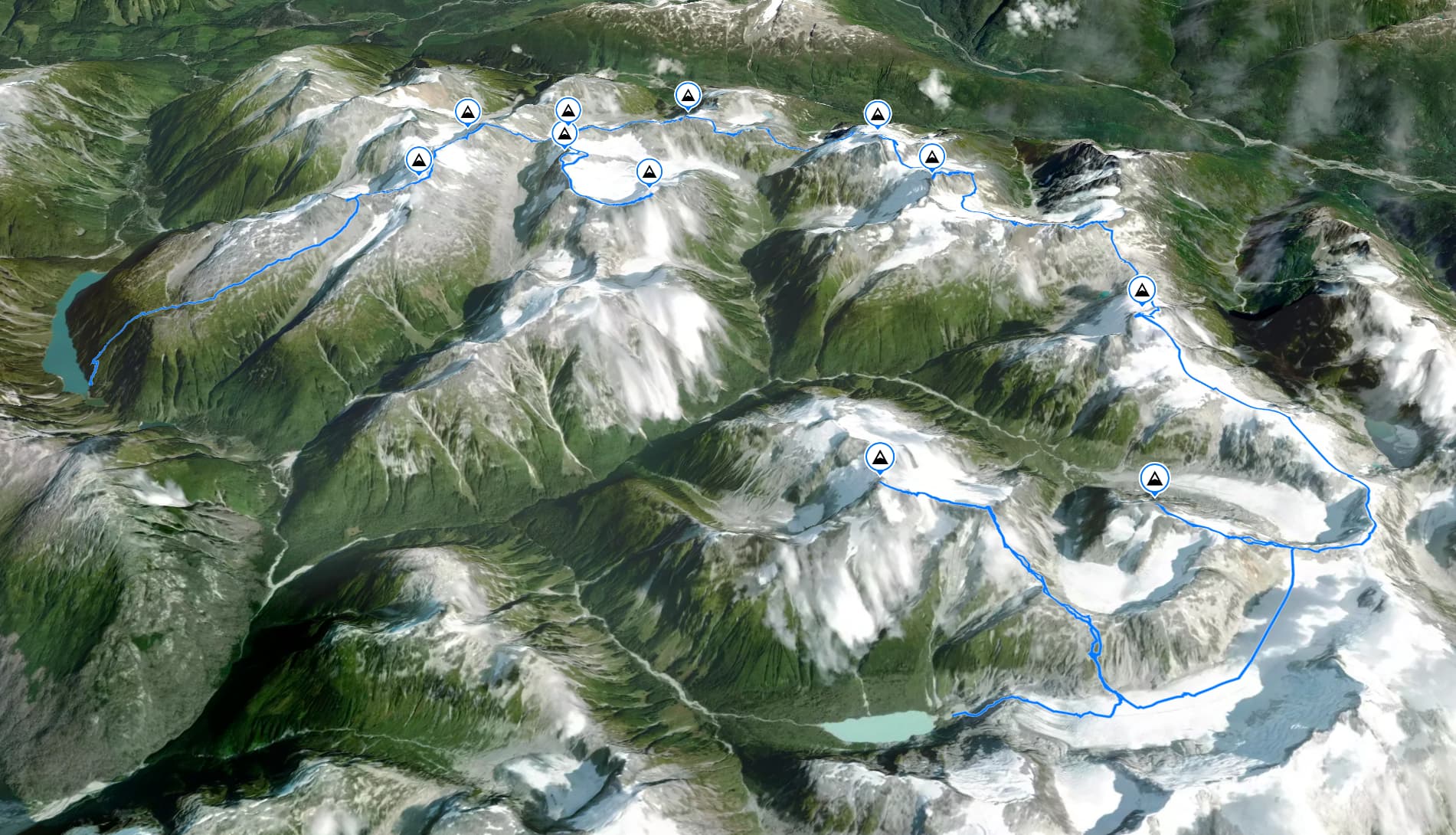
Within that area we were particularly interested in two small groups of summits. The first was around an unnamed glacial lake that forms the western most part of the Kapella River head waters and the second was group of peaks further north east that are bounded to the west by Tipso Creek and Kapella River. After speaking with Mark Grist and confirming that the northern part of the traverse was well worth the journey we decided we would take a float plane into the unnamed lake and join up with Mark and Mike’s traverse to Kimsquit Lake. We’d carve out some time to explore the potentially unclimbed summits off of their main traverse line before getting picked up by float plane from Kimsquit Lake. In total, we set aside 14 days to complete the traverse and made the later regrettable decision to pack all 14 days worth of food on our backs.
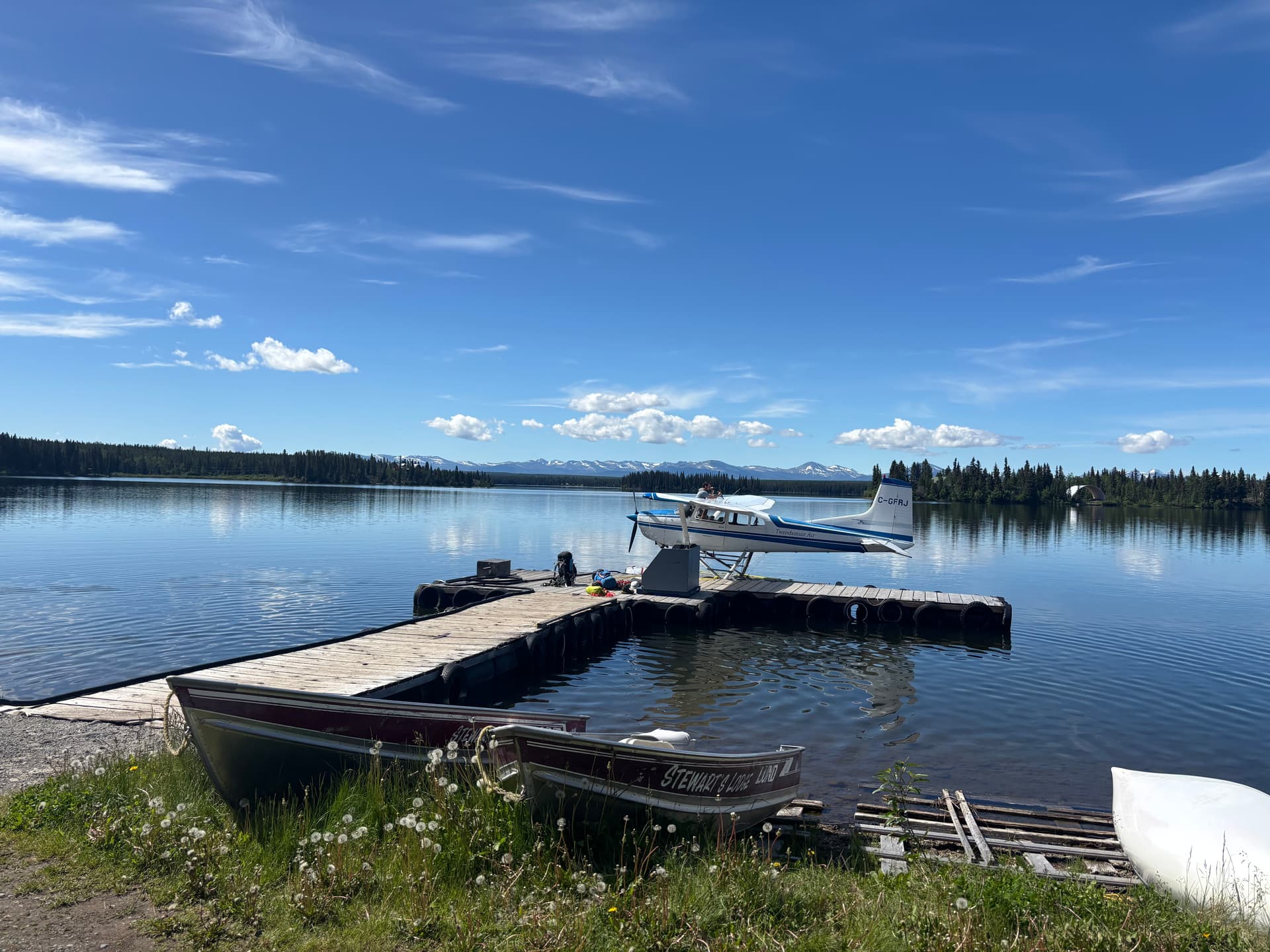
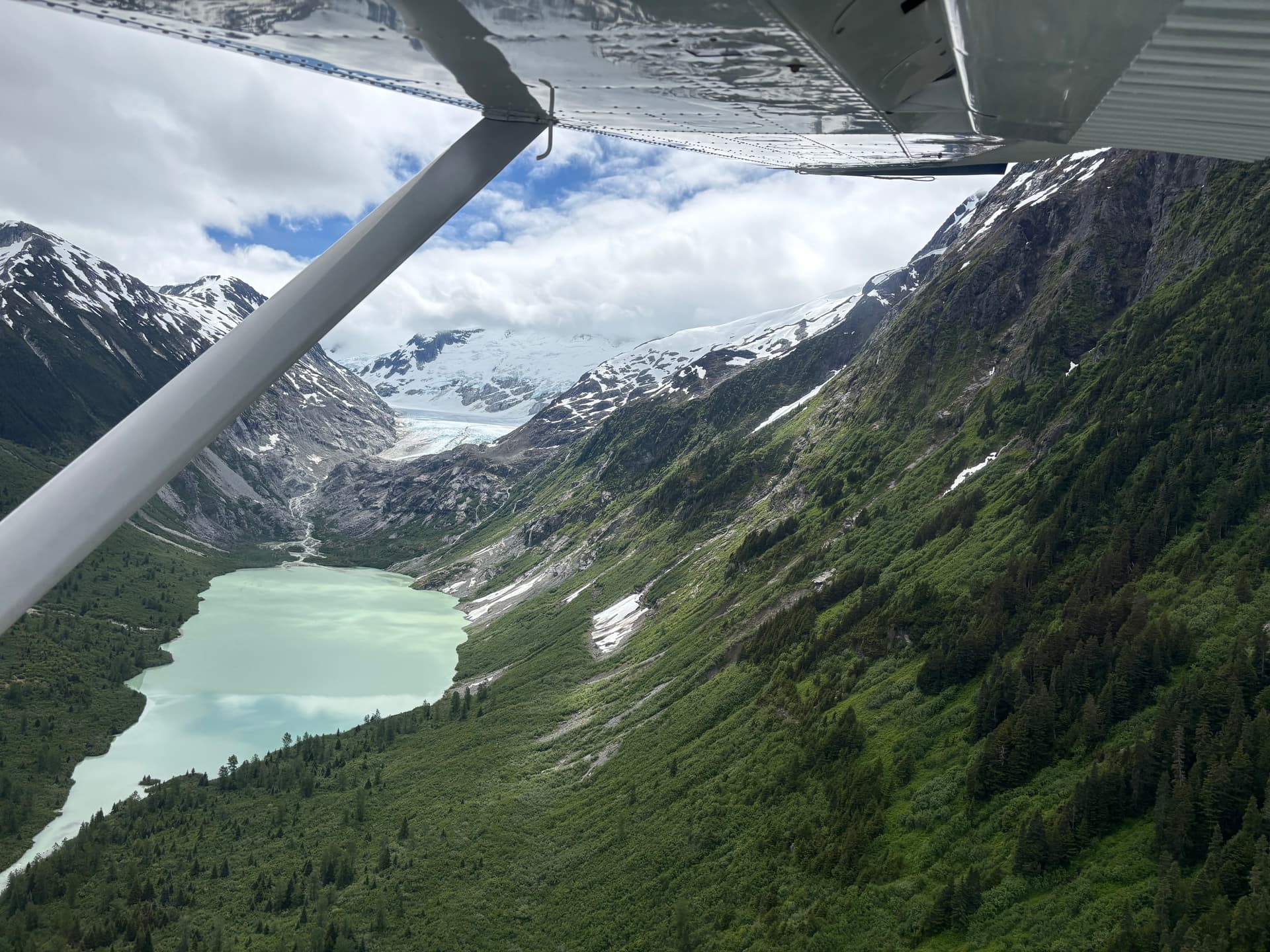
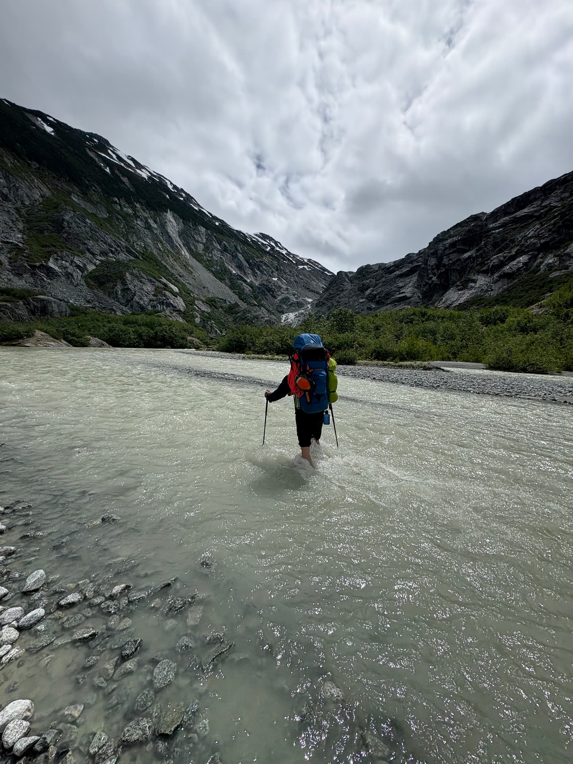
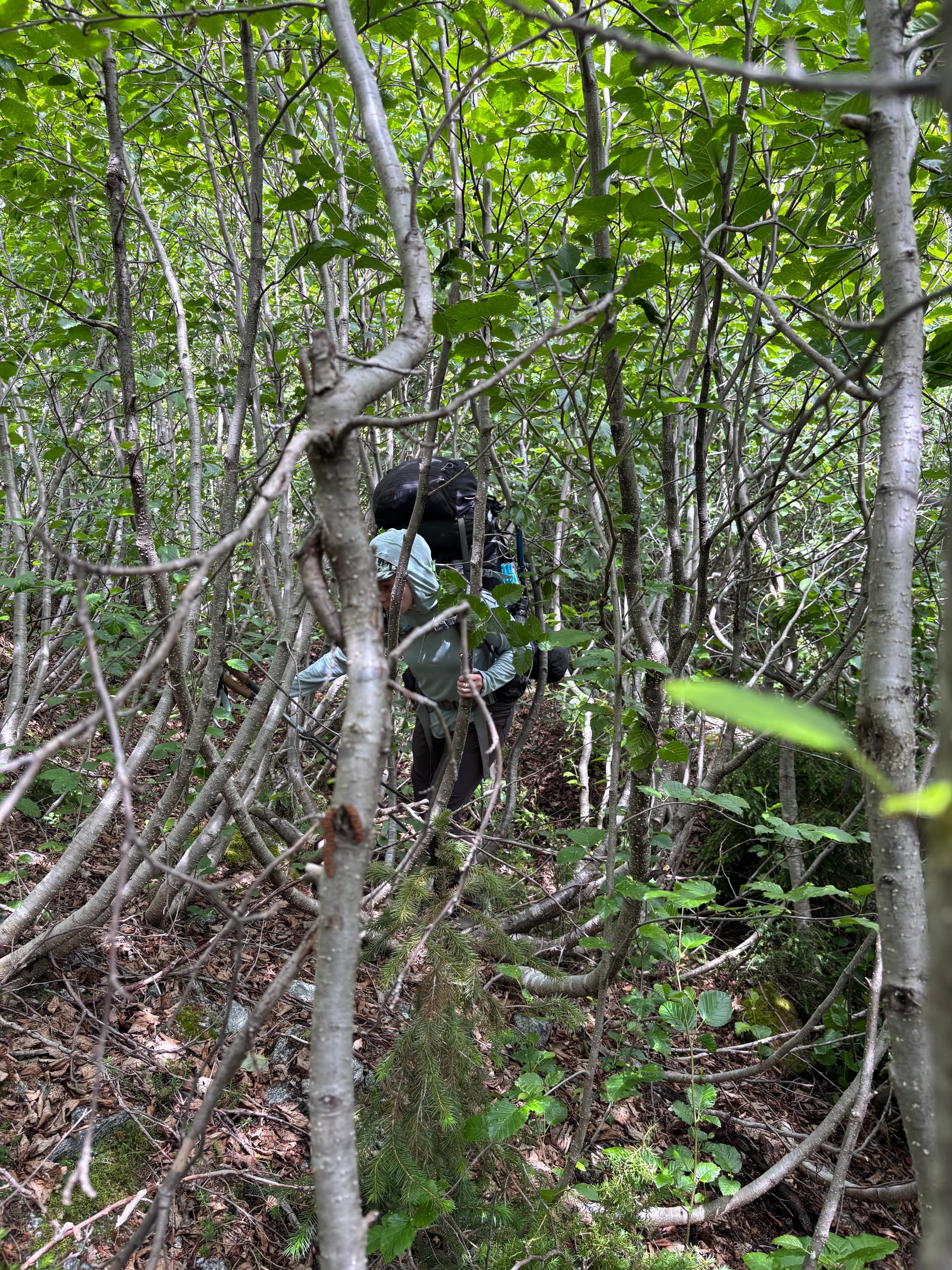
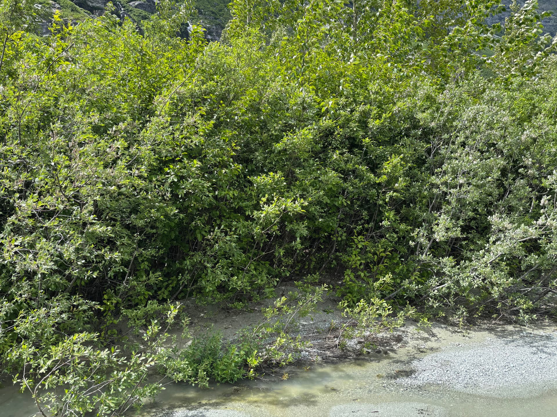
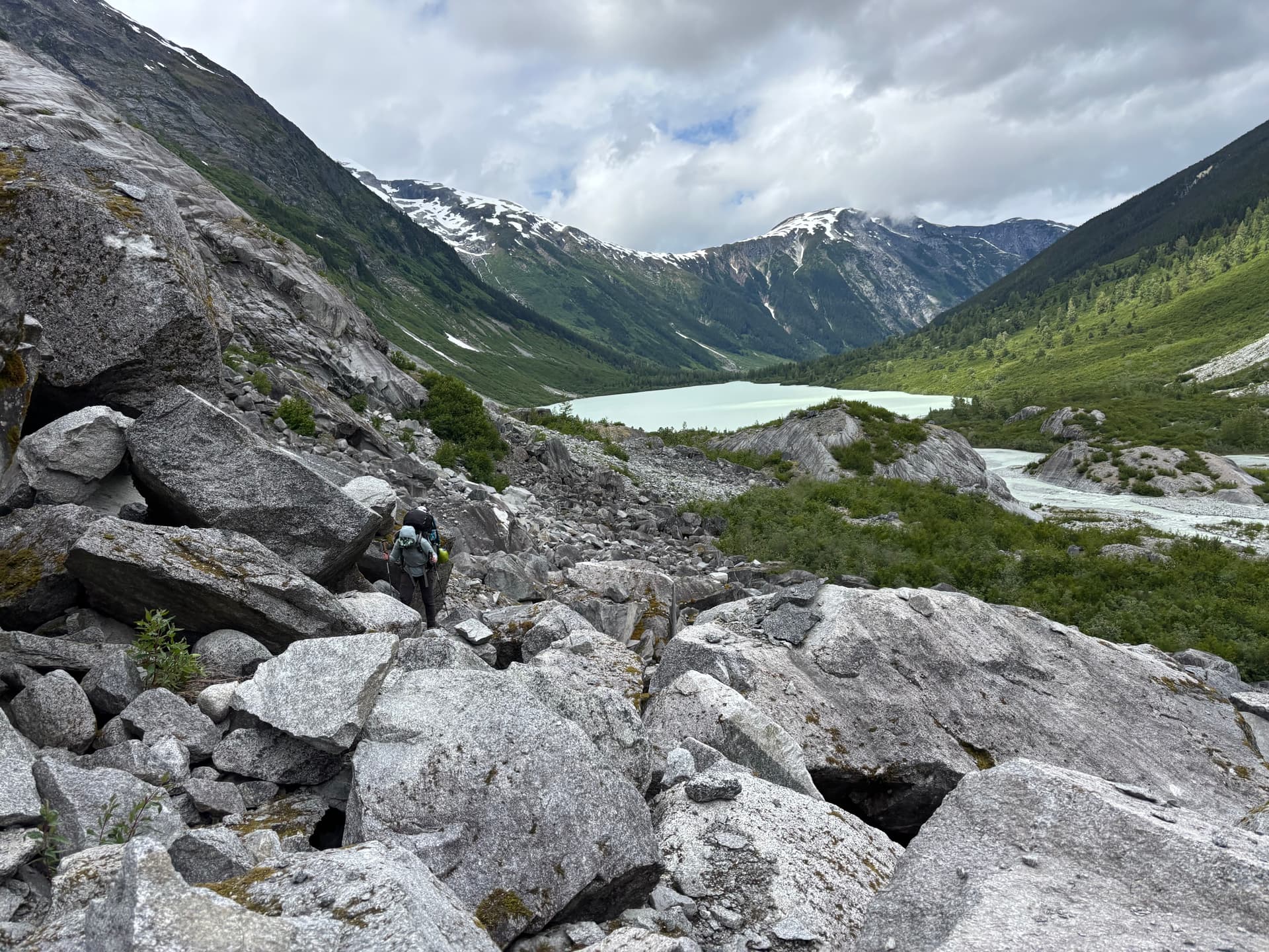
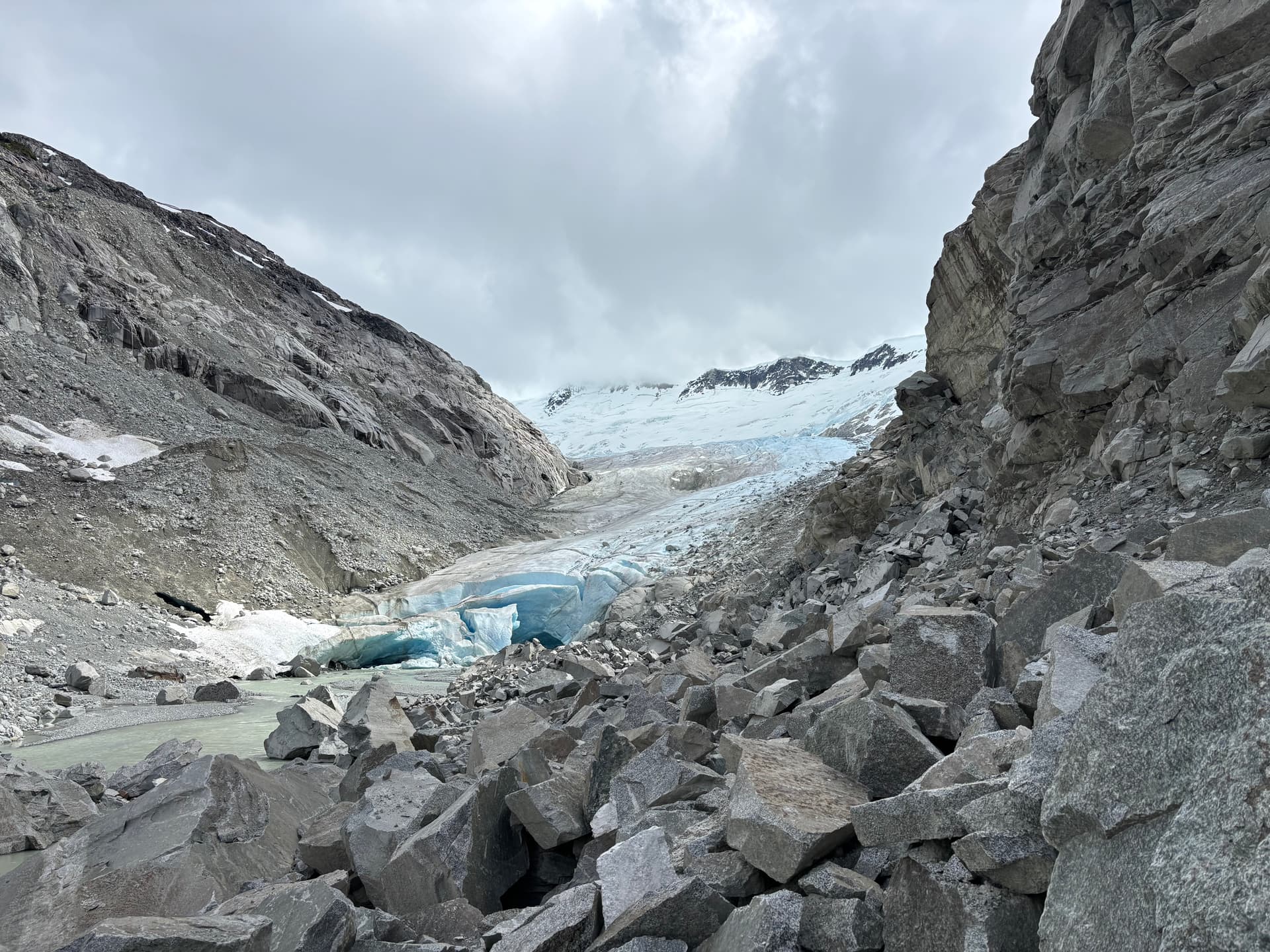
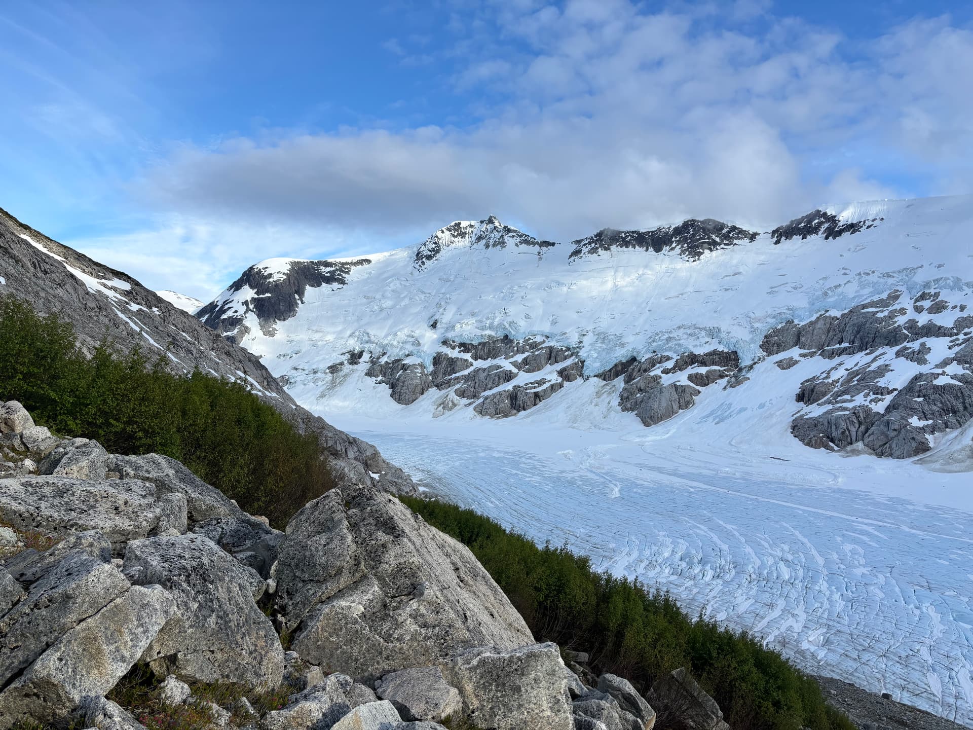
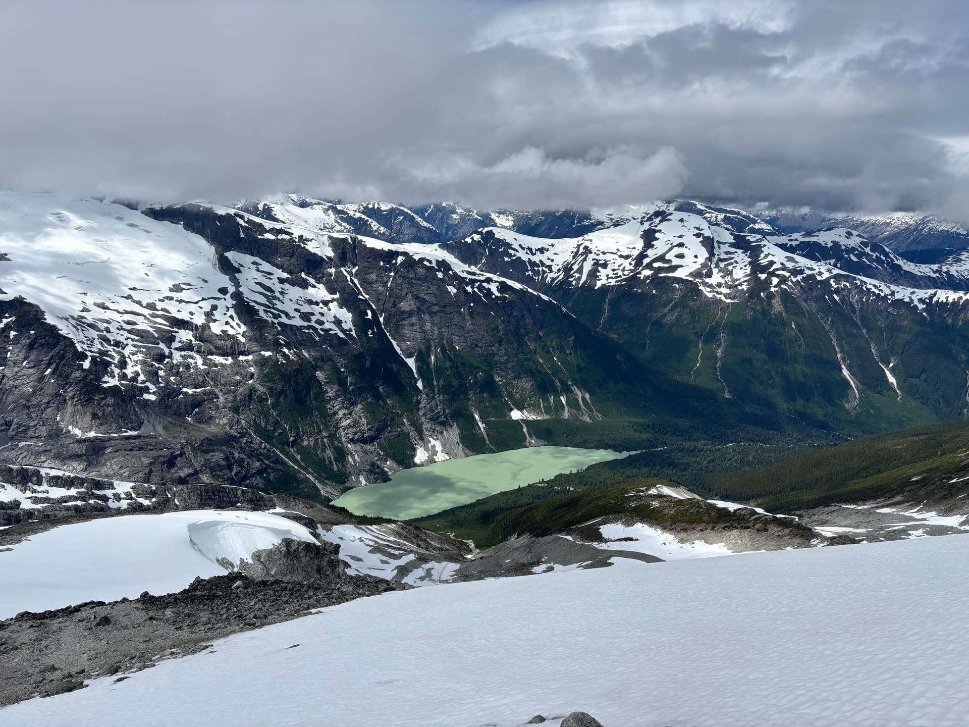
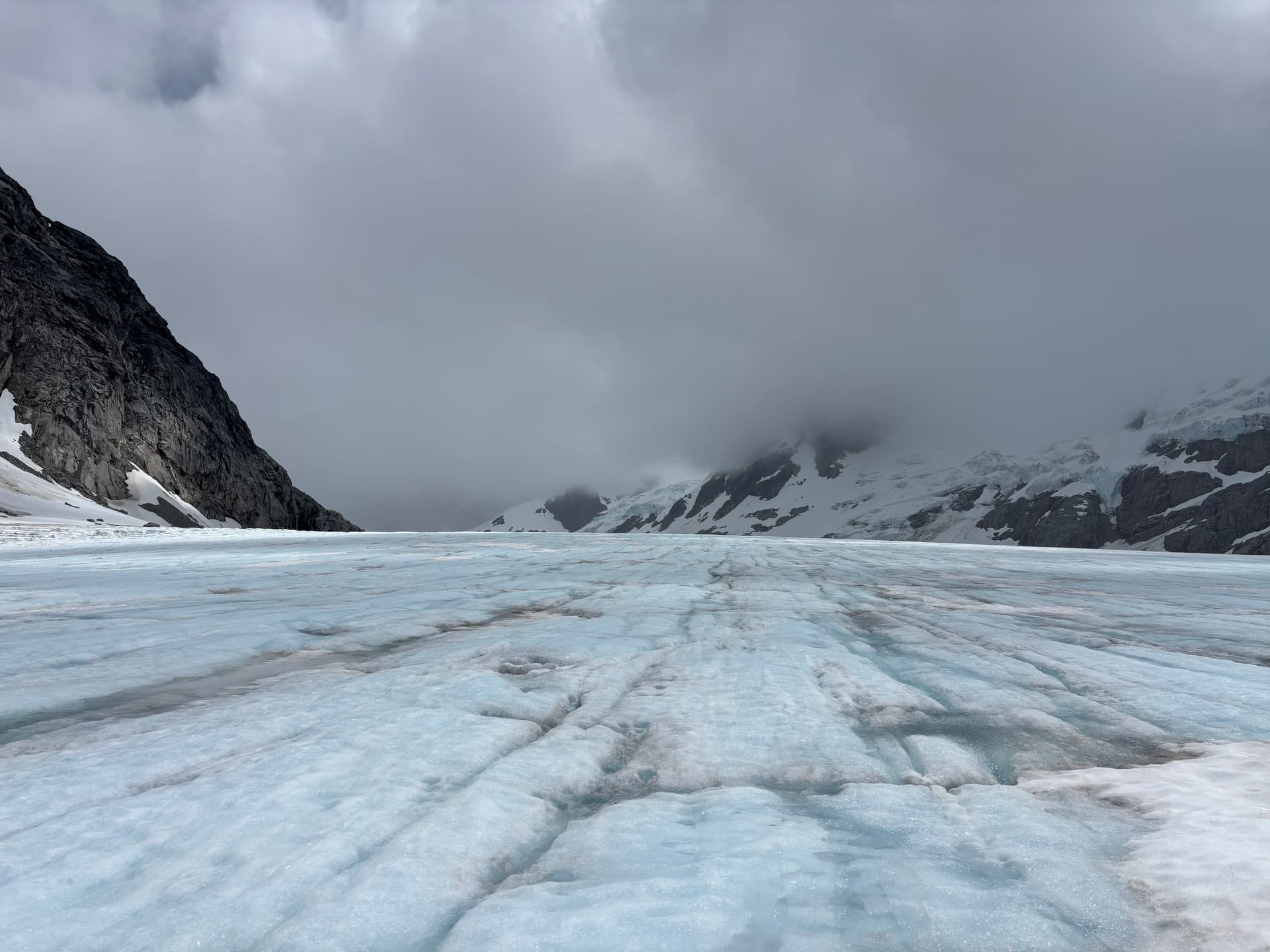
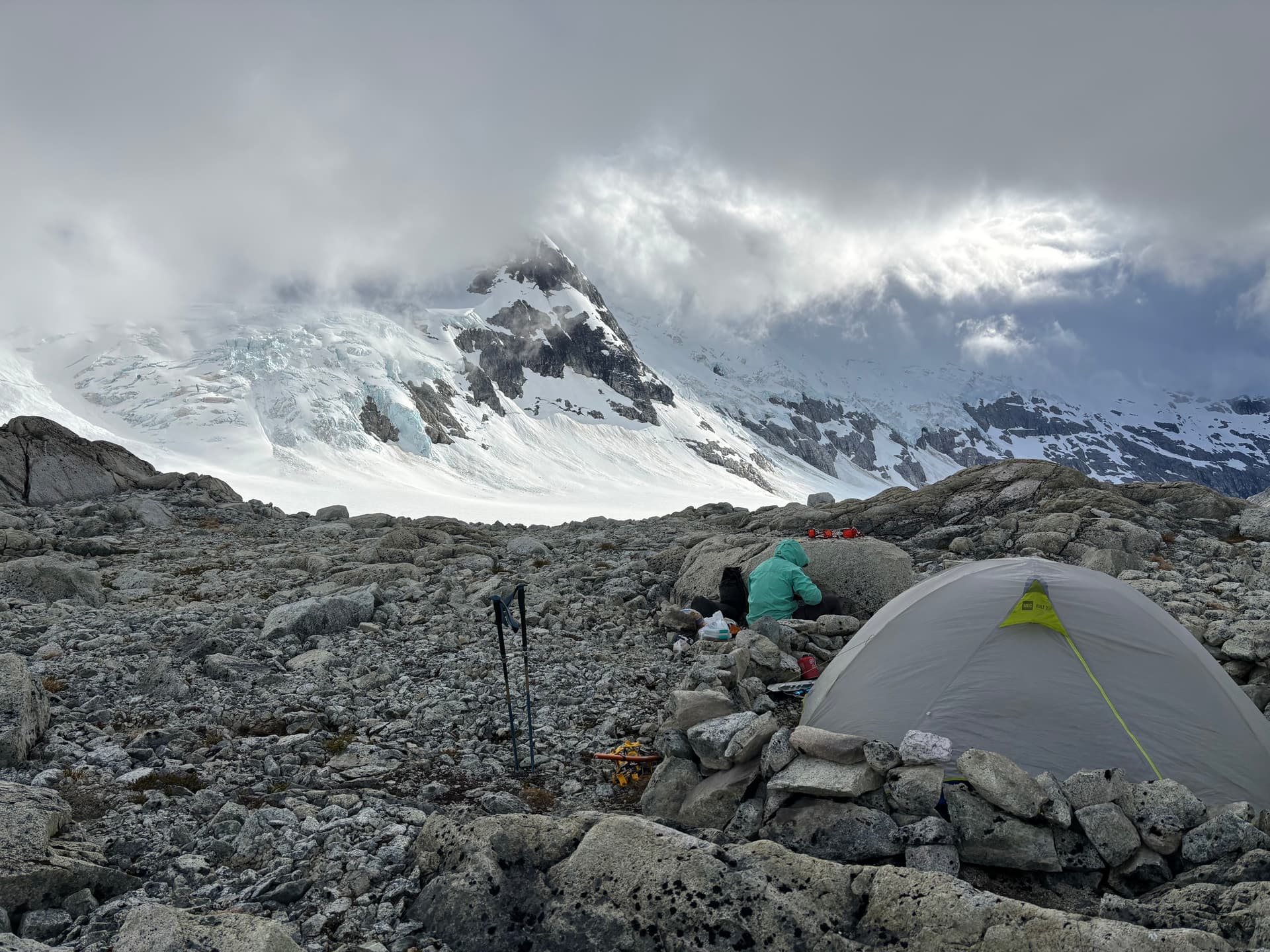
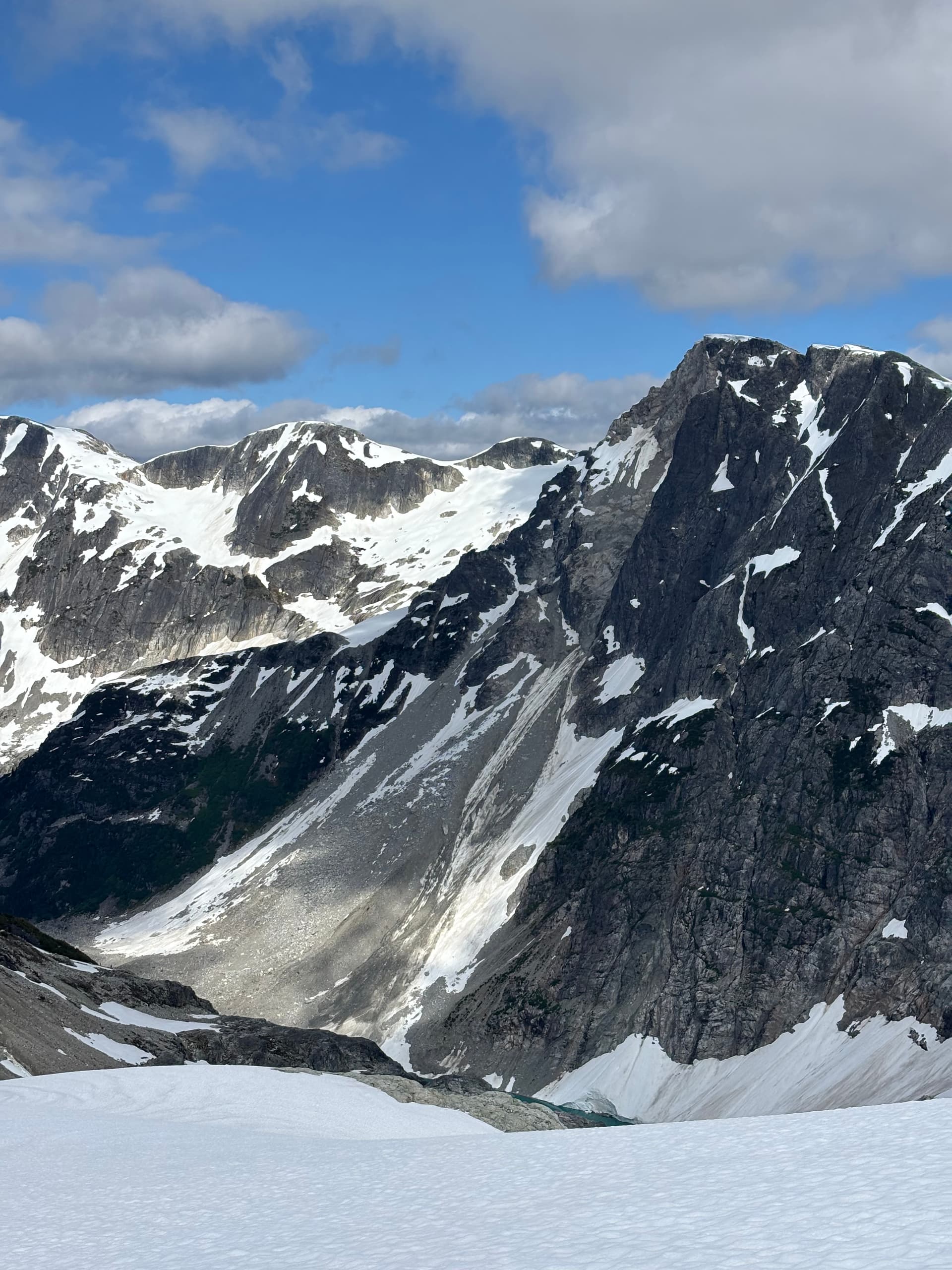
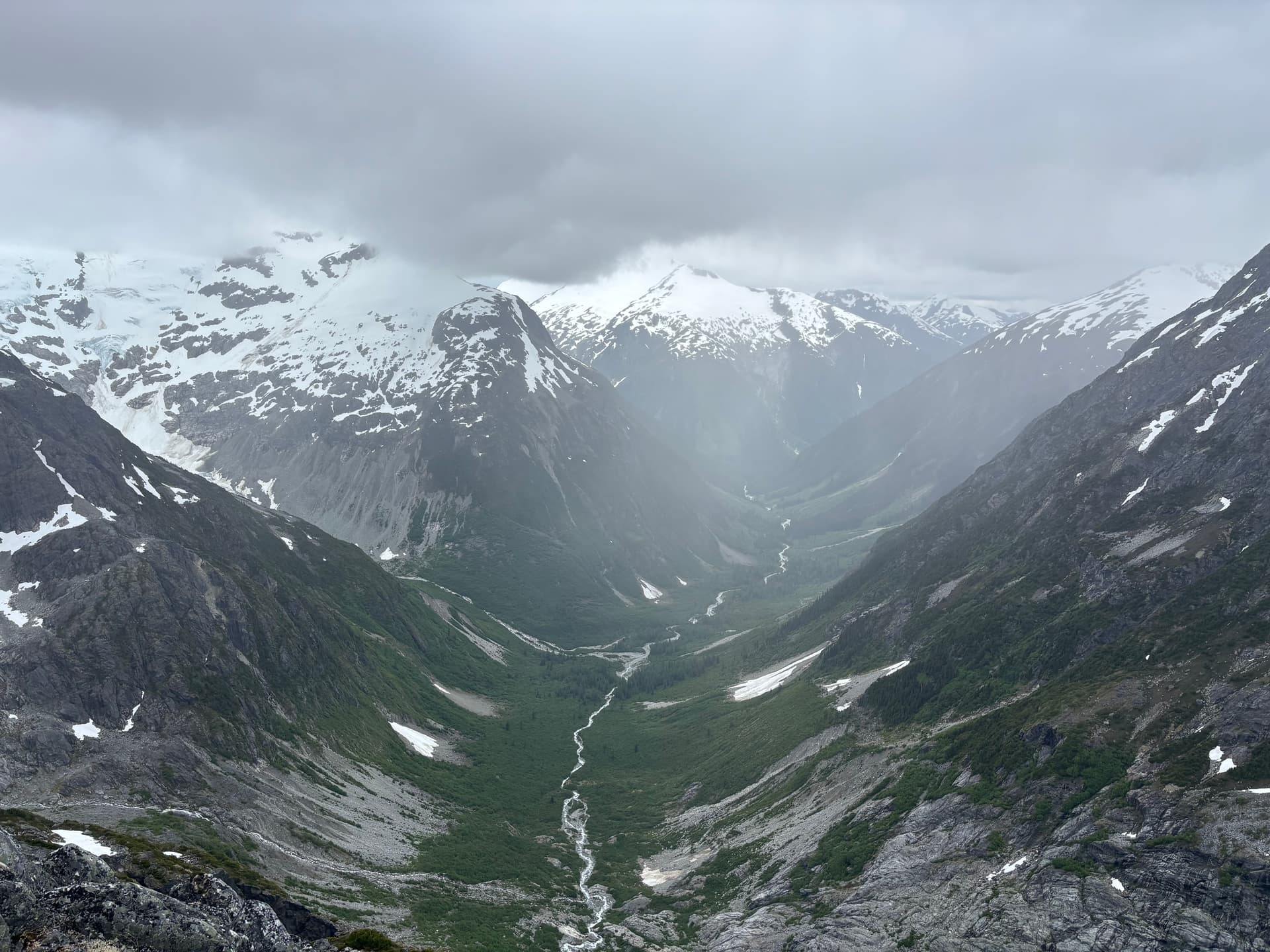
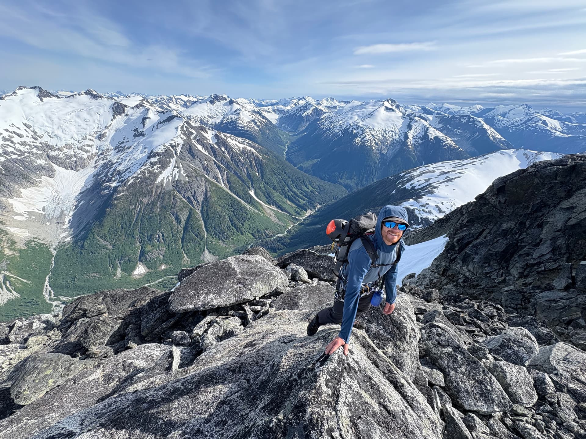
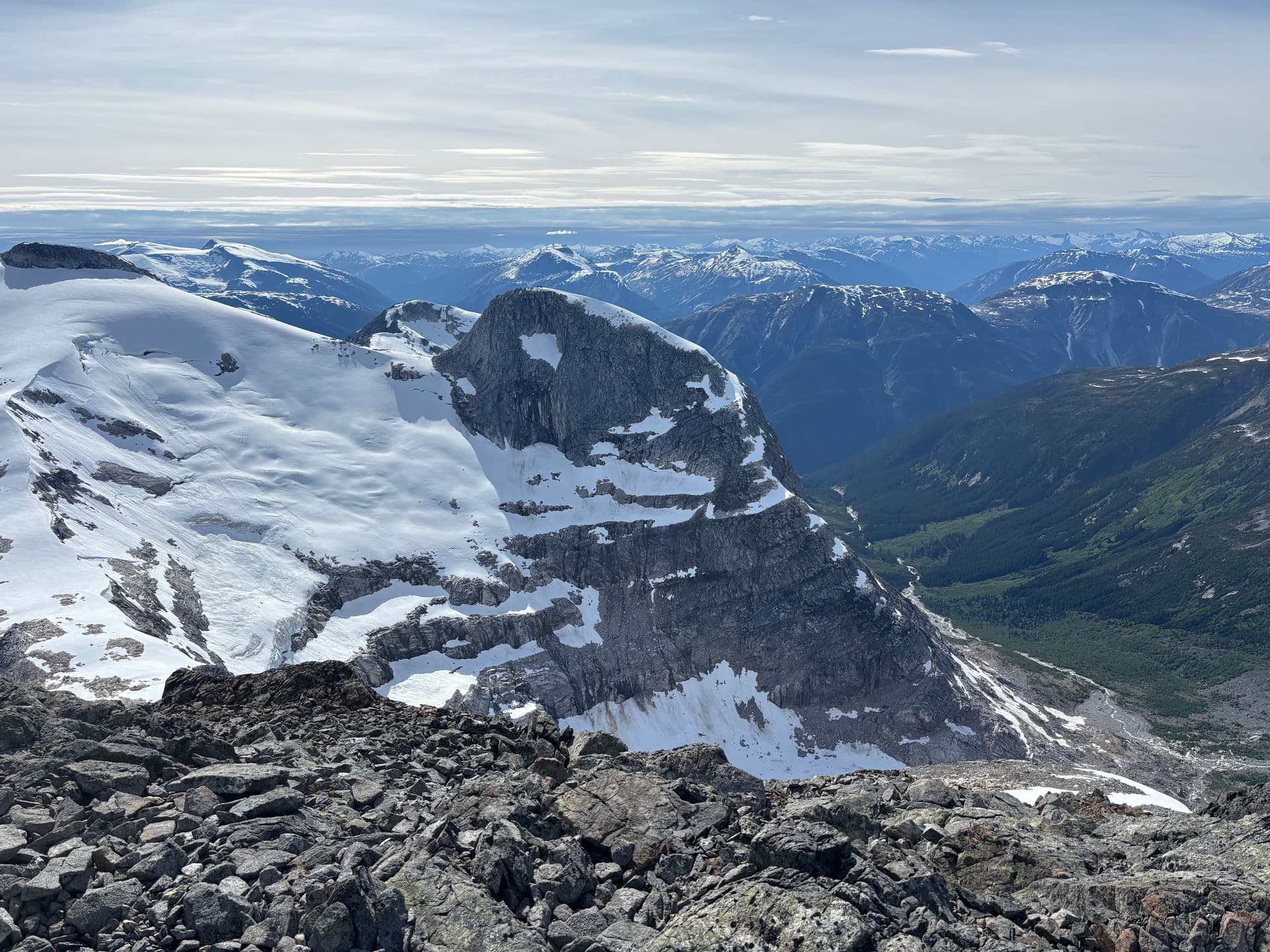
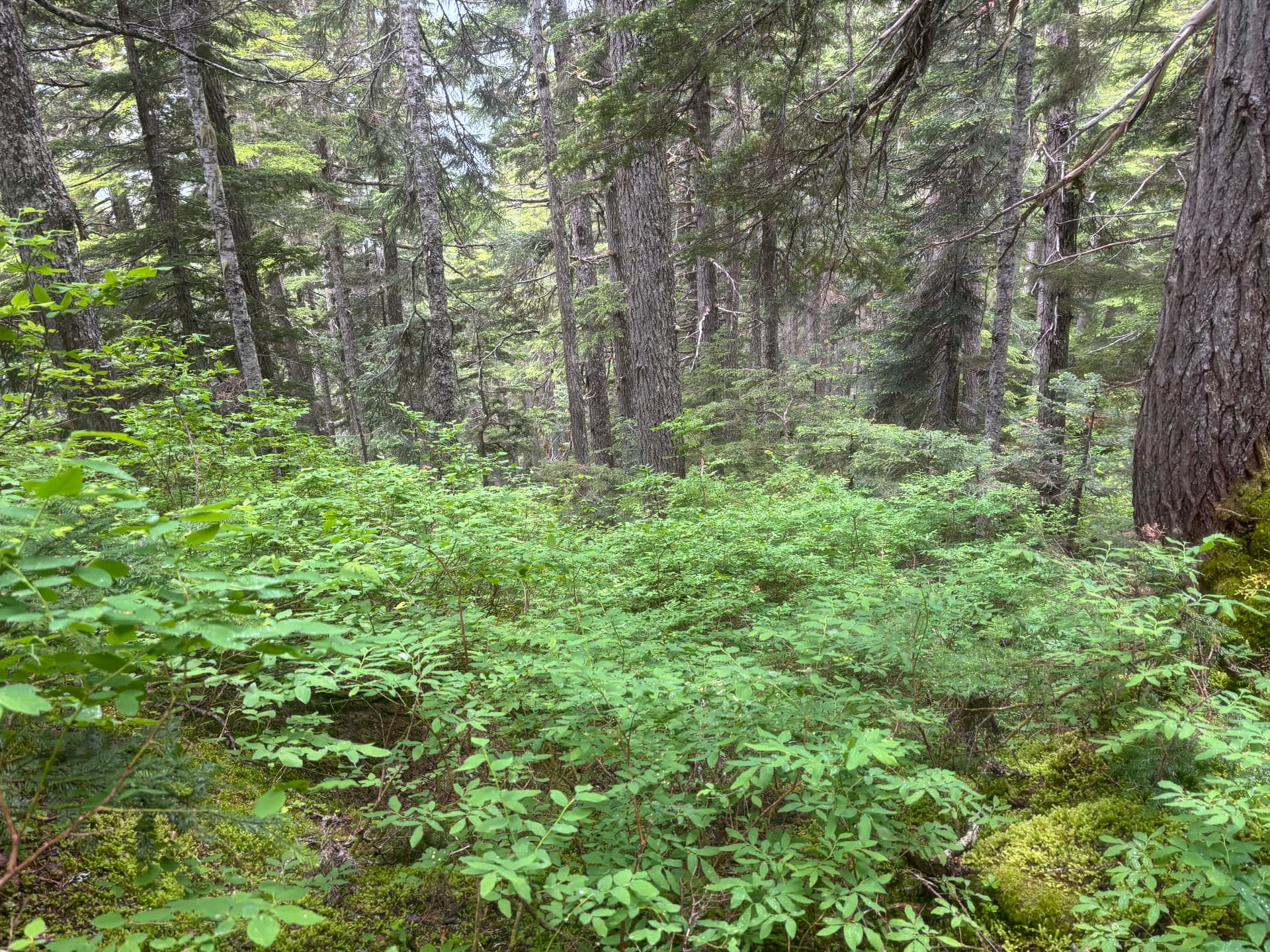
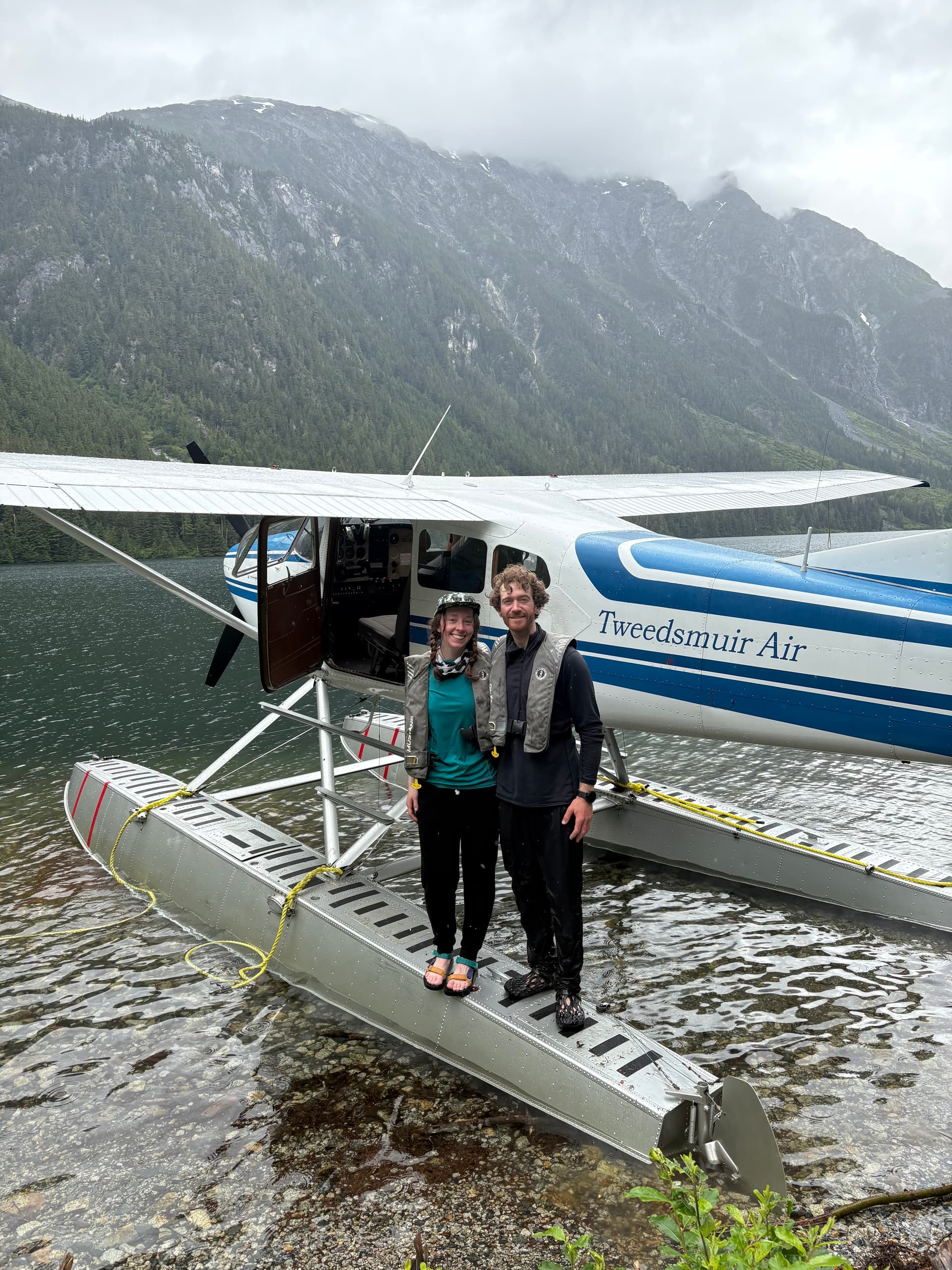
On the 28th we drove out to Nimpo Lake and spent the following Sunday hanging around town for the weather to improve. Thankfully after just a days wait, Tweedsmuir Air whisked us off to the unnamed glacial lake. We had an hour long flight to pore over countless breath taking summits before our pilot, Sam, made a smooth glide down to the water up to a perfect sandy beach. After the plane left our sights, we got to work heading towards the glacier snout above the lake. First we had to pay the coastal bushwhack tax though. This new greenery hadn’t appeared on any satellite imagery, but by the time we arrived it had a well established foot hold up to the glacier. Buckling under the weight of our back packs, we fought our way through the alder and brush before finally reaching easier moraine high above. A narrow canyon offered safe passage at climbers right and by late afternoon we had reached the glacier at last.
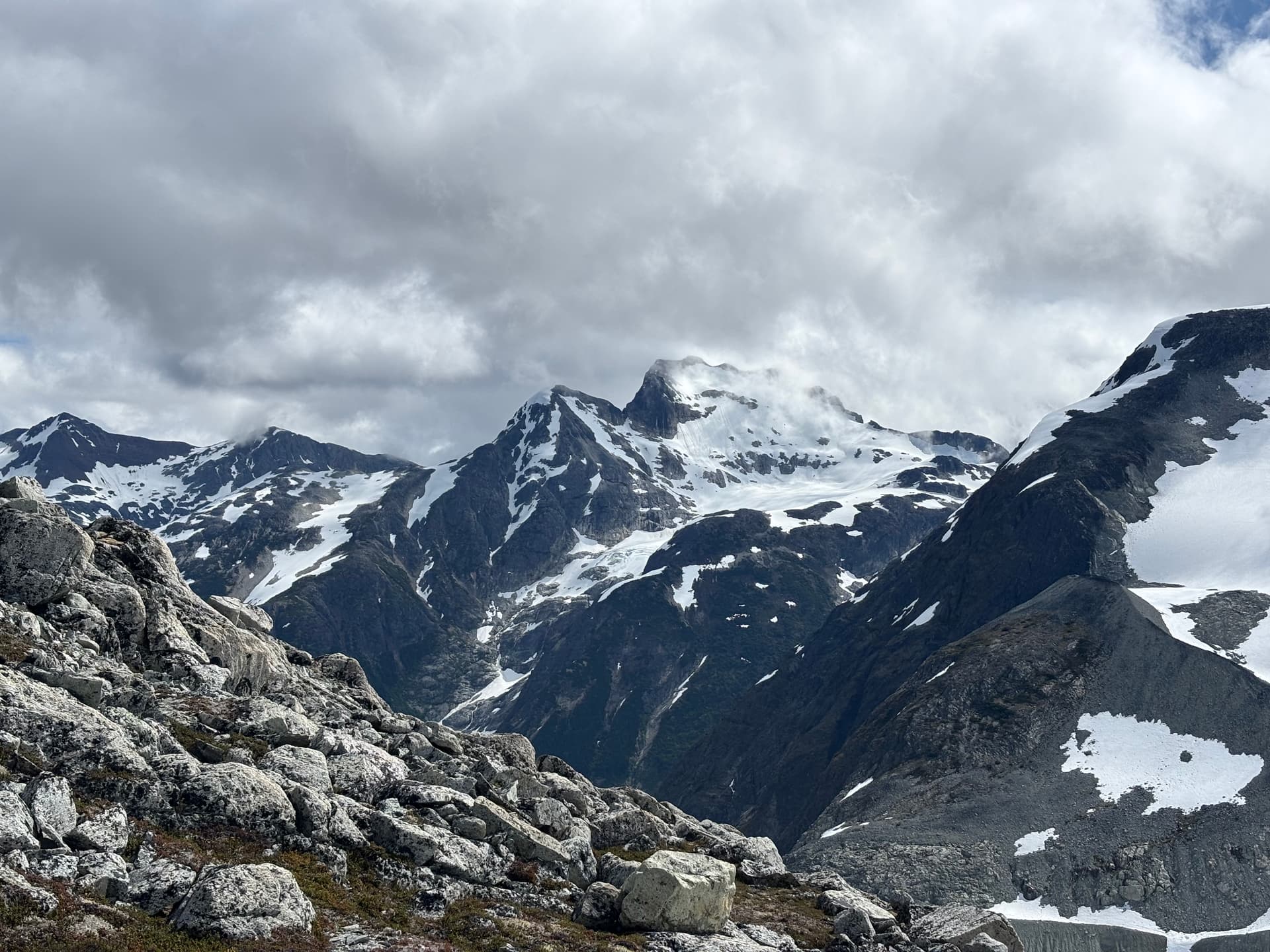
We set up camp high on the heather slopes above the east side of the glacier and enjoyed a lovely sunset over the surrounding terrain. On the following day we scrambled up the ~2258m summit to the east and I believe was left unclimbed by John and company in 1992.
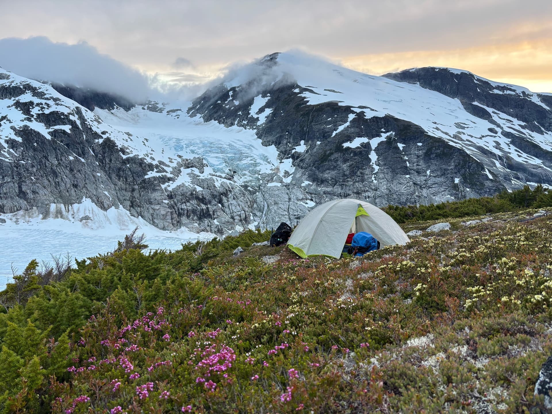
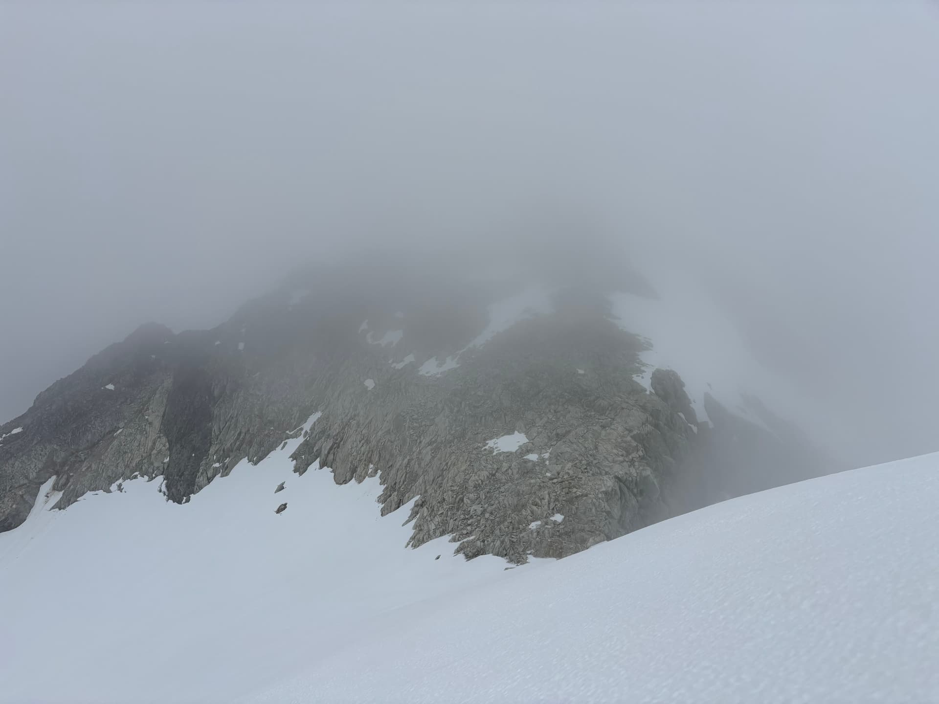
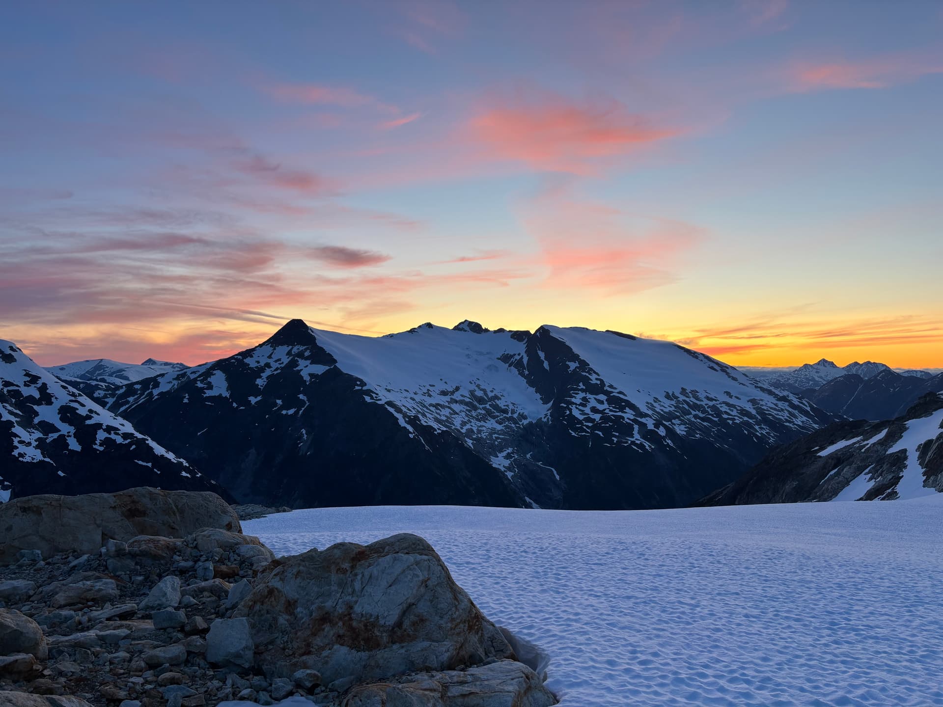
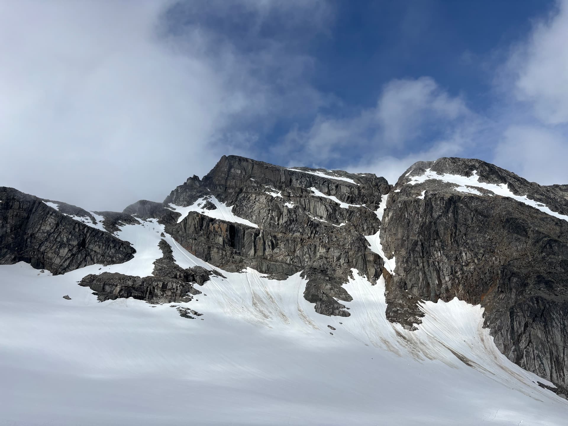
We returned to camp and awoke to moody skies and periodic drizzles of rain. Not wanting to wait out a day of rain, we packed up and headed up the glacier to a col just west of Cornice Creek. The next day the rain had cleared but the clouds still clung high to the summits. We made a side trip north to an ~2020m summit which may have been unclimbed as well, but there’s some doubt cast on that due to the fuzzy details of John Clarke’s report. After our side trip we packed up and head towards the unnamed 2,251m peak (listed as “Encke” on bivouac) which John Clare and co certainly did climb. This also marked the point where we joined up with Mark and Mike’s traverse. Our camp was situated just west of the summit in a slabby alcove where we had arguably the best sunset of the trip.
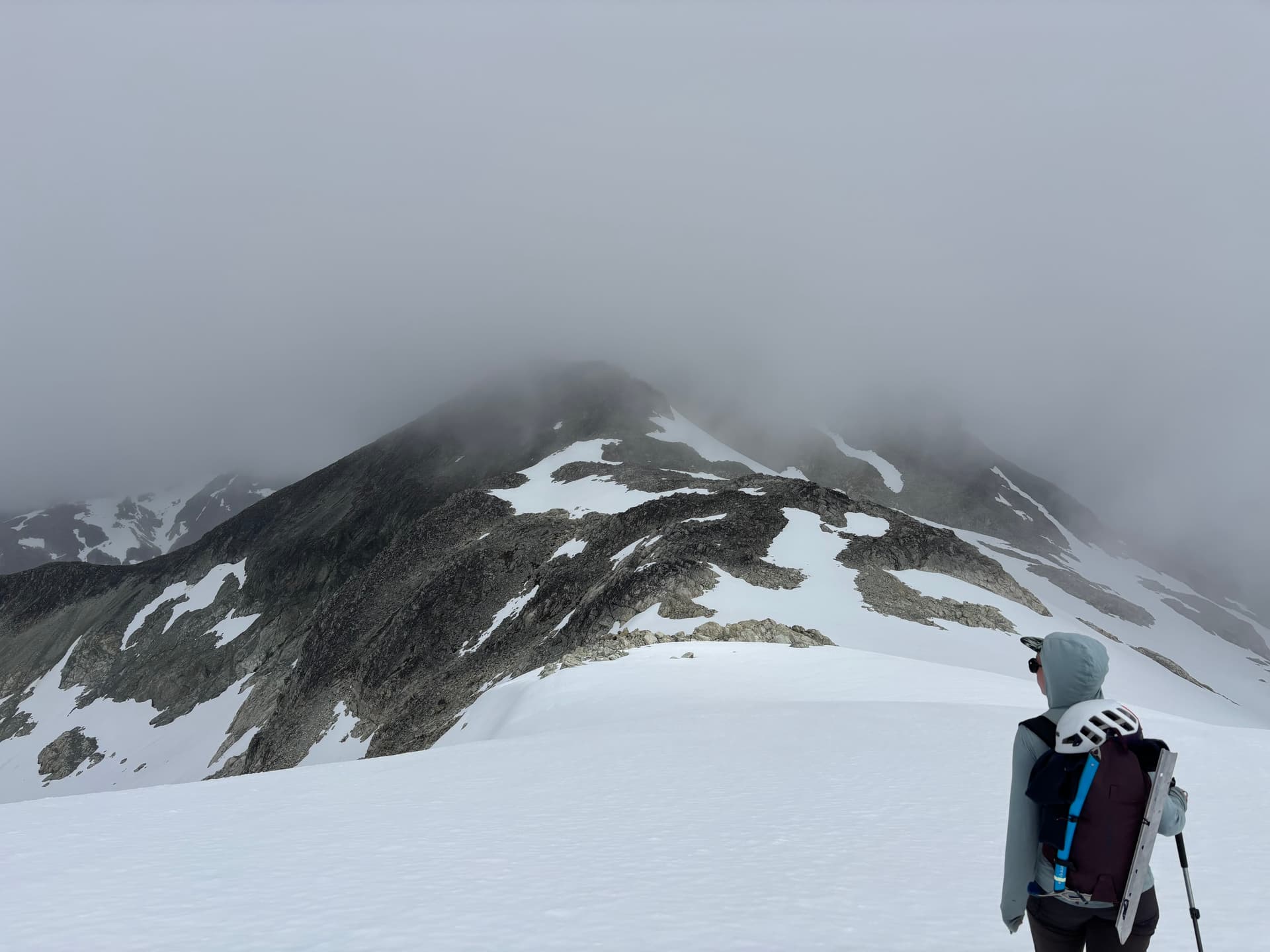
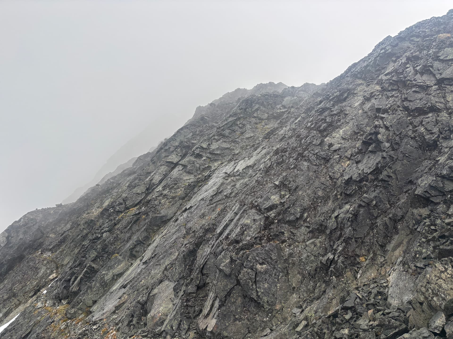
On day 5 we had beautiful sunny skies and made our way up and over the 2,251m peak losing some 600m of elevation before regaining most of it up to the ridge of Cornice Peak. As we made the long slog up our 1.5 day period of good weather would close shut. Once on the ridge we discovered a complete lack of tenable camping spots. The ridge was comprised almost entirely of bed rock with loose talus on top and after an hour of searching we found a measly patch of muddy dirt with a large rock sticking out to sleep on. Our tent was erected just as the last light faded and the rain bore down.
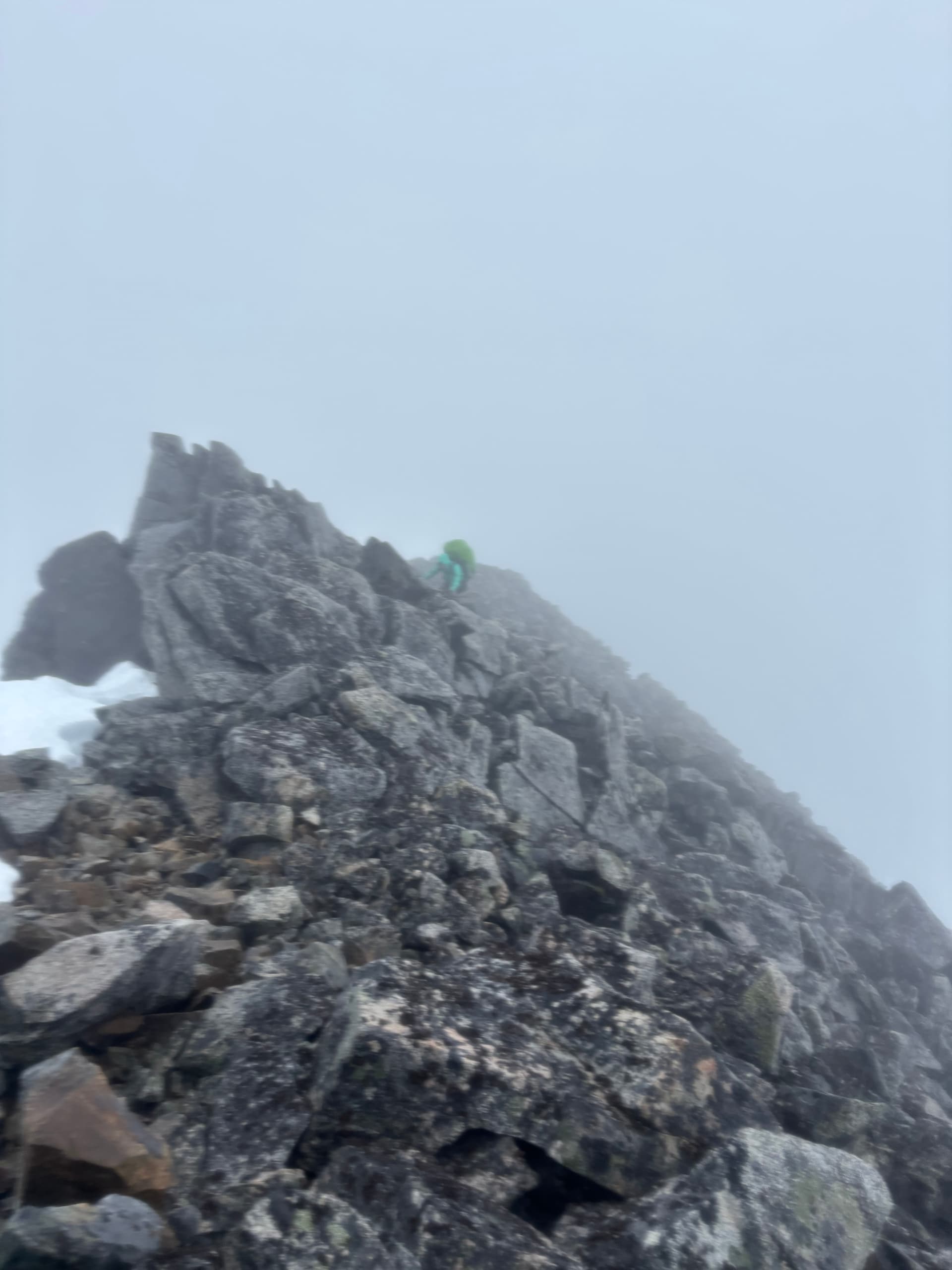
Day 6 was a rest day of reading and dreaming of a less muddy camp site, but we made due. Part way through the 7th day the clouds cleared and we quickly packed up and continued north along the ridge towards “Peak 7300” and “Peak 7400”. A small red summit along the ridge gave us some grief when we discovered a crumbly knife edge ridge, but we managed to bypass it on snow to the west. We skipped Peak 7300 and plunged down the glacier to an easy scree gully on the south east side of Peak 7400. There we ditched packs on the ridge and scrambled up to the summit. Afterwards we set about making a camp at around 1970m on the east ridge.
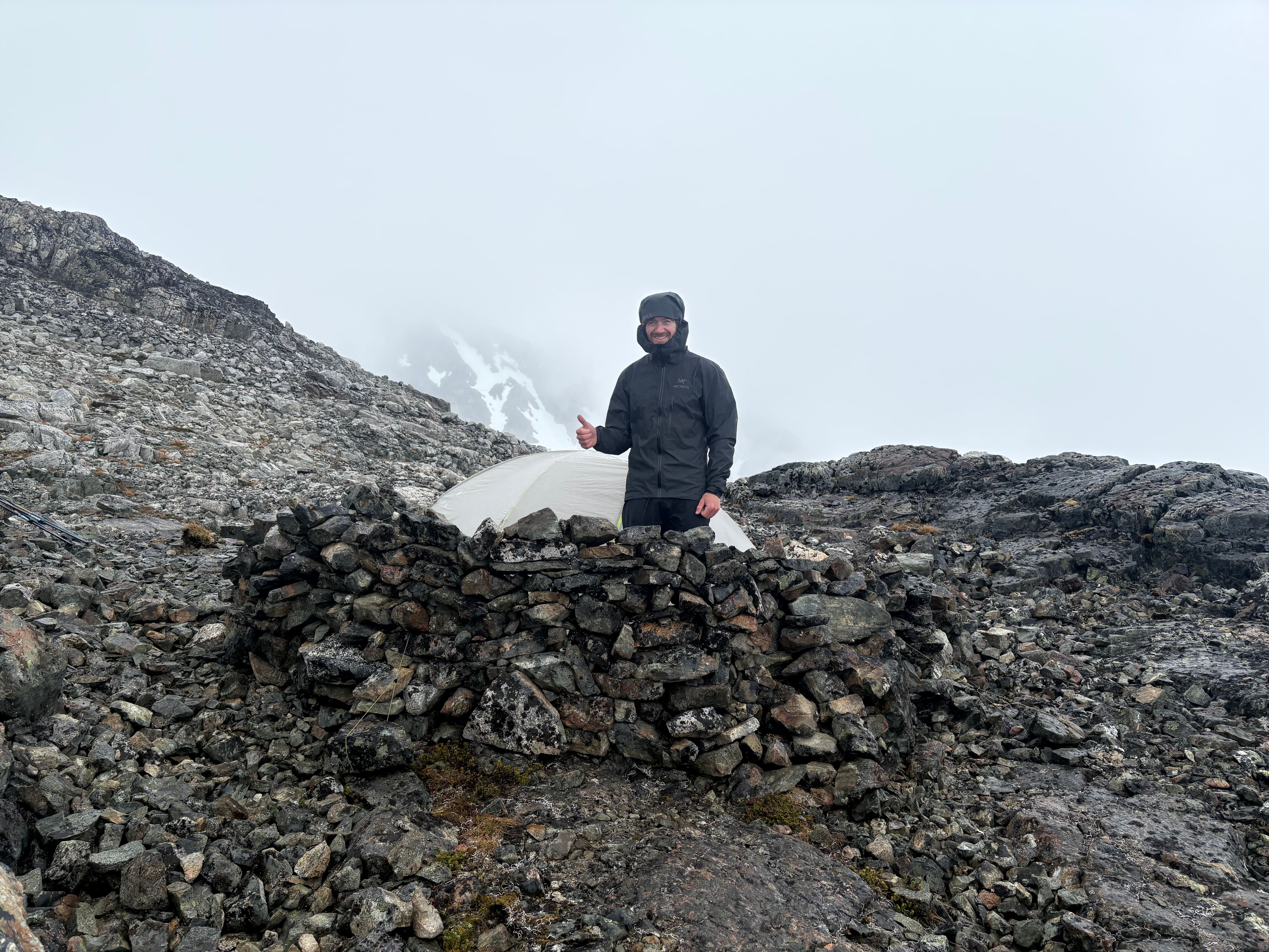
The next morning (day 8), a storm came in an wreaked havoc on our exposed camp site. We quickly got to work building a replica roman coliseum around the tent in the hopes of fending off the driving wind and rain. That night the storm reached a crescendo and we lost several guy-lines to the violent affair. We managed to rebuff the winds with some dyneema slings where there small guylines failed, but no sleep was had. Andrea and I played name games with mountains and countries to distract from the thoughts of a tent fly getting ripped up.
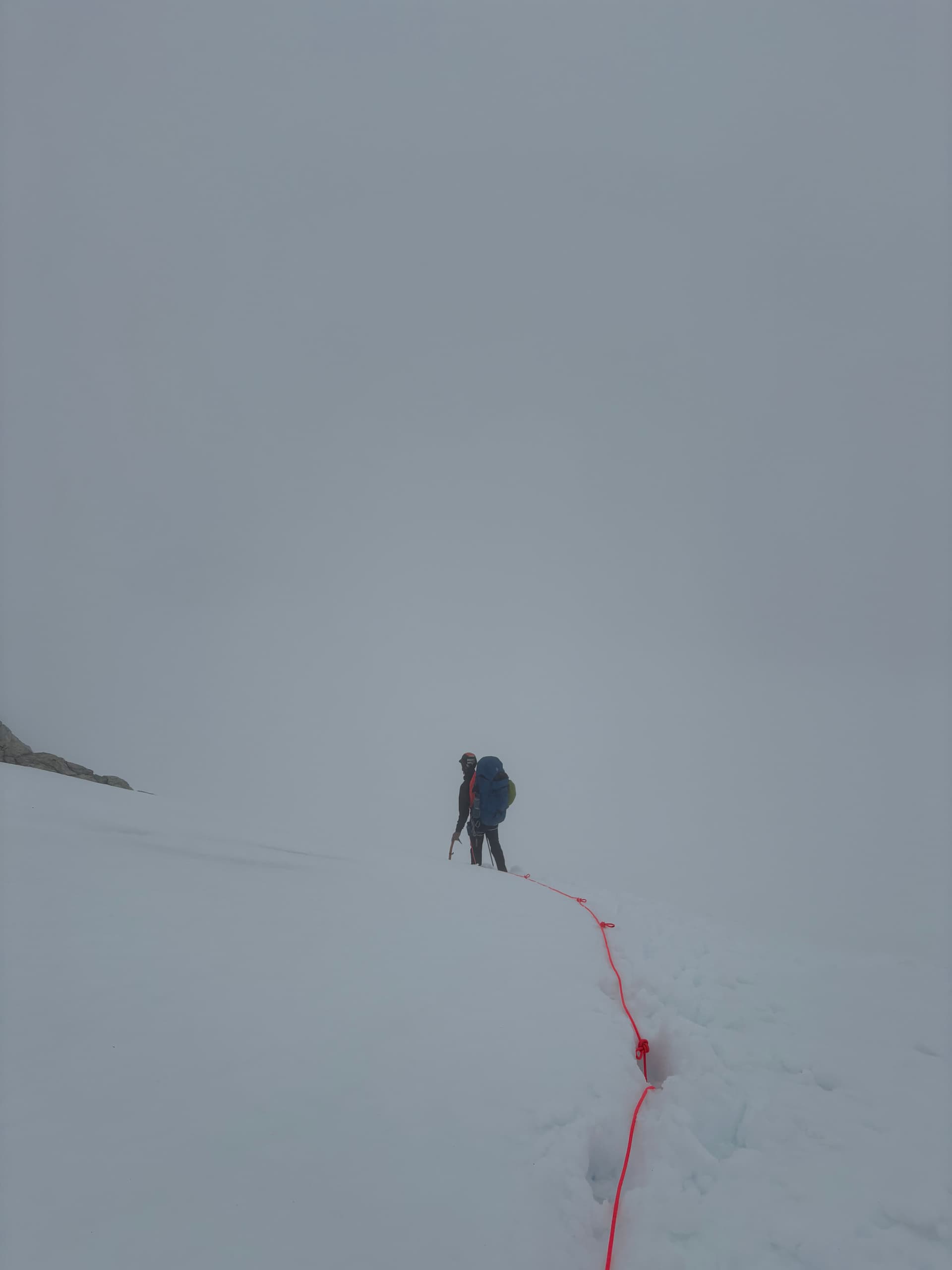
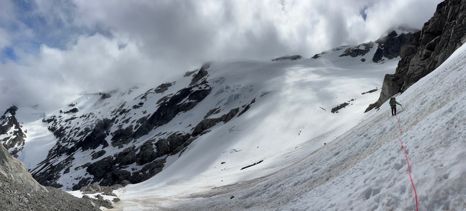
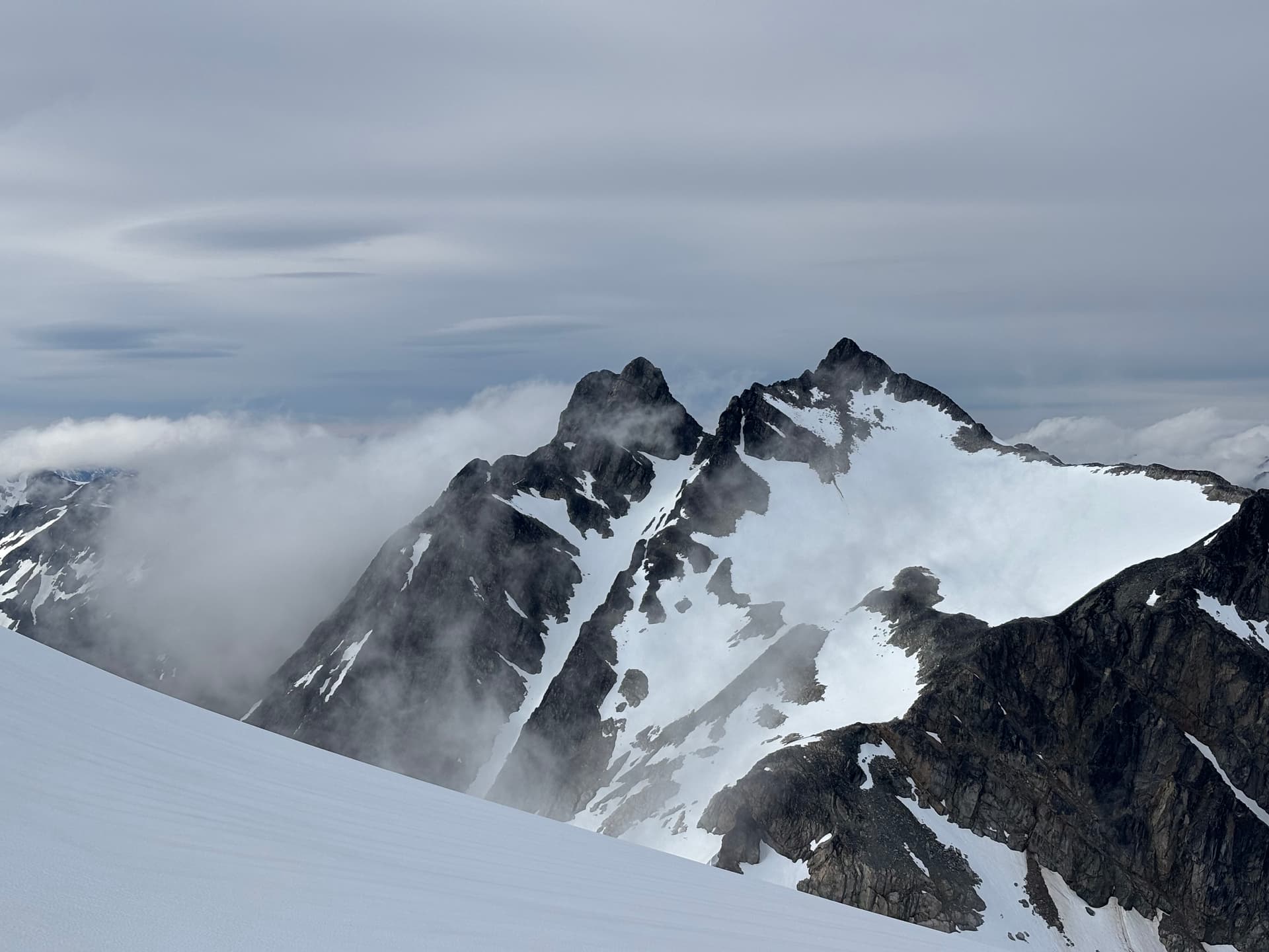
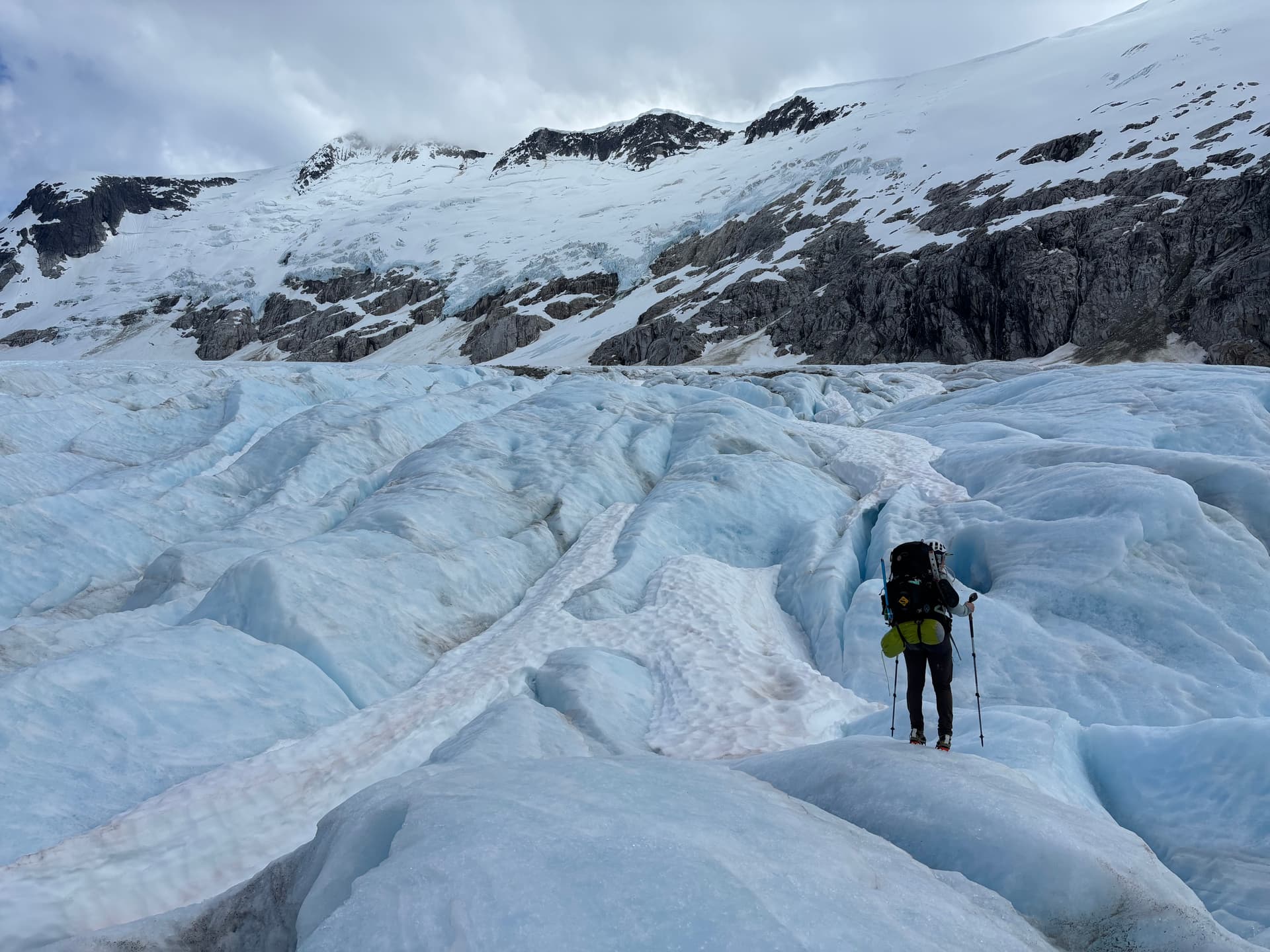
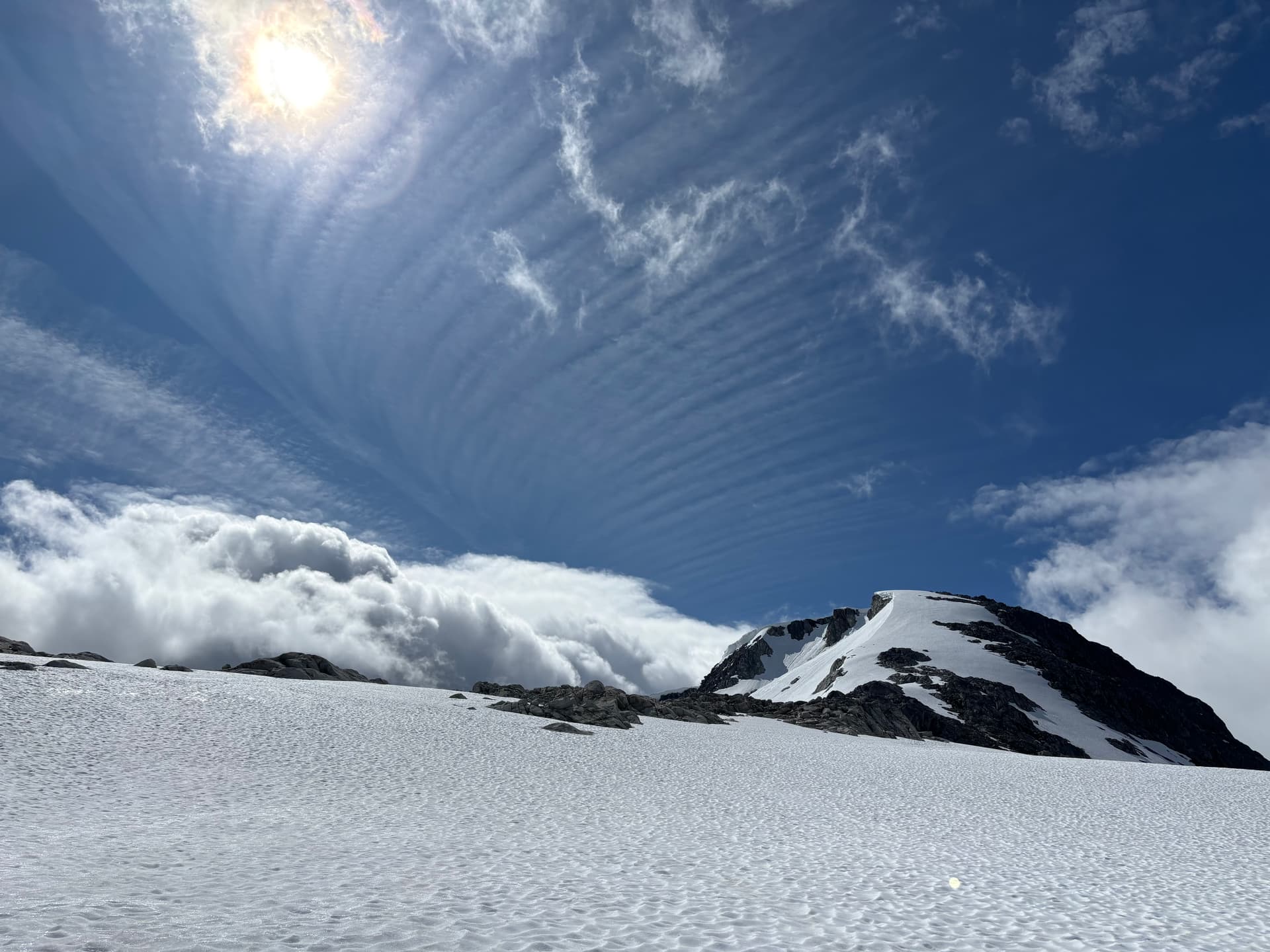
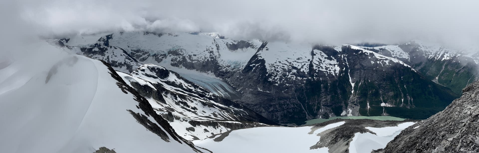
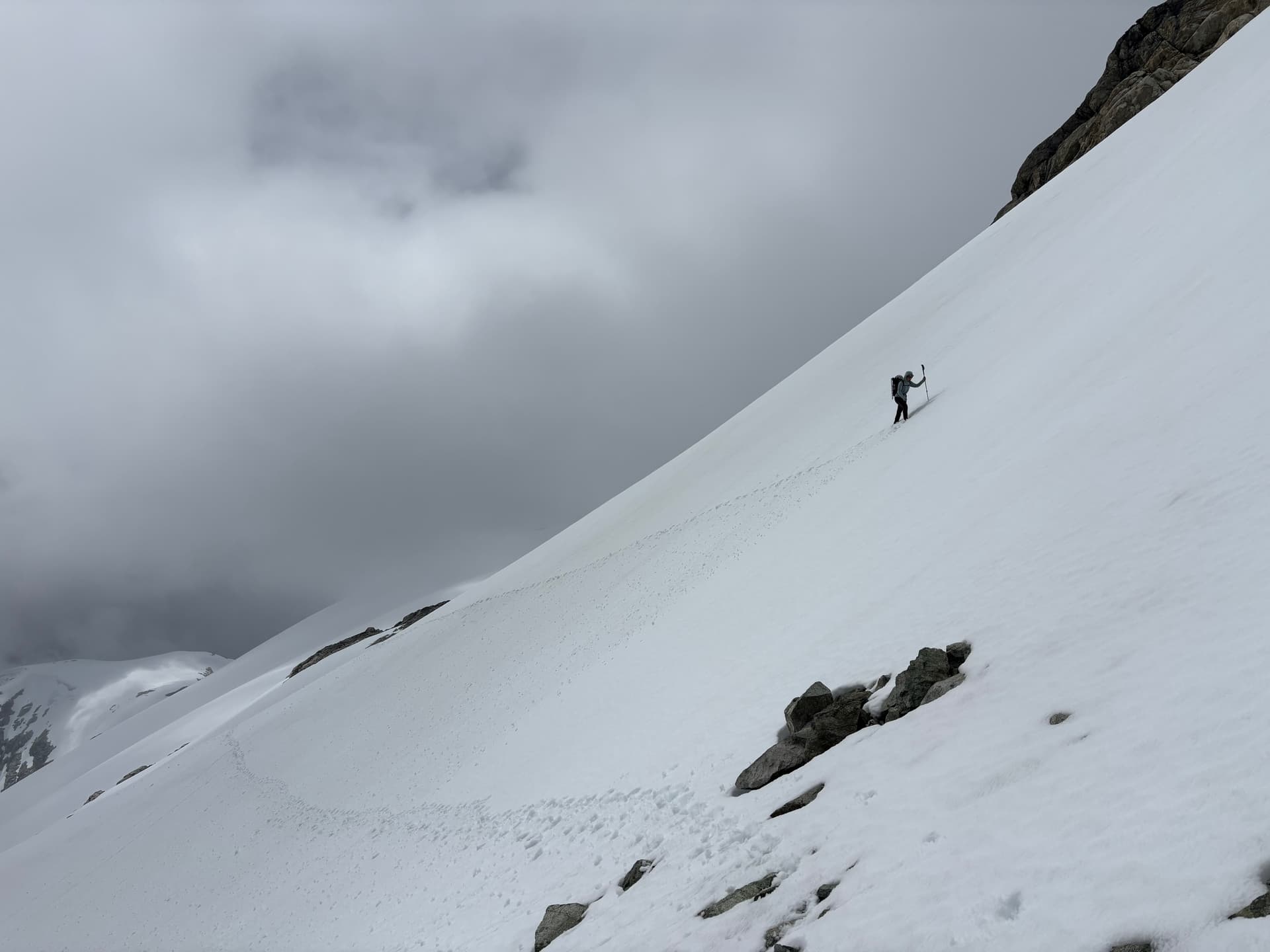
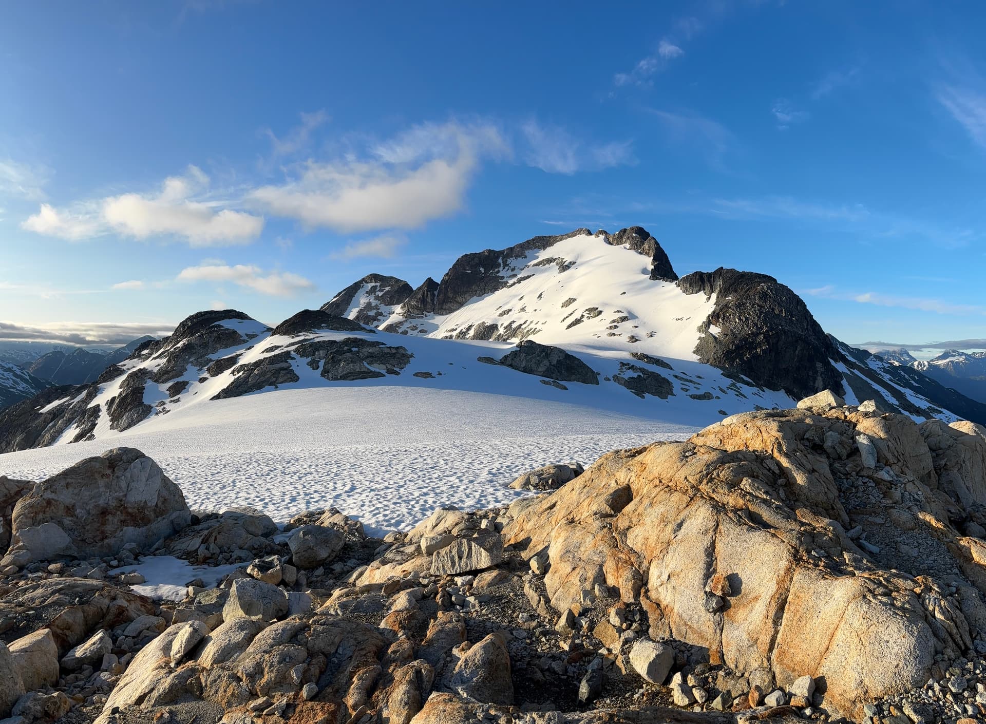
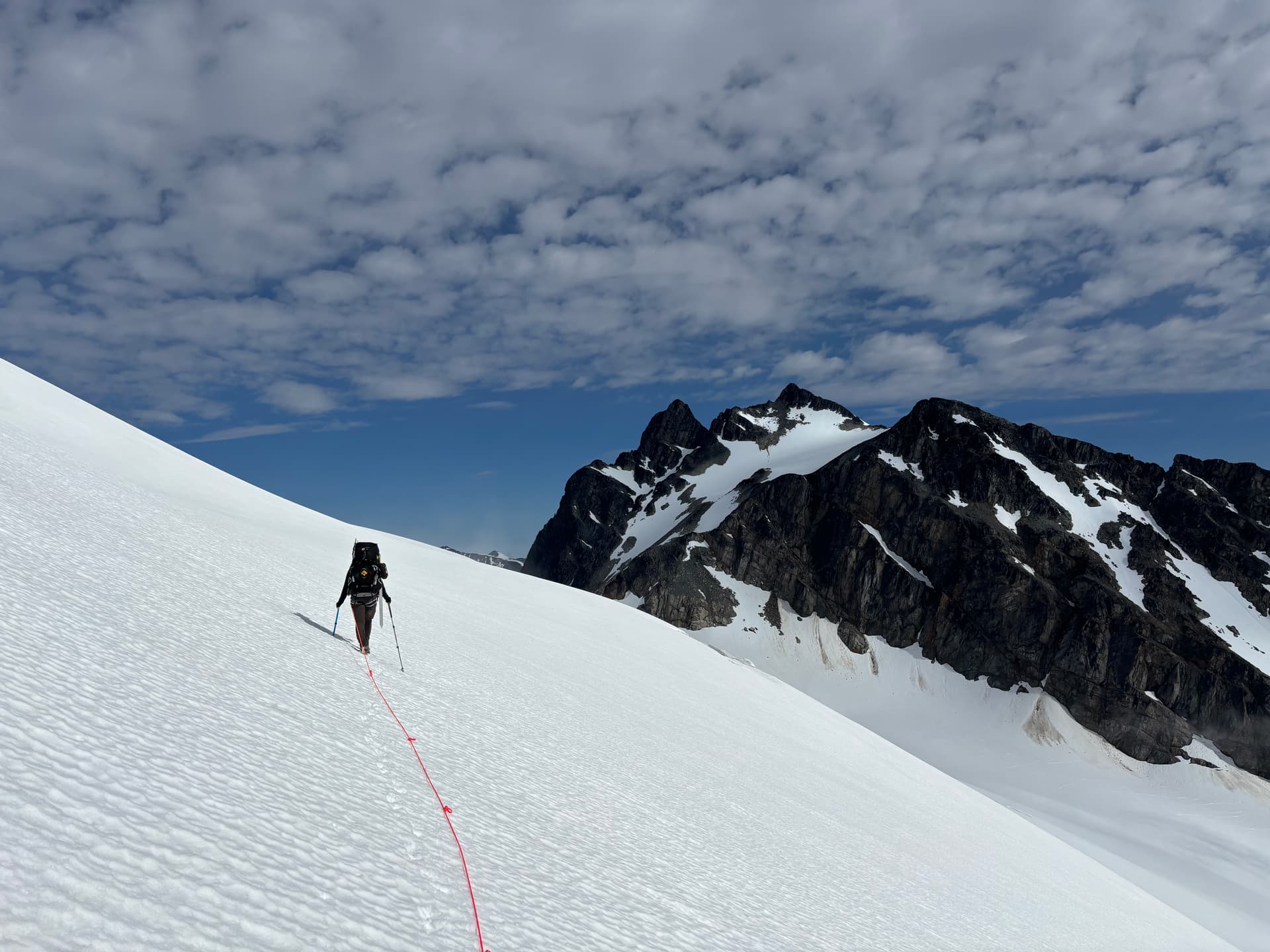
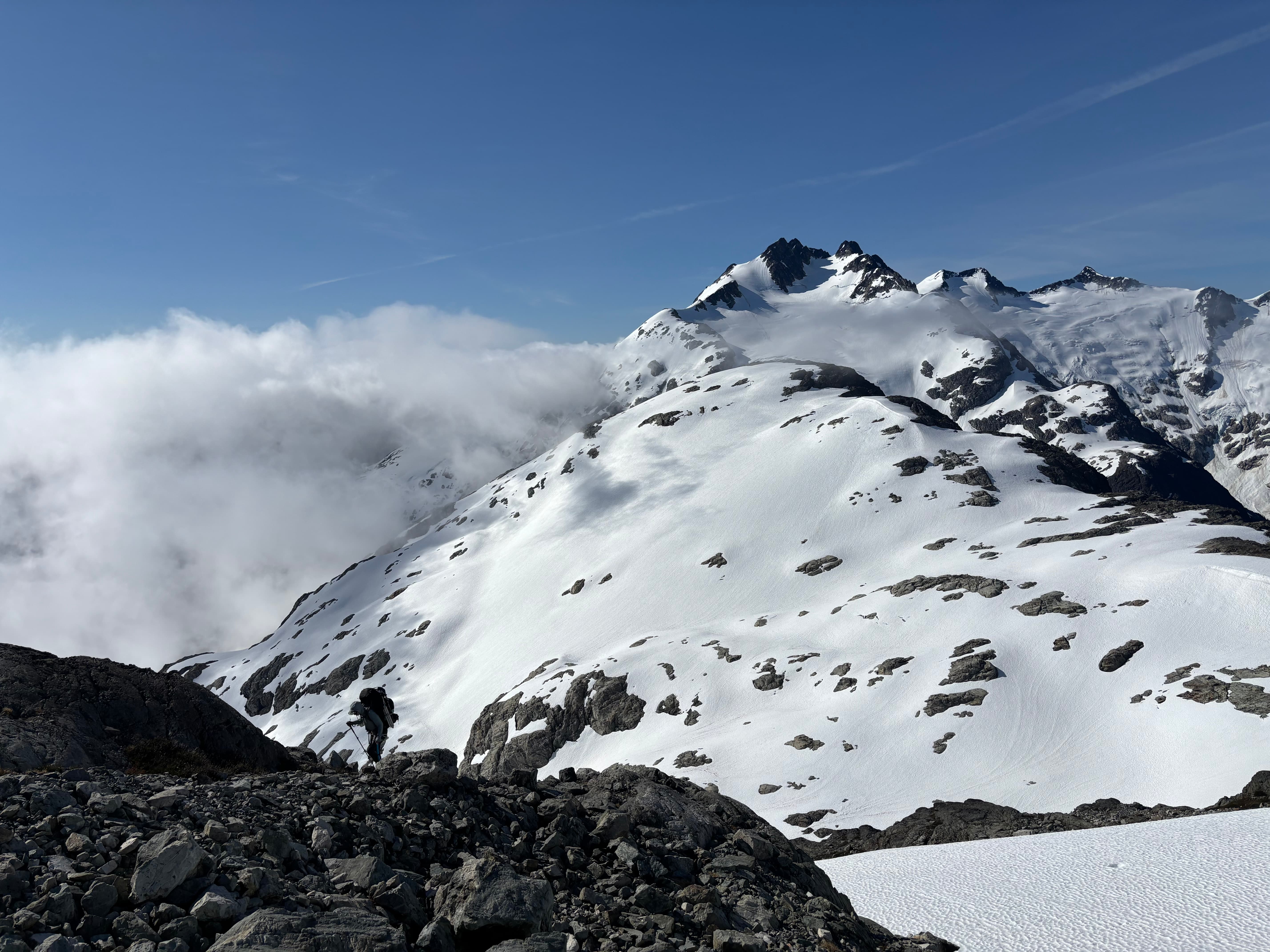
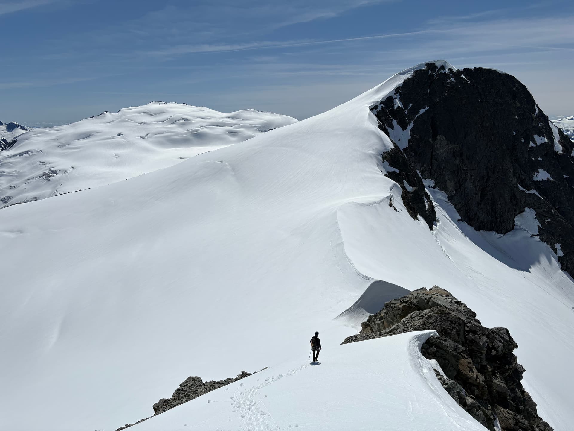
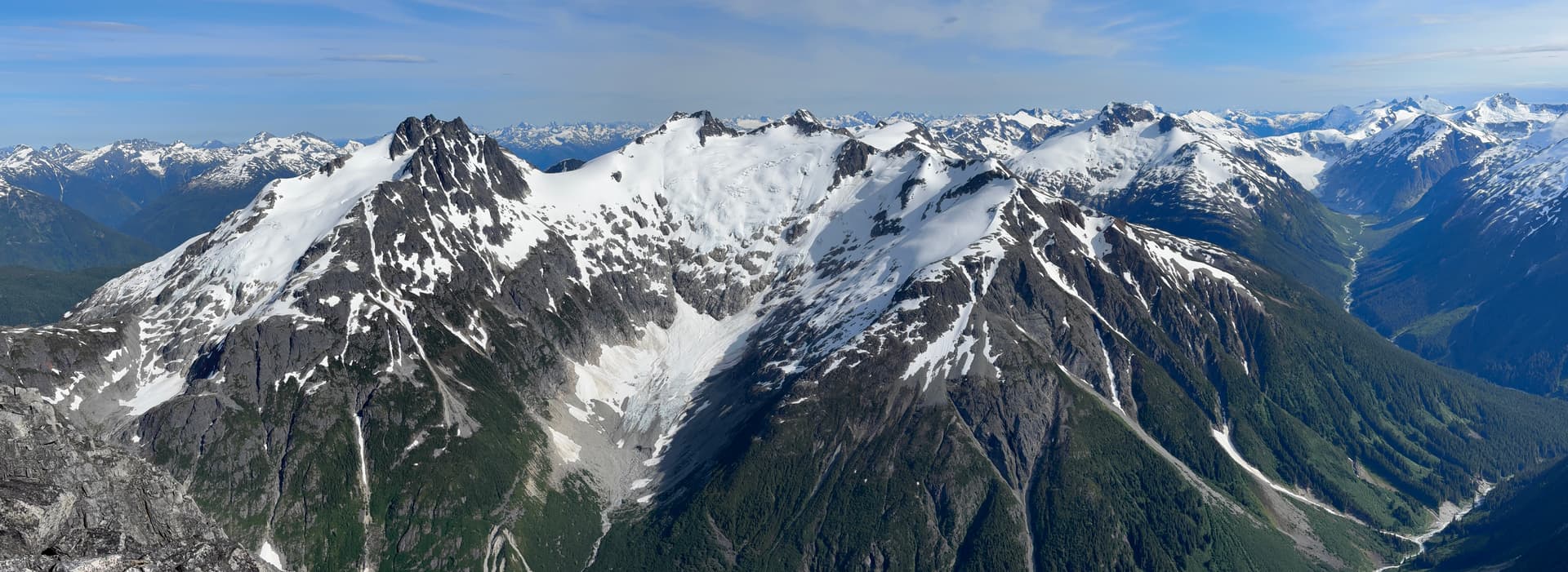
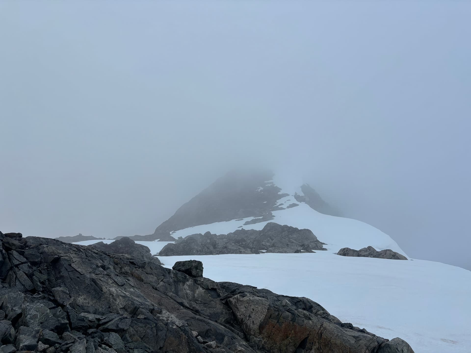
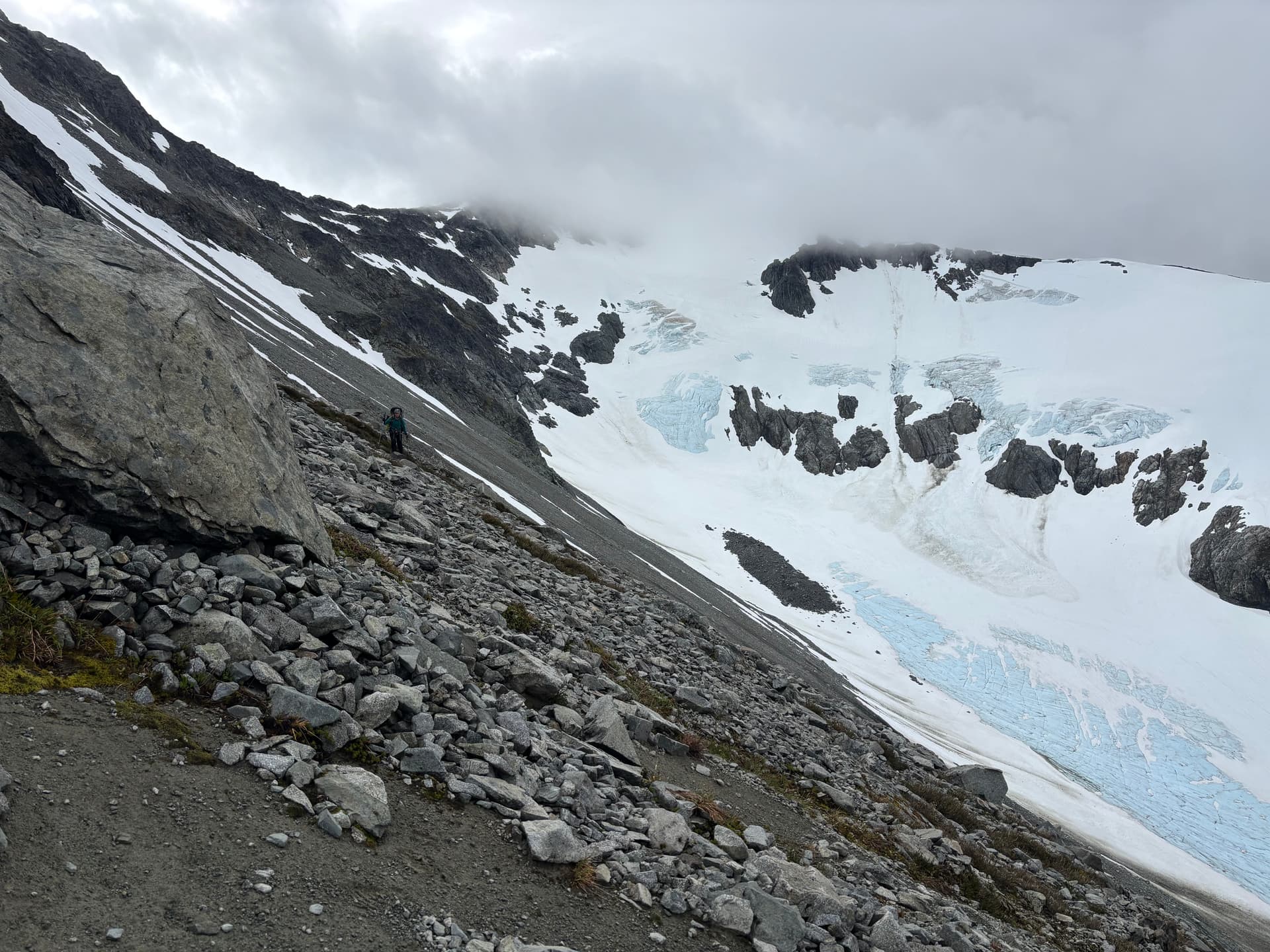
By the next morning the winds had abated but the rainy weather continued on and we spent one more day tent bound. Day 10 was to be an excellent one when we awoke to gorgeous sun at last. We’d finally get to climb up and over Sharks Teeth Peaks; an aesthetic set of pointed summits that marked the highest point on our traverse. This also marked the trickiest section of glacial travel as the north side of Sharks Teeth looked down right daunting in satellite imagery.
From our camp we traversed along the north east glaciated face of Peak 7400 and then up to the Sharks Teeth. Together we scrambled up the highest summit while I went further to the second highest to get eyes on the glacier. Unfortunately the crux of the glacier was not visible, so there was nothing left to do but check it out. We returned to our packs and head down the north side. Much to our luck we find a viable option along the skiers right side before reaching the top of a massive ice fall. This part of the glacier likely once connected with the col below, but that was no more. Again we found a bypass on the right side down slabs and scree and reached the col at last!
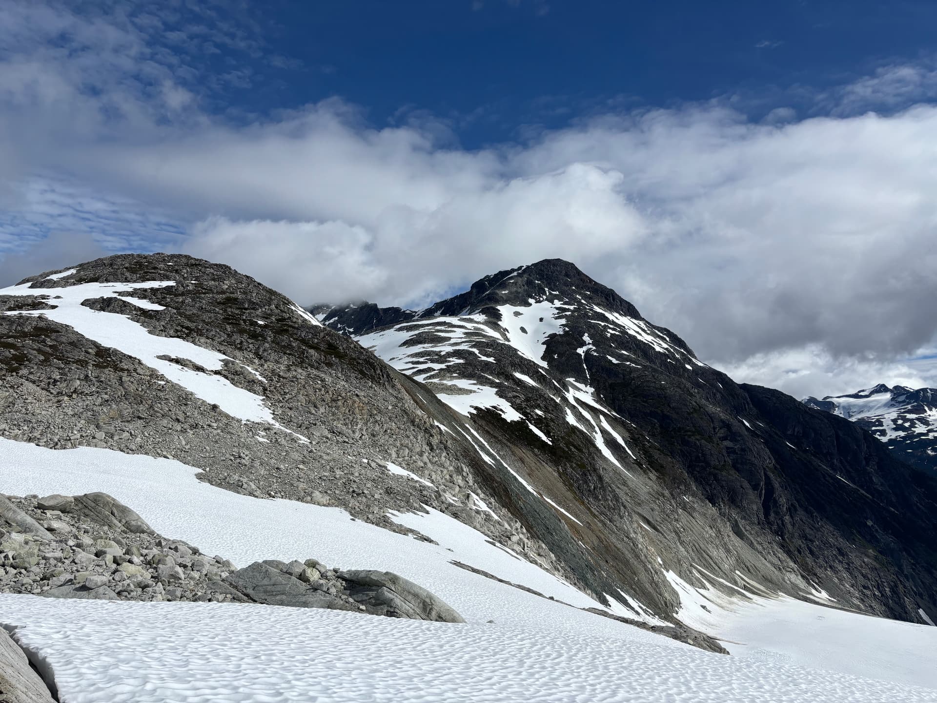
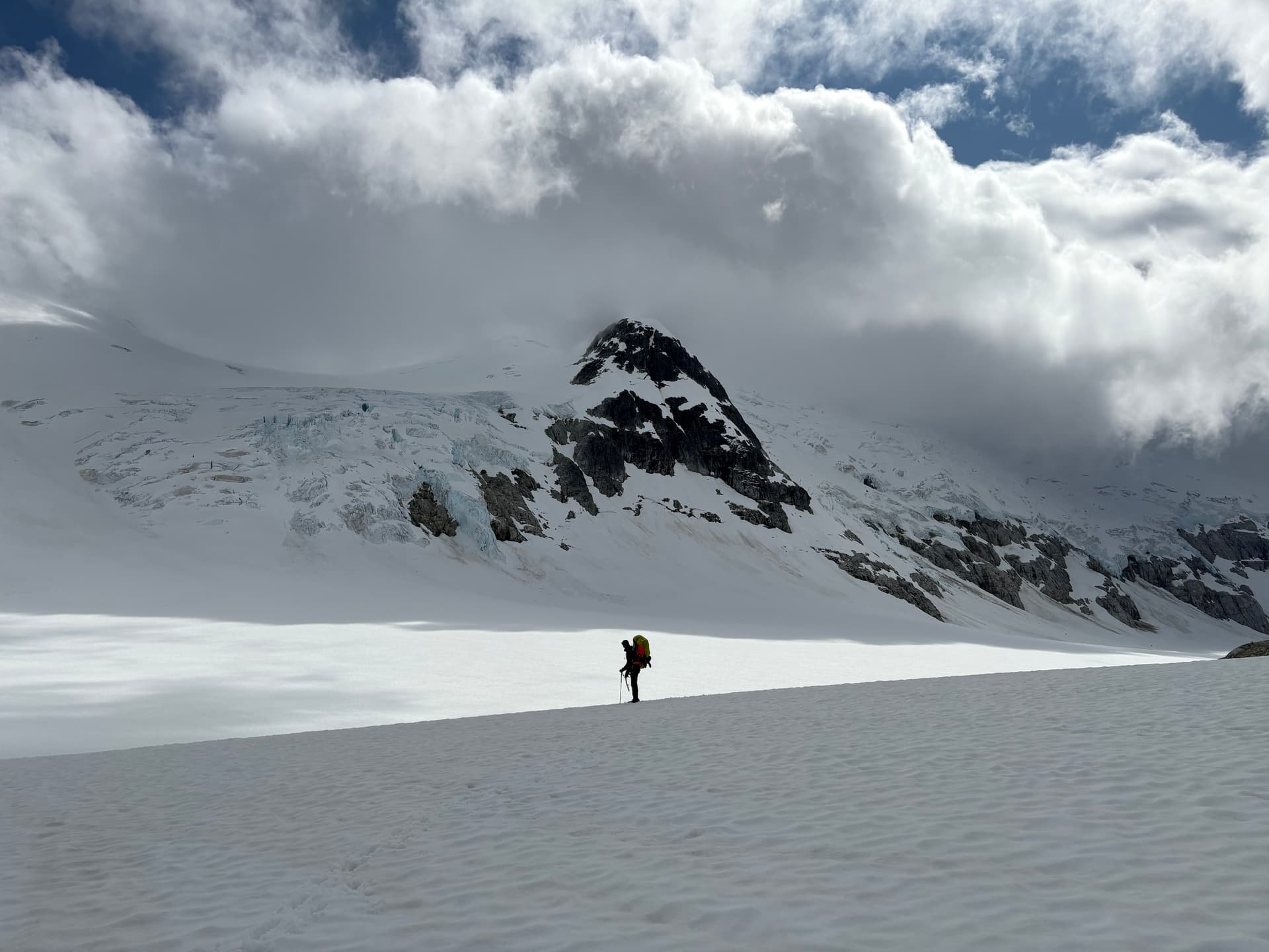
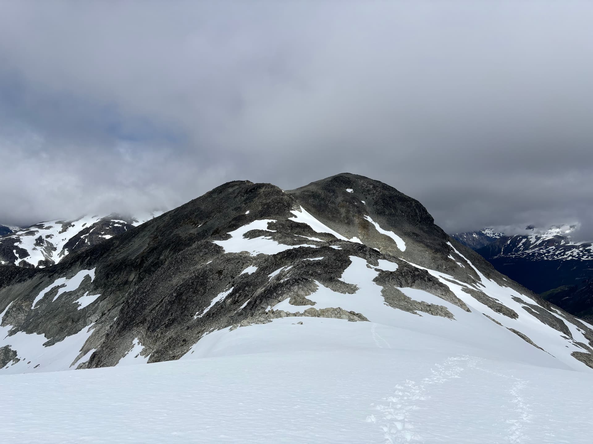
With energy and sun to back our day, we skipped camping at the gorgeous heather zone in the col and pressed on to “Peak 6600”. This summit had been the technical crux for Mark and Mike’s trip as some sort of aberration in the ridge required some rope work to get through. We didn’t have any idea what this would look like and we were a bit anxious to find out. Our plan had been to get through the crux that evening and camp at the col with Peak 7200 to the north. Unfortunately the weather closed in as we reached the final slopes up to Peak 6600 and we were forced to hunker down and find a camp site. Thankfully only small bouts of rain came through and the next morning was the most blue bird of the entire trip.
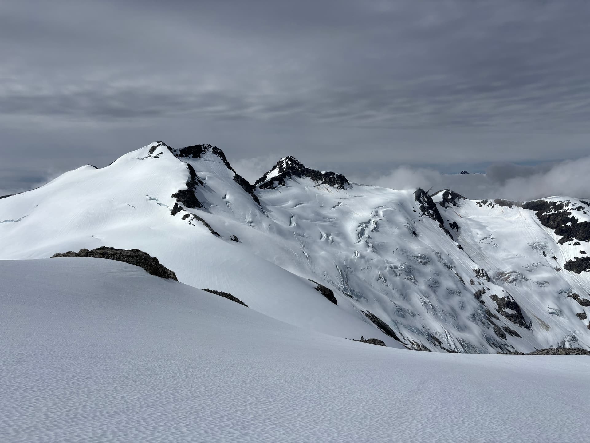
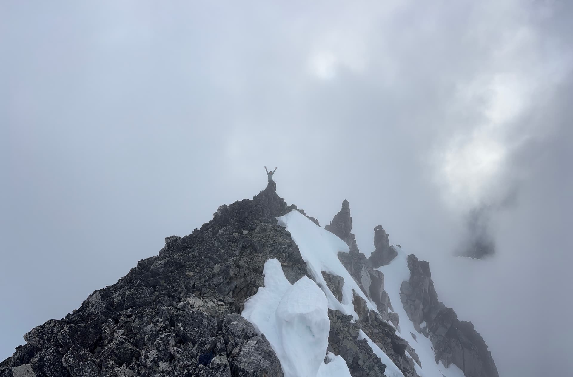
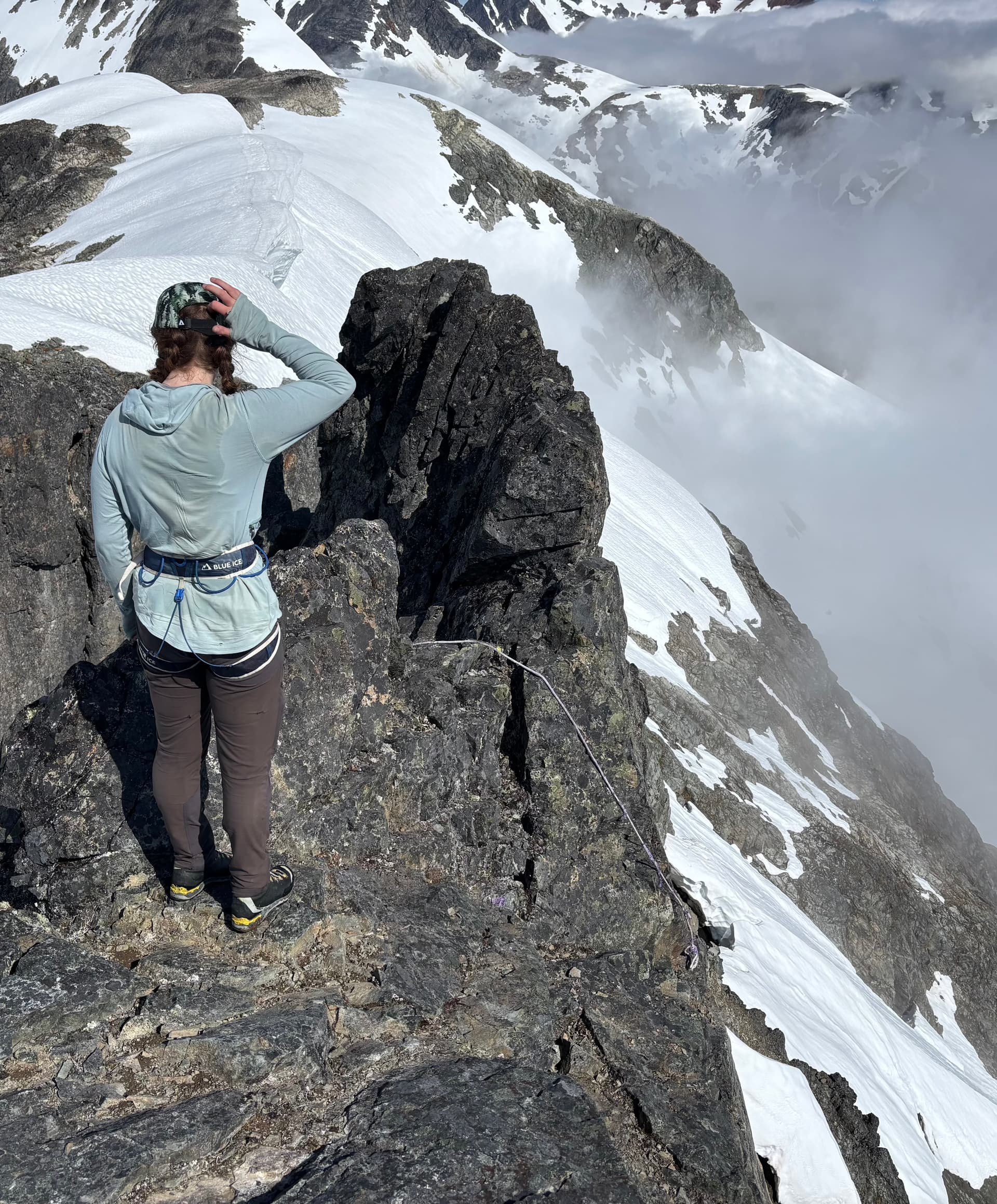
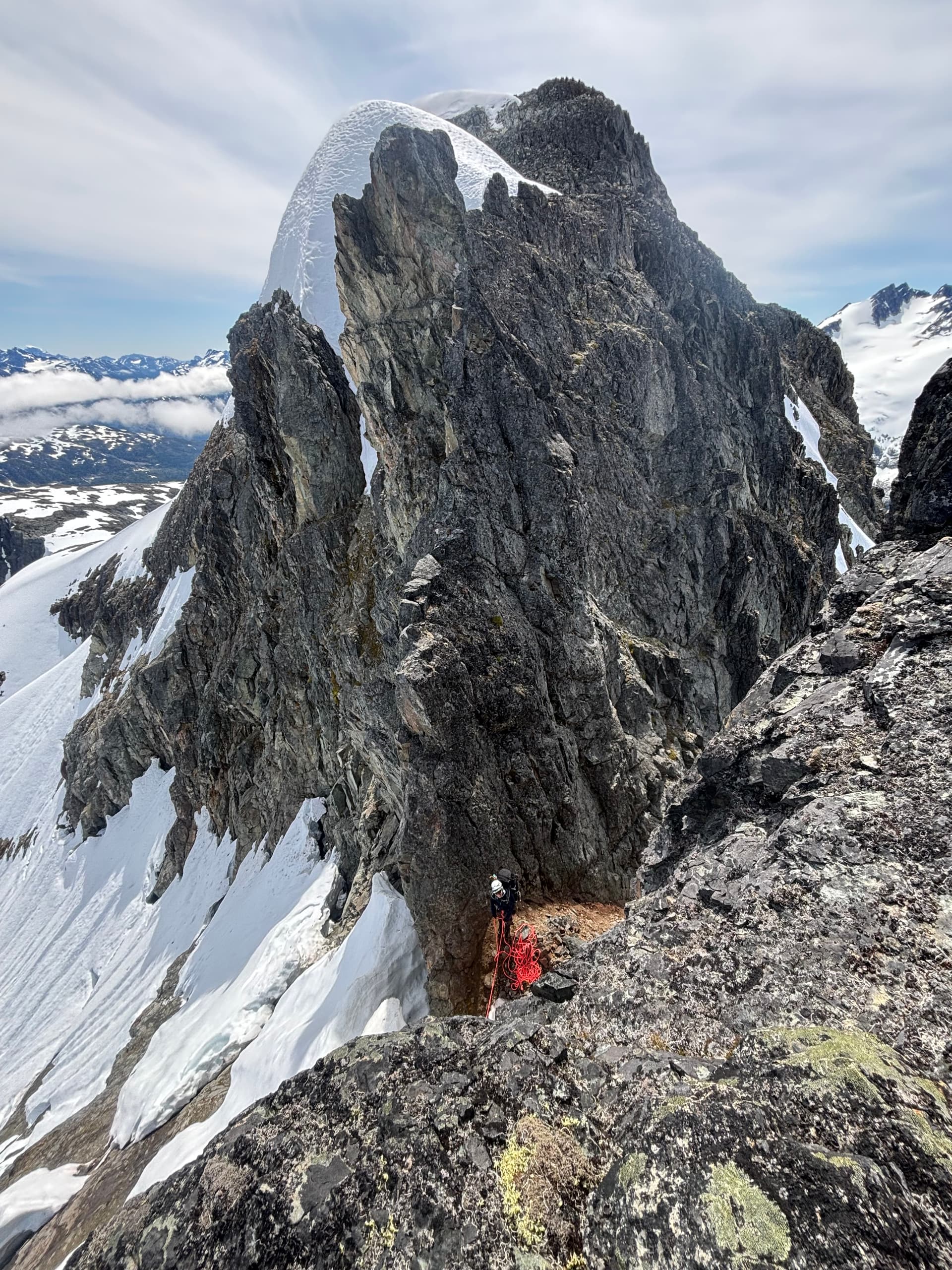
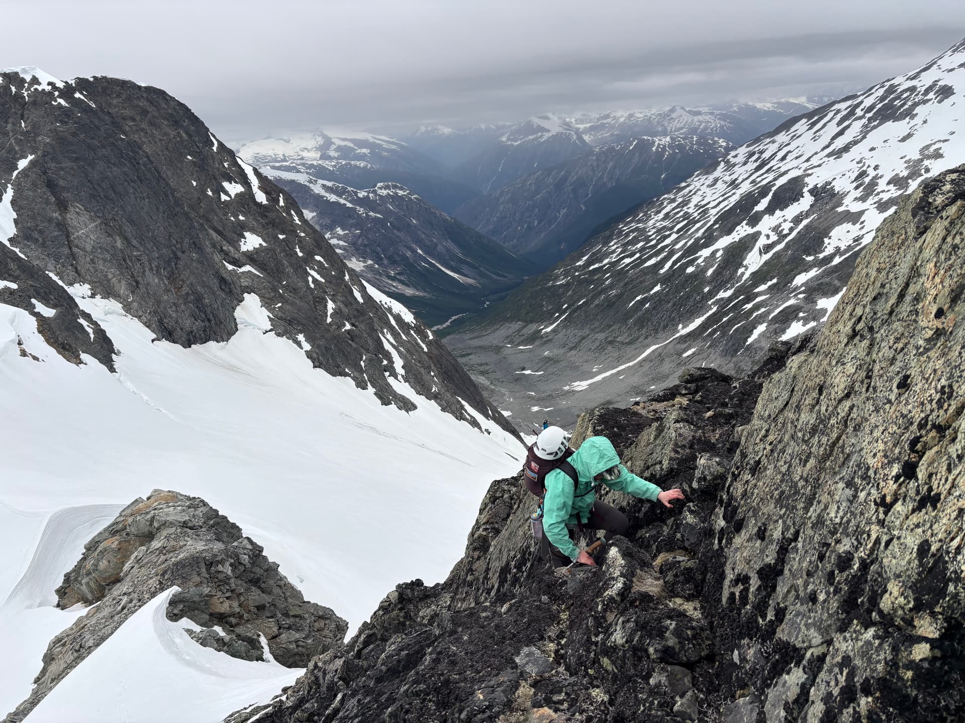
We ascended up Peak 6600 and caught our first glimpse of the crux. There was some relief to see it was a rather short, but deep notch and not a multi-pitch affair. Technical climbing is usually a key selling point for us, but with over weight back packs we were hoping for something tame. Thankfully the notch was not all difficult, with one rappel and a perfect snow wall offering a guide rail around the steepest part of the wall. There was one maybe 5.4 move through a chock stone and the dirty work was over. We continued north up to the summit of Peak 7200 and ditched our heavy packs to make a side trip to the summits in the second zone we had been interested from the outset.
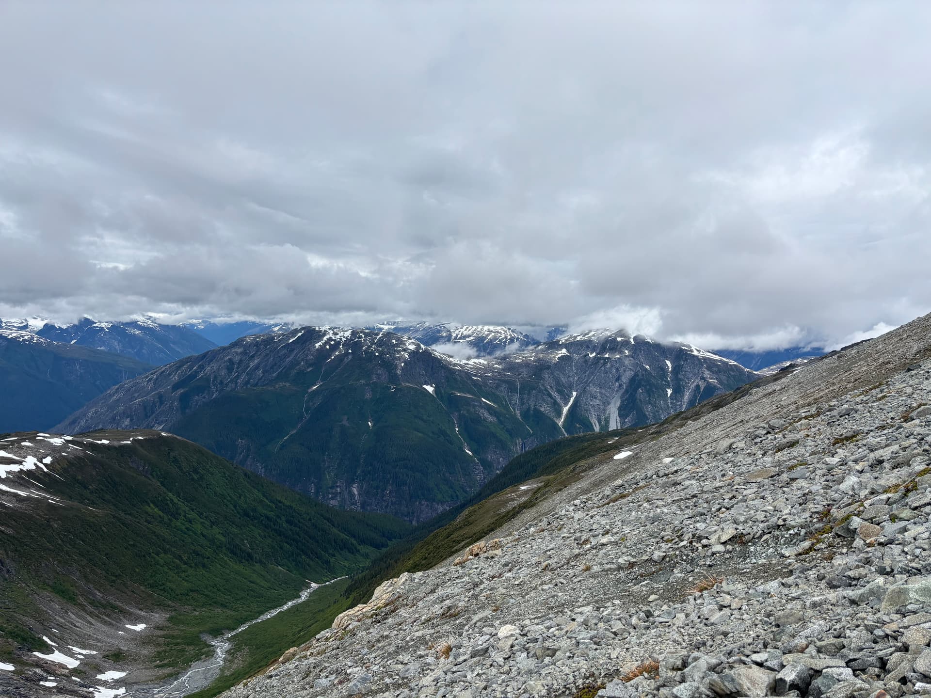
Bad weather had cut short our ability to explore this area east of the Tipso Creek-Kapella boundary so we had to settle for a half-day side mission instead. We set eyes on the tallest peak in this group an approximately 2245m summit to the south west. From “Peak 7200” we descended to the glacier and climbed up another ~7200ft summit that ended up being marginally taller than its eastern counterpart and likely unclimbed. From that summit we traversed along the ridge line all the way to our main objective. On the return threatening clouds began to roll in over the horizon. We hastily returned to our packs and reached them just as the rain started. From the summit we made a short scramble down to snow and then descended all the way to the col. At the base we came across fresh grizzly tracks and it was at that moment it dawned on me were in a wildlife corridor. Adding to that the col was devoid of any sheltered and/or flat spots to camp and so we resorted to deflated looking camp site inside a wind scoop.
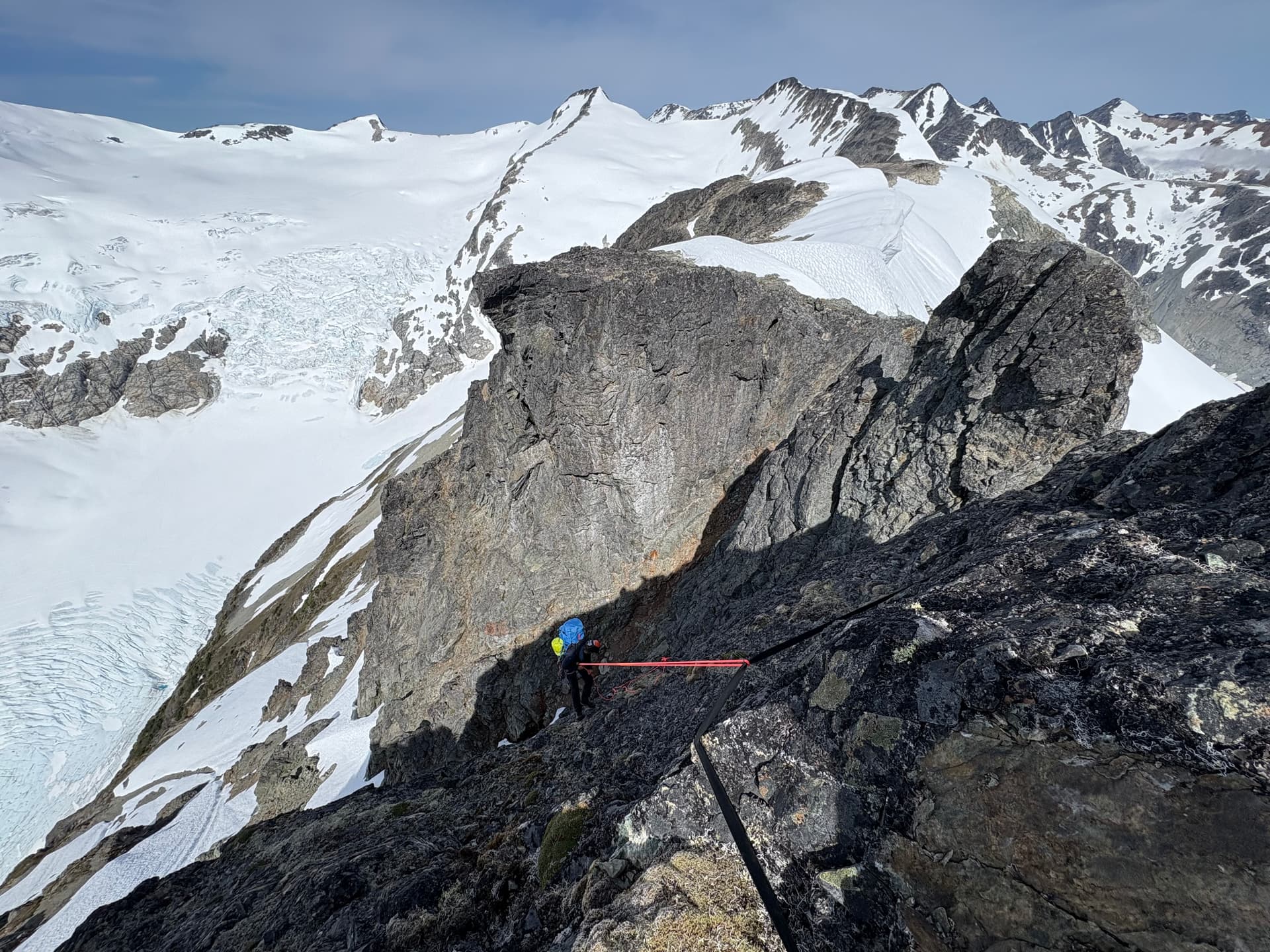
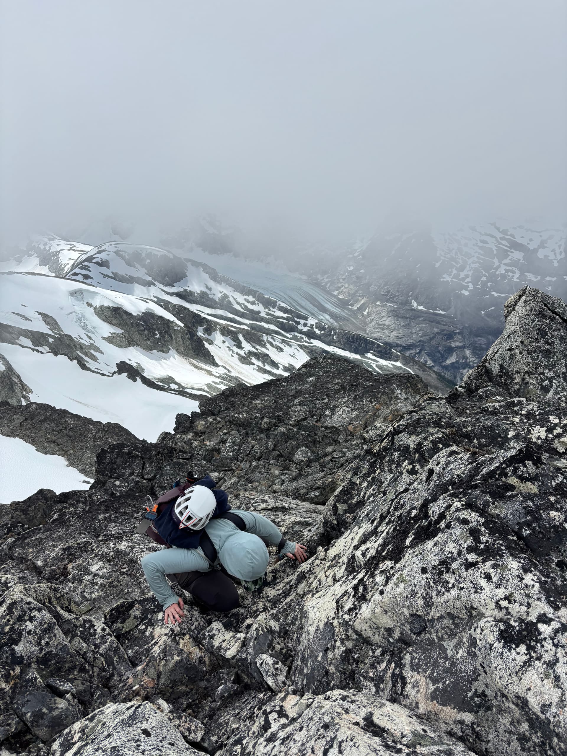
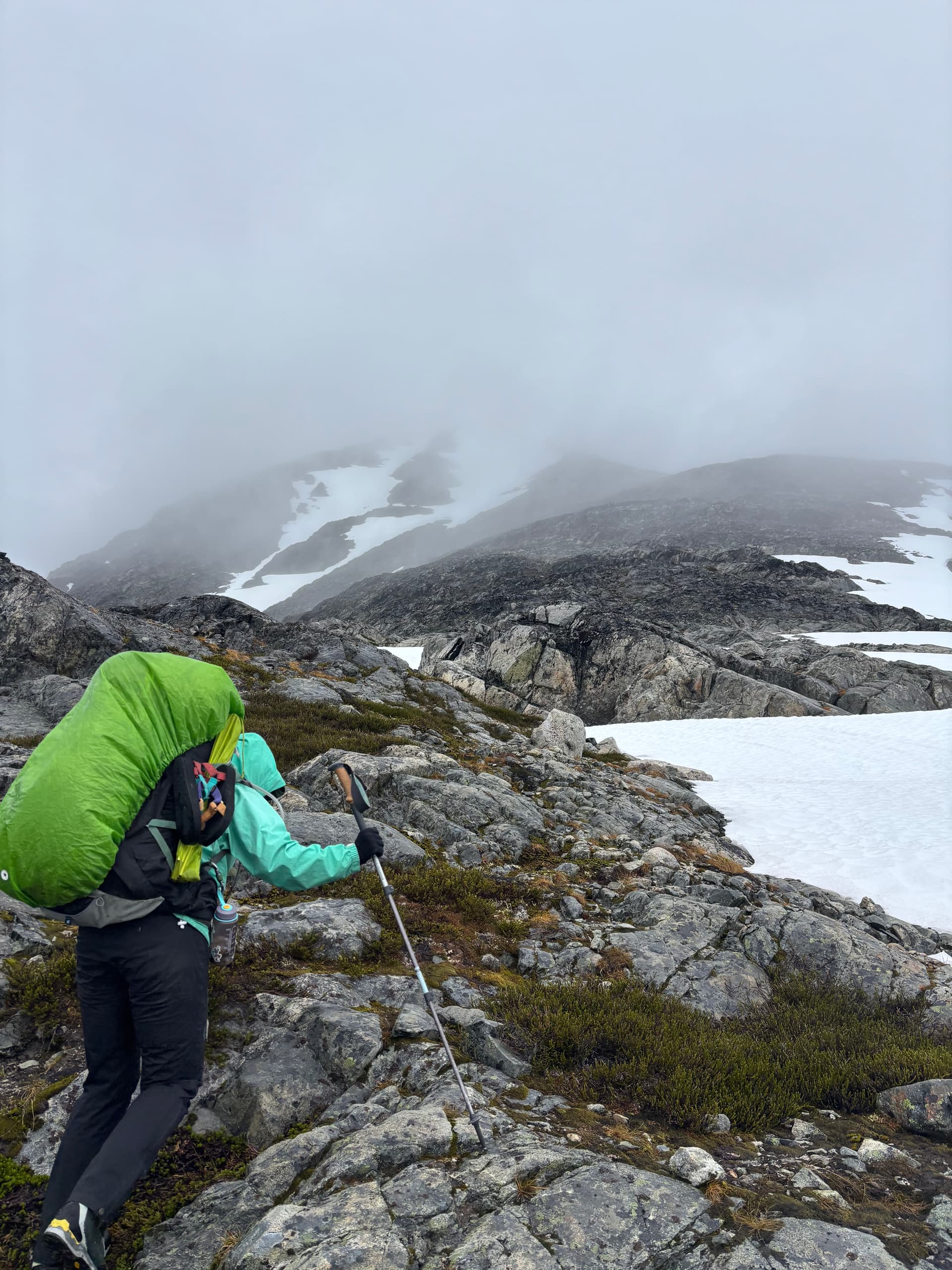
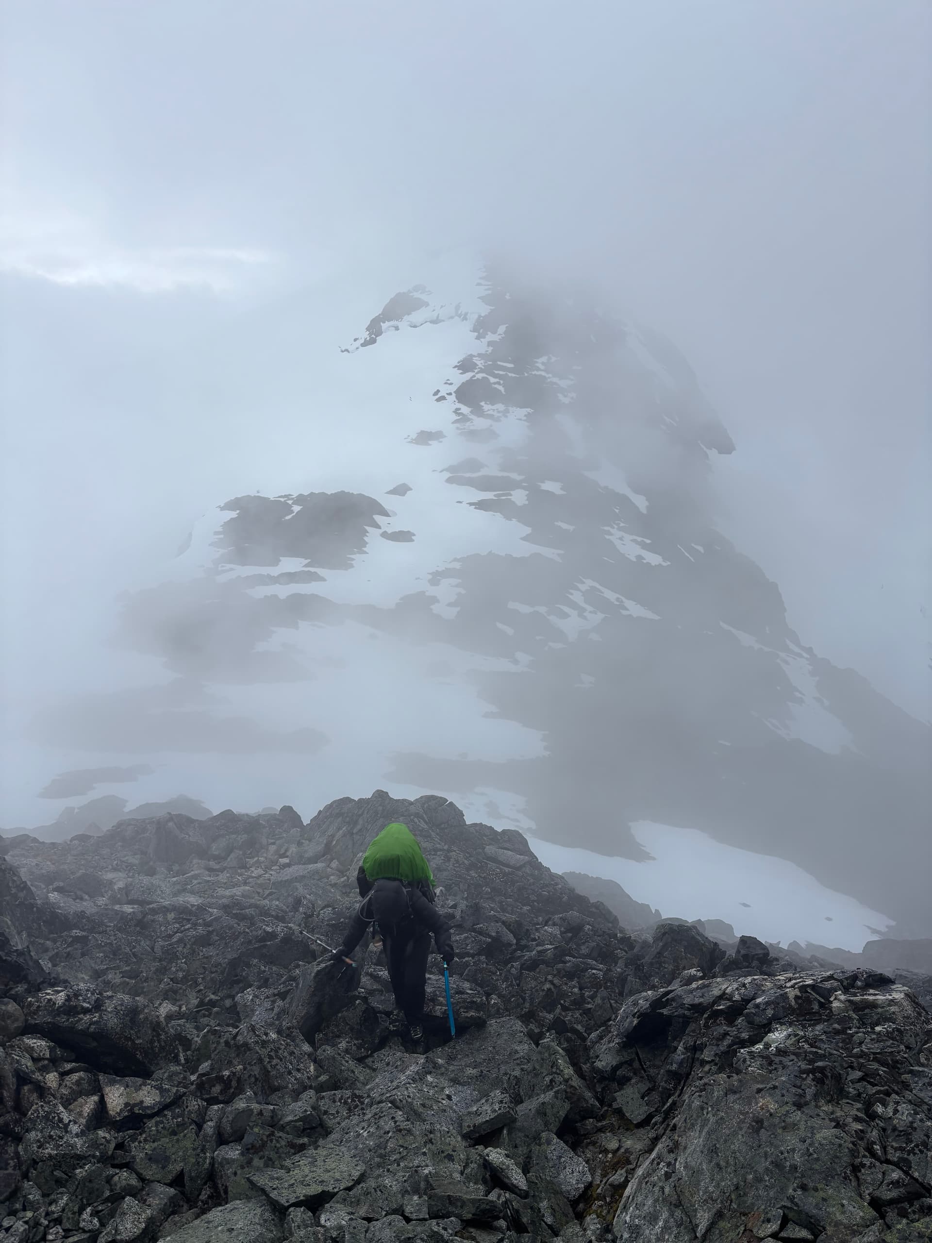
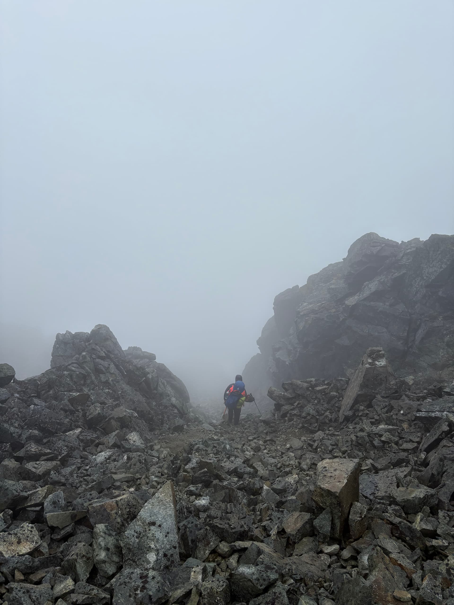
Day 11 marked the most miserable day of the trip. We knew a rainy, but amenable weather window would open briefly on Saturday and we were within shooting distance of Kimsquit Lake for a pick up. Sunday was a shut and closed affair so that left us to a tough decision: continue the traverse through the storm for a Saturday pick up or wait it out and finish Monday and overshoot our vacation time. Getting out early sounded nicer, so we bit the bullet and donned our damp pants for a waltz into the rain. Our first order of business was climbing up and over “Peak 7400” above our camp. A summit which we’ll call “Hindsight Peak” if it turns out to be unclimbed. As we ascended up tame terrain, the rain briefly paused and we thought for a moment this might not be all bad. That would all change as we rose up the ridge into the clouds. The rock steepened the light winds turned to gusts. Before long we found ourselves pulling strenuous exposed moves through slick lichen covered rock as the rain and wind hammered us. After a tense section of perhaps 4th class scrambling we topped out on the ridge at last. We reached the western ridge without much trouble but hit a knife edge section on the descent. Visibility was down to 10 meters, but we managed to find a snowy bypass and were relieved to finally hit the col a short while later.
From there we continued on to “Peak 7500” which promised easier terrain. Unfortunately another knife edge ridge conjured up by the glacier forced us on to snow again. That proved to be the last of the hard terrain and we found ourselves on the col between “Peak 7500” and “Peak 7400” to the north. Now fully soaked and getting quite cold we made the call to setup camp instead of continuing on. As we warmed up on in our dismal snow camp we thought back on our stupid decision to start the day at all. In hindsight we should have stayed in camp and avoid the “get-there-itis” that has plagued so many parties of the past.
Day 12 marked the final day of our trip. We had arranged with Tweedsmuir Air to pick us up at noon and we were only 6km from Kimsquit Lake. All that stood between us and the lake was “Peak 7400”. When we awoke we discovered the rain had briefly let off and wind swept ridges were occasionally revealed by breaks in the cloud. The air was cold and the idea of donning our completely soaked clothing had no appeal. I decided to sacrifice my dry sleeping layers and Andrea did the same. We gathered the rest of our cold damp gear and set off up the ridge. Perhaps 120m below the summit we hit an interesting crux of steep 3rd/maybe 4th class climbing covered in more of our favourite wet lichen. At this precise moment the clouds cleared on the glacier below and we could see a scree ramp that would work to bypass this summit altogether. We didn’t hesitate for a moment to skip the summit as we couldn’t see what was further beyond and the zeal was gone for hours of potential slick rock scrambling.
The scree ramp took us down to tame slopes and snow fields and we traversed a long ways around Peak 7400 and into the forest. At this point we were hoping for a fast descent as we had pushed the float plane pick up back 30 minutes and even that was looking tight. The sub-alpine forest zone was the most time consuming with bluffs, slick brush and roots and we fell down looney-tunes style until more open forest around 700m. Again realizing we might not make the pick up time we sent one last minute message to come at 1pm, but we weren’t certain if it went out in time. From there it was a frenzied rush down to the shore line. 300m above the lake we heard the plane land on the water. Andrea let me run ahead to catch the pilots attention, so I bull dozed my way down through the forest half falling towards shore and popped out above the cliffy shoreline. I yelled frantically but the plane’s engine was running and I wasn’t sure if they’d just circle around before powering off. I damn near fell into water trying to wave him down, but the shore was just too bushy for him to see me. Finally our pilot, Ethan, cut the engine and I managed to get his attention. From there the pressure was off.
As it later turned out, they had received our message and were even planning to hang out until at least 1:30 on the shore so there wasn’t some imminent take-off thread like I thought. Andrea popped out of the bush shortly after and we both looked sopping wet and dishevelled. A few hours later the storm returned, but we were long gone!
Summary:
- 12 days, ~80km and 7400m of elevation gain
- 10 summits (11 if you count the lower prominence of the eastern most Peak 7200)
- Potential First Ascents (pending confirmation from the previous two parties):
- Peak 7400 - 52.96170, -127.36000 a.k.a. “Kepler Peak” on bivouac
- Peak 6600 - 52.92837, -127.33263
- Peak 7200 - 53.05209, -127.29194
- Peak 7400 - 53.03139, -127.29611 a.k.a. “Black Dog” on bivouac
- Peak 7400 - 53.07076, -127.29839 (Mike and Mark logically could have done this so very tentative)
We’ll come up with some better names once we know for certain which peaks were unclimbed or not.