Editors Note: This slog took place on the unceeded territories of the St’át’imc peoples, and I am grateful for the many journeys I have had through their lands over the past fifteen years.
Editors Note: This has been edited for brevity and cut down for the public since it’s a region of limited recent public beta. The more narrative experience is on my personal blog casualdisregard . com/mount-pitt/, with a LOT more photos, but more personal thoughts about my life - readers have been advised.
I have read many failed ascent reports of Mt. Pitt, and yet to find a successful one online from my lifetime, so I’m not ashamed to be adding my name to the prestigious category of “failures” on this one.
If you’re looking for info on Mt Pitt itself, turn around now: I bailed on the approach: 3-ish kilometers from Tuwasus pass and Rollercoaster Ridge. I’ve included some high resolution photos of the route, however.
Saturday:
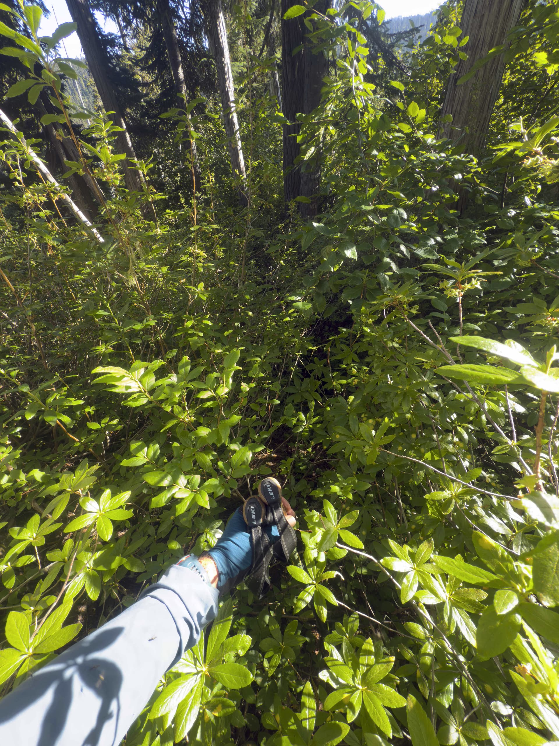
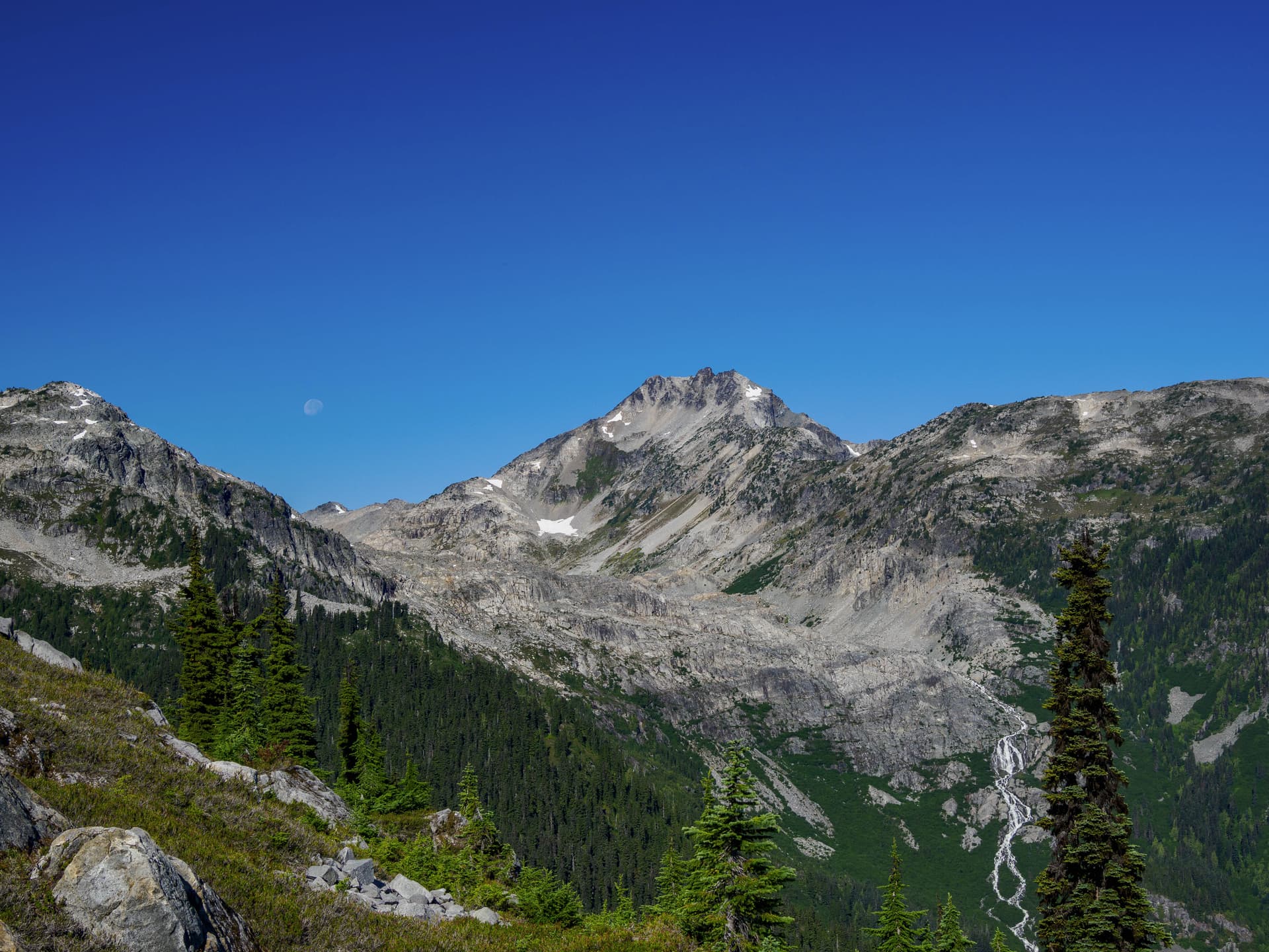
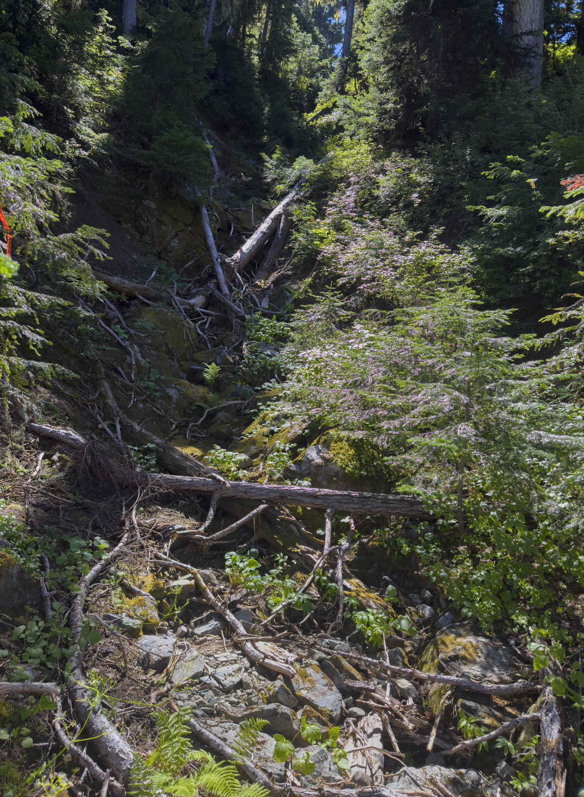
Midafternoon, after finally hitting an impassable tank trap at the 900m level of the Chief George, I parked the van off the side of the road and repacked my bag to ditch some luxuries. I left behind my spare camera body but retained my ultralight rappel kit - at just over a pound for 30m, it was worthwhile to bring along. I was feeling pretty darn tired but figured I could make it at least to Bluemantle meadows before I lost the daylight. I made good time up the road despite the heat, but became a bit lost in the network of fresh spur roads at the very top. Eventually I picked what looked like the shortest amount of forest to cut up through and made a go of it, clawing my way up through slide alder and willow for just over half an hour. It was oppressively hot and still, but I emerged into the meadows below Lone Knoll and gorged on Blueberries in lengthening alpine shadows.
From here I fucked up and in my severely sleep deprived state decided to very rigorously follow the 13 year old GPX track from Pardeep Longia & Fred Touche, rather than interpret the contours and imagery myself. This lead to beating through a wall of endless bushwack along the 1400m contour line, rather than just finding a better path not covered in a wall of bush, until I emerged into a vast bog where an incomprehensible volume of mosquitoes consumed me for the next hour. The bog was wet, dotted with death pits (abrupt swamp moulins with sediment more than 2 meters deep at the bottom), but did have a number of interesting wildflowers and plants which I had not seen in Garibaldi before - including quite a lot of Sundew. I was hot, exhausted, and just wanted to lay down and sleep but this really felt like the worst place to do that even if there was water. Looked like a bear heaven. So I pressed on for a solid hour, slowly winding my way uphill to the nearest lake which looked larger than a drying tarn on the map, occasionally sitting down and fighting the urge to pass out then and there with my pack still on.
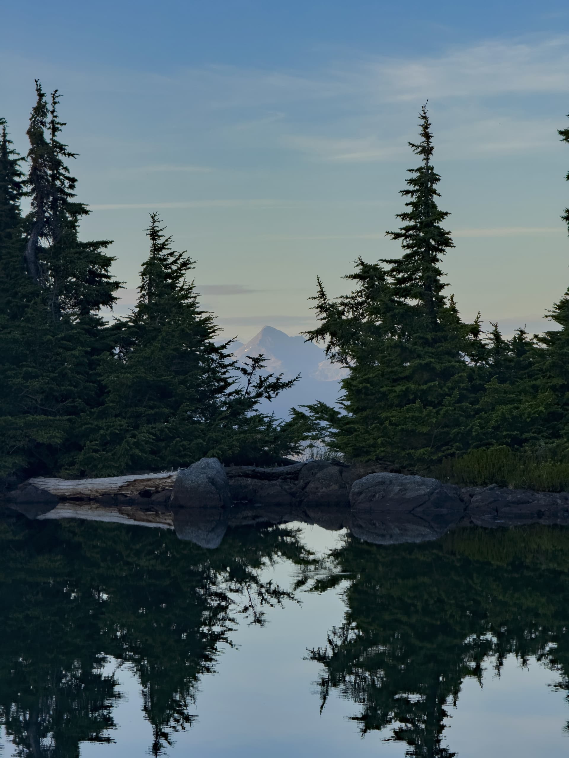
When I finally saw that little lake come into view, I could have wept I was so exhausted. Clear waters, crisp shoreline, perfect tent pad. I dropped my bag, set up camp, made some dinner, and crawled into bed in just under an hour. I was out like a switch flicked before my head hit the pillow, and regained consciousness at 6am the next morning. I realized the crux of this trip was not going to be technicality or brutality of the terrain, but rather what I had done to myself immediately prior to setting out.
This is a good time to unbury the lede here: I’d had a tight five hours of sleep on Thursday after a housewarming, and Friday night I had left Vancouver late and arrived at the top of the Phelix Creek FSR around 1am. I then loaded 122lbs of dimensional lumber onto an ancient 1970’s frame pack, a full size too large for me and which club legend claims Roland had taken off a corpse on Huascarán, then gone and overnight hauled that lumber up to the Brian Waddington Hut to assist the ongoing repair work. My nightshift compatriot had hauled 130lbs, but he is over ten years younger than I am. We had reached the hut around 4am, where I got three hours of sleep after nearly 23 hours awake, and by 8am I was headed back down the trail to my van and driving south to start this Mt Pitt attempt.
It could be said that I had perhaps not really set myself up for success with this pregame strategy, but I am nothing if not a sucker for helping the VOC.
Daily Stats:
Moving time: 9hr 14min (5hr 14min from CG FSR start)
Total Distance (Incl Phelix): 19.6km
Total Elevation (Incl Phelix): 1333m
Sunday:
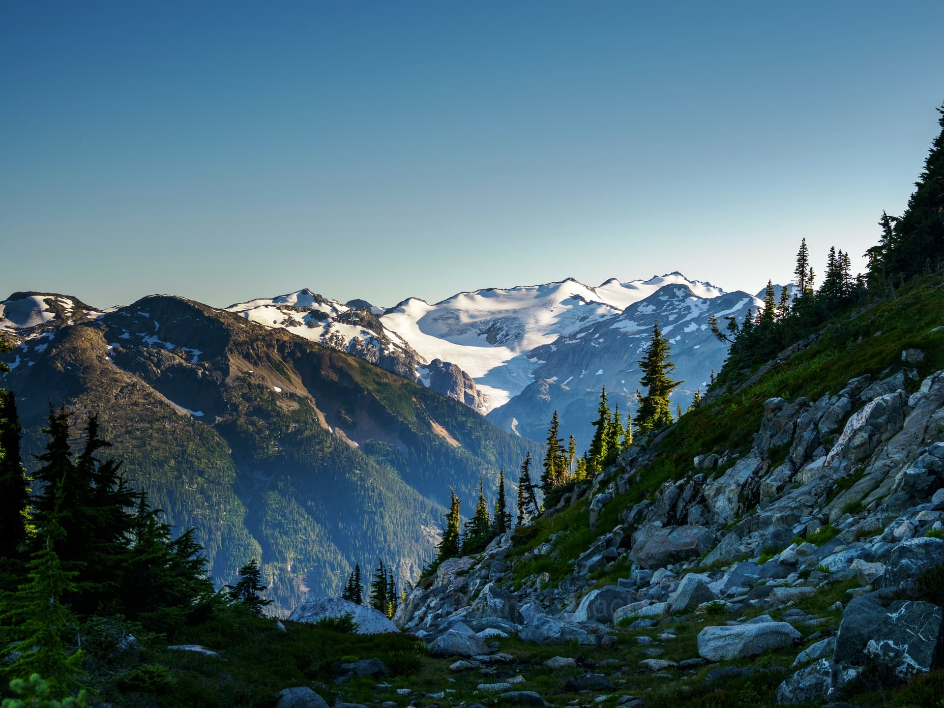
I was lagging my schedule, so I knew I had a serious push to make Tuwasus Pass by nightfall. A quick hot breakfast and camp breakdown and I was off by 7am. An hour later found me a few kilometers along the ridge and swimming in a larger lake, because it was becoming muggy as all hell and I felt gross after yesterdays bushwack. The heat climbed with the sun, and by the time I reached the vast meadow below bluemantle, around 10am, it was cooking. The creekbeds through the meadow were gorgeous however, absolutely chock full of wildflowers and butterflies and I was disappointed the lighting was too high and harsh to take many good photos.
I spent the next hour and a half slogging my way across a boulderfield and threading my way up the ledges on the shoulder of Three Bears, below Goldilocks Lake. The sun was oppressive, I was not doing great, at one point I felt as if I was going to vomit or faint or both - which was not super ideal while holding onto a small tree and smearing up a slab section with a 50-80m drop below me. Midway up I realized the route I’d picked through the ledges was rather asinine. Eventually I gained the 1800m contour and found a crystal-clear torrent emerging from a glacier a few hundred meters above, took my boots and socks off, and lay down in it fully clothed.
I was dry fifteen minutes later.
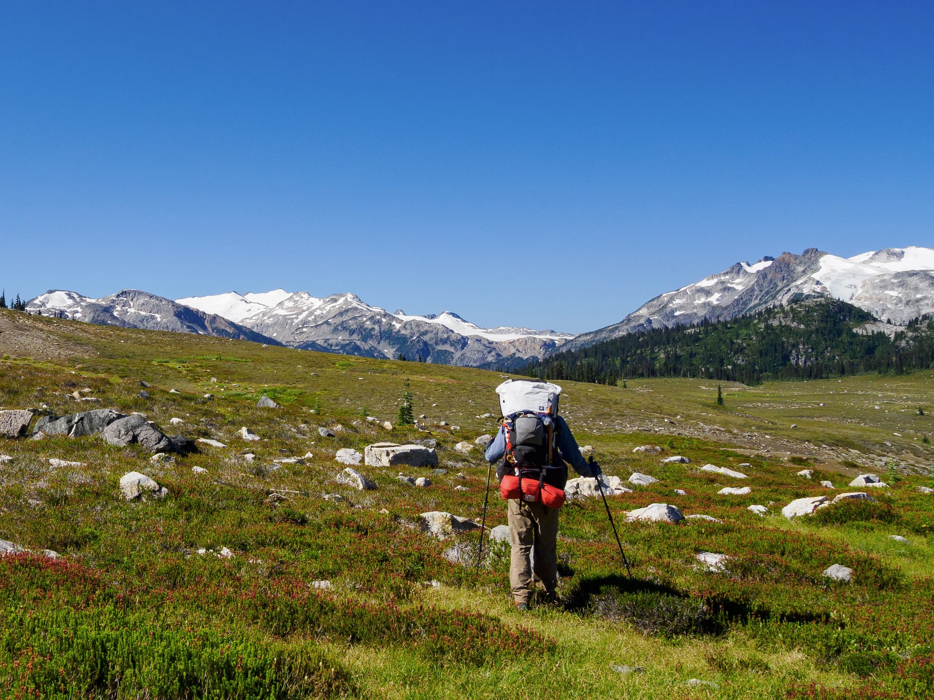
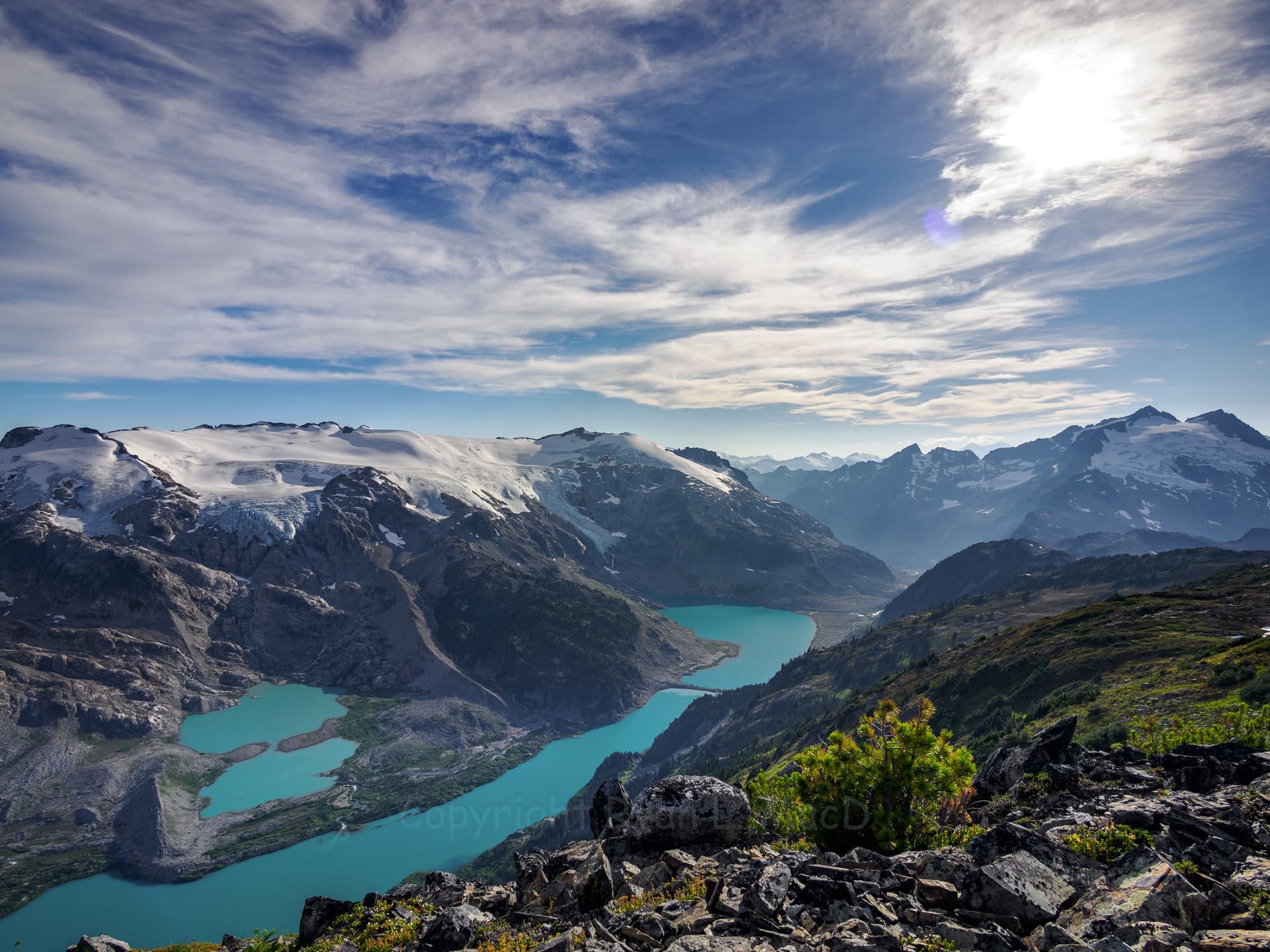
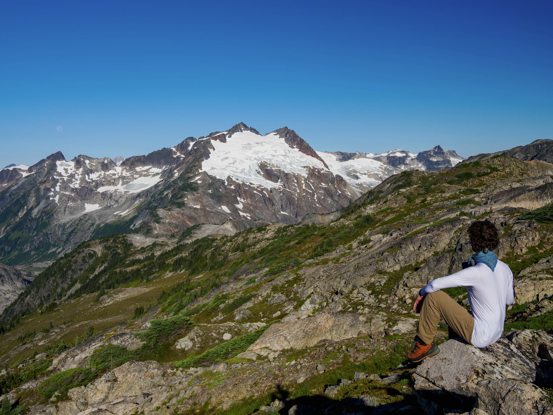
The east shore of Goldilocks is pleasant rolling bluffs and I made quick work along them, stopping at the north shore of the lake around 12:30 for lunch and a swim. Here I washed my clothes and set them out to dry, thinking this was the last major water body I would see for the next few days as I had no intention of dropping all the way down to Snowcap Lakes. My watch claimed it was 35 degrees, I found that hard to believe. I started over the ridge towards Icemantle at 1pm, and promptly had my first major shock: There was no glacier where I was expecting one.
The valley was mostly a lake. A sickly sludge-green with the suspended sediment of rapid glacial melt, dotted with little icebergs.
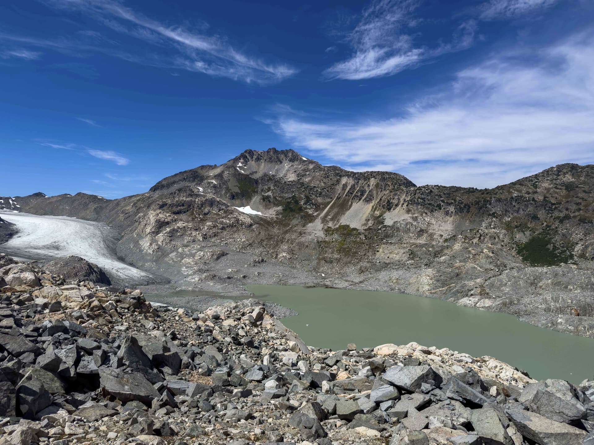
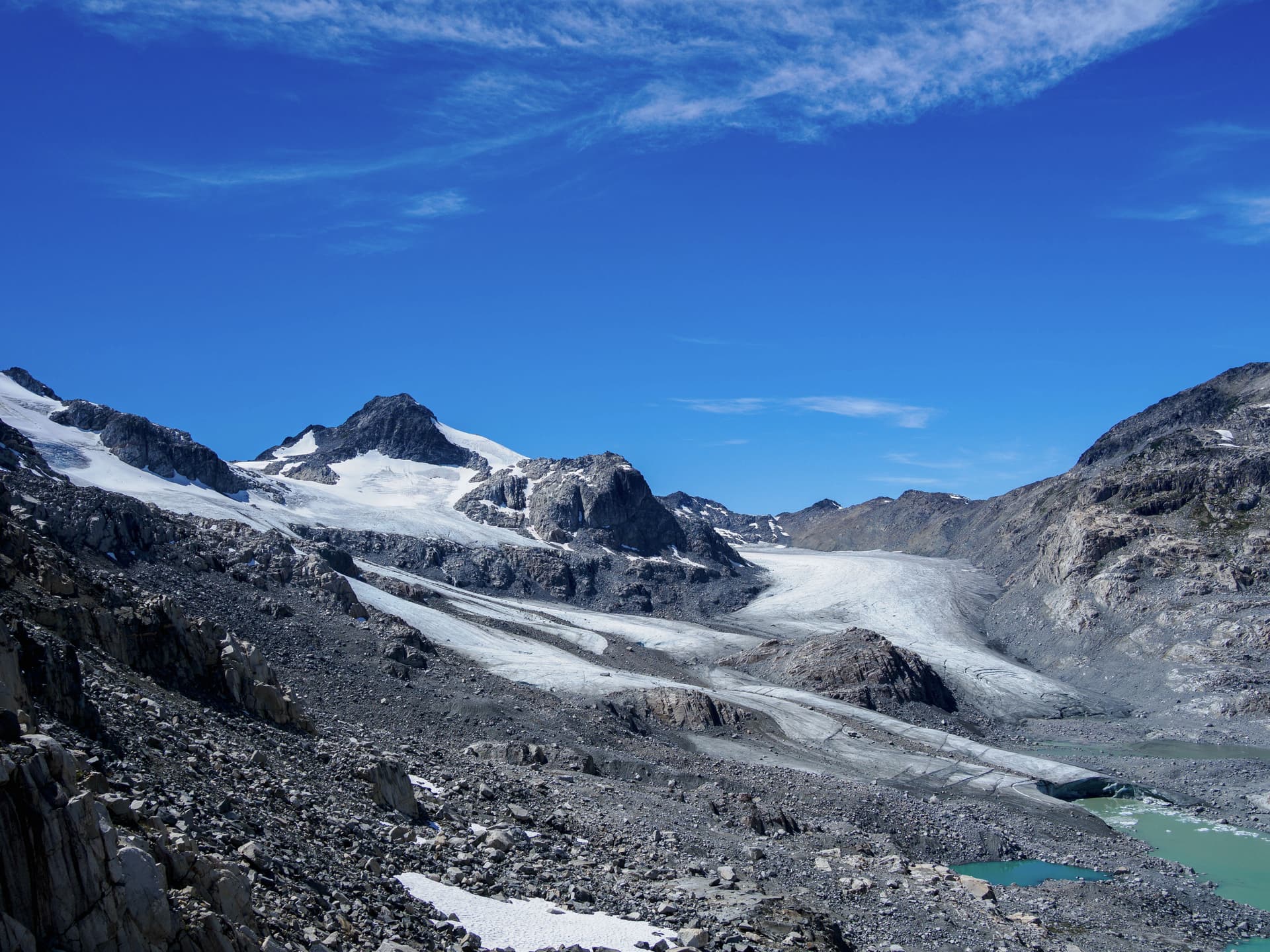
As it turns out, the imagery on Caltopo is very old. The glacier has retreated by over a kilometer since the 2013 bivouac report I had pulled, and lost a hundred meters or more of thickness in the process. Rather than a short scramble down the valley side onto the ice, I was confronted by an extended rubble traverse through a recently carved valley: steep, extremely loose slopes covered with boulders which had yet to find any equilibrium and were sitting on soft wet glacial till. Several times I would look at a minifridge sized rock the wrong way and it would topple down. Whenever I am scrambling on steeper debris fields I have a constant fear of disturbing the wrong rock and having the entire slope destabilize around me when it goes, burying me in a rockslide, and it felt like if there were ever a place for that fear to manifest it was going to be in this valley.
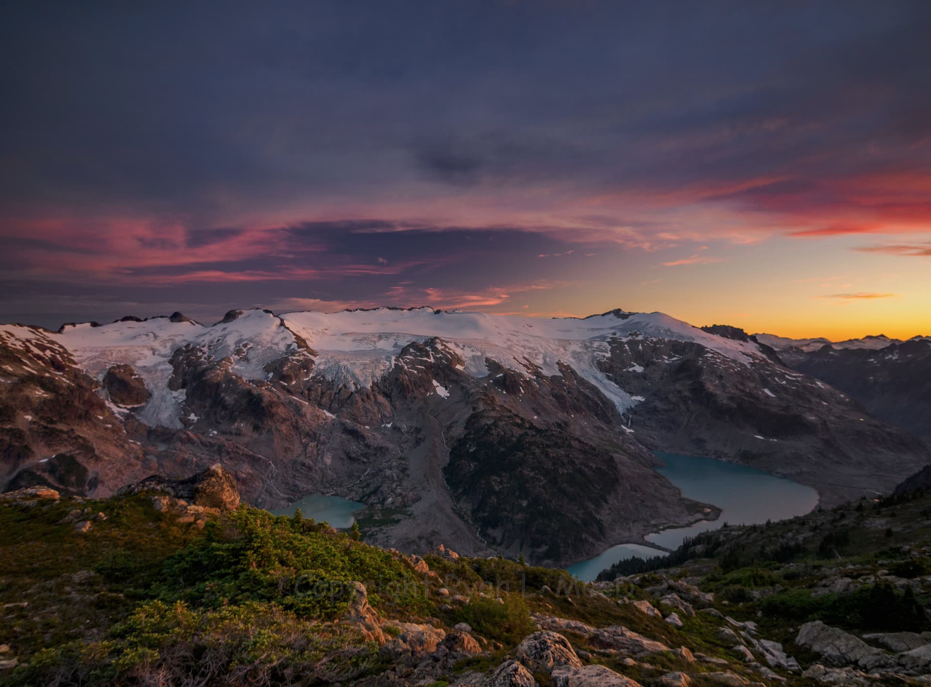
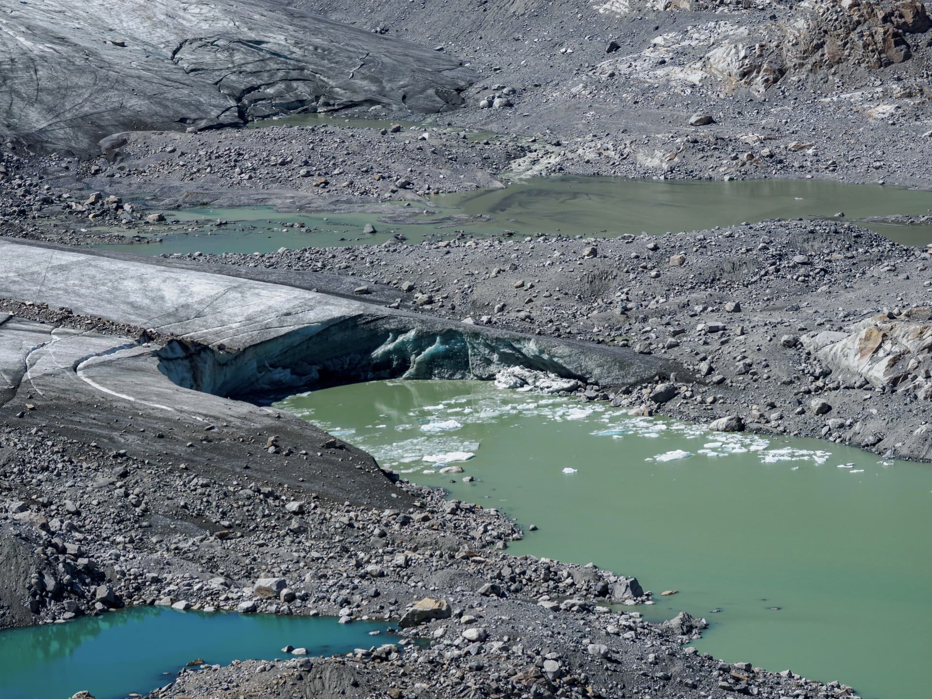
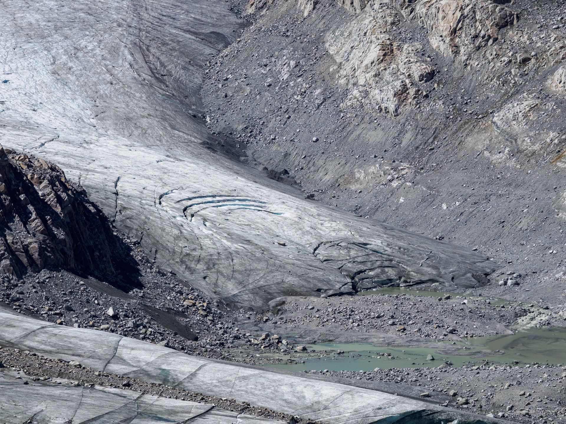
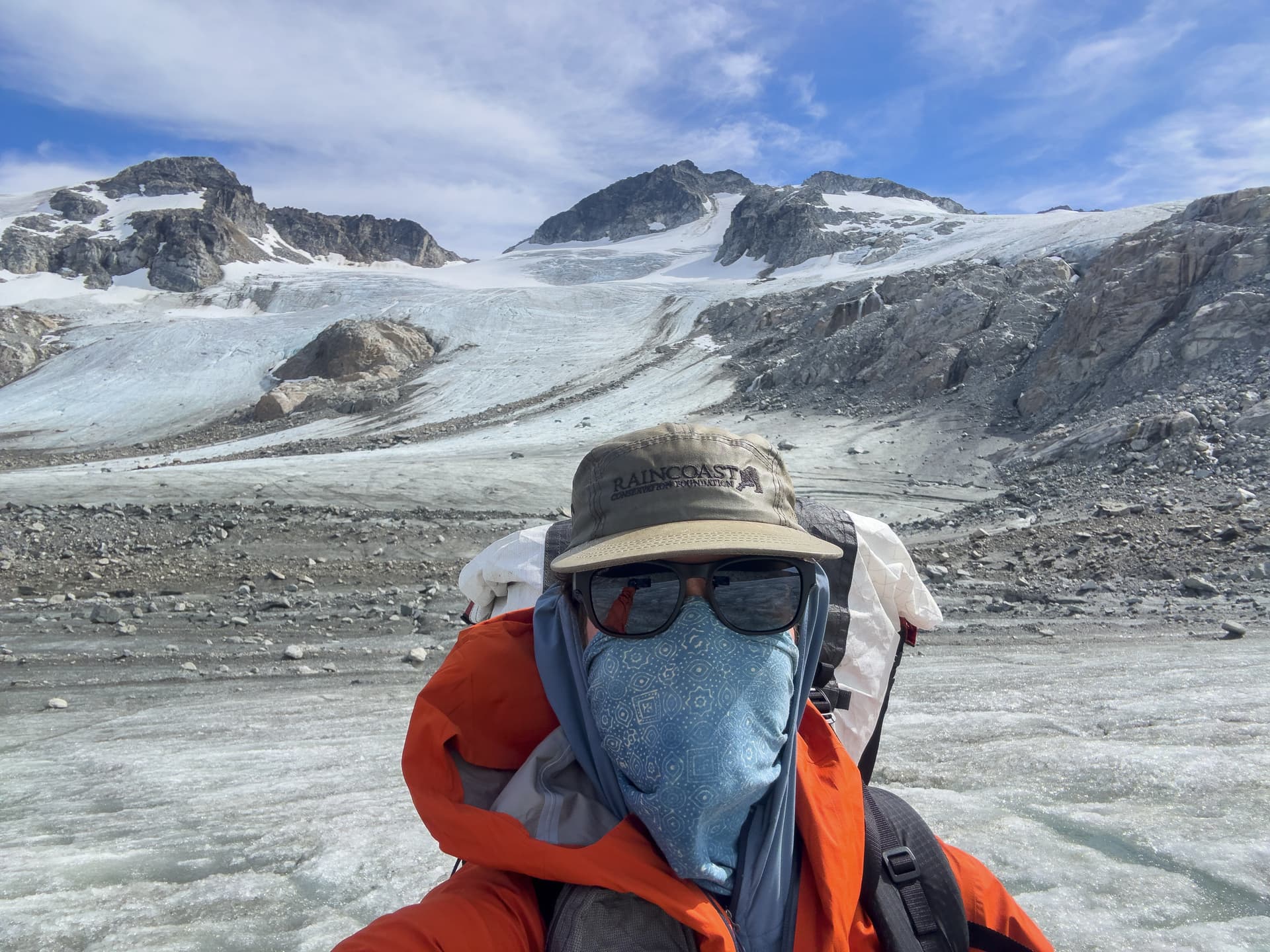
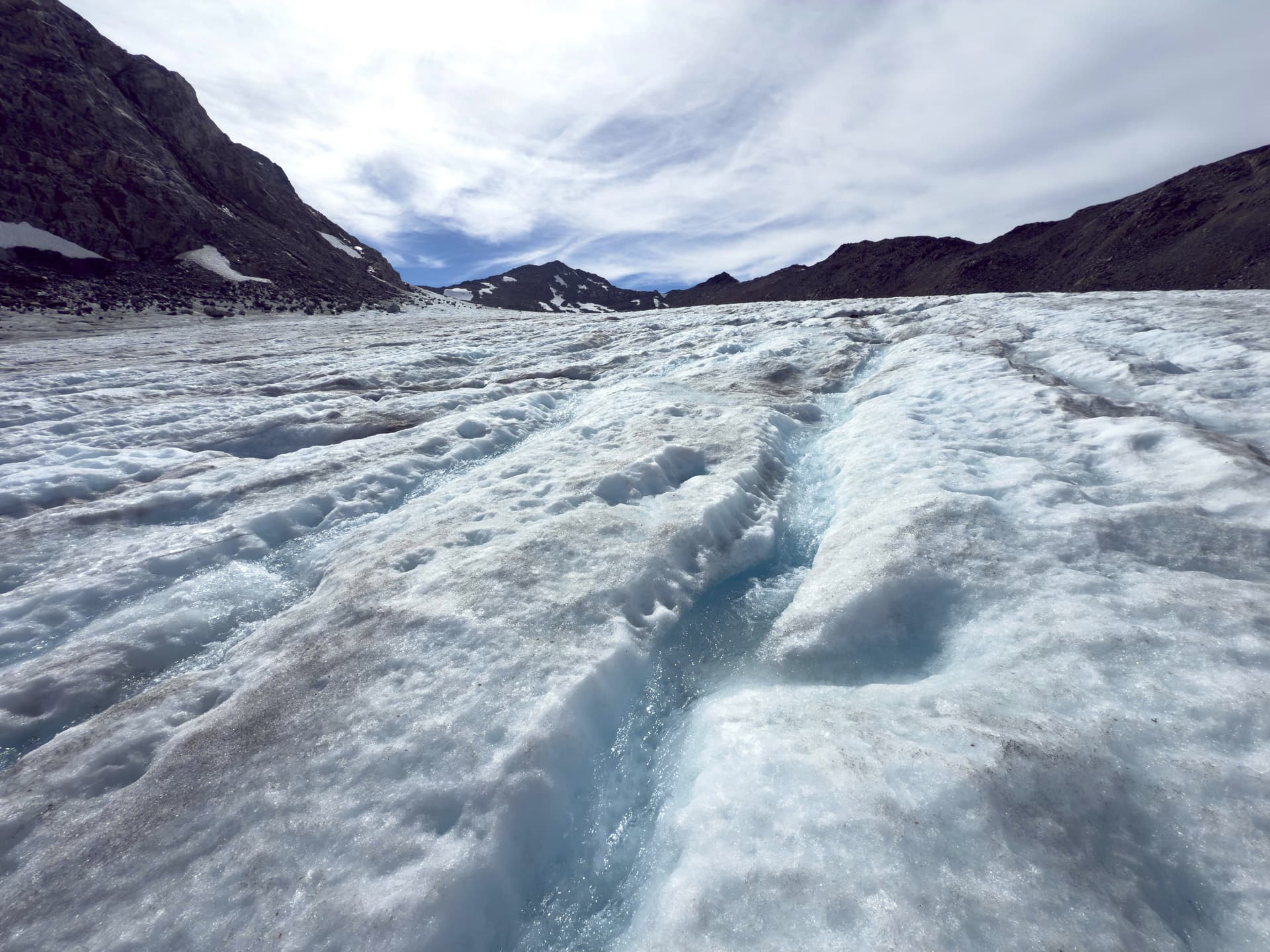
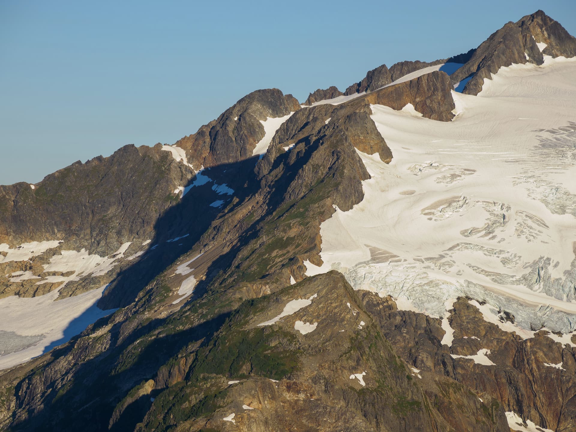
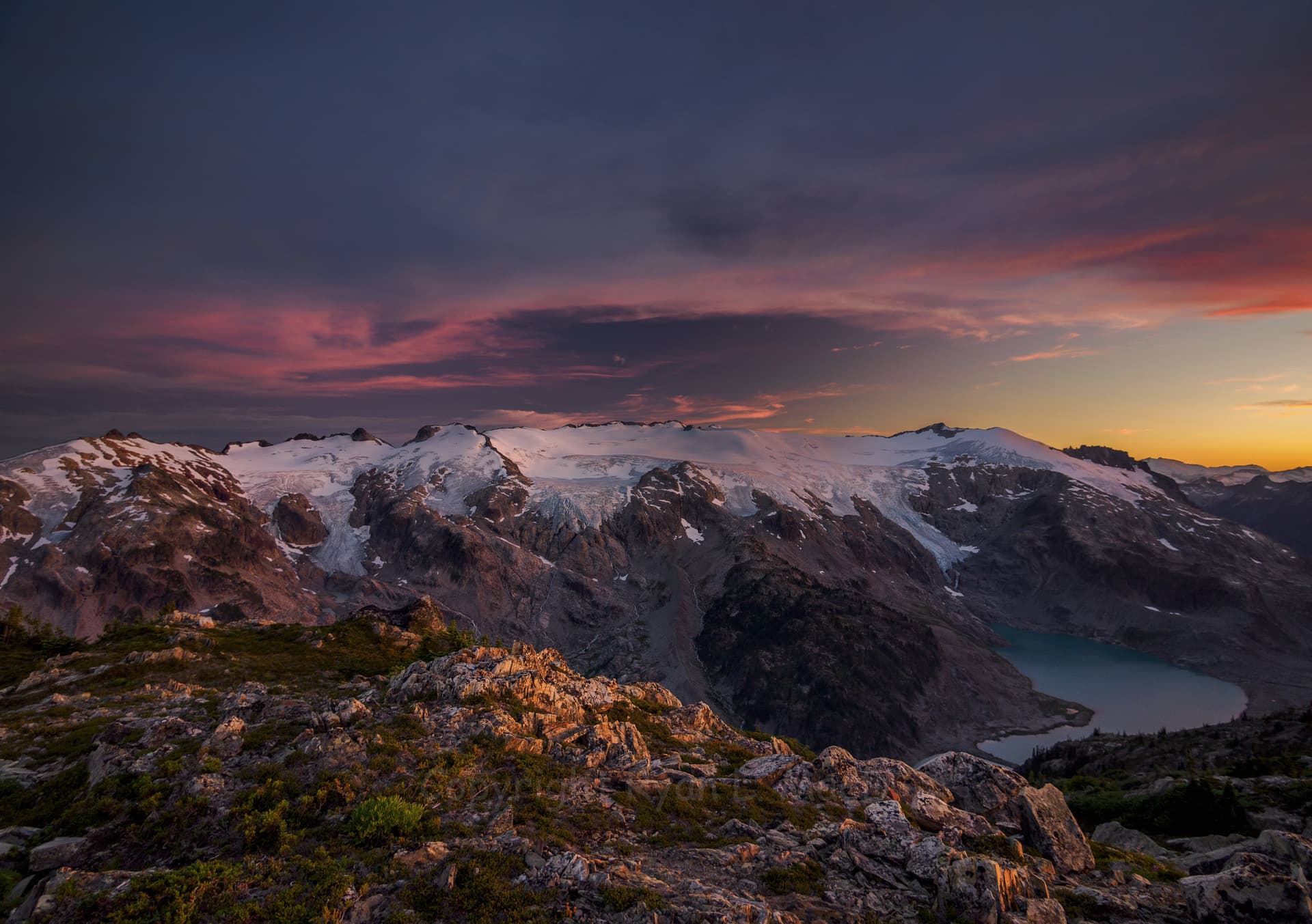
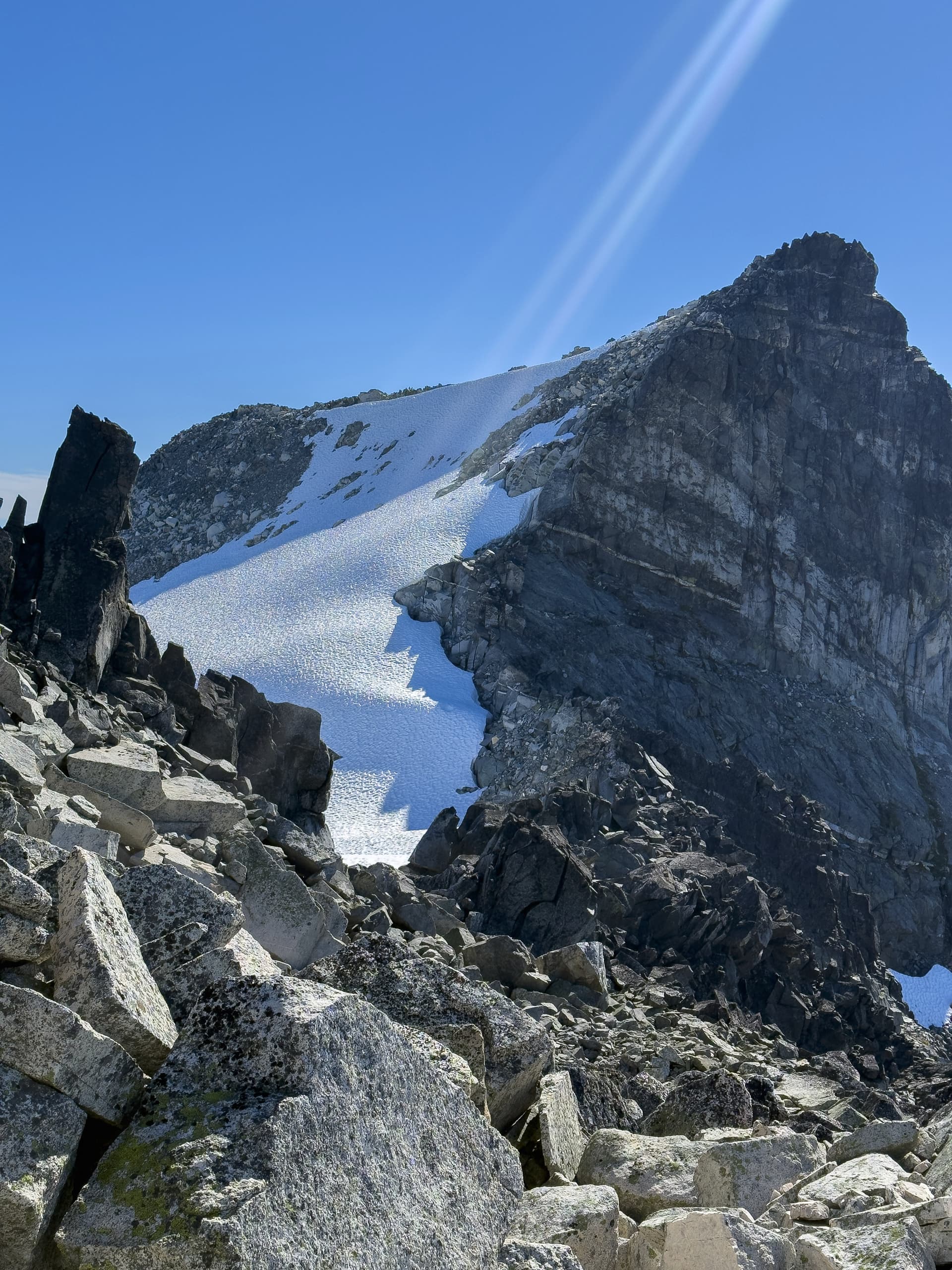
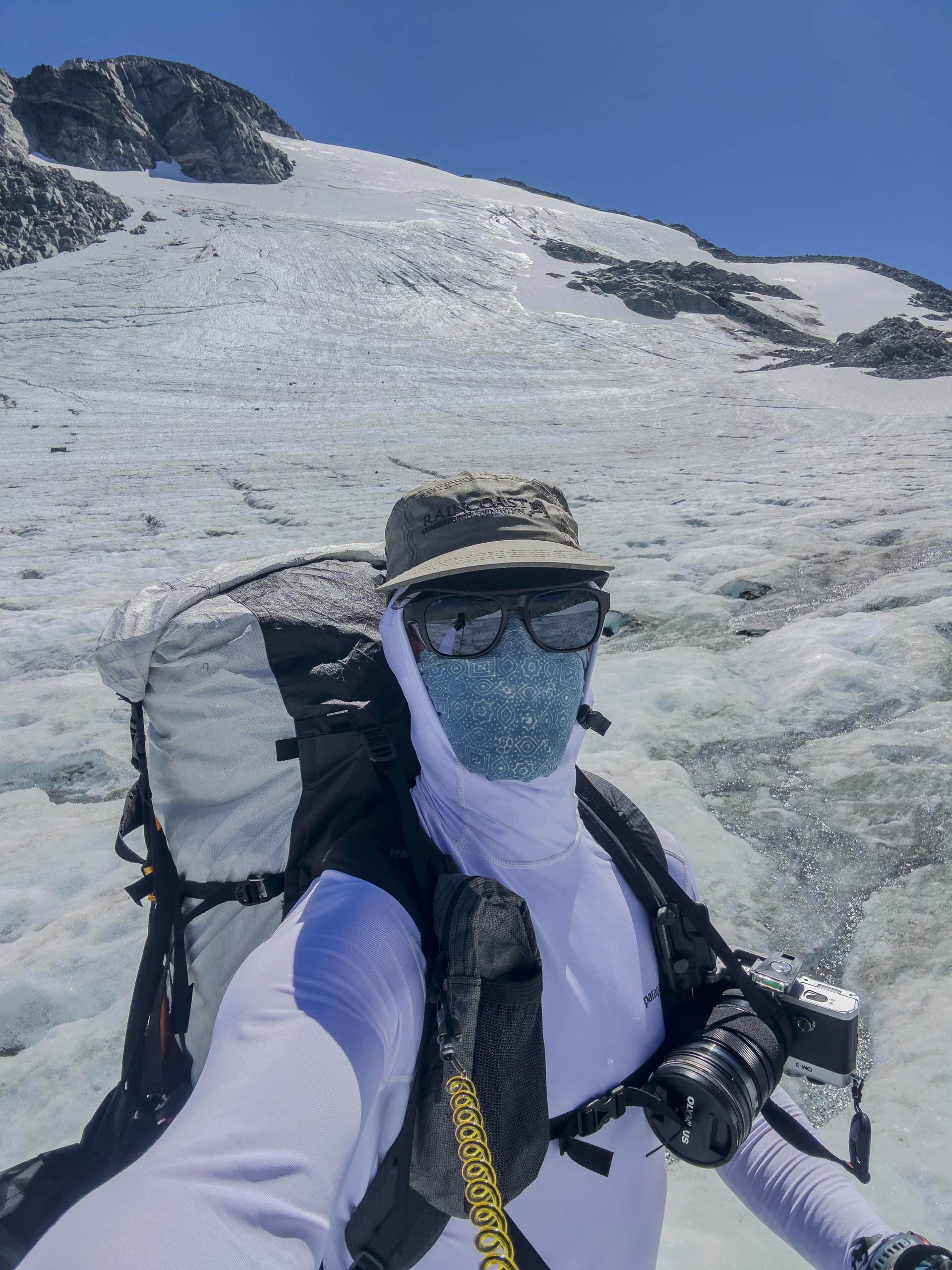
I finally made it onto what remained of the Icemantle at 3pm, and found not a glacier but rather a decomposing corpse. I’d had a good view of it from the ridge and could see it had little in the way of crevasses, but what had not been visible were the moulins. Ranging from pothole sized, to vast craters fifty or more meters across where the glacier had collapsed from below into death-pits from which there would be no escape. The surface of the glacier was rough and textured, as if it had been recently ploughed, and I found my crampons dramatically slowed me down with how deeply they dug into the rotting surface layers. Everywhere were meltwater channels filled with racing torrents, the few crevasses I encountered were full to the brim with tourquoise water, and passing moulins I would hear water rushing deep below - every one seemed to go straight to bedrock. The worst crevasses were to the left (approach view) side below Greenmantle, so I stayed roughly in the middle all the way up figuring it would have the most stable ice. This would prove very, very wise the next day.
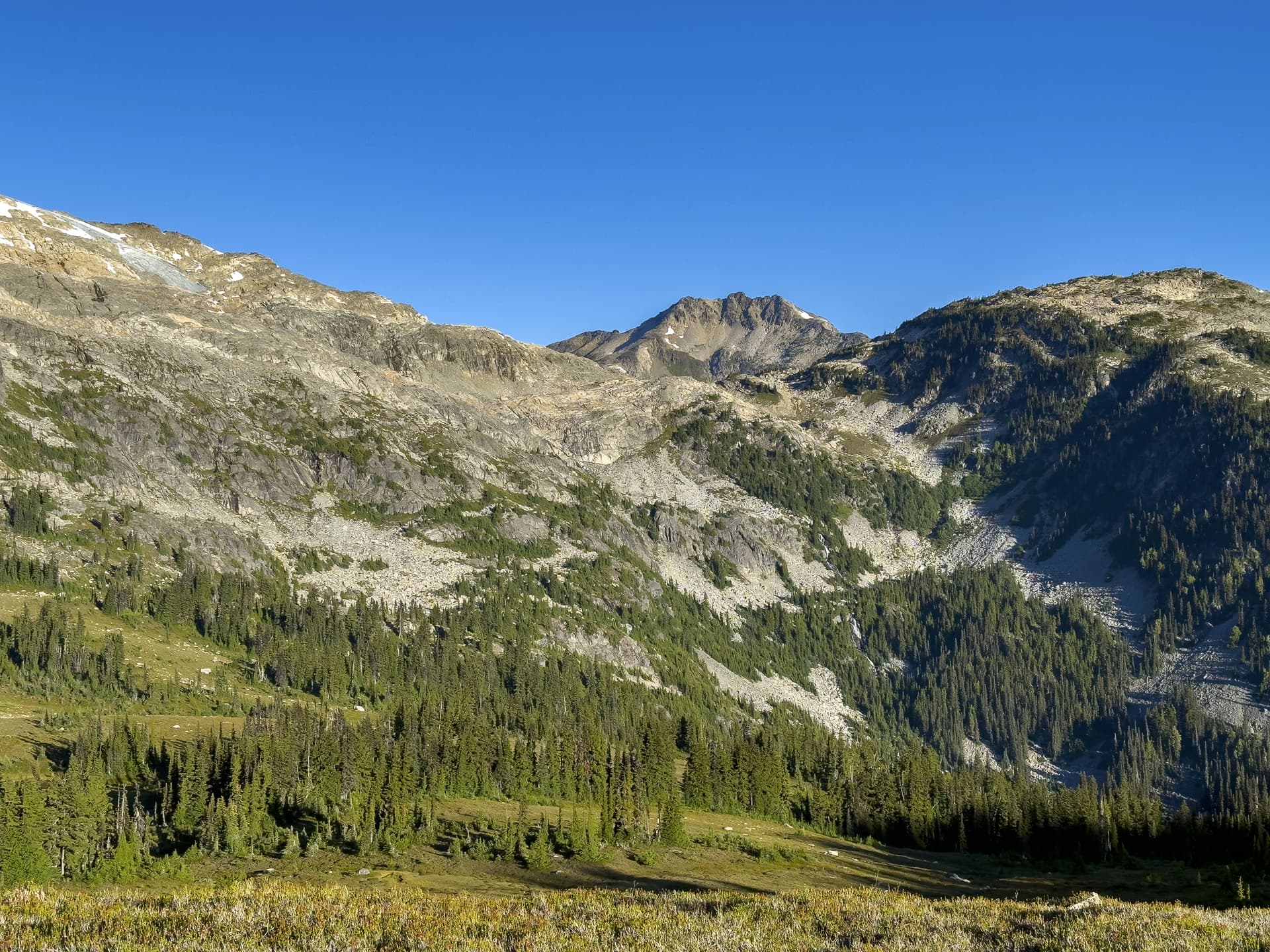
I got off the Icemantle and into the col below Greenmantle at 5pm. I saw how very far I still had to go, Pitt looming in the distance, and I cursed the wild inaccuracy of the report claiming that this was only 30km from car to summit. Not a chance. More like 70-80km, round trip? I’d come this far, though, so I soldiered on. A swift descent to the equally decaying Greenmantle glacier, and a quick 30 minute ascent on hardpack - staying to the right to avoid the more heavily crevassed contours, found me on the ridge. Great rambling up there, very fast terrain, but I was losing both light and gas in my tank rapidly.
Roughly halfway along the ridge to Tuwasus Pass, I pulled the plug. I had three bars of reception and checked the weather forecast and discovered a few things:
- One: There was a heat warning in effect for Garibaldi and it had been pushing 35 degrees most of the day. It would continue to do so for at least 48 hours.
- Two: The weather was going to shit starting as early as Tuesday night, with heavy rain coming by Thursday. I was now in a pickle. I wanted a rest day before trying for the summit, or at the worst before turning around after summitting, but if I took a rest day in either case it would push descending the ledges below goldilocks to Thursday which then would risk the terrain being wet from rain - and I did not consider that section safe in the slightest to descend solo if wet. With only 30m of rope and two anchor sets, I doubted I could successfully link up enough rappels. If I was trapped by rain beyond Friday, I would run out of food. A rest day of cooking in a tent with temperatures into the thirties in terrain with zero shade also sounded like a great recipe for not getting much rest.
- Three: Finally, even if I did try to summit: crossing the steep south-facing slopes of the upper solitude glacier, solo, certainly near noon, with temperatures remaining sustained into the high thirties, was outside even my cavalier risk tolerance.
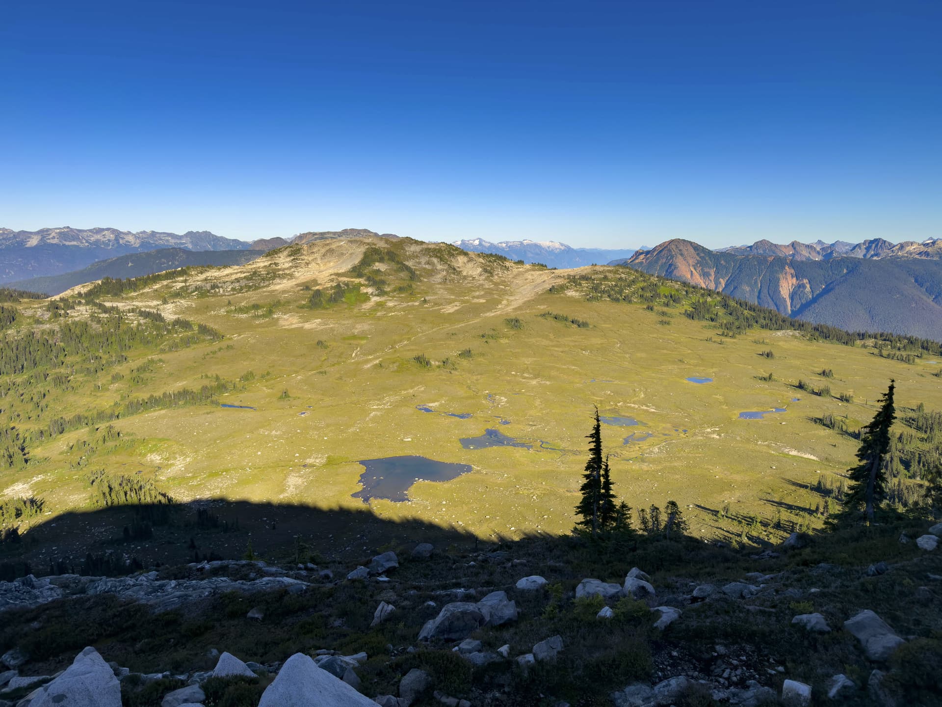
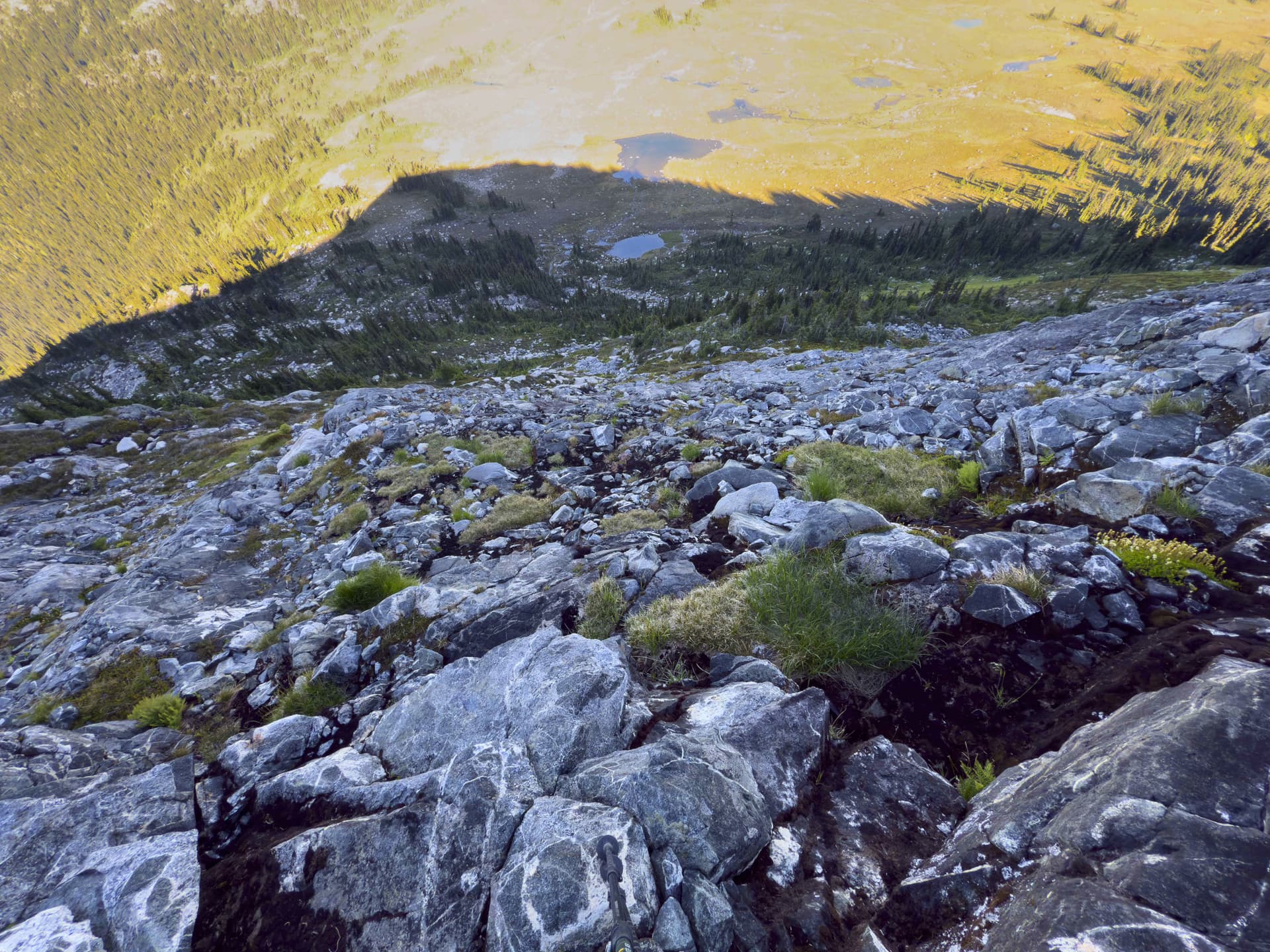
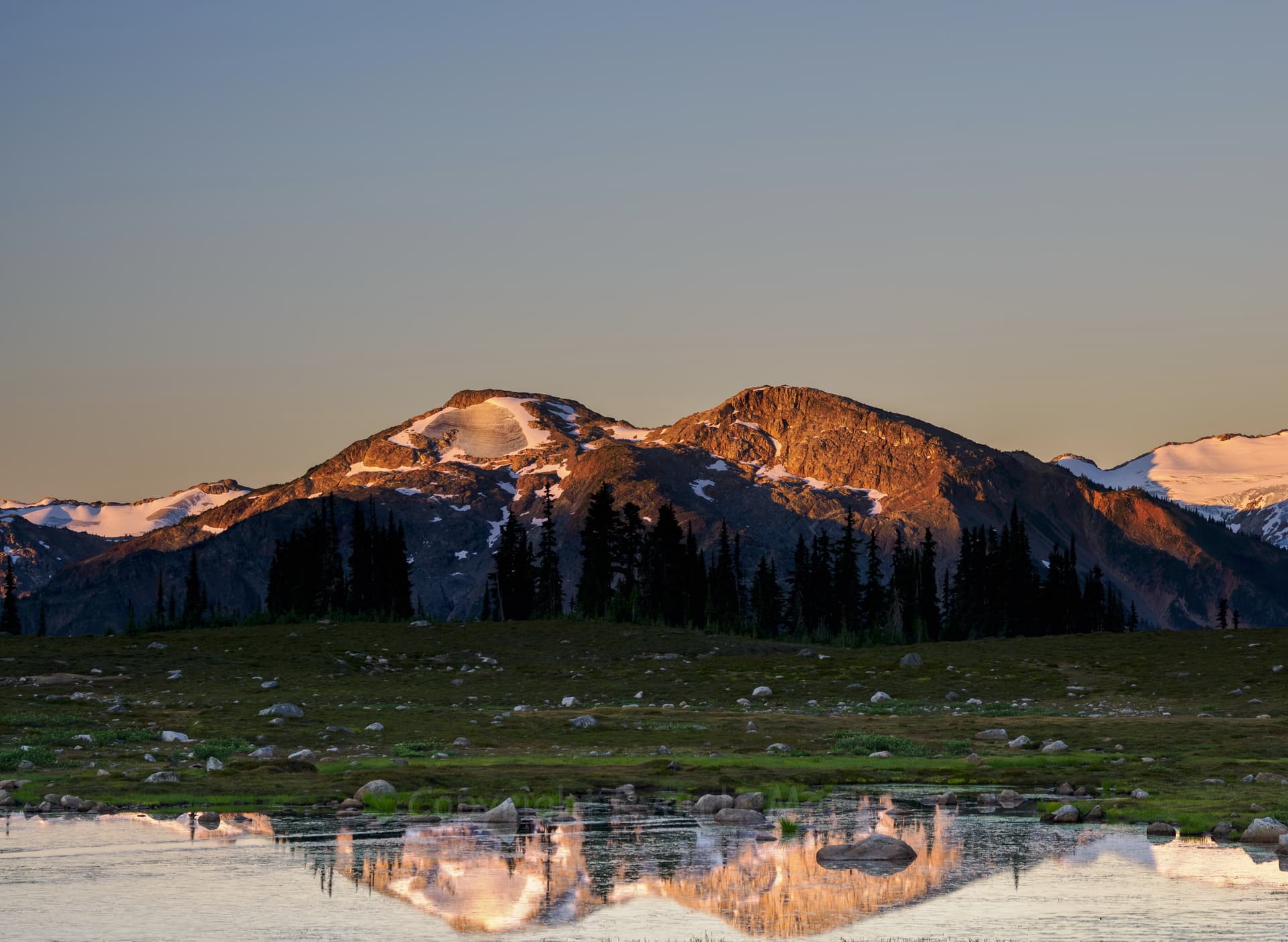
I looked at how much ridge was left, and how little daylight. There was a tarn near me for water, and a roughly flat tent space, so I called it and made camp there. I found some real weird geology on that ridge, perhaps all those rumors about the lost gold mine are true after all.
“More painful are the times that we badly want to reach the top of the mountain, but the various forces that make alpinism difficult turn us down below. However, just because we’ve failed does not mean we can’t be proud of our effort.”
Colin Haley - Alpinist Magazine, 2016
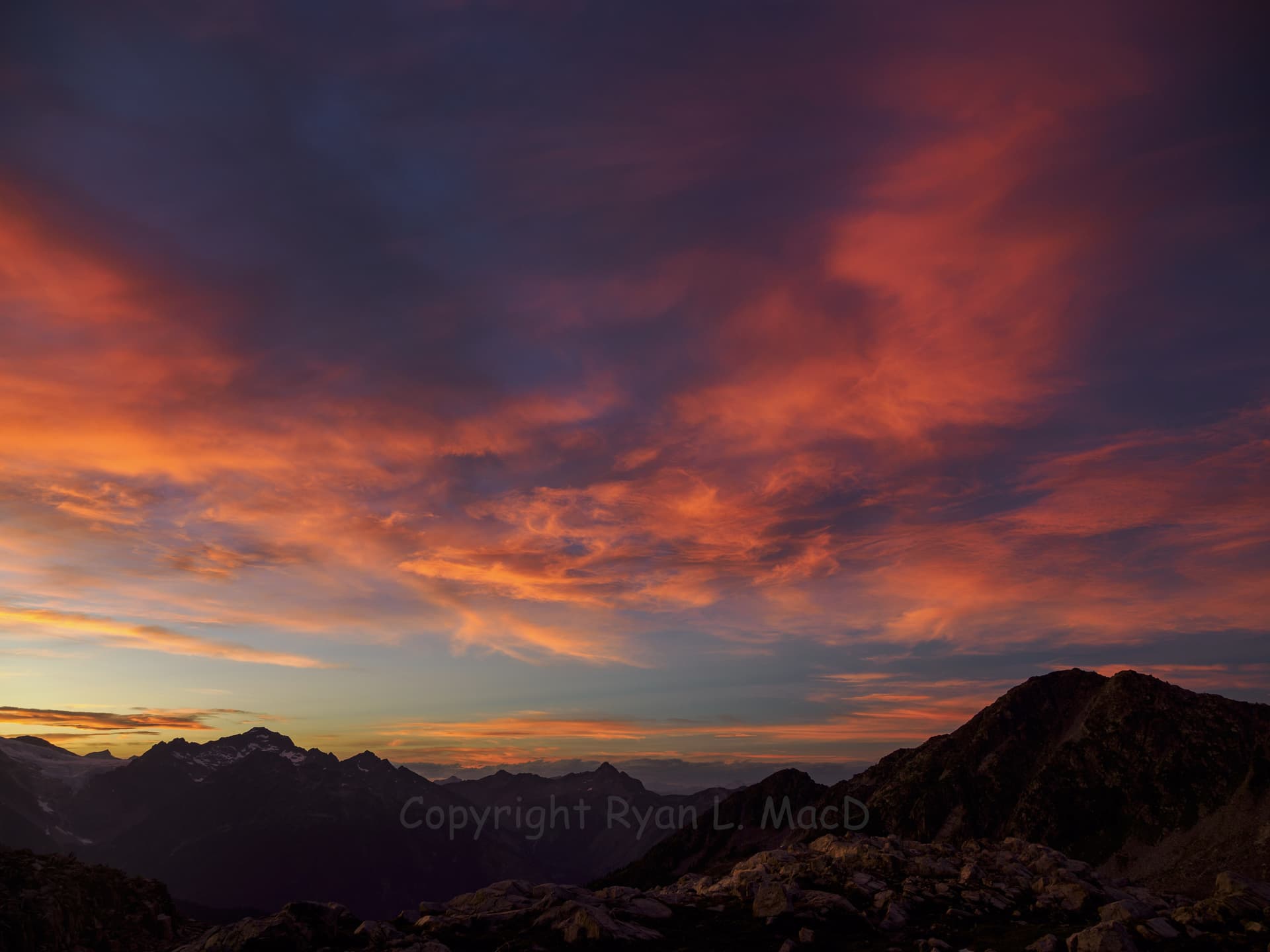
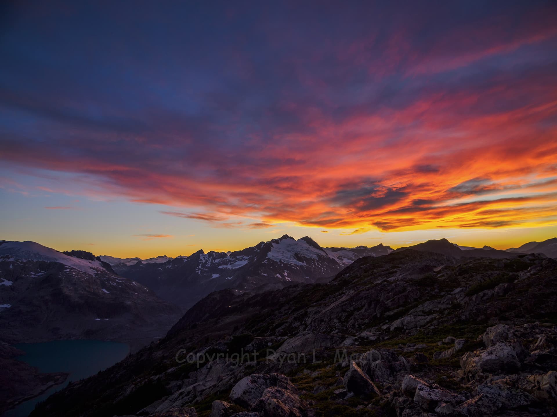
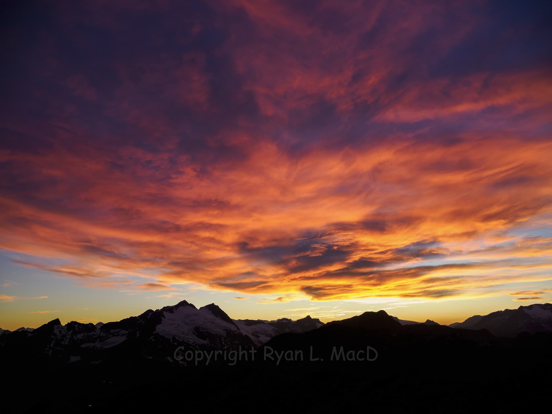
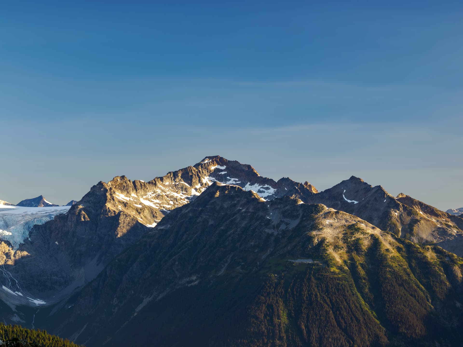
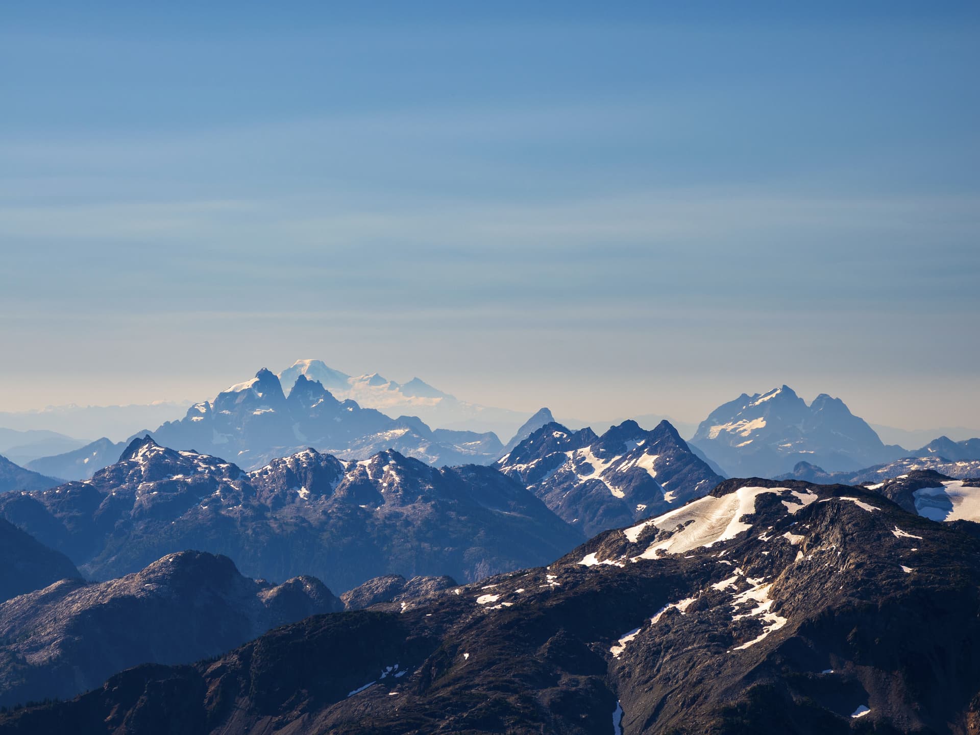
I got some really astoundingly banger photos from the ridge, though, arguably some of the best I have ever taken. One of them (above) was recently featured on the front page of Flickr to (for me, at least) insane amounts of acclaim, so the decision to stop there there was to me a more successful choice.
Daily Stats:
Moving time: 10hr 35min
Total Distance: 18.5km
Total Elevation: 1573m
Monday:
I woke up slightly recovered but still pretty bagged. Breakfast and packing up was sluggish, but some electrolyte water quickly improved matters. The sky was blue, hyper-clear, and I could tell it was going to be hotter than the mouth of hell again all day long. As I headed back towards the Greenmantle Glacier, I decided that I may as well summit Greenmantle on the way back since I was already 3/4 of the way up the mountain. I dropped my main bag and pulled out my summit pack, and set off with the report from Klaus Haring & Lisa Baile twenty years earlier to guide me.
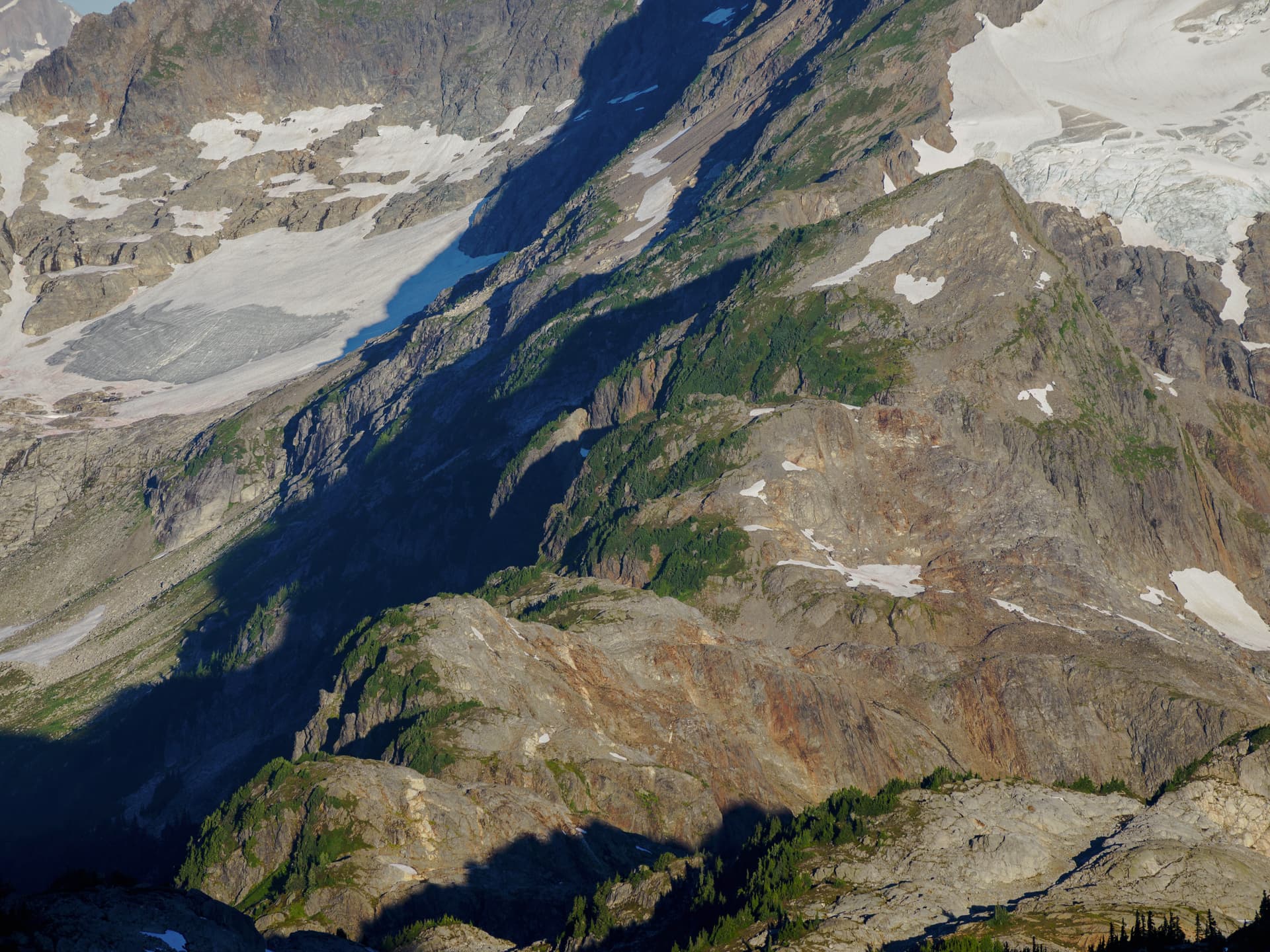
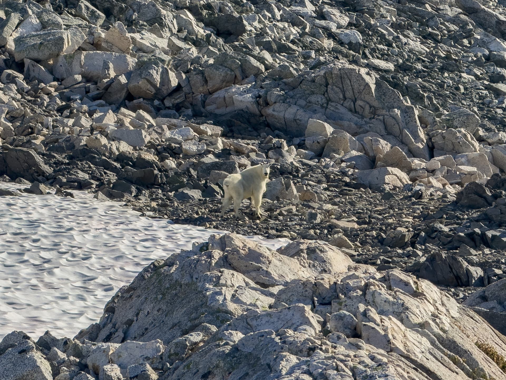
The scramble up to the false summit was quick and easy, about 45 minutes boulder hopping leading to delightful bluffs to broken summit blocks. Just below the ridge to the true summit, as I was realizing I had left my snickers in my main pack, I stumbled across a true King of the Mountain: the biggest goat I have ever run into. He startled, and then stood there majestically contemplating this intruder in his domain, and as I reached slowly for my real camera took off running. I would find his toilet less than 50m from the summit itself, a reminder that while many of these peaks have “first ascents” claimed as late as the 1970’s - we are far from the first ones to stand on them.
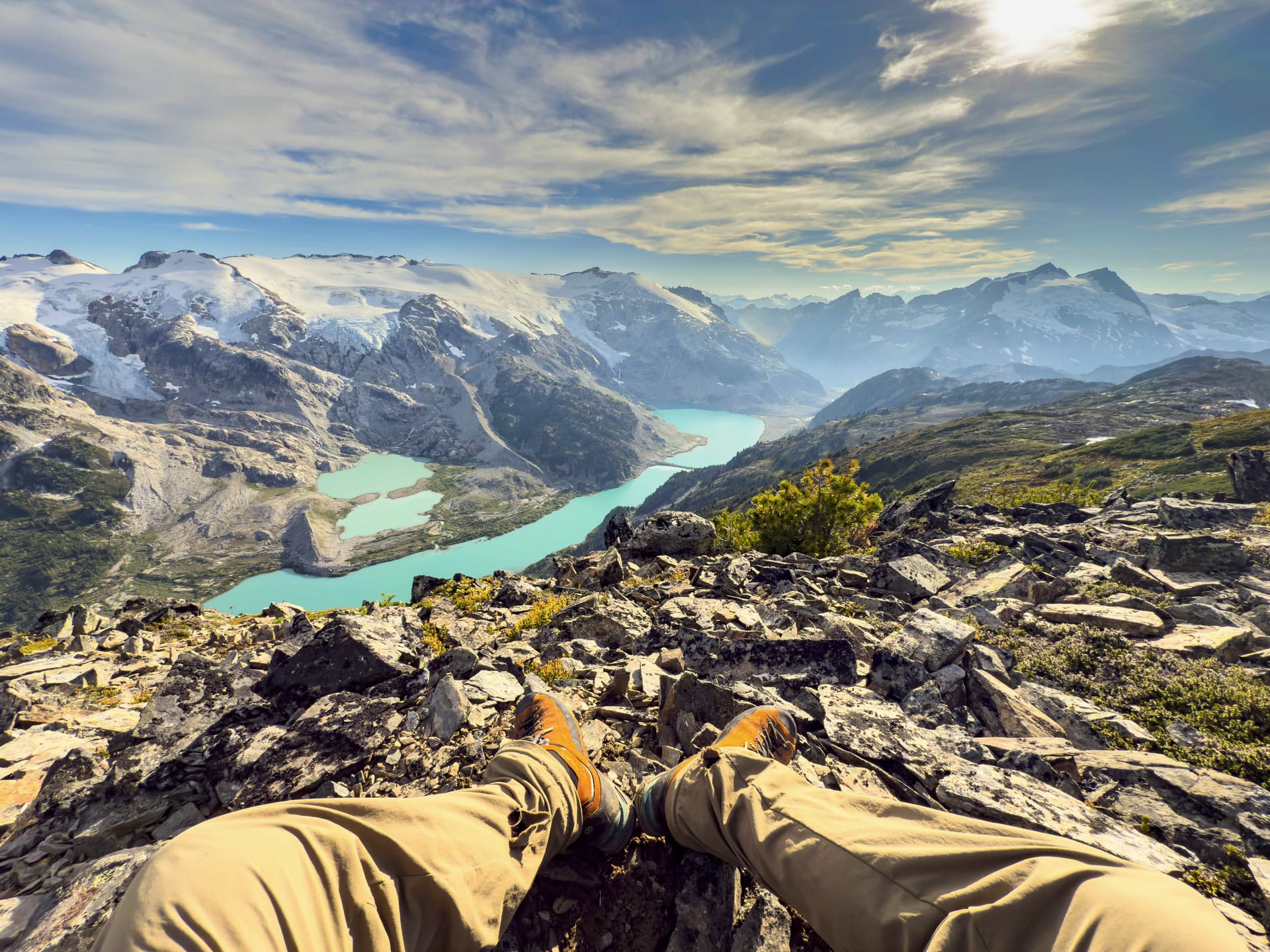
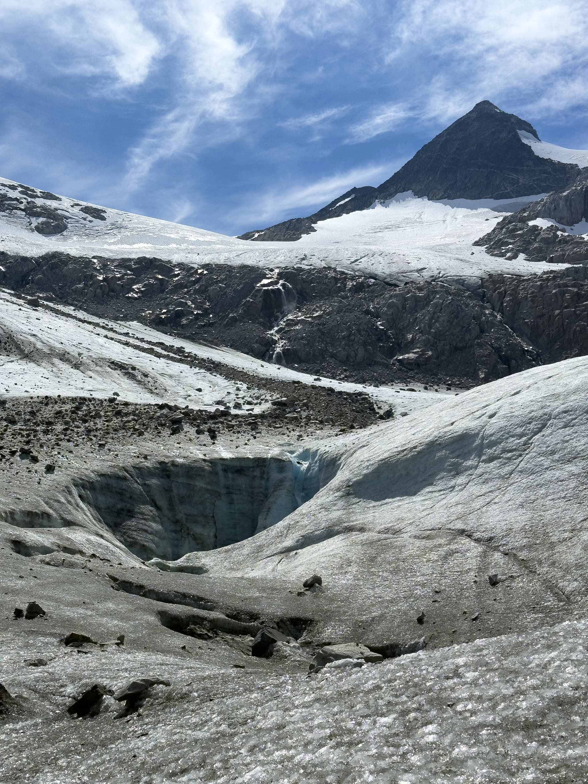
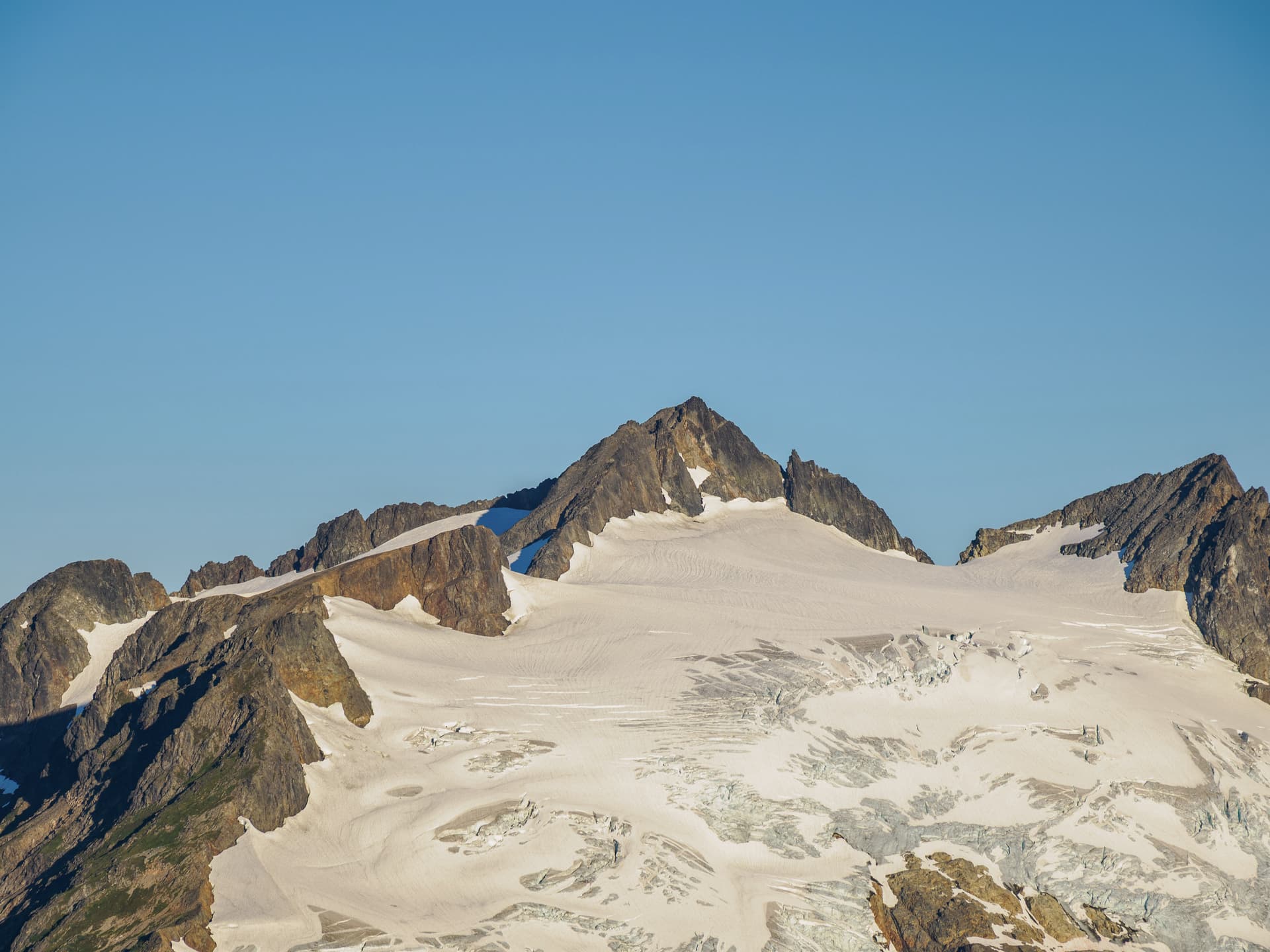
The false-summit blocks provided some tricky route finding, cliffing out a few times before finally getting down to the glacier. The final ascent had changed a fair bit from when Klaus & Lisa had attempted it. The glacier & snowpack had receded and mellowed in angle, and where the ice had once reached the peak there was now a moderate slope followed by an unstable summit boulder field, which negated the need for the sketchy class-5 section they had used to bypass the hardpack. I was quickly on the summit, great views, got a bar of reception and updated my peakbagger tick list.
While on the summit I took a series of high resolution zoom photos of every peak or glacier I could see, to contribute to some crowd sourced mountain conditions projects.
Back down to the ridge, pack on, and I was down the Greenmantle and on the col above the Icemantle by 12:30. I stopped here for a quick lunch, finding a tattered orange nylon curtain half-buried in the silt and discovering my smoked cheddar had liquefied and my hummus separated beyond safe consumption, and then headed down the glacier again. Just before stepping onto it, a rock the size of two pool tables declared independence from the upper reaches of Greenmantle and glissaded gleefully towards its bretheren on the ice - and I realized the many boulders on the glacier were not erratics melting out but rather debris shedding from above in the heat.
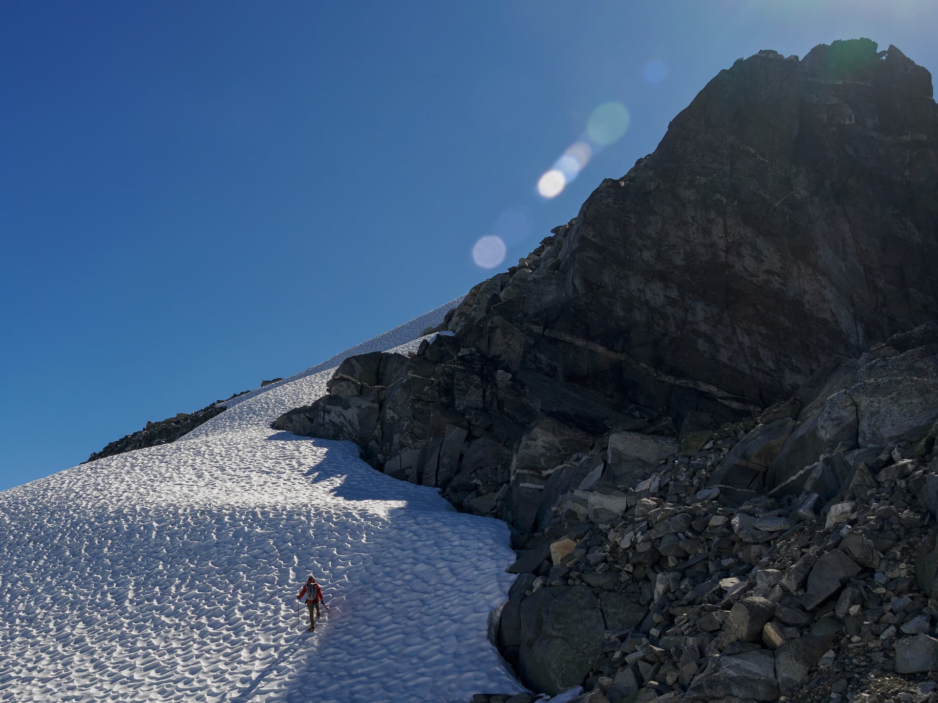
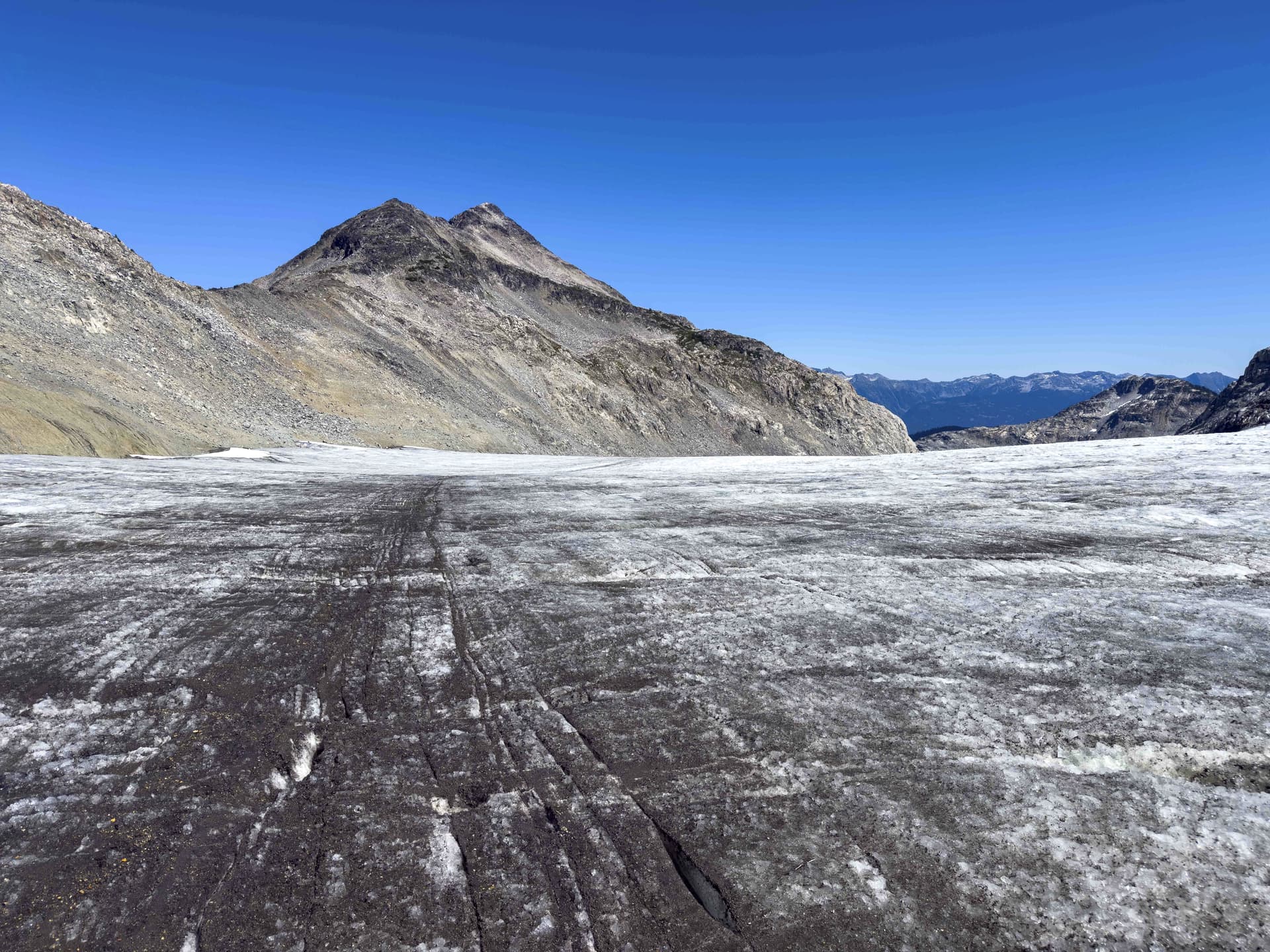
I took the far left (descent view) track down the glacier, as it had looked less wet and chewed up on that side. This proved to be a good move. It was still shotgunned with water-filled crevasses and moulins, there are few things more unnerving than passing by a pit and hearing it gurgle like a witches cauldron or the sound of gigatonnes of water rushing across bedrock 80m below you, but the surface was flatter and better textured and wasn’t far off from a paved road. I made excellent time. At one point the glacier made a weird noise, and the world felt like it moved around me every so slightly, and a little geyser shot up out of the ice some way off to my right towards the center. Fun. The dirt track on the ice had the same texture as an asphalt highway, and I didn’t bother with my crampons for the descent which made it quite speedy.
It is, perhaps, not particularly wise to gallivant across these bloated corpses in temperatures this high, but there was no other feasible way out. From the summit of Greenmantle I had scoped out Klaus Harings 1978 alternate route around the south of Three Bears and judged the exposure on the slopes to be “more sustained than I preferred”. I thought pretty strongly about how this slush sheet I was walking on was basically just swiss cheese at this point: shot through with holes and cracks which were filled with rushing water and the whole thing lubricated underneath by actual rivers lifting it off the bedrock, and about how if the differential between the imagery and the present day was correct it had to be melting out at a rate far in excess of 50-70 meters a year.
Which is f’in crazy.
I had little doubt this glacier would be gone within my lifetime, and this route itself likely infeasible within the next ten years at best. In either case, we will probably have more pressing existential concerns than poorly executed hiking trips by then. I suspect very few people in the lower mainland have any idea just how much ice is hidden on the northern faces of the mountains we enjoy living in the shadow of, how much we rely on that ice to maintain our rivers and the ecosystems they support, and how rapidly all of that ice is disappearing.
It is quite sobering to mountaineer, in 2025.
I got off the glacier around 3pm, and started my slog up the valley. Rather than following my inbound route, contouring down near the lakeshore and having to regain several hundred meters on the far end up uncomfortably loose debris slopes, I cut a hard right near the toe of the glacier avoiding the largest crater moulins and made for a contour along the base of Three Bears. I stayed very high indeed to avoid the collapsing seracs on that edge of the ice. There was little sign of fresh rockfall from above in this area, and the debris wasn’t too bad for navigating. The heat was oppressive however and my routefinding increasingly became less than ideal, halfway down the valley I had to stop for water and electrolytes in the shade for an hour, after making a stiff Class-4 scramble up some very tiny ledges which was completely ill-advised in terms of exposure. After crossing a fresh debris track near the far end of Three Bears, which had come down just as I was getting off the Icemantle proper, I discovered I was about 80m too high above the pass and contoured my way down to Goldilocks - where I promptly stripped off and swam for half an hour until I no longer felt like a boiled potato.
Not feeling confident in downclimbing the heather ledges with my fatigue levels far beyond redlined, definitely not willing to risk rappelling them on my 5mm line, I opted to try a higher route over the shoulder of Three Bears above the cliffbands. This “went”, but it was uncomfortably loose at the top, involved an exposed class-4 step around a ledge, and ended up dumping me onto only marginally wider heather cliff bands which then took ages to pick my way down and out of and added like 200m of worthless elevation gain and loss. Reviewing the photos I took of the mountainside here, I do believe there is an easier and less exposed route in and out of Goldilocks - it just requires time to thread it and ideally not during an intense heatwave. I reflected on what Klaus’s report in 2006 had said about this area: that the 40m contour lines are completely useless and must have been automatically interpolated from the 100m contours, which made using them to determine terrain features impossible and honestly dangerous.
I staggered into the wide meadow below Bluemantle at 7:30pm and set up camp beside the lake. I dropped my hiking gloves beside my poles in my haste to go get water, promptly forgot about them, and had them stolen in the night by marmots. I didn’t bother putting the tent fly on, it was almost 30 degrees at nightfall. I had drank about 6.5L of water and electrolytes that day, but I was beginning to seriously worry about what this much sustained dehydration would do to my kidneys.
I did not wake up to catch a single glimpse of the Persiedes, I was wrung dry.
Daily Stats:
Moving time: 10hr 42min
Total Distance: 16.5km
Total Elevation: 2598m
Tuesday:
It was hard to move, and to get moving. I woke up feeling like I had been shoved into a dryer and put on tumble cycle with several hammers, just absolute broken down ass. If the past few days had been a slog, today was more of a stagger forwards. I didn’t bother with a hot breakfast, I just wanted to move before the heat picked up as it was already cooking before 8am. The meadows which had soaked my boots only two days ago were bone dry, there had been no dew overnight. I slogged back up towards my first nights camp, stopping to soak my head in many tarns along the way, and finally pulled into that first lake for a swim and to wash my clothes around 11am. I swam for a long lovely hour, getting a nice sunburn in the process, and then put my top back on soaking wet. The nice thing about the Patagonia R0 hoodie is that it takes a while to dry, and until it does it cools you by like ten degrees, that shirt had probably saved my ass the past few days in all honesty.
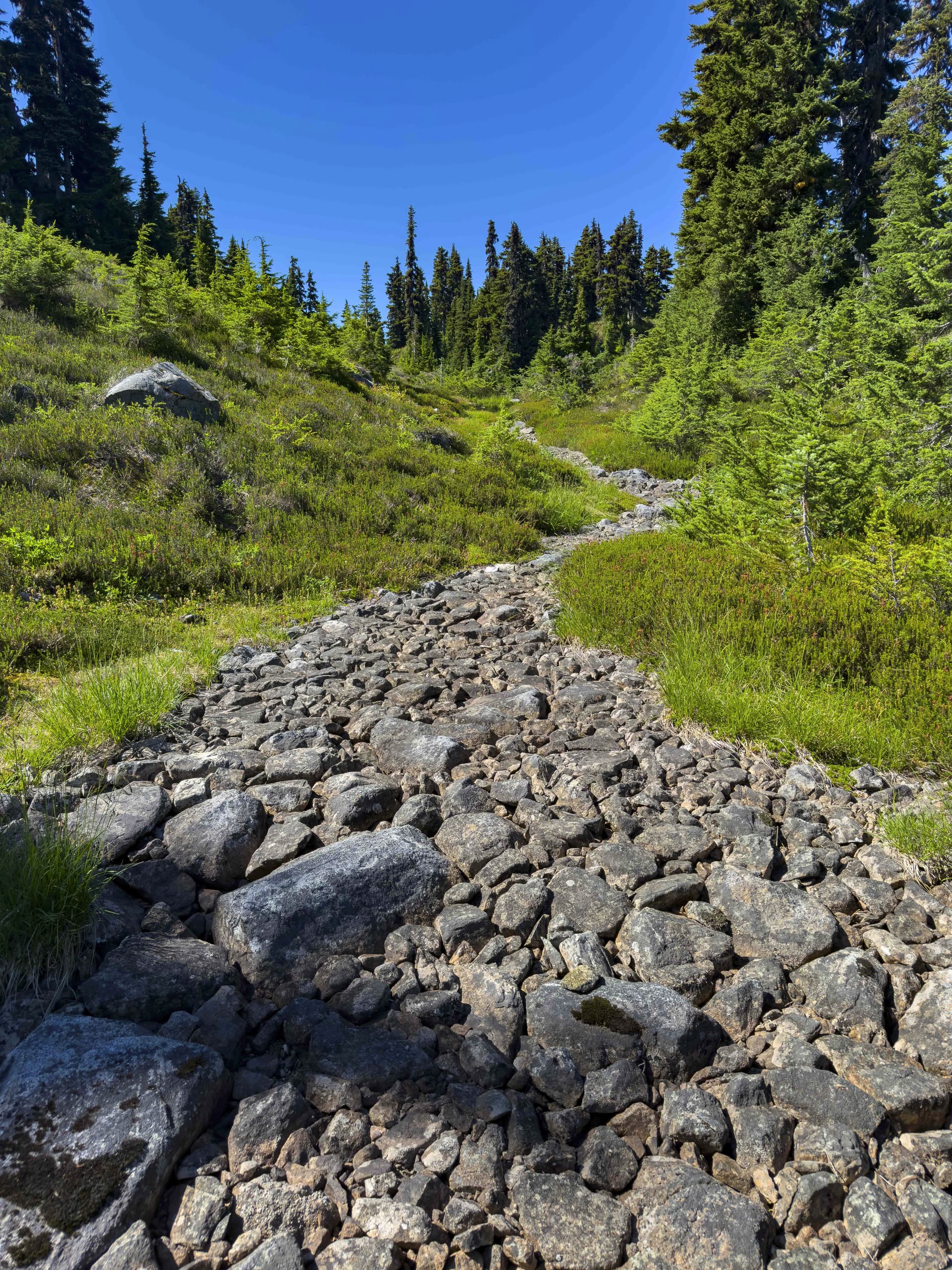
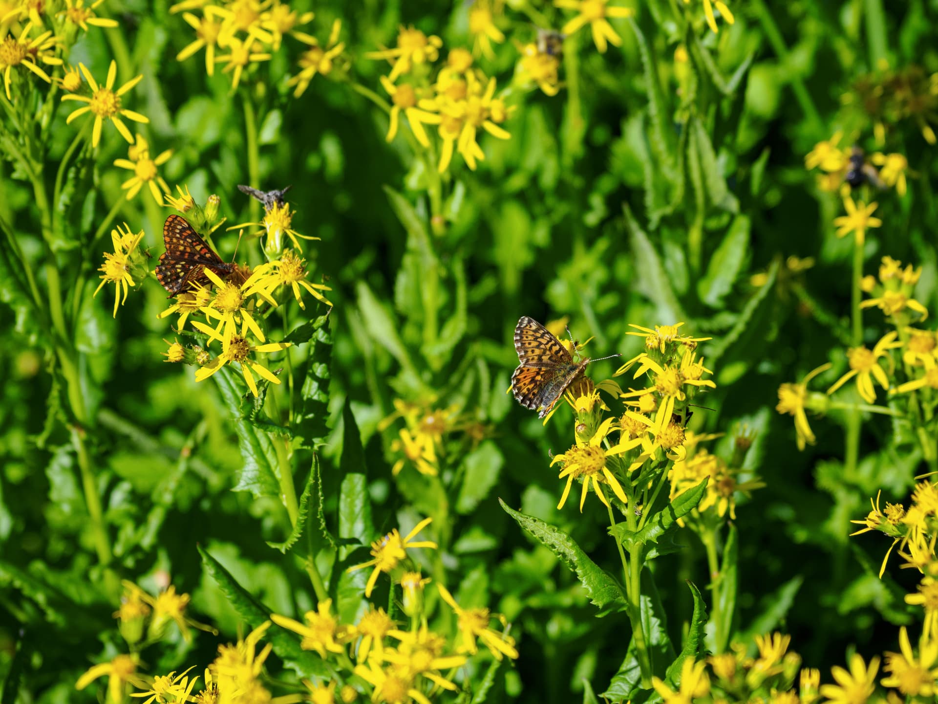
Just past the lake I found a fantastic cobblestone road built by forest elves - which saved me much time and ended in a gentle drainage filled with an abundance of wildflowers, several types of butterflies, and copious friendly bees. Beyond this little paradise lay the upper west side of the bog.
I took a better contour out and avoided the huge bog entirely, in the process discovering that if you stay between 1460 and 1475 meters you avoid the worst of the willow / alder bushwack and are in fairly open forest which goes quite quickly. The tradeoff being endless forest spider webs filled with fat forest spiders: I committed a small spider genocide battling my way through them. Early afternoon it was cooking, and there were no lakes between me and the van to cool down in this time. So I took a brief rest in the shade of the forest and thought about life. I listened to the wind in the trees, and thought about my roommate who was astounded I could handle taking off into the wilderness for six days alone without losing my shit - while having that discussion, they had realized they’d likely never been totally without human contact for longer than a day in their life and had a deep moment of introspection.
I spent some good time on further “bullshit philosophical introspection”.
Regaining the open meadows on the east of Lone Knoll around 3pm, I quickly identified a wide drainage and used it to avoid the 500m bushwack to the CH1650 entirely. A dry waterfall cliff at the end required a detour, but the road is less than 40m away by that point. This drainage is by far the easiest and best route up to the alpine around Lone Knoll. It also exits into a wonderfully rich patch of black huckleberries and dwarf raspberries - a fine reward for the suffering.
From here it was an hour and a bit of pounding down the FSR, my legs wailing in protest, to finally collapse at my van around 4:30pm. I took the Sts’ailes home and blew out a rear shock, observed an insane sunset, and fell into bed around 10pm.
Daily Stats:
Moving time: 8hr 24min
Total Distance: 16.5km
Total Elevation: 802m
Conclusion
I’m headed back to Oz & Nz in two weeks and have blocked off most of next summer to take my kayak to Alaska, bagging obscure peaks up the inside passage along the way, but I am not one to give up so easily. I will be making a second solo attempt on Mt Pitt next August: I can shave many hours off the approach now that I know the terrain, and I won’t start the next attempt with a 122lb overnight lumber haul.
I don’t think I would have seen success here even if I hadn’t done the night run to Phelix: the weather window would have been tight regardless and the considerable terrain changes since the last reports still eaten extra time, and frankly I was very rusty at routefinding after the year I have had away from the mountains - sitting in a pickup truck in the outback. Regardless of the failure in reaching my objective I still got to experience a corner of Garibaldi rarely ever visited by people, one which IMHO far exceeds the western entrance in terms of beauty and firmly argues that this should be a National, rather than Provincial, park. I had the place entirely to my self, no instagram hordes, the way I like it.
Thursday night the rain started, and by Friday an entire months worth of rain had dumped up there (80mm!) - confirming that I did indeed make the correct decision bailing ahead of the weather.
As far as I have seen nobody has ever hauled a DSLR out there, and I dare say these pictures bring me more pride than pushing ahead and standing on the summit ever could have. It will still be there next year.
Cumulative Total Statistics:
Average moving speed (according to Garmin): 2.5km/h
Total Time Elapsed: 72-ish hours from CG FSR
Total Moving Time: 34hr 56min
Total Distance (Incl Phelix): 70.8km
Total Elevation (Incl Phelix): 6306m